Americae nova Tabula

Print $20.00
- Digital $50.00
Americae nova Tabula
1635
Size: 18.4 x 24.3 inches
93812
A New Map of the Whole Continent of America. Divided into North and South and West Indies, wherein are exactly decribed the United States of North America as well as the Several European Possessions according to the Preliminaries of Peace…

Print $40.00
- Digital $50.00
A New Map of the Whole Continent of America. Divided into North and South and West Indies, wherein are exactly decribed the United States of North America as well as the Several European Possessions according to the Preliminaries of Peace…
Size: 22.0 x 48.3 inches
95135
A New Map of the Whole Continent of America. Divided into North and South and West Indies, wherein are exactly decribed the United States of North America as well as the Several European Possessions according to the Preliminaries of Peace…

Print $40.00
- Digital $50.00
A New Map of the Whole Continent of America. Divided into North and South and West Indies, wherein are exactly decribed the United States of North America as well as the Several European Possessions according to the Preliminaries of Peace…
Size: 22.0 x 48.7 inches
95136
A New Map of the Whole Continent of America. Divided into North and South and West Indies, wherein are exactly decribed the United States of North America as well as the Several European Possessions according to the Preliminaries of Peace…

Print $40.00
- Digital $50.00
A New Map of the Whole Continent of America. Divided into North and South and West Indies, wherein are exactly decribed the United States of North America as well as the Several European Possessions according to the Preliminaries of Peace…
Size: 42.8 x 48.8 inches
95137
Map of the United States, the British Provinces, Mexico &c. Showing the Routes of the U.S. Mail Steam Packets to California and a Plan of the Gold Region

Print $20.00
- Digital $50.00
Map of the United States, the British Provinces, Mexico &c. Showing the Routes of the U.S. Mail Steam Packets to California and a Plan of the Gold Region
1849
Size: 19.6 x 26.6 inches
95695
Americae Nova Descriptio

Print $20.00
- Digital $50.00
Americae Nova Descriptio
1663
Size: 14.5 x 18.0 inches
95708
Americæ Nova Tabula

Print $20.00
- Digital $50.00
Americæ Nova Tabula
1633
Size: 15.3 x 18.7 inches
95827
The Inca, Machu Picchu Salutes the Sun

The Inca, Machu Picchu Salutes the Sun
Size: 20.4 x 31.3 inches
95935
Descripcion de las Yndias Ocidentales

Print $20.00
- Digital $50.00
Descripcion de las Yndias Ocidentales
1726
Size: 9.6 x 13.2 inches
95962
Carte d'Amerique, Divisee en ses Principaux Pays, Dressee sur les Memoires les plus recents, et sur differents Voyages, et assujettie aux observations Astronomiques de Mrs. de l'Academie Royale des Sciences

Print $40.00
- Digital $50.00
Carte d'Amerique, Divisee en ses Principaux Pays, Dressee sur les Memoires les plus recents, et sur differents Voyages, et assujettie aux observations Astronomiques de Mrs. de l'Academie Royale des Sciences
1787
Size: 43.5 x 51.3 inches
96430
A New, Plaine, and Exact map of America : described by N.I. Visscher, and don into English, enlarged, and corrected, according to I. Blaeu, with the habits of the countries, and the manner of the cheife Citties, the like never before

Print $20.00
- Digital $50.00
A New, Plaine, and Exact map of America : described by N.I. Visscher, and don into English, enlarged, and corrected, according to I. Blaeu, with the habits of the countries, and the manner of the cheife Citties, the like never before
1658
Size: 16.4 x 20.9 inches
96787
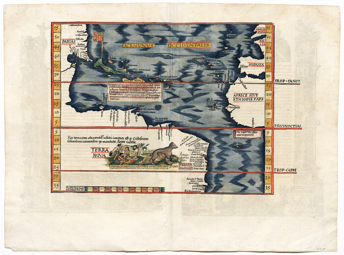
Tabula Terre Nove

Print $20.00
- Digital $50.00
Tabula Terre Nove
1513
Size: 18.7 x 24.6 inches
93800
[Oceani occidentalis seu terrae novae tabula]
Print $20.00
- Digital $50.00
[Oceani occidentalis seu terrae novae tabula]
1535
Size: 16.0 x 21.6 inches
95835
Die Neüwen Inseln / so hinder Hispanien gegen Orient bey dem Landt Indie ligen

Print $20.00
- Digital $50.00
Die Neüwen Inseln / so hinder Hispanien gegen Orient bey dem Landt Indie ligen
1540
Size: 12.3 x 15.6 inches
93803
Die Neüwen Inseln / so hinder Hispanien gegen Orient bey dem Landt Indie ligen

Print $20.00
- Digital $50.00
Die Neüwen Inseln / so hinder Hispanien gegen Orient bey dem Landt Indie ligen
1540
Size: 10.8 x 15.8 inches
93831
La table des isles neufues, lesquelles on appelle isles d'occident & d'Indie pour divers regardz

Print $20.00
- Digital $50.00
La table des isles neufues, lesquelles on appelle isles d'occident & d'Indie pour divers regardz
1552
Size: 12.3 x 15.7 inches
95836
Mexico, Regia et Celebris Hispaniae Novae Civitas [and] Cusco, Rengi Peru in Novo Orbe Casvt

Print $20.00
- Digital $50.00
Mexico, Regia et Celebris Hispaniae Novae Civitas [and] Cusco, Rengi Peru in Novo Orbe Casvt
1572
Size: 13.8 x 20.1 inches
97025
Americae Sive Novi Orbis, Nova Descriptio

Print $20.00
- Digital $50.00
Americae Sive Novi Orbis, Nova Descriptio
1573
Size: 15.6 x 22.3 inches
95834
Qvarte Partie Dv Monde

Print $20.00
- Digital $50.00
Qvarte Partie Dv Monde
1575
Size: 15.3 x 18.9 inches
93806
Americae Sive Novi Orbis Nova Descriptio

Print $20.00
- Digital $50.00
Americae Sive Novi Orbis Nova Descriptio
1579
Size: 18.0 x 22.9 inches
93805
La Florida / Peruviae Avriferæ Regionis Typus / Guastecan

Print $20.00
- Digital $50.00
La Florida / Peruviae Avriferæ Regionis Typus / Guastecan
1584
Size: 16.8 x 20.9 inches
94100
America siue India Nova ad magnae Gerardi Mercatoris aui Vniversalis imitationem in compendium redacta

Print $20.00
- Digital $50.00
America siue India Nova ad magnae Gerardi Mercatoris aui Vniversalis imitationem in compendium redacta
1585
Size: 16.9 x 20.2 inches
93808
Il Cuscho Citta Principale Della Provincia del Peru

Print $20.00
- Digital $50.00
Il Cuscho Citta Principale Della Provincia del Peru
1592
Size: 12.3 x 15.4 inches
97026
America siue India Nova ad magnae Gerardi Mercatoris aui Vniversalis imitationem in compendium redacta

Print $20.00
- Digital $50.00
America siue India Nova ad magnae Gerardi Mercatoris aui Vniversalis imitationem in compendium redacta
1595
Size: 18.3 x 21.6 inches
93807
America sive novvs orbis respectv evropaeorvm inferior globi terrestris pars 1596

Print $20.00
- Digital $50.00
America sive novvs orbis respectv evropaeorvm inferior globi terrestris pars 1596
1596
Size: 14.7 x 18.1 inches
93809
Americae Sive Novi Orbis Nova Descriptio

Print $20.00
- Digital $50.00
Americae Sive Novi Orbis Nova Descriptio
1606
Size: 16.5 x 22.4 inches
93810
Americae Sive Novi Orbis Nova Descriptio

Print $20.00
- Digital $50.00
Americae Sive Novi Orbis Nova Descriptio
1606
Size: 16.4 x 22.3 inches
93829
Nova et Acurata Totius Americae Tabula

Print $40.00
Nova et Acurata Totius Americae Tabula
1608
Size: 40.8 x 56.5 inches
97019
Americae nova Tabula
Print $20.00
- Digital $50.00
Americae nova Tabula
1635
-
Size
18.4 x 24.3 inches
-
Map/Doc
93812
-
Creation Date
1635
A New Map of the Whole Continent of America. Divided into North and South and West Indies, wherein are exactly decribed the United States of North America as well as the Several European Possessions according to the Preliminaries of Peace…
Print $40.00
- Digital $50.00
A New Map of the Whole Continent of America. Divided into North and South and West Indies, wherein are exactly decribed the United States of North America as well as the Several European Possessions according to the Preliminaries of Peace…
-
Size
22.0 x 48.3 inches
-
Map/Doc
95135
A New Map of the Whole Continent of America. Divided into North and South and West Indies, wherein are exactly decribed the United States of North America as well as the Several European Possessions according to the Preliminaries of Peace…
Print $40.00
- Digital $50.00
A New Map of the Whole Continent of America. Divided into North and South and West Indies, wherein are exactly decribed the United States of North America as well as the Several European Possessions according to the Preliminaries of Peace…
-
Size
22.0 x 48.7 inches
-
Map/Doc
95136
A New Map of the Whole Continent of America. Divided into North and South and West Indies, wherein are exactly decribed the United States of North America as well as the Several European Possessions according to the Preliminaries of Peace…
Print $40.00
- Digital $50.00
A New Map of the Whole Continent of America. Divided into North and South and West Indies, wherein are exactly decribed the United States of North America as well as the Several European Possessions according to the Preliminaries of Peace…
-
Size
42.8 x 48.8 inches
-
Map/Doc
95137
Map of America

Print $20.00
- Digital $50.00
Map of America
1841
-
Size
21.6 x 24.9 inches
-
Map/Doc
95150
-
Creation Date
1841
Map of the United States, the British Provinces, Mexico &c. Showing the Routes of the U.S. Mail Steam Packets to California and a Plan of the Gold Region
Print $20.00
- Digital $50.00
Map of the United States, the British Provinces, Mexico &c. Showing the Routes of the U.S. Mail Steam Packets to California and a Plan of the Gold Region
1849
-
Size
19.6 x 26.6 inches
-
Map/Doc
95695
-
Creation Date
1849
Americae Nova Descriptio
Print $20.00
- Digital $50.00
Americae Nova Descriptio
1663
-
Size
14.5 x 18.0 inches
-
Map/Doc
95708
-
Creation Date
1663
Americæ Nova Tabula
Print $20.00
- Digital $50.00
Americæ Nova Tabula
1633
-
Size
15.3 x 18.7 inches
-
Map/Doc
95827
-
Creation Date
1633
The Inca, Machu Picchu Salutes the Sun
The Inca, Machu Picchu Salutes the Sun
-
Size
20.4 x 31.3 inches
-
Map/Doc
95935
Descripcion de las Yndias Ocidentales
Print $20.00
- Digital $50.00
Descripcion de las Yndias Ocidentales
1726
-
Size
9.6 x 13.2 inches
-
Map/Doc
95962
-
Creation Date
1726
Carte d'Amerique, Divisee en ses Principaux Pays, Dressee sur les Memoires les plus recents, et sur differents Voyages, et assujettie aux observations Astronomiques de Mrs. de l'Academie Royale des Sciences
Print $40.00
- Digital $50.00
Carte d'Amerique, Divisee en ses Principaux Pays, Dressee sur les Memoires les plus recents, et sur differents Voyages, et assujettie aux observations Astronomiques de Mrs. de l'Academie Royale des Sciences
1787
-
Size
43.5 x 51.3 inches
-
Map/Doc
96430
-
Creation Date
1787
A New, Plaine, and Exact map of America : described by N.I. Visscher, and don into English, enlarged, and corrected, according to I. Blaeu, with the habits of the countries, and the manner of the cheife Citties, the like never before
Print $20.00
- Digital $50.00
A New, Plaine, and Exact map of America : described by N.I. Visscher, and don into English, enlarged, and corrected, according to I. Blaeu, with the habits of the countries, and the manner of the cheife Citties, the like never before
1658
-
Size
16.4 x 20.9 inches
-
Map/Doc
96787
-
Creation Date
1658
Tabula Terre Nove
Print $20.00
- Digital $50.00
Tabula Terre Nove
1513
-
Size
18.7 x 24.6 inches
-
Map/Doc
93800
-
Creation Date
1513
[Oceani occidentalis seu terrae novae tabula]
Print $20.00
- Digital $50.00
[Oceani occidentalis seu terrae novae tabula]
1535
-
Size
16.0 x 21.6 inches
-
Map/Doc
95835
-
Creation Date
1535
Die Neüwen Inseln / so hinder Hispanien gegen Orient bey dem Landt Indie ligen
Print $20.00
- Digital $50.00
Die Neüwen Inseln / so hinder Hispanien gegen Orient bey dem Landt Indie ligen
1540
-
Size
12.3 x 15.6 inches
-
Map/Doc
93803
-
Creation Date
1540
Die Neüwen Inseln / so hinder Hispanien gegen Orient bey dem Landt Indie ligen
Print $20.00
- Digital $50.00
Die Neüwen Inseln / so hinder Hispanien gegen Orient bey dem Landt Indie ligen
1540
-
Size
10.8 x 15.8 inches
-
Map/Doc
93831
-
Creation Date
1540
La table des isles neufues, lesquelles on appelle isles d'occident & d'Indie pour divers regardz
Print $20.00
- Digital $50.00
La table des isles neufues, lesquelles on appelle isles d'occident & d'Indie pour divers regardz
1552
-
Size
12.3 x 15.7 inches
-
Map/Doc
95836
-
Creation Date
1552
Mexico, Regia et Celebris Hispaniae Novae Civitas [and] Cusco, Rengi Peru in Novo Orbe Casvt
Print $20.00
- Digital $50.00
Mexico, Regia et Celebris Hispaniae Novae Civitas [and] Cusco, Rengi Peru in Novo Orbe Casvt
1572
-
Size
13.8 x 20.1 inches
-
Map/Doc
97025
-
Creation Date
1572
Americae Sive Novi Orbis, Nova Descriptio
Print $20.00
- Digital $50.00
Americae Sive Novi Orbis, Nova Descriptio
1573
-
Size
15.6 x 22.3 inches
-
Map/Doc
95834
-
Creation Date
1573
Qvarte Partie Dv Monde
Print $20.00
- Digital $50.00
Qvarte Partie Dv Monde
1575
-
Size
15.3 x 18.9 inches
-
Map/Doc
93806
-
Creation Date
1575
Americae Sive Novi Orbis Nova Descriptio
Print $20.00
- Digital $50.00
Americae Sive Novi Orbis Nova Descriptio
1579
-
Size
18.0 x 22.9 inches
-
Map/Doc
93805
-
Creation Date
1579
La Florida / Peruviae Avriferæ Regionis Typus / Guastecan
Print $20.00
- Digital $50.00
La Florida / Peruviae Avriferæ Regionis Typus / Guastecan
1584
-
Size
16.8 x 20.9 inches
-
Map/Doc
94100
-
Creation Date
1584
America siue India Nova ad magnae Gerardi Mercatoris aui Vniversalis imitationem in compendium redacta
Print $20.00
- Digital $50.00
America siue India Nova ad magnae Gerardi Mercatoris aui Vniversalis imitationem in compendium redacta
1585
-
Size
16.9 x 20.2 inches
-
Map/Doc
93808
-
Creation Date
1585
Il Cuscho Citta Principale Della Provincia del Peru
Print $20.00
- Digital $50.00
Il Cuscho Citta Principale Della Provincia del Peru
1592
-
Size
12.3 x 15.4 inches
-
Map/Doc
97026
-
Creation Date
1592
America siue India Nova ad magnae Gerardi Mercatoris aui Vniversalis imitationem in compendium redacta
Print $20.00
- Digital $50.00
America siue India Nova ad magnae Gerardi Mercatoris aui Vniversalis imitationem in compendium redacta
1595
-
Size
18.3 x 21.6 inches
-
Map/Doc
93807
-
Creation Date
1595
America sive novvs orbis respectv evropaeorvm inferior globi terrestris pars 1596
Print $20.00
- Digital $50.00
America sive novvs orbis respectv evropaeorvm inferior globi terrestris pars 1596
1596
-
Size
14.7 x 18.1 inches
-
Map/Doc
93809
-
Creation Date
1596
Americae Sive Novi Orbis Nova Descriptio
Print $20.00
- Digital $50.00
Americae Sive Novi Orbis Nova Descriptio
1606
-
Size
16.5 x 22.4 inches
-
Map/Doc
93810
-
Creation Date
1606
Americae Sive Novi Orbis Nova Descriptio
Print $20.00
- Digital $50.00
Americae Sive Novi Orbis Nova Descriptio
1606
-
Size
16.4 x 22.3 inches
-
Map/Doc
93829
-
Creation Date
1606
America

Print $20.00
- Digital $50.00
America
1607
-
Size
18.1 x 21.3 inches
-
Map/Doc
93811
-
Creation Date
1607
Nova et Acurata Totius Americae Tabula
Print $40.00
Nova et Acurata Totius Americae Tabula
1608
This map is an anonymous version of Blaeu's map of 1608 published in Venice in 1646.
-
Size
40.8 x 56.5 inches
-
Map/Doc
97019
-
Creation Date
1608