Lipscomb County Working Sketch 9

Print $20.00
- Digital $50.00
Lipscomb County Working Sketch 9
1995
Size: 44.1 x 22.3 inches
70585
Lipscomb County Working Sketch 8

Print $20.00
- Digital $50.00
Lipscomb County Working Sketch 8
1982
Size: 42.7 x 23.6 inches
70584
Lipscomb County Working Sketch 7

Print $20.00
- Digital $50.00
Lipscomb County Working Sketch 7
1982
Size: 42.7 x 21.4 inches
70583
Lipscomb County Working Sketch 6

Print $20.00
- Digital $50.00
Lipscomb County Working Sketch 6
1980
Size: 35.7 x 20.8 inches
70582
Lipscomb County Working Sketch 5

Print $20.00
- Digital $50.00
Lipscomb County Working Sketch 5
1977
Size: 26.8 x 30.0 inches
70581
Lipscomb County Working Sketch 4

Print $40.00
- Digital $50.00
Lipscomb County Working Sketch 4
1974
Size: 51.7 x 43.8 inches
70580
Lipscomb County Rolled Sketch 7

Print $20.00
- Digital $50.00
Lipscomb County Rolled Sketch 7
1968
Size: 23.6 x 23.4 inches
6630
Lipscomb County Working Sketch 3

Print $20.00
- Digital $50.00
Lipscomb County Working Sketch 3
1965
Size: 27.8 x 46.1 inches
70579
Lipscomb County Sketch File 6

Print $20.00
- Digital $50.00
Lipscomb County Sketch File 6
1965
Size: 19.4 x 26.1 inches
12005
Lipscomb County Working Sketch 1

Print $20.00
- Digital $50.00
Lipscomb County Working Sketch 1
1964
Size: 30.7 x 34.1 inches
70577
General Highway Map, Lipscomb County, Texas

Print $20.00
General Highway Map, Lipscomb County, Texas
1961
Size: 18.1 x 24.6 inches
79573
Lipscomb County Working Sketch 2

Print $20.00
- Digital $50.00
Lipscomb County Working Sketch 2
1959
Size: 33.4 x 36.6 inches
70578
Hemphill County Sketch File 9

Print $26.00
- Digital $50.00
Hemphill County Sketch File 9
1955
Size: 11.0 x 8.8 inches
26312
Lipscomb County Rolled Sketch 6

Print $20.00
- Digital $50.00
Lipscomb County Rolled Sketch 6
1941
Size: 44.8 x 21.8 inches
42260
Lipscomb County Rolled Sketch 5

Print $20.00
- Digital $50.00
Lipscomb County Rolled Sketch 5
1941
Size: 45.8 x 23.3 inches
9451
Lipscomb County Rolled Sketch 6

Print $20.00
- Digital $50.00
Lipscomb County Rolled Sketch 6
1941
Size: 45.0 x 46.0 inches
9452
Lipscomb County Rolled Sketch 8

Print $40.00
- Digital $50.00
Lipscomb County Rolled Sketch 8
1940
Size: 59.2 x 28.5 inches
9453
General Highway Map, Lipscomb County, Texas

Print $20.00
General Highway Map, Lipscomb County, Texas
1940
Size: 18.2 x 24.7 inches
79175
Ochiltree County Sketch File 8

Print $16.00
- Digital $50.00
Ochiltree County Sketch File 8
1933
Size: 11.2 x 8.7 inches
33186
Ochiltree County Sketch File 6

Print $20.00
- Digital $50.00
Ochiltree County Sketch File 6
1930
Size: 9.5 x 32.7 inches
42203
Hutchinson County Sketch File 23

Print $22.00
- Digital $50.00
Hutchinson County Sketch File 23
1913
Size: 11.2 x 8.8 inches
27245
Lipscomb County Sketch File 4

Print $56.00
- Digital $50.00
Lipscomb County Sketch File 4
1910
Size: 11.2 x 8.7 inches
30233
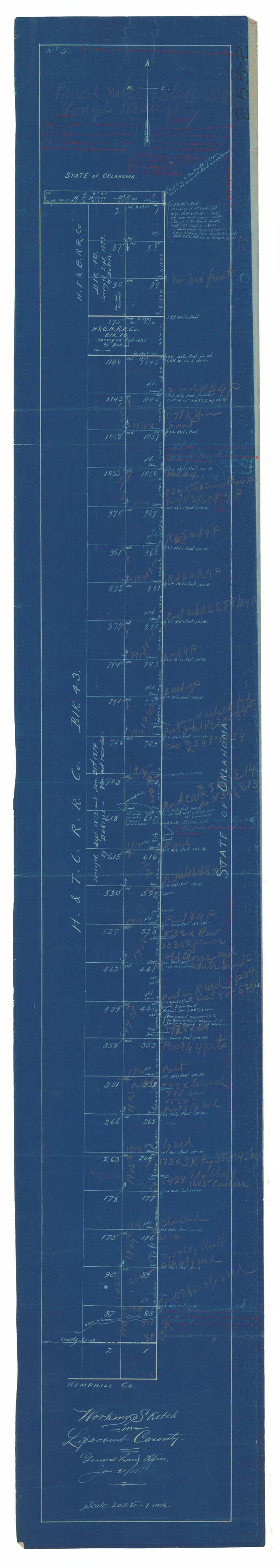
Working Sketch in Lipscomb County [showing East line of County along border with Oklahoma]
Print $20.00
- Digital $50.00
Working Sketch in Lipscomb County [showing East line of County along border with Oklahoma]
1910
Size: 4.9 x 25.9 inches
92083
Ochiltree County Sketch File 2

Print $38.00
- Digital $50.00
Ochiltree County Sketch File 2
1903
Size: 11.3 x 8.6 inches
33168
Lipscomb County Sketch File 2

Print $20.00
- Digital $50.00
Lipscomb County Sketch File 2
1902
Size: 10.7 x 8.2 inches
30223
Map of Lipscomb County

Print $20.00
- Digital $50.00
Map of Lipscomb County
1899
Size: 45.1 x 39.6 inches
1883
Map of Lipscomb County

Print $20.00
- Digital $50.00
Map of Lipscomb County
1899
Size: 43.1 x 39.2 inches
5017
Lipscomb County Working Sketch Graphic Index

Print $20.00
- Digital $50.00
Lipscomb County Working Sketch Graphic Index
1899
Size: 41.4 x 38.4 inches
76622
Lipscomb County Working Sketch 9
Print $20.00
- Digital $50.00
Lipscomb County Working Sketch 9
1995
-
Size
44.1 x 22.3 inches
-
Map/Doc
70585
-
Creation Date
1995
Lipscomb County Working Sketch 8
Print $20.00
- Digital $50.00
Lipscomb County Working Sketch 8
1982
-
Size
42.7 x 23.6 inches
-
Map/Doc
70584
-
Creation Date
1982
Lipscomb County Working Sketch 7
Print $20.00
- Digital $50.00
Lipscomb County Working Sketch 7
1982
-
Size
42.7 x 21.4 inches
-
Map/Doc
70583
-
Creation Date
1982
Lipscomb County Working Sketch 6
Print $20.00
- Digital $50.00
Lipscomb County Working Sketch 6
1980
-
Size
35.7 x 20.8 inches
-
Map/Doc
70582
-
Creation Date
1980
Lipscomb County Working Sketch 5
Print $20.00
- Digital $50.00
Lipscomb County Working Sketch 5
1977
-
Size
26.8 x 30.0 inches
-
Map/Doc
70581
-
Creation Date
1977
Lipscomb County Working Sketch 4
Print $40.00
- Digital $50.00
Lipscomb County Working Sketch 4
1974
-
Size
51.7 x 43.8 inches
-
Map/Doc
70580
-
Creation Date
1974
Lipscomb County Rolled Sketch 7
Print $20.00
- Digital $50.00
Lipscomb County Rolled Sketch 7
1968
-
Size
23.6 x 23.4 inches
-
Map/Doc
6630
-
Creation Date
1968
Lipscomb County Working Sketch 3
Print $20.00
- Digital $50.00
Lipscomb County Working Sketch 3
1965
-
Size
27.8 x 46.1 inches
-
Map/Doc
70579
-
Creation Date
1965
Lipscomb County Sketch File 6
Print $20.00
- Digital $50.00
Lipscomb County Sketch File 6
1965
-
Size
19.4 x 26.1 inches
-
Map/Doc
12005
-
Creation Date
1965
Lipscomb County Working Sketch 1
Print $20.00
- Digital $50.00
Lipscomb County Working Sketch 1
1964
-
Size
30.7 x 34.1 inches
-
Map/Doc
70577
-
Creation Date
1964
General Highway Map, Lipscomb County, Texas
Print $20.00
General Highway Map, Lipscomb County, Texas
1961
-
Size
18.1 x 24.6 inches
-
Map/Doc
79573
-
Creation Date
1961
Lipscomb County Working Sketch 2
Print $20.00
- Digital $50.00
Lipscomb County Working Sketch 2
1959
-
Size
33.4 x 36.6 inches
-
Map/Doc
70578
-
Creation Date
1959
Hemphill County Sketch File 9
Print $26.00
- Digital $50.00
Hemphill County Sketch File 9
1955
-
Size
11.0 x 8.8 inches
-
Map/Doc
26312
-
Creation Date
1955
Lipscomb County Rolled Sketch 6
Print $20.00
- Digital $50.00
Lipscomb County Rolled Sketch 6
1941
-
Size
44.8 x 21.8 inches
-
Map/Doc
42260
-
Creation Date
1941
Lipscomb County Rolled Sketch 5
Print $20.00
- Digital $50.00
Lipscomb County Rolled Sketch 5
1941
-
Size
45.8 x 23.3 inches
-
Map/Doc
9451
-
Creation Date
1941
Lipscomb County Rolled Sketch 6
Print $20.00
- Digital $50.00
Lipscomb County Rolled Sketch 6
1941
-
Size
45.0 x 46.0 inches
-
Map/Doc
9452
-
Creation Date
1941
Lipscomb County Rolled Sketch 8
Print $40.00
- Digital $50.00
Lipscomb County Rolled Sketch 8
1940
-
Size
59.2 x 28.5 inches
-
Map/Doc
9453
-
Creation Date
1940
General Highway Map, Lipscomb County, Texas
Print $20.00
General Highway Map, Lipscomb County, Texas
1940
-
Size
18.2 x 24.7 inches
-
Map/Doc
79175
-
Creation Date
1940
Ochiltree County Sketch File 8
Print $16.00
- Digital $50.00
Ochiltree County Sketch File 8
1933
-
Size
11.2 x 8.7 inches
-
Map/Doc
33186
-
Creation Date
1933
Lipscomb County

Print $20.00
- Digital $50.00
Lipscomb County
1932
-
Size
40.5 x 37.5 inches
-
Map/Doc
73222
-
Creation Date
1932
Lipscomb County

Print $20.00
- Digital $50.00
Lipscomb County
1932
-
Size
40.2 x 37.1 inches
-
Map/Doc
77355
-
Creation Date
1932
Ochiltree County Sketch File 6
Print $20.00
- Digital $50.00
Ochiltree County Sketch File 6
1930
-
Size
9.5 x 32.7 inches
-
Map/Doc
42203
-
Creation Date
1930
Hutchinson County Sketch File 23
Print $22.00
- Digital $50.00
Hutchinson County Sketch File 23
1913
-
Size
11.2 x 8.8 inches
-
Map/Doc
27245
-
Creation Date
1913
Lipscomb County Sketch File 4
Print $56.00
- Digital $50.00
Lipscomb County Sketch File 4
1910
-
Size
11.2 x 8.7 inches
-
Map/Doc
30233
-
Creation Date
1910
Working Sketch in Lipscomb County [showing East line of County along border with Oklahoma]
Print $20.00
- Digital $50.00
Working Sketch in Lipscomb County [showing East line of County along border with Oklahoma]
1910
-
Size
4.9 x 25.9 inches
-
Map/Doc
92083
-
Creation Date
1910
Ochiltree County Sketch File 2
Print $38.00
- Digital $50.00
Ochiltree County Sketch File 2
1903
-
Size
11.3 x 8.6 inches
-
Map/Doc
33168
-
Creation Date
1903
Lipscomb County Sketch File 2
Print $20.00
- Digital $50.00
Lipscomb County Sketch File 2
1902
-
Size
10.7 x 8.2 inches
-
Map/Doc
30223
-
Creation Date
1902
Map of Lipscomb County
Print $20.00
- Digital $50.00
Map of Lipscomb County
1899
-
Size
45.1 x 39.6 inches
-
Map/Doc
1883
-
Creation Date
1899
Map of Lipscomb County
Print $20.00
- Digital $50.00
Map of Lipscomb County
1899
-
Size
43.1 x 39.2 inches
-
Map/Doc
5017
-
Creation Date
1899
Lipscomb County Working Sketch Graphic Index
Print $20.00
- Digital $50.00
Lipscomb County Working Sketch Graphic Index
1899
-
Size
41.4 x 38.4 inches
-
Map/Doc
76622
-
Creation Date
1899