Wheeler County Sketch File 7

Print $20.00
- Digital $50.00
Wheeler County Sketch File 7
Size: 38.1 x 47.7 inches
10431
Lipscomb County Rolled Sketch 5

Print $40.00
- Digital $50.00
Lipscomb County Rolled Sketch 5
Size: 61.8 x 8.1 inches
10640
Childress County Rolled Sketch 1

Print $20.00
- Digital $50.00
Childress County Rolled Sketch 1
Size: 31.2 x 26.5 inches
5437
Wheeler County Boundary File 1

Print $24.00
- Digital $50.00
Wheeler County Boundary File 1
Size: 14.4 x 8.7 inches
59856
Wheeler County Boundary File 1a

Print $2.00
- Digital $50.00
Wheeler County Boundary File 1a
Size: 12.8 x 8.8 inches
59868
Wheeler County Boundary File 1b

Print $2.00
- Digital $50.00
Wheeler County Boundary File 1b
Size: 12.3 x 8.8 inches
59869
Wheeler County Boundary File 1c

Print $4.00
- Digital $50.00
Wheeler County Boundary File 1c
Size: 11.4 x 8.9 inches
59870
Wheeler County Boundary File 93

Print $64.00
- Digital $50.00
Wheeler County Boundary File 93
Size: 9.4 x 5.1 inches
59872
Texas Panhandle East Boundary Line

Print $40.00
- Digital $50.00
Texas Panhandle East Boundary Line
Size: 66.1 x 9.3 inches
65380
Donley County Working Sketch 3

Print $40.00
- Digital $50.00
Donley County Working Sketch 3
Size: 58.7 x 44.8 inches
68736
Field Notes of surveys in Hutchinson and Wheeler Counties

Field Notes of surveys in Hutchinson and Wheeler Counties
81670
Wheeler County Rolled Sketch 3

Print $20.00
- Digital $50.00
Wheeler County Rolled Sketch 3
Size: 31.9 x 21.9 inches
8239
[Sketch Between Wheeler County and Oklahoma]
Print $40.00
- Digital $50.00
[Sketch Between Wheeler County and Oklahoma]
Size: 8.8 x 62.7 inches
89665
[Sketch between Wheeler County and Oklahoma]
Print $40.00
- Digital $50.00
[Sketch between Wheeler County and Oklahoma]
Size: 64.9 x 10.2 inches
89674
[East line of Wheeler County along Oklahoma]

Print $40.00
- Digital $50.00
[East line of Wheeler County along Oklahoma]
Size: 8.4 x 62.2 inches
89824
[East line of Wheeler County along Oklahoma]
Print $40.00
- Digital $50.00
[East line of Wheeler County along Oklahoma]
Size: 8.5 x 62.9 inches
89825
[North and West Line of Gray County, North Line of Wheeler County]
Print $40.00
- Digital $50.00
[North and West Line of Gray County, North Line of Wheeler County]
Size: 43.4 x 71.6 inches
89943
Plat of South Side Addition on Section 37 Block 17, Wheeler County, Texas

Print $20.00
- Digital $50.00
Plat of South Side Addition on Section 37 Block 17, Wheeler County, Texas
Size: 12.0 x 16.9 inches
92103
State of Texas, Wheeler County, Surveys 37-44-46, Block 17

Print $20.00
- Digital $50.00
State of Texas, Wheeler County, Surveys 37-44-46, Block 17
Size: 19.4 x 13.0 inches
92115
Pendleton-Baxter Addition to Shamrock, Texas

Print $20.00
- Digital $50.00
Pendleton-Baxter Addition to Shamrock, Texas
Size: 13.0 x 14.0 inches
92116
Revised Map of Pendleton-Baxter-Addition to Shamrock Located on N.E. 1/4 Section 37, Block 17 H. & G.N.RR.Co., Wheeler County, Texas

Print $20.00
- Digital $50.00
Revised Map of Pendleton-Baxter-Addition to Shamrock Located on N.E. 1/4 Section 37, Block 17 H. & G.N.RR.Co., Wheeler County, Texas
Size: 16.7 x 18.8 inches
92123
Shamrock, Amended Plat on Section 44, Block 17, Wheeler County, Texas

Print $20.00
- Digital $50.00
Shamrock, Amended Plat on Section 44, Block 17, Wheeler County, Texas
Size: 19.6 x 24.9 inches
92132
Map of Shamrock Cemetery Located in Southwest 10 acres of Southeast 1/4 Section 43, Block 17

Print $20.00
- Digital $50.00
Map of Shamrock Cemetery Located in Southwest 10 acres of Southeast 1/4 Section 43, Block 17
Size: 22.8 x 24.0 inches
92134
Shamrock, Amended Plat on Section 44, Block 17, Wheeler County, Texas

Print $20.00
- Digital $50.00
Shamrock, Amended Plat on Section 44, Block 17, Wheeler County, Texas
Size: 30.0 x 35.5 inches
92144
Wheeler County Sketch File 1

Print $20.00
- Digital $50.00
Wheeler County Sketch File 1
Size: 17.1 x 26.8 inches
12672
[Young Territory]

Print $40.00
- Digital $50.00
[Young Territory]
1875
Size: 49.0 x 87.4 inches
16784
Wheeler County Sketch File 2

Print $26.00
- Digital $50.00
Wheeler County Sketch File 2
1881
Size: 19.0 x 7.9 inches
39994
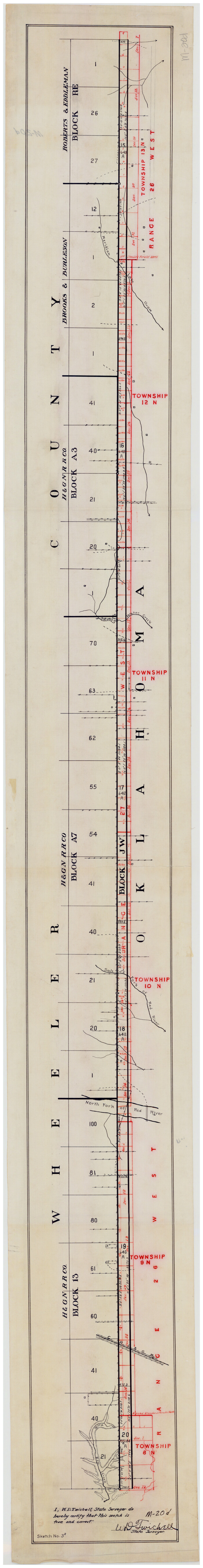
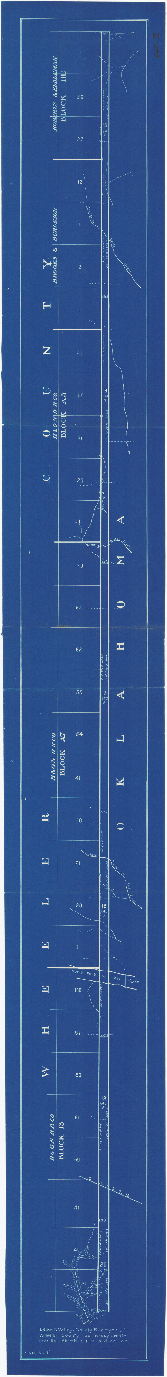
Wheeler County Sketch File 3

Print $24.00
- Digital $50.00
Wheeler County Sketch File 3
1881
Size: 12.9 x 8.4 inches
39998
Wheeler County Sketch File 4

Print $30.00
- Digital $50.00
Wheeler County Sketch File 4
1886
Size: 9.1 x 8.4 inches
40000
Wheeler County Sketch File 7
Print $20.00
- Digital $50.00
Wheeler County Sketch File 7
-
Size
38.1 x 47.7 inches
-
Map/Doc
10431
Lipscomb County Rolled Sketch 5
Print $40.00
- Digital $50.00
Lipscomb County Rolled Sketch 5
-
Size
61.8 x 8.1 inches
-
Map/Doc
10640
Childress County Rolled Sketch 1
Print $20.00
- Digital $50.00
Childress County Rolled Sketch 1
-
Size
31.2 x 26.5 inches
-
Map/Doc
5437
Wheeler County Boundary File 1
Print $24.00
- Digital $50.00
Wheeler County Boundary File 1
-
Size
14.4 x 8.7 inches
-
Map/Doc
59856
Wheeler County Boundary File 1a
Print $2.00
- Digital $50.00
Wheeler County Boundary File 1a
-
Size
12.8 x 8.8 inches
-
Map/Doc
59868
Wheeler County Boundary File 1b
Print $2.00
- Digital $50.00
Wheeler County Boundary File 1b
-
Size
12.3 x 8.8 inches
-
Map/Doc
59869
Wheeler County Boundary File 1c
Print $4.00
- Digital $50.00
Wheeler County Boundary File 1c
-
Size
11.4 x 8.9 inches
-
Map/Doc
59870
Wheeler County Boundary File 93
Print $64.00
- Digital $50.00
Wheeler County Boundary File 93
-
Size
9.4 x 5.1 inches
-
Map/Doc
59872
Texas Panhandle East Boundary Line
Print $40.00
- Digital $50.00
Texas Panhandle East Boundary Line
-
Size
66.1 x 9.3 inches
-
Map/Doc
65380
Donley County Working Sketch 3
Print $40.00
- Digital $50.00
Donley County Working Sketch 3
-
Size
58.7 x 44.8 inches
-
Map/Doc
68736
Field Notes of surveys in Hutchinson and Wheeler Counties
Field Notes of surveys in Hutchinson and Wheeler Counties
-
Map/Doc
81670
Wheeler County Rolled Sketch 3
Print $20.00
- Digital $50.00
Wheeler County Rolled Sketch 3
-
Size
31.9 x 21.9 inches
-
Map/Doc
8239
[Sketch Between Wheeler County and Oklahoma]
Print $40.00
- Digital $50.00
[Sketch Between Wheeler County and Oklahoma]
-
Size
8.8 x 62.7 inches
-
Map/Doc
89665
[Sketch between Wheeler County and Oklahoma]
Print $40.00
- Digital $50.00
[Sketch between Wheeler County and Oklahoma]
-
Size
64.9 x 10.2 inches
-
Map/Doc
89674
[East line of Wheeler County along Oklahoma]
Print $40.00
- Digital $50.00
[East line of Wheeler County along Oklahoma]
-
Size
8.4 x 62.2 inches
-
Map/Doc
89824
[East line of Wheeler County along Oklahoma]
Print $40.00
- Digital $50.00
[East line of Wheeler County along Oklahoma]
-
Size
8.5 x 62.9 inches
-
Map/Doc
89825
[North and West Line of Gray County, North Line of Wheeler County]
Print $40.00
- Digital $50.00
[North and West Line of Gray County, North Line of Wheeler County]
-
Size
43.4 x 71.6 inches
-
Map/Doc
89943
Plat of South Side Addition on Section 37 Block 17, Wheeler County, Texas
Print $20.00
- Digital $50.00
Plat of South Side Addition on Section 37 Block 17, Wheeler County, Texas
-
Size
12.0 x 16.9 inches
-
Map/Doc
92103
State of Texas, Wheeler County, Surveys 37-44-46, Block 17
Print $20.00
- Digital $50.00
State of Texas, Wheeler County, Surveys 37-44-46, Block 17
-
Size
19.4 x 13.0 inches
-
Map/Doc
92115
Pendleton-Baxter Addition to Shamrock, Texas
Print $20.00
- Digital $50.00
Pendleton-Baxter Addition to Shamrock, Texas
-
Size
13.0 x 14.0 inches
-
Map/Doc
92116
Revised Map of Pendleton-Baxter-Addition to Shamrock Located on N.E. 1/4 Section 37, Block 17 H. & G.N.RR.Co., Wheeler County, Texas
Print $20.00
- Digital $50.00
Revised Map of Pendleton-Baxter-Addition to Shamrock Located on N.E. 1/4 Section 37, Block 17 H. & G.N.RR.Co., Wheeler County, Texas
-
Size
16.7 x 18.8 inches
-
Map/Doc
92123
Shamrock, Amended Plat on Section 44, Block 17, Wheeler County, Texas
Print $20.00
- Digital $50.00
Shamrock, Amended Plat on Section 44, Block 17, Wheeler County, Texas
-
Size
19.6 x 24.9 inches
-
Map/Doc
92132
Map of Shamrock Cemetery Located in Southwest 10 acres of Southeast 1/4 Section 43, Block 17
Print $20.00
- Digital $50.00
Map of Shamrock Cemetery Located in Southwest 10 acres of Southeast 1/4 Section 43, Block 17
-
Size
22.8 x 24.0 inches
-
Map/Doc
92134
Shamrock, Amended Plat on Section 44, Block 17, Wheeler County, Texas
Print $20.00
- Digital $50.00
Shamrock, Amended Plat on Section 44, Block 17, Wheeler County, Texas
-
Size
30.0 x 35.5 inches
-
Map/Doc
92144
Wheeler County Sketch File 1
Print $20.00
- Digital $50.00
Wheeler County Sketch File 1
-
Size
17.1 x 26.8 inches
-
Map/Doc
12672
[Young Territory]
Print $40.00
- Digital $50.00
[Young Territory]
1875
-
Size
49.0 x 87.4 inches
-
Map/Doc
16784
-
Creation Date
1875
Wheeler County

Print $20.00
- Digital $50.00
Wheeler County
1878
-
Size
18.5 x 16.6 inches
-
Map/Doc
4140
-
Creation Date
1878
Wheeler County Sketch File 2
Print $26.00
- Digital $50.00
Wheeler County Sketch File 2
1881
-
Size
19.0 x 7.9 inches
-
Map/Doc
39994
-
Creation Date
1881
Wheeler County Sketch File 3
Print $24.00
- Digital $50.00
Wheeler County Sketch File 3
1881
-
Size
12.9 x 8.4 inches
-
Map/Doc
39998
-
Creation Date
1881
Wheeler County Sketch File 4
Print $30.00
- Digital $50.00
Wheeler County Sketch File 4
1886
-
Size
9.1 x 8.4 inches
-
Map/Doc
40000
-
Creation Date
1886