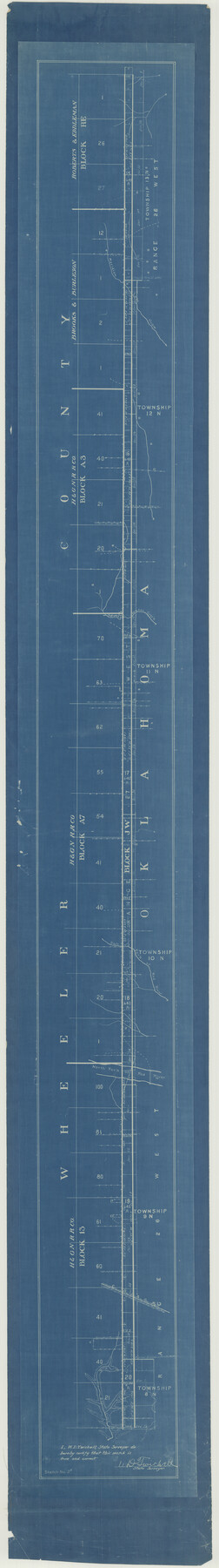
Texas Panhandle East Boundary Line
Texas Oklahoma Boundary
-
Map/Doc
65380
-
Collection
General Map Collection
-
People and Organizations
W.D. Twichell (Surveyor/Engineer)
-
Counties
Wheeler
-
Subjects
Texas Boundaries
-
Height x Width
66.1 x 9.3 inches
167.9 x 23.6 cm
-
Medium
blueprint
-
Comments
Texas Oklahoma Boundary
Part of: General Map Collection
Travis County Sketch File 1

Print $4.00
- Digital $50.00
Travis County Sketch File 1
Size 16.1 x 12.7 inches
Map/Doc 38270
Pecos County Sketch File 118

Print $28.00
- Digital $50.00
Pecos County Sketch File 118
1933
Size 5.0 x 7.5 inches
Map/Doc 34097
Fractional Township No. 7 South Range No. 20 East of the Indian Meridian, Indian Territory

Print $20.00
- Digital $50.00
Fractional Township No. 7 South Range No. 20 East of the Indian Meridian, Indian Territory
1897
Size 19.2 x 24.2 inches
Map/Doc 75236
[Old Coastal Chart of Texas Coast showing passes with depth readings]
![4662, [Old Coastal Chart of Texas Coast showing passes with depth readings], General Map Collection](https://historictexasmaps.com/wmedia_w700/maps/4662-1.tif.jpg)
Print $40.00
- Digital $50.00
[Old Coastal Chart of Texas Coast showing passes with depth readings]
Size 25.4 x 48.6 inches
Map/Doc 4662
Sutton County Sketch File 5

Print $40.00
- Digital $50.00
Sutton County Sketch File 5
Size 14.0 x 17.3 inches
Map/Doc 37356
Wichita County Boundary File 2a

Print $28.00
- Digital $50.00
Wichita County Boundary File 2a
Size 14.0 x 8.9 inches
Map/Doc 59906
Clay County Boundary File 16

Print $56.00
- Digital $50.00
Clay County Boundary File 16
Size 9.1 x 3.7 inches
Map/Doc 51422
Jasper County Rolled Sketch 8

Print $20.00
- Digital $50.00
Jasper County Rolled Sketch 8
Size 17.7 x 12.0 inches
Map/Doc 6356
Rio Grande from San Juan River to the Gulf of Mexico showing Boundary between the United States and Mexico

Print $20.00
- Digital $50.00
Rio Grande from San Juan River to the Gulf of Mexico showing Boundary between the United States and Mexico
1903
Size 25.6 x 15.8 inches
Map/Doc 2065
Pecos County Sketch File 68

Print $6.00
- Digital $50.00
Pecos County Sketch File 68
1920
Size 14.4 x 8.8 inches
Map/Doc 33866
Bell County Boundary File 1

Print $8.00
- Digital $50.00
Bell County Boundary File 1
Size 14.0 x 8.5 inches
Map/Doc 50481
Victoria County Rolled Sketch 7

Print $40.00
- Digital $50.00
Victoria County Rolled Sketch 7
1945
Size 54.2 x 16.3 inches
Map/Doc 10098
You may also like
Flight Mission No. CUG-1P, Frame 165, Kleberg County

Print $20.00
- Digital $50.00
Flight Mission No. CUG-1P, Frame 165, Kleberg County
1956
Size 18.7 x 22.2 inches
Map/Doc 86172
Wichita County Working Sketch 15

Print $20.00
- Digital $50.00
Wichita County Working Sketch 15
1919
Size 29.9 x 38.5 inches
Map/Doc 72525
El Paso County Sketch File 42

Print $16.00
- Digital $50.00
El Paso County Sketch File 42
1996
Size 14.3 x 8.9 inches
Map/Doc 22241
Orange County Working Sketch 51

Print $20.00
- Digital $50.00
Orange County Working Sketch 51
1992
Size 29.6 x 22.0 inches
Map/Doc 71383
King County Boundary File 2

Print $54.00
- Digital $50.00
King County Boundary File 2
Size 8.8 x 7.7 inches
Map/Doc 64887
Maps of Gulf Intracoastal Waterway, Texas - Sabine River to the Rio Grande and connecting waterways including ship channels

Print $20.00
- Digital $50.00
Maps of Gulf Intracoastal Waterway, Texas - Sabine River to the Rio Grande and connecting waterways including ship channels
1966
Size 14.6 x 22.3 inches
Map/Doc 61954
Jefferson County Sketch File 23

Print $20.00
- Digital $50.00
Jefferson County Sketch File 23
Size 15.8 x 17.8 inches
Map/Doc 11871
Fayette County Rolled Sketch K

Print $20.00
- Digital $50.00
Fayette County Rolled Sketch K
1936
Size 41.2 x 40.0 inches
Map/Doc 8886
Cass County Working Sketch 39

Print $20.00
- Digital $50.00
Cass County Working Sketch 39
1983
Size 26.3 x 34.6 inches
Map/Doc 67942
Presidio County Sketch File 75

Print $30.00
- Digital $50.00
Presidio County Sketch File 75
1946
Size 8.9 x 14.3 inches
Map/Doc 34691

Hall County Sketch File C1

Print $24.00
- Digital $50.00
Hall County Sketch File C1
1912
Size 8.3 x 5.3 inches
Map/Doc 24787