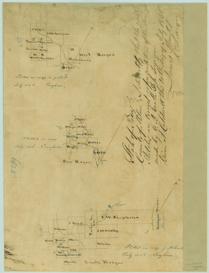
[Surveys in the Milam District along the Brazos River, North Bosque River, West Bosque River and Cow Bayou]
Print $2.00
- Digital $50.00
[Surveys in the Milam District along the Brazos River, North Bosque River, West Bosque River and Cow Bayou]
1846
Size: 11.7 x 8.9 inches
231
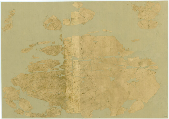
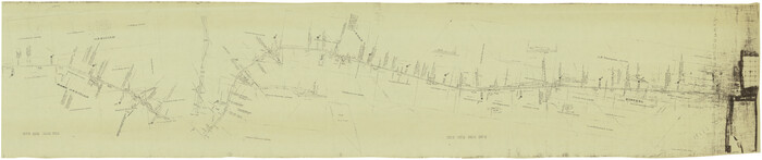
[Surveys in Robertson's Colony]
Print $20.00
- Digital $50.00
[Surveys in Robertson's Colony]
Size: 18.6 x 26.5 inches
78358
[Surveys along Cow and Deer Creeks]

Print $2.00
- Digital $50.00
[Surveys along Cow and Deer Creeks]
1845
Size: 15.8 x 8.6 inches
306
[Surveys along Bosque and Hog Creek]
Print $20.00
- Digital $50.00
[Surveys along Bosque and Hog Creek]
1845
Size: 23.9 x 17.0 inches
238
[Sketch of Col. Cooke's Military Road expedition from Red River to Austin]
Print $20.00
- Digital $50.00
[Sketch of Col. Cooke's Military Road expedition from Red River to Austin]
Size: 33.4 x 23.4 inches
82146
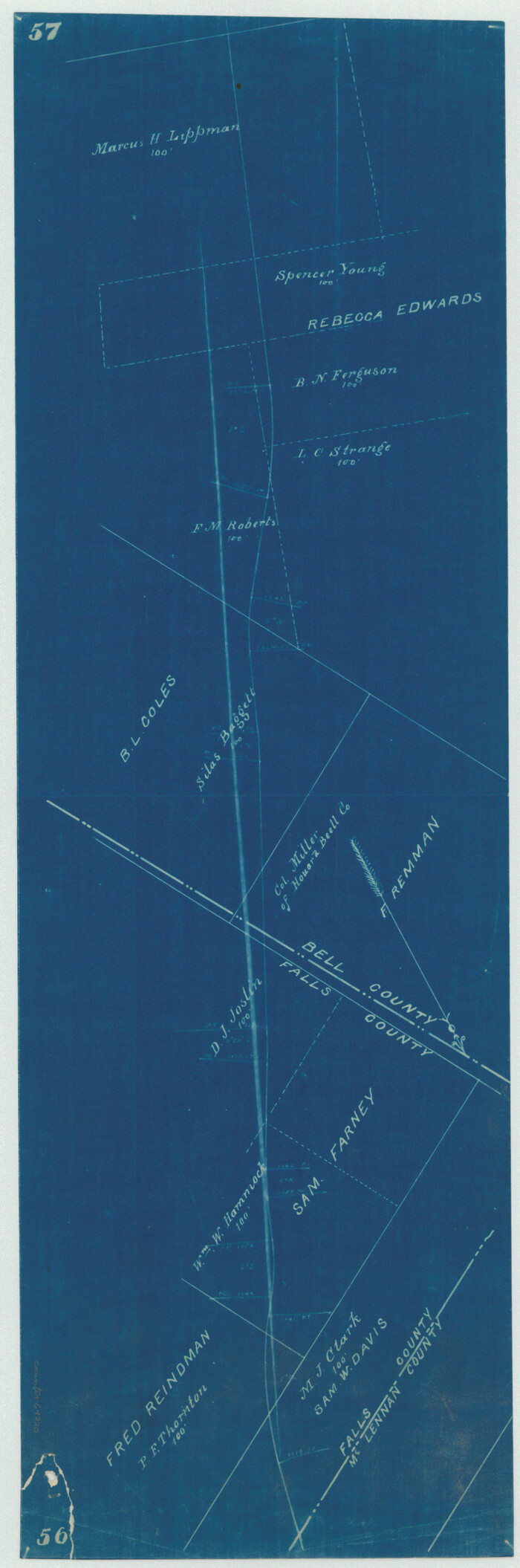
[Right of Way Map, Belton Branch of the M.K.&T. RR.]
Print $20.00
- Digital $50.00
[Right of Way Map, Belton Branch of the M.K.&T. RR.]
1896
Size: 22.2 x 7.4 inches
64220
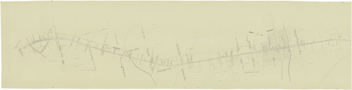
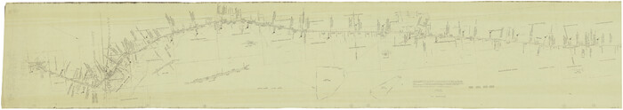
[Gulf, Colorado & Santa Fe]
Print $40.00
- Digital $50.00
[Gulf, Colorado & Santa Fe]
Size: 32.5 x 122.6 inches
64573
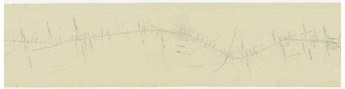
[Gulf, Colorado & Santa Fe]
Print $40.00
- Digital $50.00
[Gulf, Colorado & Santa Fe]
Size: 32.8 x 126.0 inches
64574
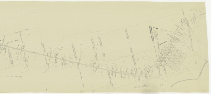
[Gulf, Colorado & Santa Fe]
Print $40.00
- Digital $50.00
[Gulf, Colorado & Santa Fe]
Size: 31.9 x 71.7 inches
64575
[Gulf, Colorado & Santa Fe]
Print $40.00
- Digital $50.00
[Gulf, Colorado & Santa Fe]
Size: 32.4 x 84.9 inches
64576
[Gulf, Colorado & Santa Fe]
Print $20.00
- Digital $50.00
[Gulf, Colorado & Santa Fe]
Size: 32.4 x 47.4 inches
64577
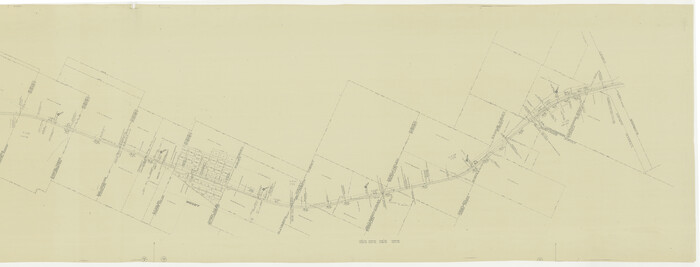
[Gulf, Colorado & Santa Fe Railway Company]
Print $20.00
- Digital $50.00
[Gulf, Colorado & Santa Fe Railway Company]
1893
Size: 20.1 x 41.5 inches
64411
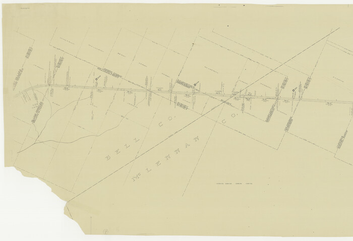
[G.C. and S. F. R.R. Co. Through Bosque County from McLennan Co. and E. to Hill Co. Station M. P. 259 to M. P. 297]
Print $40.00
- Digital $50.00
[G.C. and S. F. R.R. Co. Through Bosque County from McLennan Co. and E. to Hill Co. Station M. P. 259 to M. P. 297]
Size: 21.7 x 120.5 inches
64563
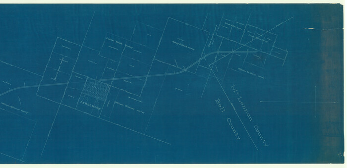
[G.C. and S. F. R.R. Co. Through Bosque County from McLennan Co. and E. to Hill Co. Station M. P. 259 to M. P. 297]
Print $40.00
- Digital $50.00
[G.C. and S. F. R.R. Co. Through Bosque County from McLennan Co. and E. to Hill Co. Station M. P. 259 to M. P. 297]
1898
Size: 22.4 x 101.5 inches
64564
Waco, Tex., County Seat of McLennan Co.

Print $20.00
Waco, Tex., County Seat of McLennan Co.
1886
Size: 23.1 x 32.7 inches
89212
Waco, Tex., County Seat of McLennan Co.

Print $20.00
Waco, Tex., County Seat of McLennan Co.
1886
Size: 16.9 x 30.7 inches
93473
Waco Village, County Seat of McLennan County

Print $20.00
Waco Village, County Seat of McLennan County
1850
Size: 15.8 x 12.4 inches
76268
University and College Lands

Print $20.00
- Digital $50.00
University and College Lands
1841
Size: 21.3 x 27.0 inches
169
Sketch of work done by Erath and Green in August 1846 on the north fork of Cow Bayou

Print $2.00
- Digital $50.00
Sketch of work done by Erath and Green in August 1846 on the north fork of Cow Bayou
1846
Size: 9.8 x 7.9 inches
78373
Sketch of surveys on Deer Creek, Milam District

Print $2.00
- Digital $50.00
Sketch of surveys on Deer Creek, Milam District
1846
Size: 7.8 x 10.9 inches
76046
Sketch of surveys made by Erath and Green in August 1846 on the waters of the Bosque River

Print $2.00
- Digital $50.00
Sketch of surveys made by Erath and Green in August 1846 on the waters of the Bosque River
1846
Size: 10.6 x 7.8 inches
303
Set of new maps of Austin's Colony by G. Borden, Jr.

Print $20.00
- Digital $50.00
Set of new maps of Austin's Colony by G. Borden, Jr.
1833
Size: 25.0 x 17.0 inches
131
McLennan County Working Sketch Graphic Index

Print $20.00
- Digital $50.00
McLennan County Working Sketch Graphic Index
1946
Size: 41.8 x 44.8 inches
76637
McLennan County Working Sketch 9

Print $20.00
- Digital $50.00
McLennan County Working Sketch 9
2008
Size: 23.0 x 28.9 inches
88768
McLennan County Working Sketch 8

Print $20.00
- Digital $50.00
McLennan County Working Sketch 8
1974
Size: 34.1 x 30.6 inches
70701
McLennan County Working Sketch 7

Print $20.00
- Digital $50.00
McLennan County Working Sketch 7
1959
Size: 22.6 x 23.9 inches
70700
McLennan County Working Sketch 6

Print $20.00
- Digital $50.00
McLennan County Working Sketch 6
1957
Size: 26.7 x 24.8 inches
70699
McLennan County Working Sketch 5

Print $20.00
- Digital $50.00
McLennan County Working Sketch 5
1943
Size: 14.6 x 12.8 inches
70698
[Surveys in the Milam District along the Brazos River, North Bosque River, West Bosque River and Cow Bayou]
Print $2.00
- Digital $50.00
[Surveys in the Milam District along the Brazos River, North Bosque River, West Bosque River and Cow Bayou]
1846
-
Size
11.7 x 8.9 inches
-
Map/Doc
231
-
Creation Date
1846
[Surveys in Robertson's Colony]
Print $20.00
- Digital $50.00
[Surveys in Robertson's Colony]
-
Size
18.6 x 26.5 inches
-
Map/Doc
78358
[Surveys along Cow and Deer Creeks]
Print $2.00
- Digital $50.00
[Surveys along Cow and Deer Creeks]
1845
-
Size
15.8 x 8.6 inches
-
Map/Doc
306
-
Creation Date
1845
[Surveys along Bosque and Hog Creek]
Print $20.00
- Digital $50.00
[Surveys along Bosque and Hog Creek]
1845
-
Size
23.9 x 17.0 inches
-
Map/Doc
238
-
Creation Date
1845
[Sketch of Col. Cooke's Military Road expedition from Red River to Austin]
Print $20.00
- Digital $50.00
[Sketch of Col. Cooke's Military Road expedition from Red River to Austin]
-
Size
33.4 x 23.4 inches
-
Map/Doc
82146
[Right of Way Map, Belton Branch of the M.K.&T. RR.]
Print $20.00
- Digital $50.00
[Right of Way Map, Belton Branch of the M.K.&T. RR.]
1896
-
Size
22.2 x 7.4 inches
-
Map/Doc
64220
-
Creation Date
1896
[Gulf, Colorado & Santa Fe]
Print $40.00
- Digital $50.00
[Gulf, Colorado & Santa Fe]
-
Size
32.5 x 122.6 inches
-
Map/Doc
64573
[Gulf, Colorado & Santa Fe]
Print $40.00
- Digital $50.00
[Gulf, Colorado & Santa Fe]
-
Size
32.8 x 126.0 inches
-
Map/Doc
64574
[Gulf, Colorado & Santa Fe]
Print $40.00
- Digital $50.00
[Gulf, Colorado & Santa Fe]
-
Size
31.9 x 71.7 inches
-
Map/Doc
64575
[Gulf, Colorado & Santa Fe]
Print $40.00
- Digital $50.00
[Gulf, Colorado & Santa Fe]
-
Size
32.4 x 84.9 inches
-
Map/Doc
64576
[Gulf, Colorado & Santa Fe]
Print $20.00
- Digital $50.00
[Gulf, Colorado & Santa Fe]
-
Size
32.4 x 47.4 inches
-
Map/Doc
64577
[Gulf, Colorado & Santa Fe Railway Company]
Print $20.00
- Digital $50.00
[Gulf, Colorado & Santa Fe Railway Company]
1893
-
Size
20.1 x 41.5 inches
-
Map/Doc
64411
-
Creation Date
1893
[G.C. and S. F. R.R. Co. Through Bosque County from McLennan Co. and E. to Hill Co. Station M. P. 259 to M. P. 297]
Print $40.00
- Digital $50.00
[G.C. and S. F. R.R. Co. Through Bosque County from McLennan Co. and E. to Hill Co. Station M. P. 259 to M. P. 297]
-
Size
21.7 x 120.5 inches
-
Map/Doc
64563
[G.C. and S. F. R.R. Co. Through Bosque County from McLennan Co. and E. to Hill Co. Station M. P. 259 to M. P. 297]
Print $40.00
- Digital $50.00
[G.C. and S. F. R.R. Co. Through Bosque County from McLennan Co. and E. to Hill Co. Station M. P. 259 to M. P. 297]
1898
-
Size
22.4 x 101.5 inches
-
Map/Doc
64564
-
Creation Date
1898
Waco, Texas 1892

Print $20.00
Waco, Texas 1892
1892
-
Size
14.5 x 23.9 inches
-
Map/Doc
93469
-
Creation Date
1892
Waco, Tex., County Seat of McLennan Co.
Print $20.00
Waco, Tex., County Seat of McLennan Co.
1886
-
Size
23.1 x 32.7 inches
-
Map/Doc
89212
-
Creation Date
1886
Waco, Tex., County Seat of McLennan Co.
Print $20.00
Waco, Tex., County Seat of McLennan Co.
1886
-
Size
16.9 x 30.7 inches
-
Map/Doc
93473
-
Creation Date
1886
Waco Village, County Seat of McLennan County
Print $20.00
Waco Village, County Seat of McLennan County
1850
-
Size
15.8 x 12.4 inches
-
Map/Doc
76268
-
Creation Date
1850
University and College Lands
Print $20.00
- Digital $50.00
University and College Lands
1841
-
Size
21.3 x 27.0 inches
-
Map/Doc
169
-
Creation Date
1841
Sketch of work done by Erath and Green in August 1846 on the north fork of Cow Bayou
Print $2.00
- Digital $50.00
Sketch of work done by Erath and Green in August 1846 on the north fork of Cow Bayou
1846
-
Size
9.8 x 7.9 inches
-
Map/Doc
78373
-
Creation Date
1846
Sketch of surveys on Deer Creek, Milam District
Print $2.00
- Digital $50.00
Sketch of surveys on Deer Creek, Milam District
1846
-
Size
7.8 x 10.9 inches
-
Map/Doc
76046
-
Creation Date
1846
Sketch of surveys made by Erath and Green in August 1846 on the waters of the Bosque River
Print $2.00
- Digital $50.00
Sketch of surveys made by Erath and Green in August 1846 on the waters of the Bosque River
1846
-
Size
10.6 x 7.8 inches
-
Map/Doc
303
-
Creation Date
1846
Set of new maps of Austin's Colony by G. Borden, Jr.
Print $20.00
- Digital $50.00
Set of new maps of Austin's Colony by G. Borden, Jr.
1833
-
Size
25.0 x 17.0 inches
-
Map/Doc
131
-
Creation Date
1833
Milam District

Print $20.00
- Digital $50.00
Milam District
1854
-
Size
30.2 x 18.9 inches
-
Map/Doc
3859
-
Creation Date
1854
McLennan County Working Sketch Graphic Index
Print $20.00
- Digital $50.00
McLennan County Working Sketch Graphic Index
1946
-
Size
41.8 x 44.8 inches
-
Map/Doc
76637
-
Creation Date
1946
McLennan County Working Sketch 9
Print $20.00
- Digital $50.00
McLennan County Working Sketch 9
2008
-
Size
23.0 x 28.9 inches
-
Map/Doc
88768
-
Creation Date
2008
McLennan County Working Sketch 8
Print $20.00
- Digital $50.00
McLennan County Working Sketch 8
1974
-
Size
34.1 x 30.6 inches
-
Map/Doc
70701
-
Creation Date
1974
McLennan County Working Sketch 7
Print $20.00
- Digital $50.00
McLennan County Working Sketch 7
1959
-
Size
22.6 x 23.9 inches
-
Map/Doc
70700
-
Creation Date
1959
McLennan County Working Sketch 6
Print $20.00
- Digital $50.00
McLennan County Working Sketch 6
1957
-
Size
26.7 x 24.8 inches
-
Map/Doc
70699
-
Creation Date
1957
McLennan County Working Sketch 5
Print $20.00
- Digital $50.00
McLennan County Working Sketch 5
1943
-
Size
14.6 x 12.8 inches
-
Map/Doc
70698
-
Creation Date
1943