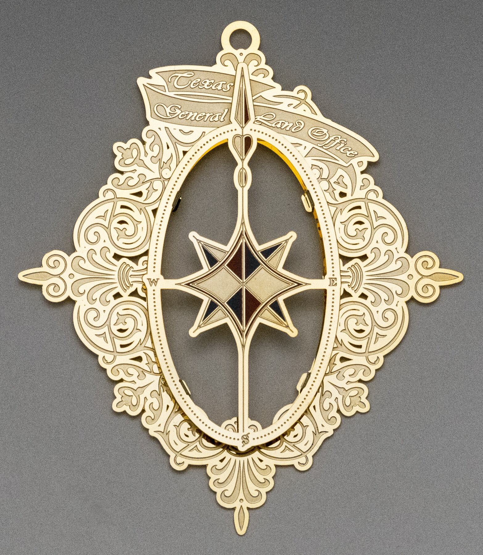
The Compass Rose of Austin's Colony
2016 Texas General Land Office Holiday Ornament
The Compass Rose of Austin’s Colony is the first ornament produced by the Texas General Land Office Save Texas History Program. It was inspired by Stephen F. Austin’s 1837 Connected Map of Austin’s Colony, which is one of the most important in the collection, establishing the model for future mapping at the GLO.
-
Map/Doc
94443
-
Collection
Save Texas History Collectibles
-
Object Dates
2016 (Creation Date)
-
Subjects
Tejano Genealogical Society - September 26-27, 2025
-
Height x Width
4.0 x 3.5 inches
10.2 x 8.9 cm
-
Comments
To view other ornaments available, please see our Publication and Collectibles.
Related maps
Connected Map of Austin's Colony

Print $40.00
- Digital $50.00
Connected Map of Austin's Colony
1837
Size 90.6 x 80.9 inches
Map/Doc 1943
Connected Map of Austin's Colony

Print $40.00
- Digital $50.00
Connected Map of Austin's Colony
1837
Size 90.8 x 85.6 inches
Map/Doc 1944
Part of: Save Texas History Collectibles

"The Spirit of the Alamo Lives On"
.tif.jpg)
Price $20.00
"The Spirit of the Alamo Lives On"
2009
Size 24.0 x 36.0 inches
Map/Doc 95290
Texas Takes Shape: A History in Maps from the General Land Office

Price $48.71
Texas Takes Shape: A History in Maps from the General Land Office
Map/Doc 97432
Commemorative Poster: "Onward was the cry!" the 175th Anniversary of the Texas Revolution

Price $5.00
Commemorative Poster: "Onward was the cry!" the 175th Anniversary of the Texas Revolution
2011
Size 20.0 x 16.0 inches
Map/Doc 97132


The Star of Llano County

Price $20.00
The Star of Llano County
2023
Size 3.3 x 2.8 inches
Map/Doc 97175
The Compass Rose of Austin's Colony

Price $20.00
The Compass Rose of Austin's Colony
2016
Size 4.0 x 3.5 inches
Map/Doc 94443

The Yellow Rose Compass

Price $20.00
The Yellow Rose Compass
2025
Size 3.5 x 2.8 inches
Map/Doc 97508

Lay's Eagle of the United States

Price $20.00
Lay's Eagle of the United States
2020
Size 3.6 x 4.9 inches
Map/Doc 95952
You may also like
Crockett County Working Sketch 36

Print $20.00
- Digital $50.00
Crockett County Working Sketch 36
1927
Size 22.4 x 26.0 inches
Map/Doc 68369
Ector County Sketch File 13

Print $16.00
- Digital $50.00
Ector County Sketch File 13
1988
Size 11.5 x 9.0 inches
Map/Doc 21651
Brewster County Sketch File 23

Print $12.00
- Digital $50.00
Brewster County Sketch File 23
1958
Size 11.3 x 8.7 inches
Map/Doc 15825
Mileage Map of the Best Roads of Texas showing paved roads, road distances

Print $20.00
- Digital $50.00
Mileage Map of the Best Roads of Texas showing paved roads, road distances
1900
Size 21.7 x 28.7 inches
Map/Doc 95894
Red River County Working Sketch 82

Print $20.00
- Digital $50.00
Red River County Working Sketch 82
1996
Size 21.9 x 30.6 inches
Map/Doc 72068
Liberty County Sketch File 44

Print $2.00
- Digital $50.00
Liberty County Sketch File 44
Size 6.0 x 10.3 inches
Map/Doc 30002
General Highway Map, Young County, Texas

Print $20.00
General Highway Map, Young County, Texas
1961
Size 18.3 x 24.8 inches
Map/Doc 79720
Upton County Sketch File 14CF

Print $8.00
- Digital $50.00
Upton County Sketch File 14CF
1926
Size 11.3 x 8.8 inches
Map/Doc 38860
Schleicher County Sketch File 19

Print $6.00
- Digital $50.00
Schleicher County Sketch File 19
1932
Size 11.5 x 15.1 inches
Map/Doc 36508
Galveston County NRC Article 33.136 Sketch 42

Print $26.00
- Digital $50.00
Galveston County NRC Article 33.136 Sketch 42
2006
Size 22.1 x 33.7 inches
Map/Doc 83070
Travis County Appraisal District Plat Map 2_2813

Print $20.00
- Digital $50.00
Travis County Appraisal District Plat Map 2_2813
Size 21.5 x 26.5 inches
Map/Doc 94217
Baylor County Sketch File 10

Print $40.00
- Digital $50.00
Baylor County Sketch File 10
1890
Size 19.3 x 42.7 inches
Map/Doc 10321