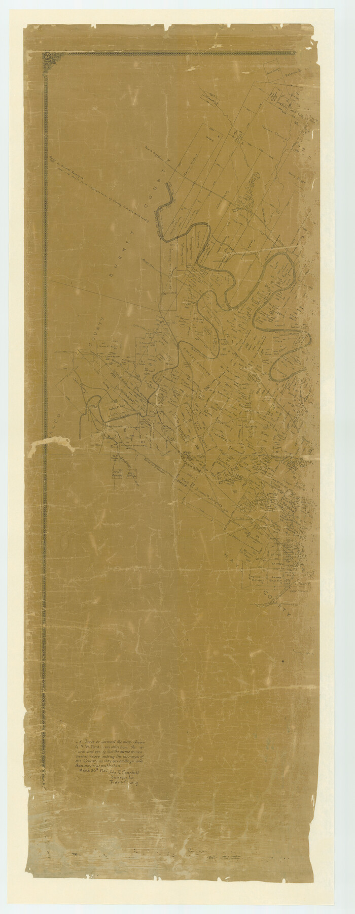
Travis County
-
Map/Doc
87934
-
Collection
General Map Collection
-
Object Dates
1880/3/30 (Creation Date)
-
People and Organizations
Reuben W. Ford (Draftsman)
Reuben W. Ford (Compiler)
August Gast & Co. (Lithographer)
-
Counties
Travis
-
Subjects
County
-
Height x Width
61.7 x 24.0 inches
156.7 x 61.0 cm
-
Comments
Digitally combined version of counter numbers 87934 and 87935.
Prints made at 88%. -
Features
Falls Creek
Road from Fredericksburg
Spring Creek
Deadman's Creek
Road to Birdtown
Bason Creek
Shingle Hills
Shingle Hills
Bee Creek
Cypress Creek
Pedernales River
Marble Falls [ in Burnet County is about 10 miles from intersection of county line]
Corwin's Mill Post Office
Burnett Road
Red Bank Creek
El[ ] Creek
Burnet Road
Post Oak Creek
Travis Peak Post Office
Colorado River
Cow Creek
Road to Burnet
Part of: General Map Collection
[The S.K. Ry. of Texas, State Line to Pecos, Reeves Co., Texas]
![64162, [The S.K. Ry. of Texas, State Line to Pecos, Reeves Co., Texas], General Map Collection](https://historictexasmaps.com/wmedia_w700/maps/64162.tif.jpg)
Print $40.00
- Digital $50.00
[The S.K. Ry. of Texas, State Line to Pecos, Reeves Co., Texas]
1910
Size 19.8 x 120.7 inches
Map/Doc 64162
Lavaca County Working Sketch Graphic Index

Print $40.00
- Digital $50.00
Lavaca County Working Sketch Graphic Index
1946
Size 49.9 x 41.5 inches
Map/Doc 76616
Starr County Sketch File 52

Print $4.00
- Digital $50.00
Starr County Sketch File 52
Size 13.9 x 9.0 inches
Map/Doc 37011
Guadalupe County

Print $20.00
- Digital $50.00
Guadalupe County
1872
Size 24.6 x 23.7 inches
Map/Doc 3610
Newton County

Print $40.00
- Digital $50.00
Newton County
1946
Size 48.7 x 42.6 inches
Map/Doc 73250
Flight Mission No. CRC-2R, Frame 111, Chambers County

Print $20.00
- Digital $50.00
Flight Mission No. CRC-2R, Frame 111, Chambers County
1956
Size 18.4 x 22.3 inches
Map/Doc 84738
Wharton County Rolled Sketch 10

Print $20.00
- Digital $50.00
Wharton County Rolled Sketch 10
Size 21.9 x 32.8 inches
Map/Doc 8234
Pecos County Working Sketch 76

Print $20.00
- Digital $50.00
Pecos County Working Sketch 76
1959
Size 26.7 x 40.1 inches
Map/Doc 71548
San Jacinto County Working Sketch 13

Print $20.00
- Digital $50.00
San Jacinto County Working Sketch 13
1935
Size 25.0 x 18.8 inches
Map/Doc 63726
Flight Mission No. DIX-10P, Frame 64, Aransas County

Print $20.00
- Digital $50.00
Flight Mission No. DIX-10P, Frame 64, Aransas County
1956
Size 18.7 x 22.3 inches
Map/Doc 83925
Sutton County Sketch File 50

Print $20.00
- Digital $50.00
Sutton County Sketch File 50
1941
Size 18.6 x 18.4 inches
Map/Doc 12392
Harris County Rolled Sketch J

Print $40.00
- Digital $50.00
Harris County Rolled Sketch J
1933
Size 53.6 x 41.6 inches
Map/Doc 9122
You may also like
Map of Jack County

Print $20.00
- Digital $50.00
Map of Jack County
1882
Size 21.6 x 24.5 inches
Map/Doc 3706
Flight Mission No. CRK-3P, Frame 125, Refugio County

Print $20.00
- Digital $50.00
Flight Mission No. CRK-3P, Frame 125, Refugio County
1956
Size 18.5 x 22.5 inches
Map/Doc 86913
Oldham County Rolled Sketch 10

Print $20.00
- Digital $50.00
Oldham County Rolled Sketch 10
Size 22.0 x 13.3 inches
Map/Doc 7176
Fractional Township No. 10 South Range No. 26 East of the Indian Meridian, Indian Territory

Print $20.00
- Digital $50.00
Fractional Township No. 10 South Range No. 26 East of the Indian Meridian, Indian Territory
1897
Size 19.2 x 24.3 inches
Map/Doc 75245
Tarrant County Sketch File 35

Print $50.00
Tarrant County Sketch File 35
2018
Size 11.0 x 8.5 inches
Map/Doc 95394
[Traverse up the Brazos and Colorado River showing distance from county site to county site]
![2054, [Traverse up the Brazos and Colorado River showing distance from county site to county site], General Map Collection](https://historictexasmaps.com/wmedia_w700/maps/2054.tif.jpg)
Print $40.00
- Digital $50.00
[Traverse up the Brazos and Colorado River showing distance from county site to county site]
1871
Size 16.2 x 98.8 inches
Map/Doc 2054
Outer Continental Shelf Leasing Maps (Louisiana Offshore Operations)

Print $20.00
- Digital $50.00
Outer Continental Shelf Leasing Maps (Louisiana Offshore Operations)
1954
Size 18.2 x 16.0 inches
Map/Doc 76105
Galveston County NRC Article 33.136 Sketch 34

Print $20.00
- Digital $50.00
Galveston County NRC Article 33.136 Sketch 34
2005
Size 24.5 x 18.5 inches
Map/Doc 83405
[E. L. & R.R. Block 1, G. C. & S. F. Blocks 1 & 2, T. R. R. Block 4]
![91280, [E. L. & R.R. Block 1, G. C. & S. F. Blocks 1 & 2, T. R. R. Block 4], Twichell Survey Records](https://historictexasmaps.com/wmedia_w700/maps/91280-1.tif.jpg)
Print $20.00
- Digital $50.00
[E. L. & R.R. Block 1, G. C. & S. F. Blocks 1 & 2, T. R. R. Block 4]
Size 8.7 x 19.3 inches
Map/Doc 91280
Chambers County Rolled Sketch FD

Print $20.00
- Digital $50.00
Chambers County Rolled Sketch FD
1935
Size 32.7 x 26.5 inches
Map/Doc 5433
General Highway Map, Hemphill County, Texas

Print $20.00
General Highway Map, Hemphill County, Texas
1961
Size 18.3 x 24.6 inches
Map/Doc 79515
Coke County Rolled Sketch 33

Print $20.00
- Digital $50.00
Coke County Rolled Sketch 33
2004
Size 28.9 x 40.5 inches
Map/Doc 82987