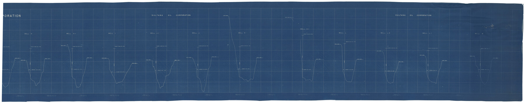
Gregg County Rolled Sketch 26
[Sultana Oil Corporation, Sabine River Bed Tract No. 6]
-
Map/Doc
76432
-
Collection
General Map Collection
-
Object Dates
6/16/1937 (Creation Date)
2/27/1976 (File Date)
-
People and Organizations
M.H. Hackney (Surveyor/Engineer)
-
Counties
Gregg
-
Subjects
Surveying Rolled Sketch
-
Height x Width
26.4 x 126.6 inches
67.1 x 321.6 cm
-
Medium
blueprint/diazo
-
Comments
Segment 2 of 2. See Gregg County Rolled Sketch 26 (9077) for segment 1.
Related maps
Gregg County Rolled Sketch 26

Print $40.00
- Digital $50.00
Gregg County Rolled Sketch 26
1937
Size 25.8 x 129.0 inches
Map/Doc 9077
Part of: General Map Collection
Guadalupe County Sketch File 5

Print $4.00
- Digital $50.00
Guadalupe County Sketch File 5
1871
Size 8.1 x 10.0 inches
Map/Doc 24659
Liberty County Working Sketch 43

Print $20.00
- Digital $50.00
Liberty County Working Sketch 43
1953
Size 30.6 x 43.7 inches
Map/Doc 70502
Liberty County Sketch File 40

Print $3.00
- Digital $50.00
Liberty County Sketch File 40
Size 9.8 x 17.3 inches
Map/Doc 29996
Brazoria County Rolled Sketch 49

Print $20.00
- Digital $50.00
Brazoria County Rolled Sketch 49
1948
Size 24.1 x 36.5 inches
Map/Doc 5186
Flight Mission No. CRK-5P, Frame 155, Refugio County

Print $20.00
- Digital $50.00
Flight Mission No. CRK-5P, Frame 155, Refugio County
1956
Size 18.7 x 22.6 inches
Map/Doc 86936
Map of Titus County

Print $20.00
- Digital $50.00
Map of Titus County
1860
Size 20.9 x 21.8 inches
Map/Doc 4081
Map of Galveston Bay from Lawrence Cove to Stevenson's Station

Print $20.00
- Digital $50.00
Map of Galveston Bay from Lawrence Cove to Stevenson's Station
1851
Size 35.2 x 29.7 inches
Map/Doc 69921
Revised Map of Jefferson County Texas

Print $20.00
- Digital $50.00
Revised Map of Jefferson County Texas
1898
Size 30.1 x 24.5 inches
Map/Doc 78177
Kendall County Sketch File 9

Print $6.00
- Digital $50.00
Kendall County Sketch File 9
1879
Size 4.6 x 9.3 inches
Map/Doc 28692
Presidio County Rolled Sketch 122

Print $20.00
- Digital $50.00
Presidio County Rolled Sketch 122
1981
Size 33.9 x 28.3 inches
Map/Doc 7395
Galveston County Sketch File 1b

Print $6.00
- Digital $50.00
Galveston County Sketch File 1b
1845
Size 16.2 x 11.0 inches
Map/Doc 23347
Fractional Township No. 9 South Range No. 24 East of the Indian Meridian, Indian Territory

Print $20.00
- Digital $50.00
Fractional Township No. 9 South Range No. 24 East of the Indian Meridian, Indian Territory
1898
Size 19.2 x 24.3 inches
Map/Doc 75241
You may also like
Real County Working Sketch 48

Print $20.00
- Digital $50.00
Real County Working Sketch 48
1956
Size 29.4 x 18.5 inches
Map/Doc 71940
Menard County Sketch File 20

Print $8.00
- Digital $50.00
Menard County Sketch File 20
1911
Size 14.2 x 8.7 inches
Map/Doc 31548
[Office Sketch Showing Surveys North of Loma Blanca Grant, Brooks County, Texas]
![412, [Office Sketch Showing Surveys North of Loma Blanca Grant, Brooks County, Texas], Maddox Collection](https://historictexasmaps.com/wmedia_w700/maps/0412.tif.jpg)
Print $20.00
- Digital $50.00
[Office Sketch Showing Surveys North of Loma Blanca Grant, Brooks County, Texas]
Size 16.6 x 19.6 inches
Map/Doc 412
Titus County Sketch File 9

Print $4.00
- Digital $50.00
Titus County Sketch File 9
1855
Size 13.0 x 8.0 inches
Map/Doc 38146
Zavala County Sketch File 33

Print $7.00
- Digital $50.00
Zavala County Sketch File 33
1886
Size 10.9 x 8.3 inches
Map/Doc 41392
Lipscomb County Working Sketch 1

Print $20.00
- Digital $50.00
Lipscomb County Working Sketch 1
1964
Size 30.7 x 34.1 inches
Map/Doc 70577
Mrs. Alex A. Slaughter Ranch Hockley County, Texas

Print $20.00
- Digital $50.00
Mrs. Alex A. Slaughter Ranch Hockley County, Texas
Size 26.2 x 19.7 inches
Map/Doc 92237
[Surveys along the Polk and Tyler County border]
![333, [Surveys along the Polk and Tyler County border], General Map Collection](https://historictexasmaps.com/wmedia_w700/maps/333.tif.jpg)
Print $2.00
- Digital $50.00
[Surveys along the Polk and Tyler County border]
Size 9.3 x 6.0 inches
Map/Doc 333
Wise County Working Sketch 23

Print $20.00
- Digital $50.00
Wise County Working Sketch 23
1981
Size 43.6 x 36.9 inches
Map/Doc 72637
Flight Mission No. BQY-15M, Frame 9, Harris County

Print $20.00
- Digital $50.00
Flight Mission No. BQY-15M, Frame 9, Harris County
1953
Size 18.6 x 22.2 inches
Map/Doc 85307
Medina County Working Sketch 18

Print $20.00
- Digital $50.00
Medina County Working Sketch 18
1980
Size 31.4 x 38.0 inches
Map/Doc 70933
Atascosa County Working Sketch 10

Print $20.00
- Digital $50.00
Atascosa County Working Sketch 10
1919
Size 26.2 x 22.3 inches
Map/Doc 67206