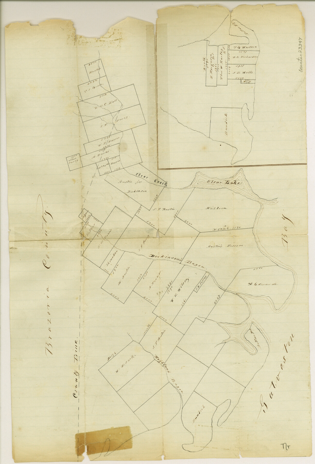
Galveston County Sketch File 1b
[Sketch of surveys on Galveston Bay]
-
Map/Doc
23347
-
Collection
General Map Collection
-
Object Dates
1845/1/23 (Creation Date)
-
People and Organizations
B.C. Smith (Surveyor/Engineer)
-
Counties
Galveston Brazoria Harris
-
Subjects
Surveying Sketch File
-
Height x Width
16.2 x 11.0 inches
41.2 x 27.9 cm
-
Medium
paper, manuscript
-
Features
Dollar Point
Clear Creek
Clear Lake
Dickinson's Bayou
Galveston Bay
Highland Bayou
Part of: General Map Collection

Harris County Rolled Sketch 87A

Print $20.00
- Digital $50.00
Harris County Rolled Sketch 87A
Size 41.1 x 47.6 inches
Map/Doc 78250
Webb County Sketch File 11-2

Print $6.00
- Digital $50.00
Webb County Sketch File 11-2
1932
Size 9.9 x 4.5 inches
Map/Doc 39788
Kleberg County Rolled Sketch 10-11

Print $20.00
- Digital $50.00
Kleberg County Rolled Sketch 10-11
1951
Size 38.2 x 33.8 inches
Map/Doc 9374
Zavala County Rolled Sketch 14

Print $20.00
- Digital $50.00
Zavala County Rolled Sketch 14
1887
Size 28.1 x 40.8 inches
Map/Doc 10175
Pecos County Rolled Sketch 85

Print $20.00
- Digital $50.00
Pecos County Rolled Sketch 85
1931
Size 36.7 x 24.4 inches
Map/Doc 7243
Bandera County Sketch File 19

Print $40.00
- Digital $50.00
Bandera County Sketch File 19
Size 15.9 x 18.9 inches
Map/Doc 10893

Township No. 1 South Range No. 20 West of the Indian Meridian

Print $20.00
- Digital $50.00
Township No. 1 South Range No. 20 West of the Indian Meridian
1875
Size 19.3 x 24.4 inches
Map/Doc 75179
Baylor County Sketch File A5

Print $6.00
- Digital $50.00
Baylor County Sketch File A5
Size 10.4 x 8.8 inches
Map/Doc 14088
Kleberg County Rolled Sketch 10-36

Print $20.00
- Digital $50.00
Kleberg County Rolled Sketch 10-36
1952
Size 35.3 x 30.7 inches
Map/Doc 9382
Kimble County Sketch File 1

Print $4.00
- Digital $50.00
Kimble County Sketch File 1
1854
Size 7.2 x 10.0 inches
Map/Doc 28907
You may also like
Galveston County Sketch File 34a

Print $20.00
- Digital $50.00
Galveston County Sketch File 34a
Size 11.4 x 20.3 inches
Map/Doc 11537
Geographically Correct County Map showing the lines of the Cotton Belt Route (St. Louis Southwestern Railway Co., St. Louis Southwestern Railway Co. of Texas, Tyler Southeastern Railway Co.) and Connections

Print $20.00
- Digital $50.00
Geographically Correct County Map showing the lines of the Cotton Belt Route (St. Louis Southwestern Railway Co., St. Louis Southwestern Railway Co. of Texas, Tyler Southeastern Railway Co.) and Connections
Size 35.2 x 30.4 inches
Map/Doc 95147
Potter County Working Sketch 2

Print $40.00
- Digital $50.00
Potter County Working Sketch 2
1919
Size 43.3 x 54.4 inches
Map/Doc 71662
Flight Mission No. DQN-5K, Frame 77, Calhoun County

Print $20.00
- Digital $50.00
Flight Mission No. DQN-5K, Frame 77, Calhoun County
1953
Size 18.5 x 22.1 inches
Map/Doc 84410
Hamilton County Working Sketch 25

Print $20.00
- Digital $50.00
Hamilton County Working Sketch 25
1963
Size 29.5 x 26.6 inches
Map/Doc 63363
Nueces County Rolled Sketch 90

Print $129.00
Nueces County Rolled Sketch 90
1983
Size 24.8 x 37.1 inches
Map/Doc 7008
Atascosa County Rolled Sketch 19

Print $20.00
- Digital $50.00
Atascosa County Rolled Sketch 19
1955
Size 22.1 x 18.3 inches
Map/Doc 5099
El Paso County Sketch File 33

Print $2.00
- Digital $50.00
El Paso County Sketch File 33
1983
Size 9.0 x 14.5 inches
Map/Doc 22128
Flight Mission No. DIX-8P, Frame 88, Aransas County

Print $20.00
- Digital $50.00
Flight Mission No. DIX-8P, Frame 88, Aransas County
1956
Size 18.6 x 22.3 inches
Map/Doc 83913

San Saba County Sketch File 14b

Print $8.00
- Digital $50.00
San Saba County Sketch File 14b
1899
Size 14.3 x 8.9 inches
Map/Doc 36448
Flight Mission No. CUG-1P, Frame 43, Kleberg County

Print $20.00
- Digital $50.00
Flight Mission No. CUG-1P, Frame 43, Kleberg County
1956
Size 18.6 x 22.4 inches
Map/Doc 86121