![412, [Office Sketch Showing Surveys North of Loma Blanca Grant, Brooks County, Texas], Maddox Collection](https://historictexasmaps.com/wmedia_w1800h1800/maps/0412.tif.jpg)
[Office Sketch Showing Surveys North of Loma Blanca Grant, Brooks County, Texas]
-
Map/Doc
412
-
Collection
Maddox Collection
-
Counties
Brooks
-
Height x Width
16.6 x 19.6 inches
42.2 x 49.8 cm
-
Medium
paper, manuscript
Part of: Maddox Collection
Map of Dewitt County, Texas

Print $20.00
- Digital $50.00
Map of Dewitt County, Texas
Size 22.8 x 27.6 inches
Map/Doc 706
San Antonio del Encinal as Corrected

Print $20.00
- Digital $50.00
San Antonio del Encinal as Corrected
1916
Size 31.2 x 31.5 inches
Map/Doc 10757
Map of Tyler County, Texas

Print $20.00
- Digital $50.00
Map of Tyler County, Texas
1882
Size 28.3 x 21.4 inches
Map/Doc 669
Map of Townsite of Swearingen, Cottle County, Texas

Print $20.00
- Digital $50.00
Map of Townsite of Swearingen, Cottle County, Texas
1919
Size 28.1 x 17.1 inches
Map/Doc 4463
Sketch in Uvalde County

Print $20.00
- Digital $50.00
Sketch in Uvalde County
1890
Size 12.3 x 15.9 inches
Map/Doc 5049
Map of Van Zandt County, Texas

Print $20.00
- Digital $50.00
Map of Van Zandt County, Texas
1879
Size 20.6 x 21.7 inches
Map/Doc 443
Hansford County, Texas

Print $20.00
- Digital $50.00
Hansford County, Texas
1880
Size 21.4 x 18.0 inches
Map/Doc 519
Plat of Surveys in Hidalgo Co.

Print $20.00
- Digital $50.00
Plat of Surveys in Hidalgo Co.
Size 18.3 x 9.2 inches
Map/Doc 75548
Saline Ranch in Mason, Kimble and Menard Counties

Print $20.00
- Digital $50.00
Saline Ranch in Mason, Kimble and Menard Counties
1916
Size 28.6 x 27.4 inches
Map/Doc 75808
[Sketch of surveys in Hutchinson County]
![75817, [Sketch of surveys in Hutchinson County], Maddox Collection](https://historictexasmaps.com/wmedia_w700/maps/75817.tif.jpg)
Print $20.00
- Digital $50.00
[Sketch of surveys in Hutchinson County]
1912
Size 25.0 x 26.8 inches
Map/Doc 75817
[Kenney's sketch of the surveys in Dickens and Motley Counties]

Print $20.00
- Digital $50.00
[Kenney's sketch of the surveys in Dickens and Motley Counties]
1905
Size 20.1 x 15.7 inches
Map/Doc 367
Gonzales County, Texas

Print $20.00
- Digital $50.00
Gonzales County, Texas
1880
Size 27.3 x 24.7 inches
Map/Doc 447
You may also like
[Beaumont, Sour Lake and Western Ry. Right of Way and Alignment - Frisco]
![64119, [Beaumont, Sour Lake and Western Ry. Right of Way and Alignment - Frisco], General Map Collection](https://historictexasmaps.com/wmedia_w700/maps/64119.tif.jpg)
Print $20.00
- Digital $50.00
[Beaumont, Sour Lake and Western Ry. Right of Way and Alignment - Frisco]
1910
Size 20.0 x 45.8 inches
Map/Doc 64119
Brazoria County Sketch File 15a

Print $4.00
- Digital $50.00
Brazoria County Sketch File 15a
1892
Size 14.2 x 8.7 inches
Map/Doc 14979
Nueces County Rolled Sketch 6
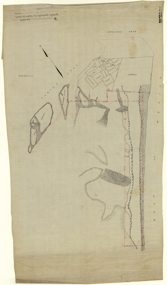
Print $20.00
- Digital $50.00
Nueces County Rolled Sketch 6
Size 37.8 x 22.2 inches
Map/Doc 6867
Sketch of surveys in Harrison & Marion Cos. Showing Caddo Lake & Subdivisions

Print $20.00
- Digital $50.00
Sketch of surveys in Harrison & Marion Cos. Showing Caddo Lake & Subdivisions
1955
Size 33.8 x 32.4 inches
Map/Doc 93284
Hardin County Sketch File 24b

Print $4.00
- Digital $50.00
Hardin County Sketch File 24b
Size 6.4 x 8.0 inches
Map/Doc 25146
Dawson County Working Sketch 16

Print $20.00
- Digital $50.00
Dawson County Working Sketch 16
1956
Size 13.9 x 18.8 inches
Map/Doc 68560
Spence Addition Owned by L.N. Goldbeck and Herman Pressler - A Subdivision of Outlot 43, Division "O"

Print $20.00
- Digital $50.00
Spence Addition Owned by L.N. Goldbeck and Herman Pressler - A Subdivision of Outlot 43, Division "O"
1913
Size 15.5 x 12.8 inches
Map/Doc 83424
Red River County Sketch File 24

Print $6.00
- Digital $50.00
Red River County Sketch File 24
1920
Size 11.4 x 8.8 inches
Map/Doc 35158

Gulf Coast Oil Fields

Print $2.00
- Digital $50.00
Gulf Coast Oil Fields
Size 12.6 x 8.1 inches
Map/Doc 90135

Flight Mission No. BQR-9K, Frame 50, Brazoria County

Print $20.00
- Digital $50.00
Flight Mission No. BQR-9K, Frame 50, Brazoria County
1952
Size 18.7 x 22.4 inches
Map/Doc 84054