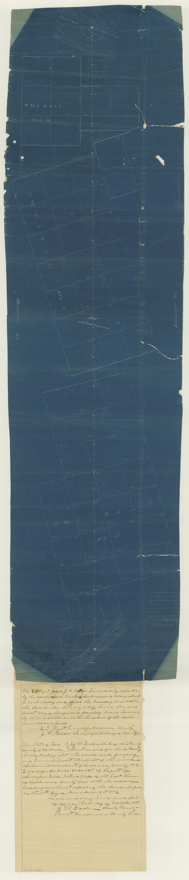
Hardeman County Boundary File 3a
Hardeman Co. bdy. East Line
-
Map/Doc
54384
-
Collection
General Map Collection
-
Counties
Hardeman
-
Subjects
County Boundaries
-
Height x Width
56.8 x 12.3 inches
144.3 x 31.2 cm
Part of: General Map Collection
Texas State Boundary Line 9

Print $174.00
Texas State Boundary Line 9
2000
Size 11.3 x 8.8 inches
Map/Doc 75076
Edwards County Rolled Sketch 34

Print $20.00
- Digital $50.00
Edwards County Rolled Sketch 34
1994
Size 18.0 x 33.5 inches
Map/Doc 5816
Montgomery County Sketch File 5

Print $5.00
- Digital $50.00
Montgomery County Sketch File 5
Size 9.8 x 16.4 inches
Map/Doc 31779

Bandera County Working Sketch 3

Print $20.00
- Digital $50.00
Bandera County Working Sketch 3
1914
Size 14.5 x 13.9 inches
Map/Doc 67596
Galveston County Sketch File 70

Print $26.00
- Digital $50.00
Galveston County Sketch File 70
1983
Size 11.3 x 8.7 inches
Map/Doc 23928
Burleson County Working Sketch 32

Print $20.00
- Digital $50.00
Burleson County Working Sketch 32
1981
Size 26.3 x 13.5 inches
Map/Doc 67751
Right of Way & Track Map San Antonio & Aransas Pass Railway Co.

Print $40.00
- Digital $50.00
Right of Way & Track Map San Antonio & Aransas Pass Railway Co.
1919
Size 25.3 x 56.5 inches
Map/Doc 64024
Dimmit County Working Sketch 21

Print $20.00
- Digital $50.00
Dimmit County Working Sketch 21
1950
Size 35.1 x 18.8 inches
Map/Doc 68682
Gaines County Working Sketch 7

Print $20.00
- Digital $50.00
Gaines County Working Sketch 7
1940
Size 16.5 x 38.5 inches
Map/Doc 69307

Trinity County Sketch File 27

Print $4.00
- Digital $50.00
Trinity County Sketch File 27
Size 12.0 x 8.6 inches
Map/Doc 38562
You may also like
Map of Brazos County, Texas

Print $20.00
- Digital $50.00
Map of Brazos County, Texas
1879
Size 21.6 x 15.3 inches
Map/Doc 597
Anderson County Rolled Sketch 11

Print $20.00
- Digital $50.00
Anderson County Rolled Sketch 11
1956
Size 33.4 x 34.4 inches
Map/Doc 8366
Flight Mission No. CRC-2R, Frame 53, Chambers County

Print $20.00
- Digital $50.00
Flight Mission No. CRC-2R, Frame 53, Chambers County
1956
Size 18.5 x 22.4 inches
Map/Doc 84726
Val Verde County Sketch File AA3

Print $20.00
- Digital $50.00
Val Verde County Sketch File AA3
1924
Size 19.5 x 20.6 inches
Map/Doc 12540
[H. & T. C. RR. Company, Block 47]
![91243, [H. & T. C. RR. Company, Block 47], Twichell Survey Records](https://historictexasmaps.com/wmedia_w700/maps/91243-1.tif.jpg)
Print $20.00
- Digital $50.00
[H. & T. C. RR. Company, Block 47]
Size 27.8 x 26.4 inches
Map/Doc 91243
Sutton County Sketch File 57

Print $24.00
- Digital $50.00
Sutton County Sketch File 57
1961
Size 11.2 x 8.8 inches
Map/Doc 37542
Crockett County Rolled Sketch 30

Print $20.00
- Digital $50.00
Crockett County Rolled Sketch 30
1934
Size 24.5 x 43.1 inches
Map/Doc 8700
Topographical Map of the Rio Grande, Sheet No. 5

Print $20.00
- Digital $50.00
Topographical Map of the Rio Grande, Sheet No. 5
1912
Map/Doc 89529

Flight Mission No. DQO-2K, Frame 89, Galveston County

Print $20.00
- Digital $50.00
Flight Mission No. DQO-2K, Frame 89, Galveston County
1952
Size 18.6 x 22.3 inches
Map/Doc 85016
Bee County Working Sketch 16

Print $20.00
- Digital $50.00
Bee County Working Sketch 16
1974
Size 18.0 x 19.6 inches
Map/Doc 67266
Washington County Working Sketch 1

Print $20.00
- Digital $50.00
Washington County Working Sketch 1
1957
Size 25.1 x 25.4 inches
Map/Doc 72362