Brewster County Rolled Sketch 114
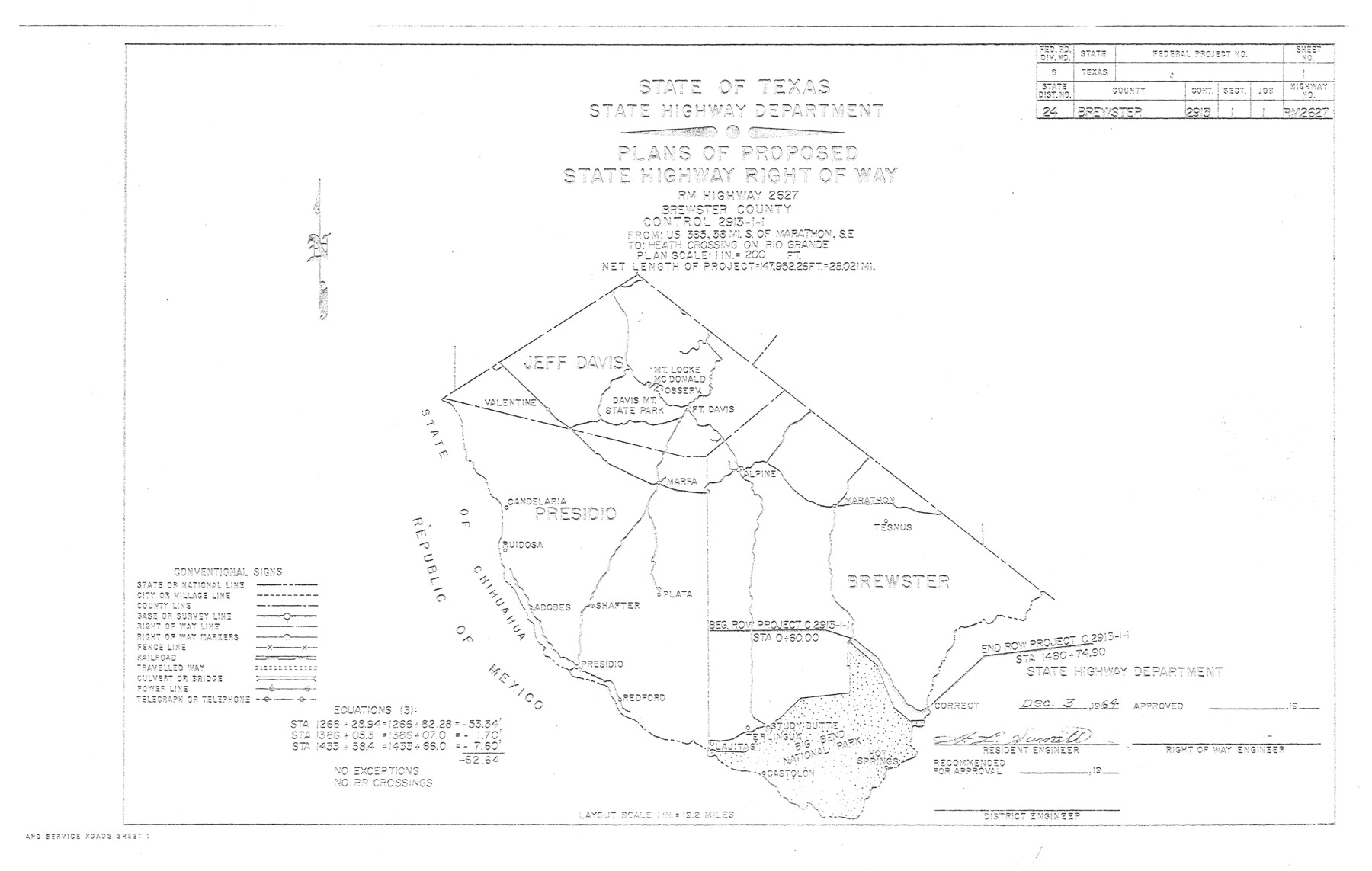
Plans of proposed State Highway Right of Way, RM Highway 2627, Brewster County, Control 2913-1-1 from: US 383, 38 mi. S of Marathon, SE to: Heath Crossing on Rio Grande (Sheet 1)
-
Map/Doc
5264
-
Collection
General Map Collection
-
Object Dates
1965/3/29 (File Date)
1964/12/3 (Creation Date)
-
People and Organizations
State Highway Department (Publisher)
-
Counties
Brewster
-
Subjects
Surveying Rolled Sketch
-
Height x Width
11.8 x 18.5 inches
30.0 x 47.0 cm
-
Medium
blueprint/diazo
-
Comments
This is one sheet of a set of 29 maps. For the complete set, see map numbers 5264-5292.
Related maps
Brewster County Rolled Sketch 114

Print $20.00
- Digital $50.00
Brewster County Rolled Sketch 114
1964
Size 11.7 x 18.4 inches
Map/Doc 5265
Brewster County Rolled Sketch 114

Print $20.00
- Digital $50.00
Brewster County Rolled Sketch 114
1964
Size 11.7 x 18.6 inches
Map/Doc 5266
Brewster County Rolled Sketch 114

Print $20.00
- Digital $50.00
Brewster County Rolled Sketch 114
1964
Size 11.7 x 18.4 inches
Map/Doc 5267
Brewster County Rolled Sketch 114

Print $20.00
- Digital $50.00
Brewster County Rolled Sketch 114
1964
Size 23.8 x 18.9 inches
Map/Doc 5268
Brewster County Rolled Sketch 114

Print $20.00
- Digital $50.00
Brewster County Rolled Sketch 114
1964
Size 11.0 x 18.3 inches
Map/Doc 5269
Brewster County Rolled Sketch 114

Print $20.00
- Digital $50.00
Brewster County Rolled Sketch 114
1964
Size 11.1 x 18.4 inches
Map/Doc 5270
Brewster County Rolled Sketch 114

Print $20.00
- Digital $50.00
Brewster County Rolled Sketch 114
1964
Size 11.5 x 18.5 inches
Map/Doc 5271
Brewster County Rolled Sketch 114

Print $20.00
- Digital $50.00
Brewster County Rolled Sketch 114
1964
Size 11.6 x 18.3 inches
Map/Doc 5272
Brewster County Rolled Sketch 114

Print $20.00
- Digital $50.00
Brewster County Rolled Sketch 114
1964
Size 11.6 x 17.3 inches
Map/Doc 5273
Brewster County Rolled Sketch 114

Print $20.00
- Digital $50.00
Brewster County Rolled Sketch 114
1964
Size 11.5 x 17.6 inches
Map/Doc 5274
Brewster County Rolled Sketch 114

Print $20.00
- Digital $50.00
Brewster County Rolled Sketch 114
1964
Size 11.6 x 18.5 inches
Map/Doc 5275
Brewster County Rolled Sketch 114

Print $20.00
- Digital $50.00
Brewster County Rolled Sketch 114
1964
Size 11.7 x 18.3 inches
Map/Doc 5276
Brewster County Rolled Sketch 114

Print $20.00
- Digital $50.00
Brewster County Rolled Sketch 114
1964
Size 11.4 x 18.4 inches
Map/Doc 5277
Brewster County Rolled Sketch 114

Print $20.00
- Digital $50.00
Brewster County Rolled Sketch 114
1964
Size 12.0 x 18.4 inches
Map/Doc 5278
Brewster County Rolled Sketch 114

Print $20.00
- Digital $50.00
Brewster County Rolled Sketch 114
1964
Size 11.9 x 18.4 inches
Map/Doc 5279
Brewster County Rolled Sketch 114

Print $20.00
- Digital $50.00
Brewster County Rolled Sketch 114
1964
Size 11.9 x 18.3 inches
Map/Doc 5280
Brewster County Rolled Sketch 114

Print $20.00
- Digital $50.00
Brewster County Rolled Sketch 114
1964
Size 11.7 x 17.7 inches
Map/Doc 5281
Brewster County Rolled Sketch 114

Print $20.00
- Digital $50.00
Brewster County Rolled Sketch 114
1964
Size 11.4 x 18.2 inches
Map/Doc 5282
Brewster County Rolled Sketch 114

Print $20.00
- Digital $50.00
Brewster County Rolled Sketch 114
1964
Size 12.2 x 17.5 inches
Map/Doc 5283
Brewster County Rolled Sketch 114

Print $20.00
- Digital $50.00
Brewster County Rolled Sketch 114
1964
Size 11.4 x 17.7 inches
Map/Doc 5284
Part of: General Map Collection
Map of Asylum & University lands situated on the waters of Hubbards Creek

Print $20.00
- Digital $50.00
Map of Asylum & University lands situated on the waters of Hubbards Creek
1857
Size 21.2 x 28.5 inches
Map/Doc 2491
Flight Mission No. CLL-3N, Frame 6, Willacy County

Print $20.00
- Digital $50.00
Flight Mission No. CLL-3N, Frame 6, Willacy County
1954
Size 18.5 x 22.2 inches
Map/Doc 87072
Goliad County Sketch File 14

Print $4.00
- Digital $50.00
Goliad County Sketch File 14
1878
Size 8.6 x 11.4 inches
Map/Doc 24243
Brazoria County Rolled Sketch 25

Print $40.00
- Digital $50.00
Brazoria County Rolled Sketch 25
1935
Size 50.8 x 33.5 inches
Map/Doc 8928
Sabine and Neches Rivers

Print $20.00
- Digital $50.00
Sabine and Neches Rivers
1971
Size 19.7 x 44.4 inches
Map/Doc 69817
Williamson County Sketch File 11

Print $4.00
- Digital $50.00
Williamson County Sketch File 11
Size 8.2 x 9.2 inches
Map/Doc 40324
Jack County Sketch File 26

Print $4.00
- Digital $50.00
Jack County Sketch File 26
1891
Size 8.7 x 9.3 inches
Map/Doc 27563
Tarrant County Sketch File 20

Print $4.00
- Digital $50.00
Tarrant County Sketch File 20
1857
Size 7.0 x 7.3 inches
Map/Doc 37723
Lampasas County Boundary File 13

Print $8.00
- Digital $50.00
Lampasas County Boundary File 13
Size 14.1 x 8.6 inches
Map/Doc 56194
Henderson County Sketch File 2

Print $20.00
- Digital $50.00
Henderson County Sketch File 2
1850
Size 21.6 x 17.1 inches
Map/Doc 11755
Right of Way and Track Map of The Wichita Falls & Southern Railroad Company

Print $40.00
- Digital $50.00
Right of Way and Track Map of The Wichita Falls & Southern Railroad Company
1942
Size 24.4 x 56.4 inches
Map/Doc 64515
Montague County

Print $20.00
- Digital $50.00
Montague County
1924
Size 47.9 x 34.7 inches
Map/Doc 95593
You may also like
Flight Mission No. DQO-3K, Frame 21, Galveston County

Print $20.00
- Digital $50.00
Flight Mission No. DQO-3K, Frame 21, Galveston County
1952
Size 18.9 x 22.5 inches
Map/Doc 85062
Roberts County Rolled Sketch 3

Print $40.00
- Digital $50.00
Roberts County Rolled Sketch 3
Size 38.0 x 49.7 inches
Map/Doc 8354
Waller County Working Sketch 6

Print $20.00
- Digital $50.00
Waller County Working Sketch 6
1988
Size 31.1 x 20.0 inches
Map/Doc 72305
Tom Green County Working Sketch 10

Print $20.00
- Digital $50.00
Tom Green County Working Sketch 10
1959
Size 22.0 x 32.7 inches
Map/Doc 69379
Terrell County Rolled Sketch 29

Print $20.00
- Digital $50.00
Terrell County Rolled Sketch 29
1929
Size 27.5 x 41.9 inches
Map/Doc 7936

Flight Mission No. CRC-5R, Frame 37, Chambers County

Print $20.00
- Digital $50.00
Flight Mission No. CRC-5R, Frame 37, Chambers County
1956
Size 18.6 x 22.4 inches
Map/Doc 84956
El Paso County State Real Property Sketch 3

Print $20.00
- Digital $50.00
El Paso County State Real Property Sketch 3
2012
Size 25.1 x 36.4 inches
Map/Doc 93700
[Map of the Stockdale-Cuero Extension G.H. & S.A. Ry.]
![64095, [Map of the Stockdale-Cuero Extension G.H. & S.A. Ry.], General Map Collection](https://historictexasmaps.com/wmedia_w700/maps/64095.tif.jpg)
Print $40.00
- Digital $50.00
[Map of the Stockdale-Cuero Extension G.H. & S.A. Ry.]
1905
Size 19.6 x 128.0 inches
Map/Doc 64095
Hardeman County Working Sketch 13

Print $20.00
- Digital $50.00
Hardeman County Working Sketch 13
1966
Size 35.8 x 45.7 inches
Map/Doc 63394
Kinney County Working Sketch 49

Print $20.00
- Digital $50.00
Kinney County Working Sketch 49
1980
Size 19.9 x 25.6 inches
Map/Doc 70231
Blanco County Rolled Sketch 16

Print $20.00
- Digital $50.00
Blanco County Rolled Sketch 16
Size 18.8 x 19.4 inches
Map/Doc 5152