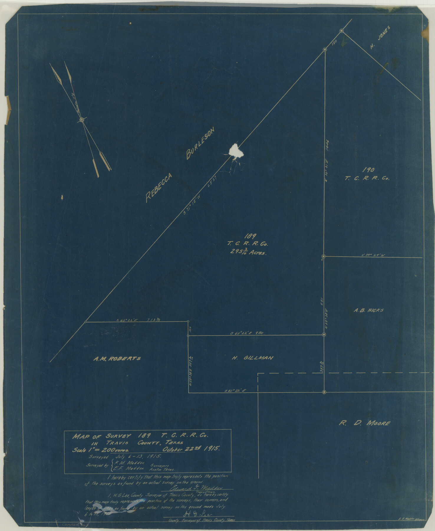
Map of survey 189, T. C. R.R. Co. in Travis County, Texas
-
Map/Doc
663
-
Collection
Maddox Collection
-
Object Dates
1915/10/22 (Creation Date)
1914/7/16 (Survey Date)
-
People and Organizations
H.G. Lee (Surveyor/Engineer)
E.F. Maddox (Draftsman)
Edward F. Maddox (Surveyor/Engineer)
F.M. Maddox (Surveyor/Engineer)
-
Counties
Travis Williamson
-
Height x Width
18.5 x 15.2 inches
47.0 x 38.6 cm
-
Medium
blueprint/diazo
-
Scale
1" = 200 varas
Part of: Maddox Collection
Kent County, Texas

Print $20.00
- Digital $50.00
Kent County, Texas
1880
Size 23.2 x 19.8 inches
Map/Doc 736
Map of Surveys on Harbor Island

Print $40.00
- Digital $50.00
Map of Surveys on Harbor Island
1912
Size 57.3 x 42.2 inches
Map/Doc 594

Map of Shackelford County, Texas

Print $20.00
- Digital $50.00
Map of Shackelford County, Texas
1879
Size 28.7 x 23.4 inches
Map/Doc 616
Lynn County, Texas

Print $20.00
- Digital $50.00
Lynn County, Texas
1883
Size 19.0 x 18.3 inches
Map/Doc 739
Map of Grimes County, Texas

Print $20.00
- Digital $50.00
Map of Grimes County, Texas
1880
Size 29.5 x 15.6 inches
Map/Doc 432
[Surveying Sketch of Loma Blanca, Santa Rosa, San Antonio del Encinal, et al]
![4449, [Surveying Sketch of Loma Blanca, Santa Rosa, San Antonio del Encinal, et al], Maddox Collection](https://historictexasmaps.com/wmedia_w700/maps/4449.tif.jpg)
Print $20.00
- Digital $50.00
[Surveying Sketch of Loma Blanca, Santa Rosa, San Antonio del Encinal, et al]
Size 19.0 x 22.1 inches
Map/Doc 4449
Leon County, Texas

Print $20.00
- Digital $50.00
Leon County, Texas
1879
Size 25.6 x 22.3 inches
Map/Doc 563
[Brooks & Burleson Block 4, Hartley County]
![5037, [Brooks & Burleson Block 4, Hartley County], Maddox Collection](https://historictexasmaps.com/wmedia_w700/maps/5037.tif.jpg)
Print $3.00
- Digital $50.00
[Brooks & Burleson Block 4, Hartley County]
Size 10.3 x 9.5 inches
Map/Doc 5037
Map showing the John B. Pier Survey, Near Houston

Print $3.00
- Digital $50.00
Map showing the John B. Pier Survey, Near Houston
Size 11.9 x 17.8 inches
Map/Doc 478
[Surveying sketch of J.C. Payne, J.D. Polk, Jos. English, et al in Travis County, Texas]
![75801, [Surveying sketch of J.C. Payne, J.D. Polk, Jos. English, et al in Travis County, Texas], Maddox Collection](https://historictexasmaps.com/wmedia_w700/maps/75801.tif.jpg)
Print $20.00
- Digital $50.00
[Surveying sketch of J.C. Payne, J.D. Polk, Jos. English, et al in Travis County, Texas]
Size 18.3 x 23.5 inches
Map/Doc 75801
[Surveying Sketch of Part of] Maverick County
![515, [Surveying Sketch of Part of] Maverick County, Maddox Collection](https://historictexasmaps.com/wmedia_w700/maps/515.tif.jpg)
Print $3.00
- Digital $50.00
[Surveying Sketch of Part of] Maverick County
1878
Size 9.8 x 13.2 inches
Map/Doc 515
You may also like
Wise County Sketch File 10

Print $6.00
- Digital $50.00
Wise County Sketch File 10
1855
Size 7.6 x 8.2 inches
Map/Doc 40541
Orange County Working Sketch 13

Print $20.00
- Digital $50.00
Orange County Working Sketch 13
1922
Size 12.9 x 15.5 inches
Map/Doc 71345
Hartley County Rolled Sketch 5

Print $20.00
- Digital $50.00
Hartley County Rolled Sketch 5
Size 26.1 x 22.0 inches
Map/Doc 6160
Flight Mission No. CLL-1N, Frame 14, Willacy County

Print $20.00
- Digital $50.00
Flight Mission No. CLL-1N, Frame 14, Willacy County
1954
Size 18.2 x 22.1 inches
Map/Doc 87001
Clay County Sketch File 27

Print $20.00
- Digital $50.00
Clay County Sketch File 27
1900
Size 18.8 x 16.5 inches
Map/Doc 11089
Sam Street's Map of Dallas County, Texas

Sam Street's Map of Dallas County, Texas
1900
Size 32.1 x 28.5 inches
Map/Doc 76173
G. C. & S. F. Ry., San Saba Branch, Texas, Right of Way Map, Hall to Brady

Print $20.00
- Digital $50.00
G. C. & S. F. Ry., San Saba Branch, Texas, Right of Way Map, Hall to Brady
1916
Size 36.9 x 34.0 inches
Map/Doc 61419
Baylor County Sketch File 23

Print $60.00
- Digital $50.00
Baylor County Sketch File 23
1927
Size 25.2 x 48.9 inches
Map/Doc 10324
Passage par terre a la Californie decouvert par le R.P. Eusebe-Francois Kino Jesuite depuis 1698 jusqua 1701 ou l'on voit encore les nouvelles Missions des PP. de la Compagnie de Texas

Print $20.00
- Digital $50.00
Passage par terre a la Californie decouvert par le R.P. Eusebe-Francois Kino Jesuite depuis 1698 jusqua 1701 ou l'on voit encore les nouvelles Missions des PP. de la Compagnie de Texas
1819
Size 10.7 x 10.6 inches
Map/Doc 96567
General Highway Map, Childress County, Texas

Print $20.00
General Highway Map, Childress County, Texas
1940
Size 18.3 x 25.2 inches
Map/Doc 79046
Flight Mission No. BRA-7M, Frame 24, Jefferson County

Print $20.00
- Digital $50.00
Flight Mission No. BRA-7M, Frame 24, Jefferson County
1953
Size 18.6 x 22.3 inches
Map/Doc 85475
[County School Land for Shackelford, Reeves, Hardeman, Val Verde, Hood, Martin, Rusk, Atascosa, and Edwards Counties]
![91100, [County School Land for Shackelford, Reeves, Hardeman, Val Verde, Hood, Martin, Rusk, Atascosa, and Edwards Counties], Twichell Survey Records](https://historictexasmaps.com/wmedia_w700/maps/91100-1.tif.jpg)
Print $2.00
- Digital $50.00
[County School Land for Shackelford, Reeves, Hardeman, Val Verde, Hood, Martin, Rusk, Atascosa, and Edwards Counties]
Size 7.5 x 6.4 inches
Map/Doc 91100