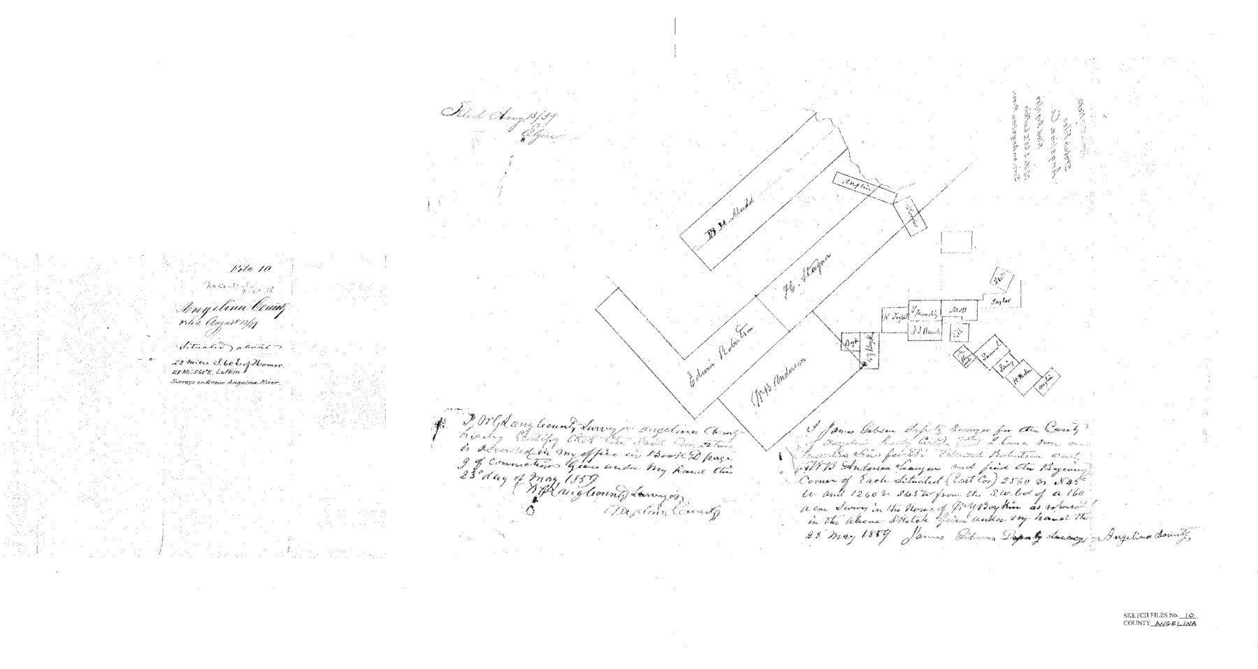
Angelina County Sketch File 10
[Sketch of area near Angelina River in southeast part of county]
-
Map/Doc
10814
-
Collection
General Map Collection
-
Object Dates
1859/5/23 (Creation Date)
1859/8/13 (File Date)
-
People and Organizations
W.G. Lang (Surveyor/Engineer)
-
Counties
Angelina
-
Subjects
Surveying Sketch File
-
Height x Width
17.2 x 32.3 inches
43.7 x 82.0 cm
-
Medium
paper, manuscript
-
Features
[Angelina River]
Part of: General Map Collection
Flight Mission No. BRA-16M, Frame 71, Jefferson County

Print $20.00
- Digital $50.00
Flight Mission No. BRA-16M, Frame 71, Jefferson County
1953
Size 18.7 x 22.3 inches
Map/Doc 85688
Wheeler County

Print $20.00
- Digital $50.00
Wheeler County
1899
Size 44.2 x 38.7 inches
Map/Doc 63121
Webb County Sketch File 9-2

Print $4.00
- Digital $50.00
Webb County Sketch File 9-2
1916
Size 11.3 x 8.6 inches
Map/Doc 39764
Newton County Rolled Sketch 14

Print $40.00
- Digital $50.00
Newton County Rolled Sketch 14
1953
Size 33.4 x 56.0 inches
Map/Doc 9579
Terrell County Working Sketch 19

Print $20.00
- Digital $50.00
Terrell County Working Sketch 19
1932
Size 18.8 x 25.7 inches
Map/Doc 62169
Hutchinson County Rolled Sketch 37

Print $20.00
- Digital $50.00
Hutchinson County Rolled Sketch 37
1950
Size 24.4 x 44.4 inches
Map/Doc 6296

Polk County Working Sketch 37

Print $20.00
- Digital $50.00
Polk County Working Sketch 37
1974
Size 31.3 x 38.2 inches
Map/Doc 71654
Harris County Rolled Sketch 94

Print $20.00
- Digital $50.00
Harris County Rolled Sketch 94
1985
Size 33.8 x 18.4 inches
Map/Doc 6133
Trinity County Sketch File 34A

Print $6.00
- Digital $50.00
Trinity County Sketch File 34A
1921
Size 16.6 x 10.8 inches
Map/Doc 38578
Live Oak County Working Sketch 36

Print $20.00
- Digital $50.00
Live Oak County Working Sketch 36
2008
Size 33.5 x 35.8 inches
Map/Doc 88879
Map of Fannin County

Print $40.00
- Digital $50.00
Map of Fannin County
1841
Size 50.4 x 46.8 inches
Map/Doc 7821
You may also like
Kinney County Rolled Sketch 17

Print $20.00
- Digital $50.00
Kinney County Rolled Sketch 17
1965
Size 18.4 x 21.5 inches
Map/Doc 6544
Nueces County Sketch File 47

Print $17.00
- Digital $50.00
Nueces County Sketch File 47
Size 14.3 x 8.5 inches
Map/Doc 32655
Flight Mission No. DIX-6P, Frame 109, Aransas County

Print $20.00
- Digital $50.00
Flight Mission No. DIX-6P, Frame 109, Aransas County
1956
Size 18.8 x 22.5 inches
Map/Doc 83815
Fort Bend County Rolled Sketch 16A

Print $60.00
- Digital $50.00
Fort Bend County Rolled Sketch 16A
1890
Size 10.6 x 16.6 inches
Map/Doc 44755
Aransas County Sketch File 21b

Print $4.00
- Digital $50.00
Aransas County Sketch File 21b
Size 8.7 x 14.2 inches
Map/Doc 13160
Pecos County Working Sketch 87

Print $20.00
- Digital $50.00
Pecos County Working Sketch 87
1962
Size 29.0 x 31.6 inches
Map/Doc 71559
Hockley County Rolled Sketch 4

Print $40.00
- Digital $50.00
Hockley County Rolled Sketch 4
Size 40.5 x 54.7 inches
Map/Doc 9174
[George Gentry, Charles Welch, and Surrounding Surveys]
![91082, [George Gentry, Charles Welch, and Surrounding Surveys], Twichell Survey Records](https://historictexasmaps.com/wmedia_w700/maps/91082-1.tif.jpg)
Print $20.00
- Digital $50.00
[George Gentry, Charles Welch, and Surrounding Surveys]
1922
Size 28.6 x 32.0 inches
Map/Doc 91082
Map Showing Location of Galveston, Harrisburg & San Antonio Railway

Print $40.00
- Digital $50.00
Map Showing Location of Galveston, Harrisburg & San Antonio Railway
1881
Size 17.4 x 59.3 inches
Map/Doc 64457
Hale County Boundary File 7

Print $48.00
- Digital $50.00
Hale County Boundary File 7
Size 25.0 x 18.6 inches
Map/Doc 54075
Map of Kerr County

Print $20.00
- Digital $50.00
Map of Kerr County
1864
Size 14.8 x 17.9 inches
Map/Doc 3760
Loving County Working Sketch 11

Print $40.00
- Digital $50.00
Loving County Working Sketch 11
1957
Size 21.2 x 120.7 inches
Map/Doc 70643