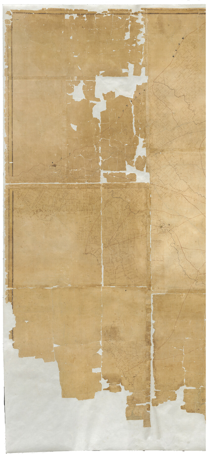
Connected Map of Austin's Colony
T-1-3
-
Map/Doc
93376
-
Collection
General Map Collection
-
Object Dates
1837 (Creation Date)
-
People and Organizations
Stephen F. Austin (Author)
James Franklin Perry (Author)
John P. Borden (Surveyor/Engineer)
Thomas Borden (Surveyor/Engineer)
Gail Borden (Surveyor/Engineer)
-
Subjects
Colony
-
Height x Width
93.2 x 43.1 inches
236.7 x 109.5 cm
-
Comments
Western half of map. See 93377 for eastern half, and 1943 for complete digital composite.
Commenced 1833 by S. F. Austin, Completed 1837 by J. F. Perry.
Conservation funded in 2002 with donation from Gardere Wynne Sewell LLP.
Digitized in 2012 with a generous donation from the Daughters of the American Revolution.
Related maps
Connected Map of Austin's Colony

Print $40.00
- Digital $50.00
Connected Map of Austin's Colony
1837
Size 90.6 x 80.9 inches
Map/Doc 1943
Connected Map of Austin's Colony

Print $40.00
- Digital $50.00
Connected Map of Austin's Colony
1837
Size 93.2 x 43.7 inches
Map/Doc 93377
Part of: General Map Collection
Current Miscellaneous File 74

Print $14.00
- Digital $50.00
Current Miscellaneous File 74
1850
Size 11.2 x 8.7 inches
Map/Doc 74181
Flight Mission No. DQN-2K, Frame 4, Calhoun County

Print $20.00
- Digital $50.00
Flight Mission No. DQN-2K, Frame 4, Calhoun County
1953
Size 18.4 x 22.2 inches
Map/Doc 84221
Marion County Working Sketch 39

Print $20.00
- Digital $50.00
Marion County Working Sketch 39
1991
Size 20.8 x 19.2 inches
Map/Doc 70815
Runnels County Boundary File 1a

Print $14.00
- Digital $50.00
Runnels County Boundary File 1a
Size 12.9 x 8.4 inches
Map/Doc 58507
A Portion of the State's Submerged Oil Field, Goose Creek - Harris County - Texas

Print $20.00
- Digital $50.00
A Portion of the State's Submerged Oil Field, Goose Creek - Harris County - Texas
1919
Size 14.2 x 17.3 inches
Map/Doc 3165
Kerr County Working Sketch 25

Print $20.00
- Digital $50.00
Kerr County Working Sketch 25
Size 21.5 x 28.5 inches
Map/Doc 70056

Kleberg County Rolled Sketch 10-37

Print $20.00
- Digital $50.00
Kleberg County Rolled Sketch 10-37
1952
Size 37.6 x 36.6 inches
Map/Doc 9361
Flight Mission No. CGI-3N, Frame 160, Cameron County

Print $20.00
- Digital $50.00
Flight Mission No. CGI-3N, Frame 160, Cameron County
1954
Size 18.5 x 22.3 inches
Map/Doc 84624
[Bastrop District]
![3131, [Bastrop District], General Map Collection](https://historictexasmaps.com/wmedia_w700/maps/3131.tif.jpg)
Print $40.00
- Digital $50.00
[Bastrop District]
1895
Size 36.5 x 52.0 inches
Map/Doc 3131
Flight Mission No. BRA-7M, Frame 142, Jefferson County

Print $20.00
- Digital $50.00
Flight Mission No. BRA-7M, Frame 142, Jefferson County
1953
Size 18.6 x 22.5 inches
Map/Doc 85536
Blanco County Rolled Sketch 10

Print $20.00
- Digital $50.00
Blanco County Rolled Sketch 10
Size 28.0 x 25.6 inches
Map/Doc 5146
You may also like
[Victor Blanco's survey along the San Antonio River]
![187, [Victor Blanco's survey along the San Antonio River], General Map Collection](https://historictexasmaps.com/wmedia_w700/maps/187.tif.jpg)
Print $2.00
- Digital $50.00
[Victor Blanco's survey along the San Antonio River]
Size 11.2 x 8.2 inches
Map/Doc 187
Dimmit County Sketch File 19 1/2

Print $40.00
- Digital $50.00
Dimmit County Sketch File 19 1/2
Size 16.6 x 13.9 inches
Map/Doc 21092
Knox County Rolled Sketch 16

Print $20.00
- Digital $50.00
Knox County Rolled Sketch 16
1892
Size 29.8 x 32.4 inches
Map/Doc 76029
[Right of Way & Track Map, The Texas & Pacific Ry. Co. Main Line]
![64668, [Right of Way & Track Map, The Texas & Pacific Ry. Co. Main Line], General Map Collection](https://historictexasmaps.com/wmedia_w700/maps/64668.tif.jpg)
Print $20.00
- Digital $50.00
[Right of Way & Track Map, The Texas & Pacific Ry. Co. Main Line]
Size 11.0 x 18.4 inches
Map/Doc 64668
Trinity River, Levee Improvement Districts, Widths of Floodways/Chambers Creek

Print $6.00
- Digital $50.00
Trinity River, Levee Improvement Districts, Widths of Floodways/Chambers Creek
1921
Size 24.9 x 31.3 inches
Map/Doc 65256
Sabine County Working Sketch 4

Print $20.00
- Digital $50.00
Sabine County Working Sketch 4
1913
Size 23.7 x 32.0 inches
Map/Doc 63675
Nueces County Sketch File 83

Print $63.00
- Digital $50.00
Nueces County Sketch File 83
1997
Size 11.1 x 8.5 inches
Map/Doc 43013
Crosbyton (Jeff Williams Plan)

Print $20.00
- Digital $50.00
Crosbyton (Jeff Williams Plan)
Size 26.0 x 18.2 inches
Map/Doc 92126

Map of Terry County

Print $20.00
- Digital $50.00
Map of Terry County
Size 34.0 x 34.2 inches
Map/Doc 92933
Calhoun County Sketch File 19

Print $70.00
- Digital $50.00
Calhoun County Sketch File 19
1998
Size 11.1 x 8.1 inches
Map/Doc 35992
[Surveys in the Liberty District in Tyler and Polk Counties]
![331, [Surveys in the Liberty District in Tyler and Polk Counties], General Map Collection](https://historictexasmaps.com/wmedia_w700/maps/331.tif.jpg)
Print $2.00
- Digital $50.00
[Surveys in the Liberty District in Tyler and Polk Counties]
1847
Size 5.9 x 8.4 inches
Map/Doc 331