![91881, [Sketch of surveys in the vicinity of sections 171 and 172 along Pedernales], Twichell Survey Records](https://historictexasmaps.com/wmedia_w1800h1800/maps/91881-1.tif.jpg)
[Sketch of surveys in the vicinity of sections 171 and 172 along Pedernales]
227-3
-
Map/Doc
91881
-
Collection
Twichell Survey Records
-
Counties
Travis
-
Height x Width
8.6 x 14.4 inches
21.8 x 36.6 cm
Part of: Twichell Survey Records
James Subdivision, NE/4 Section 1, Block E, G. C. & S. F. R.R. Co. Cert 3/360, Abstract 46

Print $3.00
- Digital $50.00
James Subdivision, NE/4 Section 1, Block E, G. C. & S. F. R.R. Co. Cert 3/360, Abstract 46
Size 11.0 x 12.2 inches
Map/Doc 92705
The Rand-McNally New Commercial Atlas Map of Texas

Print $20.00
- Digital $50.00
The Rand-McNally New Commercial Atlas Map of Texas
1913
Size 40.5 x 28.7 inches
Map/Doc 92141
[King, Knox & Stonewall Counties]
![92916, [King, Knox & Stonewall Counties], Twichell Survey Records](https://historictexasmaps.com/wmedia_w700/maps/92916-1.tif.jpg)
Print $20.00
- Digital $50.00
[King, Knox & Stonewall Counties]
1902
Size 19.6 x 28.1 inches
Map/Doc 92916
[Blocks P, D, and John H. Gibson]
![90446, [Blocks P, D, and John H. Gibson], Twichell Survey Records](https://historictexasmaps.com/wmedia_w700/maps/90446-2.tif.jpg)
Print $20.00
- Digital $50.00
[Blocks P, D, and John H. Gibson]
Size 28.2 x 19.5 inches
Map/Doc 90446
[I. & G. N. Block 1, sections 57-70]
![91668, [I. & G. N. Block 1, sections 57-70], Twichell Survey Records](https://historictexasmaps.com/wmedia_w700/maps/91668-1.tif.jpg)
Print $20.00
- Digital $50.00
[I. & G. N. Block 1, sections 57-70]
Size 28.8 x 22.1 inches
Map/Doc 91668
[R. M. Thompson Block A, Jones County School Land, and vicinity]
![91202, [R. M. Thompson Block A, Jones County School Land, and vicinity], Twichell Survey Records](https://historictexasmaps.com/wmedia_w700/maps/91202-1.tif.jpg)
Print $20.00
- Digital $50.00
[R. M. Thompson Block A, Jones County School Land, and vicinity]
Size 15.8 x 30.0 inches
Map/Doc 91202
Working Sketch in Collingsworth County [showing East line of County along border with Oklahoma]
![92086, Working Sketch in Collingsworth County [showing East line of County along border with Oklahoma], Twichell Survey Records](https://historictexasmaps.com/wmedia_w700/maps/92086-1.tif.jpg)
Print $20.00
- Digital $50.00
Working Sketch in Collingsworth County [showing East line of County along border with Oklahoma]
1910
Size 4.5 x 25.9 inches
Map/Doc 92086
[Block C-41, Sections 32, 35, 35 1/2, and vicinity]
![92622, [Block C-41, Sections 32, 35, 35 1/2, and vicinity], Twichell Survey Records](https://historictexasmaps.com/wmedia_w700/maps/92622-1.tif.jpg)
Print $20.00
- Digital $50.00
[Block C-41, Sections 32, 35, 35 1/2, and vicinity]
1951
Size 20.8 x 9.1 inches
Map/Doc 92622
[In Northwest 1/4 of County in the vicinity of the John Walker Survey]
![90903, [In Northwest 1/4 of County in the vicinity of the John Walker Survey], Twichell Survey Records](https://historictexasmaps.com/wmedia_w700/maps/90903-1.tif.jpg)
Print $2.00
- Digital $50.00
[In Northwest 1/4 of County in the vicinity of the John Walker Survey]
Size 7.3 x 15.3 inches
Map/Doc 90903
[Central Garza County]
![92659, [Central Garza County], Twichell Survey Records](https://historictexasmaps.com/wmedia_w700/maps/92659-1.tif.jpg)
Print $20.00
- Digital $50.00
[Central Garza County]
1906
Size 28.0 x 33.1 inches
Map/Doc 92659
Revised Sectional Map Number 2, Showing Land Surveys in Counties of Howard, Martin, Andrews, Glasscock, Midland, Ector, and Portions of Borden, Dawson, Irion, Reagan, Upton, Crane, Ward, and Winkler, Texas

Print $20.00
- Digital $50.00
Revised Sectional Map Number 2, Showing Land Surveys in Counties of Howard, Martin, Andrews, Glasscock, Midland, Ector, and Portions of Borden, Dawson, Irion, Reagan, Upton, Crane, Ward, and Winkler, Texas
Size 24.8 x 19.7 inches
Map/Doc 91357
[Blocks M13, S1, C3, JK3, and JK]
![90700, [Blocks M13, S1, C3, JK3, and JK], Twichell Survey Records](https://historictexasmaps.com/wmedia_w700/maps/90700-1.tif.jpg)
Print $20.00
- Digital $50.00
[Blocks M13, S1, C3, JK3, and JK]
Size 26.9 x 15.4 inches
Map/Doc 90700
You may also like
Eastern South America Brazil, Paraguay, Uruguay, and the Guianas

Eastern South America Brazil, Paraguay, Uruguay, and the Guianas
1955
Size 29.8 x 41.2 inches
Map/Doc 92389
Right of Way and Track Map, The Missouri, Kansas and Texas Ry. of Texas operated by the Missouri, Kansas and Texas Ry. of Texas, Henrietta Division

Print $40.00
- Digital $50.00
Right of Way and Track Map, The Missouri, Kansas and Texas Ry. of Texas operated by the Missouri, Kansas and Texas Ry. of Texas, Henrietta Division
1918
Size 25.1 x 56.4 inches
Map/Doc 64074
Maps of Gulf Intracoastal Waterway, Texas - Sabine River to the Rio Grande and connecting waterways including ship channels

Print $20.00
- Digital $50.00
Maps of Gulf Intracoastal Waterway, Texas - Sabine River to the Rio Grande and connecting waterways including ship channels
1966
Size 14.5 x 22.2 inches
Map/Doc 61964
University Lands Blocks 38 to 57, Crockett-Reagan-Irion-Schleicher-Counties

Print $40.00
- Digital $50.00
University Lands Blocks 38 to 57, Crockett-Reagan-Irion-Schleicher-Counties
Size 35.1 x 53.6 inches
Map/Doc 62945
[Texas State Capitol Land]
![89940, [Texas State Capitol Land], Twichell Survey Records](https://historictexasmaps.com/wmedia_w700/maps/89940-1.tif.jpg)
Print $40.00
- Digital $50.00
[Texas State Capitol Land]
Size 37.6 x 72.6 inches
Map/Doc 89940
Wilbarger County Sketch File 25

Print $6.00
- Digital $50.00
Wilbarger County Sketch File 25
Size 11.0 x 16.7 inches
Map/Doc 40225

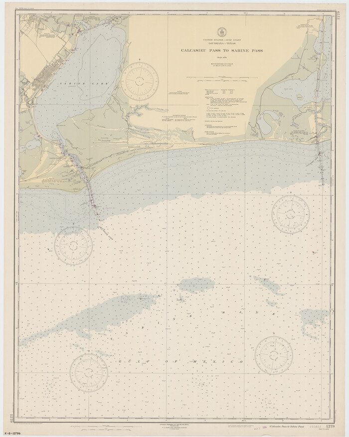
Calcasieu Pass to Sabine Pass
Print $20.00
- Digital $50.00
Calcasieu Pass to Sabine Pass
1946
Size 44.7 x 35.7 inches
Map/Doc 69806
Harris County Working Sketch 31

Print $20.00
- Digital $50.00
Harris County Working Sketch 31
1936
Size 27.7 x 22.0 inches
Map/Doc 65923
Fisher County Sketch File 10

Print $20.00
- Digital $50.00
Fisher County Sketch File 10
Size 9.7 x 37.0 inches
Map/Doc 11477
Brewster County Rolled Sketch 146B

Print $40.00
- Digital $50.00
Brewster County Rolled Sketch 146B
1985
Size 55.5 x 45.2 inches
Map/Doc 8528
Colorado County Working Sketch 21

Print $20.00
- Digital $50.00
Colorado County Working Sketch 21
1963
Size 32.1 x 30.5 inches
Map/Doc 68121