Roberts County Rolled Sketch 3
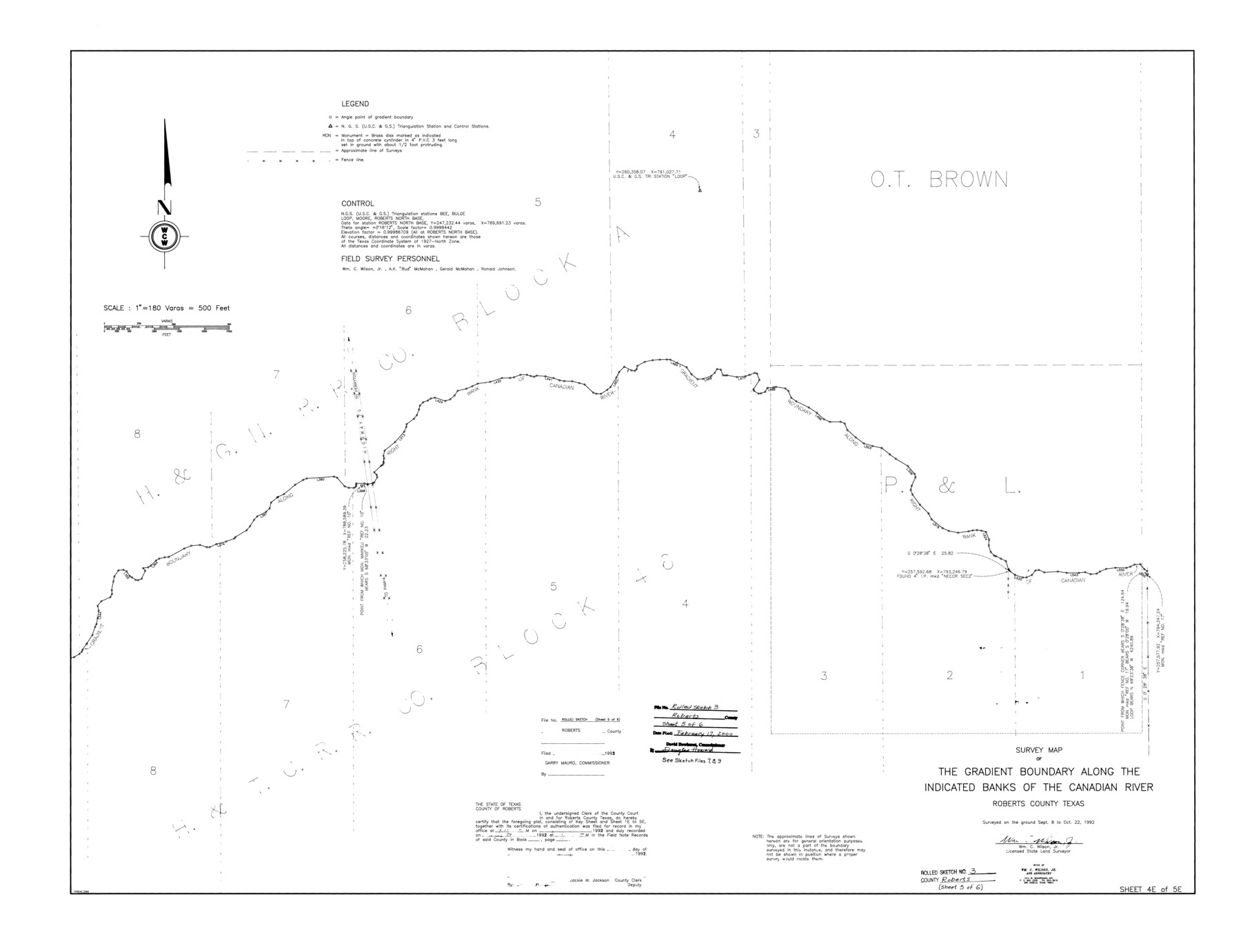
Survey map of the gradient boundary along the indicated banks of the Canadian River, Roberts County, Texas
-
Map/Doc
8358
-
Collection
General Map Collection
-
Object Dates
1992/10/22 (Survey Date)
2000/2/17 (File Date)
-
People and Organizations
Wm. C. Wilson, Jr. (Surveyor/Engineer)
-
Counties
Roberts
-
Subjects
Surveying Rolled Sketch
-
Height x Width
38.4 x 50.0 inches
97.5 x 127.0 cm
-
Medium
mylar, print
-
Scale
1" = 180 varas
-
Comments
One of six sheets. For all sheets see Roberts County Rolled Sketch 3 (8354-8359). Also see Roberts County Sketch File 7 (35316), Roberts County Sketch File 8 (35324), and Roberts County Sketch File 9 (35327) for field notes.
Related maps
Roberts County Sketch File 7

Print $16.00
- Digital $50.00
Roberts County Sketch File 7
1992
Size 14.3 x 8.8 inches
Map/Doc 35316
Roberts County Sketch File 8

Print $6.00
- Digital $50.00
Roberts County Sketch File 8
1992
Size 14.3 x 8.8 inches
Map/Doc 35324
Roberts County Sketch File 9

Print $26.00
- Digital $50.00
Roberts County Sketch File 9
1992
Size 14.3 x 9.0 inches
Map/Doc 35327
Roberts County Rolled Sketch 3

Print $40.00
- Digital $50.00
Roberts County Rolled Sketch 3
Size 38.0 x 49.7 inches
Map/Doc 8354
Roberts County Rolled Sketch 3

Print $40.00
- Digital $50.00
Roberts County Rolled Sketch 3
Size 38.0 x 49.7 inches
Map/Doc 8355
Roberts County Rolled Sketch 3

Print $40.00
- Digital $50.00
Roberts County Rolled Sketch 3
Size 38.0 x 49.7 inches
Map/Doc 8356
Roberts County Rolled Sketch 3

Print $40.00
- Digital $50.00
Roberts County Rolled Sketch 3
Size 38.0 x 49.7 inches
Map/Doc 8357
Roberts County Rolled Sketch 3

Print $40.00
- Digital $50.00
Roberts County Rolled Sketch 3
Size 37.7 x 48.9 inches
Map/Doc 8359
Part of: General Map Collection
Jeff Davis County Working Sketch 19

Print $40.00
- Digital $50.00
Jeff Davis County Working Sketch 19
1957
Size 71.3 x 34.1 inches
Map/Doc 66514
Map of Texas with population and location of principal towns and cities according to latest reliable statistics

Print $20.00
- Digital $50.00
Map of Texas with population and location of principal towns and cities according to latest reliable statistics
1921
Size 19.0 x 22.2 inches
Map/Doc 94066
Hardin County Sketch File 24a

Print $8.00
- Digital $50.00
Hardin County Sketch File 24a
1868
Size 5.8 x 7.9 inches
Map/Doc 25142
Hartley County Boundary File 1

Print $64.00
- Digital $50.00
Hartley County Boundary File 1
Size 8.8 x 25.8 inches
Map/Doc 54423
Presidio County Sketch File 88

Print $6.00
- Digital $50.00
Presidio County Sketch File 88
Size 14.5 x 8.8 inches
Map/Doc 34751
Jim Wells County Sketch File 1

Print $20.00
- Digital $50.00
Jim Wells County Sketch File 1
1931
Size 22.9 x 22.1 inches
Map/Doc 11889
Sutton County Rolled Sketch 52

Print $20.00
- Digital $50.00
Sutton County Rolled Sketch 52
1950
Size 20.8 x 35.2 inches
Map/Doc 7892
Liberty County Working Sketch 37

Print $20.00
- Digital $50.00
Liberty County Working Sketch 37
1948
Size 25.4 x 26.8 inches
Map/Doc 70496
Donley County Working Sketch 4

Print $20.00
- Digital $50.00
Donley County Working Sketch 4
1958
Size 44.0 x 39.8 inches
Map/Doc 68737
Flight Mission No. BRA-16M, Frame 140, Jefferson County

Print $20.00
- Digital $50.00
Flight Mission No. BRA-16M, Frame 140, Jefferson County
1953
Size 18.6 x 22.2 inches
Map/Doc 85746
Clay County Sketch File 14

Print $40.00
- Digital $50.00
Clay County Sketch File 14
1873
Size 16.5 x 13.8 inches
Map/Doc 18417
Fractional Township No. 9 South Range No. 24 East of the Indian Meridian, Indian Territory

Print $20.00
- Digital $50.00
Fractional Township No. 9 South Range No. 24 East of the Indian Meridian, Indian Territory
1898
Size 19.2 x 24.3 inches
Map/Doc 75241
You may also like
Presidio County Rolled Sketch 92

Print $20.00
- Digital $50.00
Presidio County Rolled Sketch 92
1947
Size 18.5 x 18.9 inches
Map/Doc 7377
Karnes County Sketch File 4

Print $8.00
- Digital $50.00
Karnes County Sketch File 4
1852
Size 5.5 x 6.8 inches
Map/Doc 28550
Hemphill County Working Sketch 26

Print $40.00
- Digital $50.00
Hemphill County Working Sketch 26
1974
Size 57.2 x 48.3 inches
Map/Doc 66121
Flight Mission No. DAG-26K, Frame 56, Matagorda County

Print $20.00
- Digital $50.00
Flight Mission No. DAG-26K, Frame 56, Matagorda County
1953
Size 18.6 x 22.7 inches
Map/Doc 86576
![3295, [Bell County], General Map Collection](https://historictexasmaps.com/wmedia_w700/maps/3295-1.tif.jpg)
Red River County

Print $20.00
- Digital $50.00
Red River County
1934
Size 45.0 x 38.6 inches
Map/Doc 77405
[Sketch of Norwood's Homestead]
![89646, [Sketch of Norwood's Homestead], Twichell Survey Records](https://historictexasmaps.com/wmedia_w700/maps/89646-1.tif.jpg)
Print $40.00
- Digital $50.00
[Sketch of Norwood's Homestead]
Size 31.8 x 49.7 inches
Map/Doc 89646
The United States of America

Print $20.00
- Digital $50.00
The United States of America
1866
Size 22.4 x 18.2 inches
Map/Doc 72645
Edwards County Rolled Sketch 20

Print $20.00
- Digital $50.00
Edwards County Rolled Sketch 20
1947
Size 31.6 x 40.4 inches
Map/Doc 8844
Cass County Rolled Sketch OPD

Print $20.00
- Digital $50.00
Cass County Rolled Sketch OPD
1936
Size 29.4 x 25.1 inches
Map/Doc 5483
Flight Mission No. CRC-3R, Frame 165, Chambers County

Print $20.00
- Digital $50.00
Flight Mission No. CRC-3R, Frame 165, Chambers County
1956
Size 18.8 x 22.5 inches
Map/Doc 84847
Zavala County Sketch File 15

Print $20.00
- Digital $50.00
Zavala County Sketch File 15
Size 23.3 x 22.3 inches
Map/Doc 12729