University Land Field Notes for Block 52 in Crockett, Irion, and Schleicher Counties, Blocks 55 and 56 in Crockett and Schleicher Counties, Block 53 in Irion and Schleicher Counties, and Blocks 54 and 57 in Schleicher County
University Field Notes
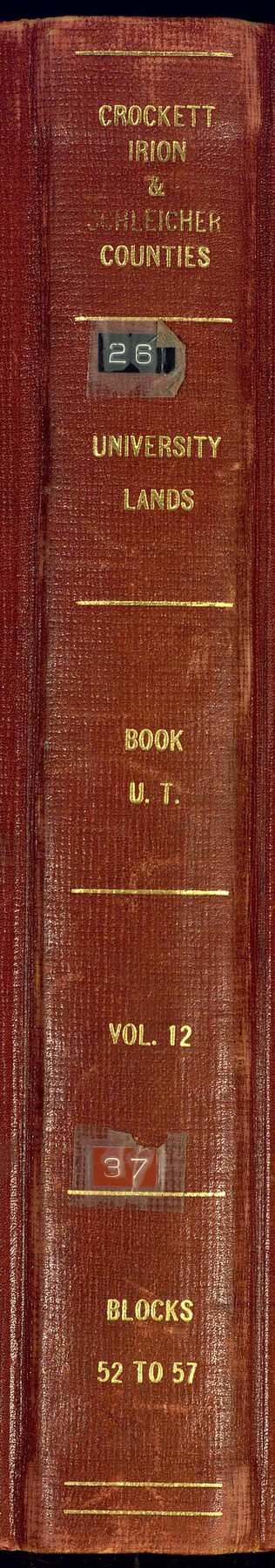
Crockett, Irion and Schleicher Counties University Lands Book U.T., Vol. 12, Blocks 52 to 57
-
Map/Doc
81719
-
Collection
General Map Collection
-
People and Organizations
Wm. H. McDonald (GLO Commissioner)
Frank F. Friend (Surveyor/Engineer)
-
Counties
Schleicher Irion Crockett
-
Subjects
Bound Volume University Land
-
Medium
paper, bound volume
-
Comments
Also includes "Report of a Re-survey, University Lands Blocks 38 to 57, inc, Irion, Crockett, Reagan, and Schleicher Counties" by Frank F. Friend.
See 97177 for an index to the University Land field note volumes.
Related maps
University Land Field Notes for Blocks 39, 41, 42, 44, 45, 46, 47, 50, and 51 in Crockett County, Blocks 38 and 40 in Crockett and Irion Counties, and Blocks 48 and 49 in Crockett and Reagan Counties, and Block 43 in Crockett, Irion, and Reagan Counties

University Land Field Notes for Blocks 39, 41, 42, 44, 45, 46, 47, 50, and 51 in Crockett County, Blocks 38 and 40 in Crockett and Irion Counties, and Blocks 48 and 49 in Crockett and Reagan Counties, and Block 43 in Crockett, Irion, and Reagan Counties
Map/Doc 81718
University Land Field Note Volume Index

University Land Field Note Volume Index
2023
Size 8.5 x 11.0 inches
Map/Doc 97177
Part of: General Map Collection
McLennan County

Print $20.00
- Digital $50.00
McLennan County
1946
Size 43.9 x 46.8 inches
Map/Doc 1887
Map of Lampasas Co.

Print $20.00
- Digital $50.00
Map of Lampasas Co.
1888
Size 34.4 x 42.4 inches
Map/Doc 5080
Presidio County Sketch File 70b

Print $6.00
- Digital $50.00
Presidio County Sketch File 70b
Size 11.2 x 8.9 inches
Map/Doc 34671
Liberty County Boundary File 1

Print $8.00
- Digital $50.00
Liberty County Boundary File 1
Size 14.2 x 8.9 inches
Map/Doc 56289
Kimble County

Print $40.00
- Digital $50.00
Kimble County
1930
Size 41.0 x 49.0 inches
Map/Doc 77340
Atascosa County Sketch File 27d

Print $8.00
- Digital $50.00
Atascosa County Sketch File 27d
1876
Size 10.9 x 8.9 inches
Map/Doc 13812
Carta Etnografica

Print $20.00
- Digital $50.00
Carta Etnografica
1897
Size 26.2 x 34.1 inches
Map/Doc 96798
Gregg County Sketch File 14

Print $6.00
- Digital $50.00
Gregg County Sketch File 14
1946
Size 14.3 x 8.8 inches
Map/Doc 24613
Tom Green County Sketch File 82

Print $20.00
- Digital $50.00
Tom Green County Sketch File 82
1888
Size 18.5 x 20.9 inches
Map/Doc 12454
Upton County Working Sketch 28

Print $40.00
- Digital $50.00
Upton County Working Sketch 28
1956
Size 52.5 x 35.9 inches
Map/Doc 69524
Ochiltree County Sketch File 8

Print $16.00
- Digital $50.00
Ochiltree County Sketch File 8
1933
Size 11.2 x 8.7 inches
Map/Doc 33186
Terry County Sketch File 5

Print $40.00
- Digital $50.00
Terry County Sketch File 5
1916
Size 15.6 x 58.6 inches
Map/Doc 10391
You may also like

Map of Galveston East Bay and Bolivar Peninsular

Print $40.00
- Digital $50.00
Map of Galveston East Bay and Bolivar Peninsular
1851
Size 30.9 x 75.8 inches
Map/Doc 69919
Motley County Sketch File E (S)

Print $52.00
- Digital $50.00
Motley County Sketch File E (S)
Size 14.6 x 9.0 inches
Map/Doc 32169
Crockett County Sketch File 52

Print $4.00
- Digital $50.00
Crockett County Sketch File 52
Size 9.5 x 8.8 inches
Map/Doc 19817
Palo Pinto County Boundary File 4a

Print $34.00
- Digital $50.00
Palo Pinto County Boundary File 4a
Size 13.3 x 8.9 inches
Map/Doc 57817
Trinity County Sketch File 35

Print $34.00
- Digital $50.00
Trinity County Sketch File 35
1920
Size 8.3 x 9.1 inches
Map/Doc 38580
Hardin County Sketch File 1

Print $8.00
- Digital $50.00
Hardin County Sketch File 1
1851
Size 10.0 x 6.9 inches
Map/Doc 25079
[St. L. S-W. Ry. of Texas Map of Lufkin Branch in Angelina County, Texas]
![64561, [St. L. S-W. Ry. of Texas Map of Lufkin Branch in Angelina County, Texas], General Map Collection](https://historictexasmaps.com/wmedia_w700/maps/64561-1.tif.jpg)
Print $40.00
- Digital $50.00
[St. L. S-W. Ry. of Texas Map of Lufkin Branch in Angelina County, Texas]
1913
Size 25.4 x 121.3 inches
Map/Doc 64561
Flight Mission No. DAH-9M, Frame 156, Orange County

Print $20.00
- Digital $50.00
Flight Mission No. DAH-9M, Frame 156, Orange County
1953
Size 18.6 x 22.4 inches
Map/Doc 86855
Sutton County Rolled Sketch 61

Print $20.00
- Digital $50.00
Sutton County Rolled Sketch 61
1890
Size 27.8 x 23.4 inches
Map/Doc 7898

[Sketch of Oyster Bay, Bastrop Bay, Chocolate Bay, and West Bay]
![3103, [Sketch of Oyster Bay, Bastrop Bay, Chocolate Bay, and West Bay], General Map Collection](https://historictexasmaps.com/wmedia_w700/maps/3103.tif.jpg)
Print $20.00
- Digital $50.00
[Sketch of Oyster Bay, Bastrop Bay, Chocolate Bay, and West Bay]
1871
Size 6.0 x 23.9 inches
Map/Doc 3103