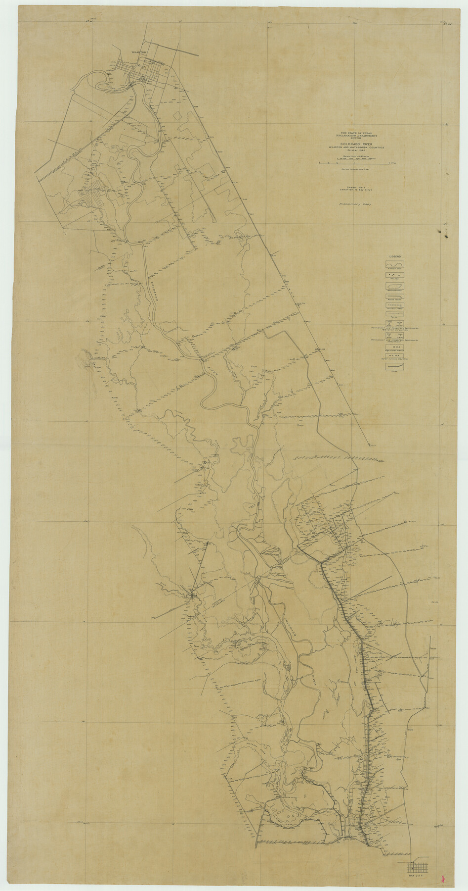
Colorado River, Wharton to Bay City Sheet 1, Texas
-
Map/Doc
65262
-
Collection
General Map Collection
-
Object Dates
1924 (Creation Date)
-
People and Organizations
Texas State Reclamation Department (Publisher)
-
Counties
Wharton Matagorda
-
Subjects
City River Surveys Topographic
-
Height x Width
73.9 x 38.9 inches
187.7 x 98.8 cm
-
Comments
Shows the location of the "Head of Raft" on the Colorado River.
Part of: General Map Collection
Johnson County Working Sketch 18

Print $20.00
- Digital $50.00
Johnson County Working Sketch 18
1985
Size 18.3 x 26.0 inches
Map/Doc 66631
Pecos County Rolled Sketch 119

Print $20.00
- Digital $50.00
Pecos County Rolled Sketch 119
1945
Size 20.5 x 21.5 inches
Map/Doc 7261
Randall County Rolled Sketch 3

Print $20.00
- Digital $50.00
Randall County Rolled Sketch 3
Size 22.0 x 24.9 inches
Map/Doc 7423
Fort Bend County Working Sketch 27

Print $20.00
- Digital $50.00
Fort Bend County Working Sketch 27
1982
Size 17.2 x 19.2 inches
Map/Doc 69233
Webb County Working Sketch 63

Print $20.00
- Digital $50.00
Webb County Working Sketch 63
1962
Size 11.1 x 24.2 inches
Map/Doc 72429
Coke County Working Sketch 29

Print $20.00
- Digital $50.00
Coke County Working Sketch 29
1982
Size 19.6 x 25.4 inches
Map/Doc 68066
Tyler County Working Sketch 11

Print $20.00
- Digital $50.00
Tyler County Working Sketch 11
1941
Size 23.0 x 17.3 inches
Map/Doc 69481
Dimmit County Working Sketch 44

Print $20.00
- Digital $50.00
Dimmit County Working Sketch 44
1979
Size 31.7 x 34.0 inches
Map/Doc 68705
Jasper County Sketch File 7

Print $22.00
- Digital $50.00
Jasper County Sketch File 7
Size 12.4 x 15.4 inches
Map/Doc 27775
Bexar County Working Sketch 21

Print $20.00
- Digital $50.00
Bexar County Working Sketch 21
1984
Size 21.3 x 28.8 inches
Map/Doc 67337
Flight Mission No. BRE-2P, Frame 39, Nueces County

Print $20.00
- Digital $50.00
Flight Mission No. BRE-2P, Frame 39, Nueces County
1956
Size 18.6 x 22.4 inches
Map/Doc 86741
Matagorda Bay and Approaches

Print $20.00
- Digital $50.00
Matagorda Bay and Approaches
1973
Size 34.9 x 45.0 inches
Map/Doc 73385
You may also like
Matagorda Light to Aransas Pass

Print $20.00
- Digital $50.00
Matagorda Light to Aransas Pass
1988
Size 35.2 x 44.3 inches
Map/Doc 73404
Galveston County Aerial Photograph Index Sheet 5

Print $20.00
- Digital $50.00
Galveston County Aerial Photograph Index Sheet 5
1953
Size 23.1 x 18.8 inches
Map/Doc 83696
Brown County Rolled Sketch 2B

Print $20.00
- Digital $50.00
Brown County Rolled Sketch 2B
1984
Size 24.3 x 18.6 inches
Map/Doc 5351
Flight Mission No. DQN-7K, Frame 36, Calhoun County

Print $20.00
- Digital $50.00
Flight Mission No. DQN-7K, Frame 36, Calhoun County
1953
Size 18.5 x 22.2 inches
Map/Doc 84474
Panola County

Print $20.00
- Digital $50.00
Panola County
1947
Size 40.7 x 40.3 inches
Map/Doc 73257
Aransas County Rolled Sketch 2

Print $40.00
- Digital $50.00
Aransas County Rolled Sketch 2
Size 42.9 x 48.2 inches
Map/Doc 73614
Henderson County Working Sketch 13

Print $20.00
- Digital $50.00
Henderson County Working Sketch 13
1918
Size 23.2 x 24.7 inches
Map/Doc 66146
Hill County Boundary File 2

Print $18.00
- Digital $50.00
Hill County Boundary File 2
Size 10.6 x 8.1 inches
Map/Doc 54734
[Sketch of PSL Blocks A21-A24, A33, A34, A36, A42, A43, A46]
![89741, [Sketch of PSL Blocks A21-A24, A33, A34, A36, A42, A43, A46], Twichell Survey Records](https://historictexasmaps.com/wmedia_w700/maps/89741-1.tif.jpg)
Print $40.00
- Digital $50.00
[Sketch of PSL Blocks A21-A24, A33, A34, A36, A42, A43, A46]
Size 23.1 x 63.1 inches
Map/Doc 89741
Dimmit County Sketch File 3

Print $4.00
- Digital $50.00
Dimmit County Sketch File 3
1874
Size 10.1 x 8.0 inches
Map/Doc 21058
No. 3 Chart of Channel connecting Corpus Christi Bay with Aransas Bay, Texas

Print $20.00
- Digital $50.00
No. 3 Chart of Channel connecting Corpus Christi Bay with Aransas Bay, Texas
1878
Size 18.3 x 27.5 inches
Map/Doc 72784
Gillespie County Boundary File 3a

Print $20.00
- Digital $50.00
Gillespie County Boundary File 3a
Size 24.6 x 37.6 inches
Map/Doc 53753