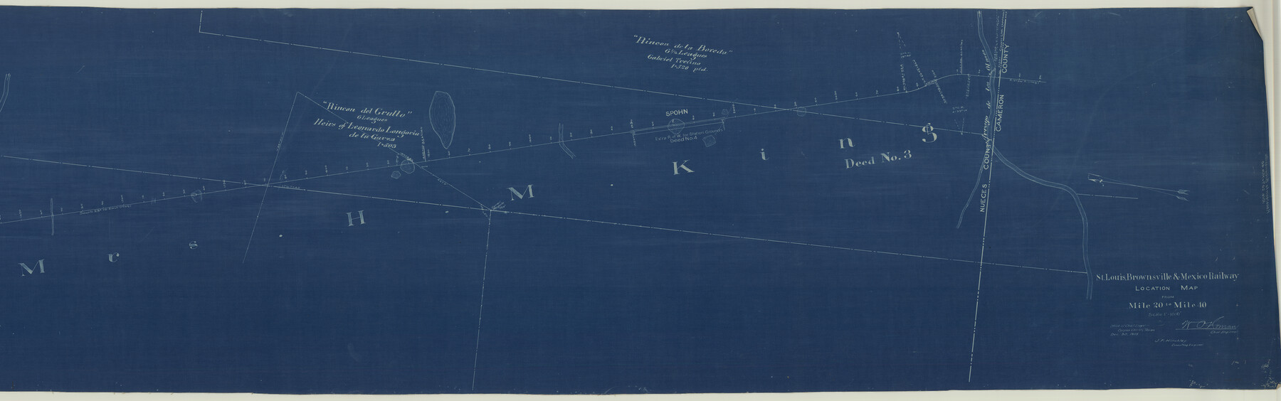
St. Louis, Brownsville & Mexico Railway Location Map from Mile 20 to Mile 40
Z-2-21
-
Map/Doc
64078
-
Collection
General Map Collection
-
Object Dates
1905/12/30 (Creation Date)
-
People and Organizations
Office of Chief Engineer (Publisher)
W. O. Homan (Surveyor/Engineer)
J. F. Hinckley (Surveyor/Engineer)
-
Counties
Cameron
-
Subjects
Railroads
-
Height x Width
19.2 x 61.4 inches
48.8 x 156.0 cm
-
Medium
blueprint/diazo
-
Scale
1" = 1000 feet
-
Comments
Segment 1. See counter no. 64076 for segment 2.
See counter 89280 for digital composite.
See counter nos. 64077 through 64080 for other related sheets and counters 89281 and 89282 for related digital composites. -
Features
SLB&M
Arroyo de los Olmos
Spohn
Part of: General Map Collection
Eastland County Rolled Sketch 14

Print $20.00
- Digital $50.00
Eastland County Rolled Sketch 14
Size 18.5 x 18.3 inches
Map/Doc 5775
Hutchinson County Sketch File 15

Print $20.00
- Digital $50.00
Hutchinson County Sketch File 15
Size 20.7 x 26.7 inches
Map/Doc 11813

Concho County Rolled Sketch 7

Print $20.00
- Digital $50.00
Concho County Rolled Sketch 7
1950
Size 36.9 x 35.7 inches
Map/Doc 8652
Township 6 North Range 13 West, North Western District, Louisiana

Print $20.00
- Digital $50.00
Township 6 North Range 13 West, North Western District, Louisiana
1841
Size 19.7 x 24.8 inches
Map/Doc 65864
Montgomery County Working Sketch 9

Print $20.00
- Digital $50.00
Montgomery County Working Sketch 9
1933
Size 26.4 x 39.6 inches
Map/Doc 71116
Flight Mission No. CGI-4N, Frame 183, Cameron County

Print $20.00
- Digital $50.00
Flight Mission No. CGI-4N, Frame 183, Cameron County
1955
Size 18.6 x 22.3 inches
Map/Doc 84686
Lubbock County Working Sketch 6

Print $20.00
- Digital $50.00
Lubbock County Working Sketch 6
1959
Size 25.1 x 22.4 inches
Map/Doc 70666
Cooke County Working Sketch 22

Print $20.00
- Digital $50.00
Cooke County Working Sketch 22
1963
Size 37.0 x 40.2 inches
Map/Doc 68259
Map of Mason County

Print $20.00
- Digital $50.00
Map of Mason County
1879
Size 22.5 x 18.8 inches
Map/Doc 3839
Roberts County Working Sketch 9

Print $20.00
- Digital $50.00
Roberts County Working Sketch 9
1964
Size 24.3 x 36.5 inches
Map/Doc 63535
Starr County Sketch File 36

Print $26.00
- Digital $50.00
Starr County Sketch File 36
1939
Size 14.3 x 8.7 inches
Map/Doc 36977
You may also like
Amistad International Reservoir on Rio Grande 79

Print $20.00
- Digital $50.00
Amistad International Reservoir on Rio Grande 79
1949
Size 28.6 x 40.3 inches
Map/Doc 75508

Map of Texas and the countries adjacent compiled in the Bureau of the Corps of Topographical Engineers from the best authorities for the State Department

Print $20.00
- Digital $50.00
Map of Texas and the countries adjacent compiled in the Bureau of the Corps of Topographical Engineers from the best authorities for the State Department
1844
Size 26.1 x 18.2 inches
Map/Doc 72715
Gaines County Rolled Sketch 14B

Print $40.00
- Digital $50.00
Gaines County Rolled Sketch 14B
1940
Size 142.9 x 24.0 inches
Map/Doc 9032
San Jacinto County Sketch File 9

Print $4.00
San Jacinto County Sketch File 9
1860
Size 8.7 x 11.7 inches
Map/Doc 35712
Kent County Sketch File 3

Print $4.00
- Digital $50.00
Kent County Sketch File 3
Size 14.2 x 8.7 inches
Map/Doc 28825
Trace of a copy of the map captured at the battle of Resaca de la Palma

Print $20.00
- Digital $50.00
Trace of a copy of the map captured at the battle of Resaca de la Palma
Size 18.3 x 27.3 inches
Map/Doc 73056
Map of Jackson County Texas

Print $20.00
- Digital $50.00
Map of Jackson County Texas
1840
Size 29.6 x 23.2 inches
Map/Doc 3708
[Meander of Yellow House Creek from Northeast Corner of Section 37, Block S to Northeast corner of Section 3, Block O]
![91387, [Meander of Yellow House Creek from Northeast Corner of Section 37, Block S to Northeast corner of Section 3, Block O], Twichell Survey Records](https://historictexasmaps.com/wmedia_w700/maps/91387-1.tif.jpg)
Print $20.00
- Digital $50.00
[Meander of Yellow House Creek from Northeast Corner of Section 37, Block S to Northeast corner of Section 3, Block O]
Size 24.8 x 32.7 inches
Map/Doc 91387
Garza County Rolled Sketch J

Print $20.00
- Digital $50.00
Garza County Rolled Sketch J
1911
Size 27.2 x 23.4 inches
Map/Doc 6004
Travis County Sketch File 61

Print $8.00
- Digital $50.00
Travis County Sketch File 61
1948
Size 14.4 x 8.8 inches
Map/Doc 38427
[J. Poitevent Blk. 1]
![90132, [J. Poitevent Blk. 1], Twichell Survey Records](https://historictexasmaps.com/wmedia_w700/maps/90132-1.tif.jpg)
Print $3.00
- Digital $50.00
[J. Poitevent Blk. 1]
Size 10.7 x 13.3 inches
Map/Doc 90132