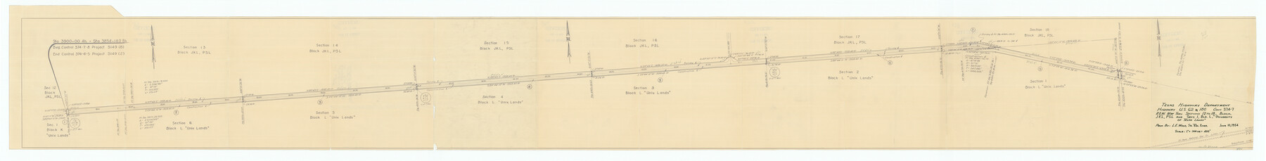
Hudspeth County Sketch File 37
[Highway ROW in Block JKL]
-
Map/Doc
27008
-
Collection
General Map Collection
-
Object Dates
6/17/1954 (File Date)
6/10/1954 (Survey Date)
-
Counties
Hudspeth
-
Subjects
Surveying Sketch File
-
Height x Width
12.5 x 98.3 inches
31.8 x 249.7 cm
-
Medium
blueprint/diazo
-
Scale
1" = 144 varas
-
Comments
Stated scale: 1" = 144 vr. = 400'
-
Features
FM Hwy. 1437
US Hwy. 62
US Hwy. 180
Part of: General Map Collection
Bell County Sketch File 19a

Print $4.00
- Digital $50.00
Bell County Sketch File 19a
Size 8.1 x 8.7 inches
Map/Doc 14404
Blanco County Rolled Sketch 12

Print $20.00
- Digital $50.00
Blanco County Rolled Sketch 12
1964
Size 17.3 x 20.0 inches
Map/Doc 5148
Limestone County State Real Property Sketch 1

Print $20.00
- Digital $50.00
Limestone County State Real Property Sketch 1
2010
Size 35.9 x 24.6 inches
Map/Doc 89570
Zavala County Working Sketch 27

Print $20.00
- Digital $50.00
Zavala County Working Sketch 27
1990
Size 22.3 x 27.5 inches
Map/Doc 62102
Montgomery County Working Sketch 61

Print $20.00
- Digital $50.00
Montgomery County Working Sketch 61
1963
Size 25.6 x 19.9 inches
Map/Doc 71168
Wood County Boundary File 2a

Print $6.00
- Digital $50.00
Wood County Boundary File 2a
Size 10.0 x 8.0 inches
Map/Doc 60159
Hudspeth County Sketch File 10a

Print $4.00
- Digital $50.00
Hudspeth County Sketch File 10a
1902
Size 11.2 x 8.8 inches
Map/Doc 26901
Wilbarger Co.

Print $40.00
- Digital $50.00
Wilbarger Co.
1949
Size 48.2 x 38.8 inches
Map/Doc 95674
Sketch of the country between the Rio Bravo del Norte and the Luna Madre as high as Monterey copied from the map found among the papers of Genl. Arista

Print $20.00
- Digital $50.00
Sketch of the country between the Rio Bravo del Norte and the Luna Madre as high as Monterey copied from the map found among the papers of Genl. Arista
1846
Size 18.2 x 24.9 inches
Map/Doc 73049
Brewster County Rolled Sketch 114

Print $20.00
- Digital $50.00
Brewster County Rolled Sketch 114
1964
Size 11.4 x 17.7 inches
Map/Doc 5284
Stephens County Sketch File 16

Print $40.00
- Digital $50.00
Stephens County Sketch File 16
Size 38.2 x 72.1 inches
Map/Doc 10608
Archer County Working Sketch 26

Print $20.00
- Digital $50.00
Archer County Working Sketch 26
1939
Size 17.1 x 31.2 inches
Map/Doc 67167
You may also like
Flight Mission No. DCL-7C, Frame 53, Kenedy County

Print $20.00
- Digital $50.00
Flight Mission No. DCL-7C, Frame 53, Kenedy County
1943
Size 16.7 x 16.4 inches
Map/Doc 86041
Motley County Sketch File 8 (S)

Print $4.00
- Digital $50.00
Motley County Sketch File 8 (S)
1883
Size 12.8 x 8.4 inches
Map/Doc 32153
Fort Bend County Sketch File 12

Print $20.00
- Digital $50.00
Fort Bend County Sketch File 12
Size 24.6 x 18.2 inches
Map/Doc 11503
[Skletch filed with corrected field notes of Surveys 27, 28, 29 and 30, Block B-19 Public School Lands]
![93056, [Skletch filed with corrected field notes of Surveys 27, 28, 29 and 30, Block B-19 Public School Lands], Twichell Survey Records](https://historictexasmaps.com/wmedia_w700/maps/93056-1.tif.jpg)
Print $20.00
- Digital $50.00
[Skletch filed with corrected field notes of Surveys 27, 28, 29 and 30, Block B-19 Public School Lands]
1943
Size 19.3 x 15.4 inches
Map/Doc 93056
Fort Bend County Sketch File 28

Print $40.00
- Digital $50.00
Fort Bend County Sketch File 28
Size 13.7 x 8.6 inches
Map/Doc 22979
Hall County Rolled Sketch 3

Print $20.00
- Digital $50.00
Hall County Rolled Sketch 3
1890
Size 12.6 x 22.6 inches
Map/Doc 6048
Tom Green County Working Sketch 12

Print $20.00
- Digital $50.00
Tom Green County Working Sketch 12
1975
Size 30.0 x 41.1 inches
Map/Doc 69381
Presidio County Working Sketch 12a

Print $20.00
- Digital $50.00
Presidio County Working Sketch 12a
1941
Size 23.7 x 43.1 inches
Map/Doc 71688
DeWitt Empresario Colony. April 15, 1825

Print $20.00
DeWitt Empresario Colony. April 15, 1825
2020
Size 18.1 x 21.7 inches
Map/Doc 95991
Welch, Dawson County, Texas

Print $20.00
- Digital $50.00
Welch, Dawson County, Texas
Size 19.4 x 16.6 inches
Map/Doc 92592
Fort Bend County Working Sketch 14

Print $20.00
- Digital $50.00
Fort Bend County Working Sketch 14
1948
Size 37.4 x 32.7 inches
Map/Doc 69220
Goliad County

Print $20.00
- Digital $50.00
Goliad County
1946
Size 42.8 x 45.0 inches
Map/Doc 73159