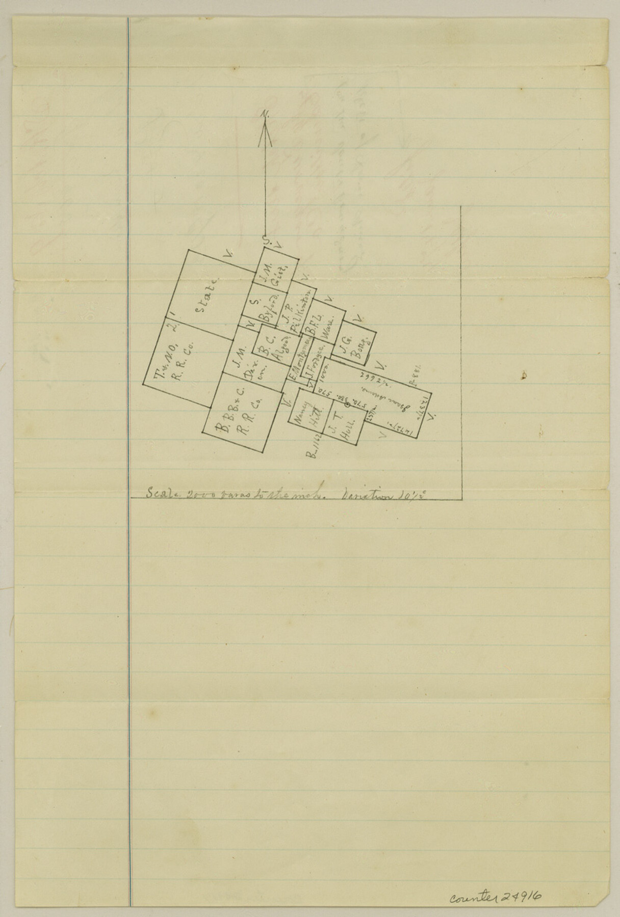
Hamilton County Sketch File 9
[Two sketches - one plat on the south boundary of the county west of the Leon River, one plat showing surveys on Hamilton-Coryell county line]
-
Map/Doc
24916
-
Collection
General Map Collection
-
Object Dates
1874/1/14 (File Date)
1873/12/15 (File Date)
1874/1/14 (Creation Date)
-
People and Organizations
Jessen (Draftsman)
-
Counties
Hamilton Coryell
-
Subjects
Surveying Sketch File
-
Height x Width
12.1 x 8.2 inches
30.7 x 20.8 cm
-
Medium
paper, manuscript
-
Scale
1:2000
-
Features
Leon River
Part of: General Map Collection
Plat of a survey of the North part of section 16, Block 362, Martha McBride, Presidio County, Texas

Print $20.00
- Digital $50.00
Plat of a survey of the North part of section 16, Block 362, Martha McBride, Presidio County, Texas
1989
Size 24.3 x 36.1 inches
Map/Doc 60523
Kendall County Sketch File 21

Print $20.00
- Digital $50.00
Kendall County Sketch File 21
1931
Size 17.9 x 22.7 inches
Map/Doc 11909
Martin County Sketch File 15

Print $4.00
- Digital $50.00
Martin County Sketch File 15
Size 11.9 x 8.3 inches
Map/Doc 30674

University Lands, Blocks 34 to 37, Terrell County

Print $20.00
- Digital $50.00
University Lands, Blocks 34 to 37, Terrell County
1938
Size 32.5 x 40.0 inches
Map/Doc 2417
Grayson County Working Sketch 18

Print $20.00
- Digital $50.00
Grayson County Working Sketch 18
1955
Size 22.8 x 21.1 inches
Map/Doc 63257
Schleicher County Sketch File 35

Print $20.00
- Digital $50.00
Schleicher County Sketch File 35
1951
Size 13.8 x 19.4 inches
Map/Doc 12308
Township 4 South Ranges 12 and 13 West, South Western District, Louisiana

Print $20.00
- Digital $50.00
Township 4 South Ranges 12 and 13 West, South Western District, Louisiana
1879
Size 19.6 x 24.7 inches
Map/Doc 65884
Roberts County Rolled Sketch 3

Print $40.00
- Digital $50.00
Roberts County Rolled Sketch 3
Size 38.0 x 49.7 inches
Map/Doc 8357
[New York, Texas & Mexican Railway]
![64148, [New York, Texas & Mexican Railway], General Map Collection](https://historictexasmaps.com/wmedia_w700/maps/64148.tif.jpg)
Print $20.00
- Digital $50.00
[New York, Texas & Mexican Railway]
Size 12.1 x 24.1 inches
Map/Doc 64148
Menard County Sketch File 26

Print $8.00
- Digital $50.00
Menard County Sketch File 26
1936
Size 8.7 x 14.3 inches
Map/Doc 31560
Trinity County Sketch File 8

Print $6.00
- Digital $50.00
Trinity County Sketch File 8
1859
Size 12.8 x 7.9 inches
Map/Doc 38513
You may also like
Lampasas County Rolled Sketch 6

Print $20.00
- Digital $50.00
Lampasas County Rolled Sketch 6
2014
Size 29.1 x 21.9 inches
Map/Doc 93775
That part of Disturnell's Treaty Map in the Vicinity of the Rio Grande and Southern Boundary of New Mexico

Print $20.00
- Digital $50.00
That part of Disturnell's Treaty Map in the Vicinity of the Rio Grande and Southern Boundary of New Mexico
1851
Size 10.7 x 12.5 inches
Map/Doc 97140

Miller-Stevens Subdivision Section 16, Block B

Print $20.00
- Digital $50.00
Miller-Stevens Subdivision Section 16, Block B
1944
Size 24.2 x 39.8 inches
Map/Doc 92401

Map of Lipscomb County

Print $20.00
- Digital $50.00
Map of Lipscomb County
1899
Size 45.1 x 39.6 inches
Map/Doc 1883
Stonewall County Sketch File 13

Print $20.00
- Digital $50.00
Stonewall County Sketch File 13
1901
Size 22.4 x 18.8 inches
Map/Doc 12365
Flight Mission No. CRC-3R, Frame 46, Chambers County

Print $20.00
- Digital $50.00
Flight Mission No. CRC-3R, Frame 46, Chambers County
1956
Size 18.6 x 22.5 inches
Map/Doc 84819
Crane County Rolled Sketch 28

Print $40.00
- Digital $50.00
Crane County Rolled Sketch 28
2020
Size 35.7 x 51.2 inches
Map/Doc 96434

Flight Mission No. CGI-2N, Frame 152, Cameron County

Print $20.00
- Digital $50.00
Flight Mission No. CGI-2N, Frame 152, Cameron County
1954
Size 18.7 x 22.1 inches
Map/Doc 84534
