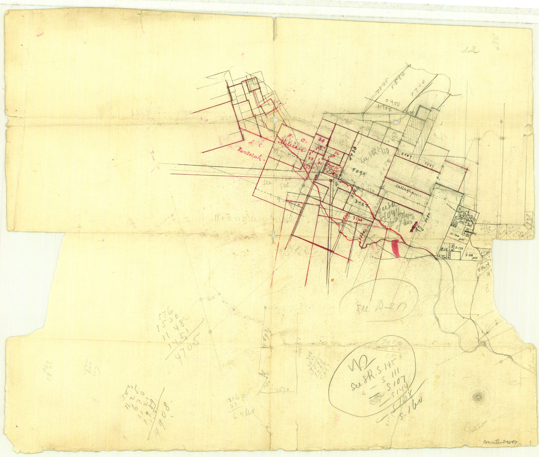
Goliad County Sketch File 16
[Sketch of surveys in south part of county]
-
Map/Doc
24247
-
Collection
General Map Collection
-
Counties
Goliad Bee
-
Subjects
Surveying Sketch File
-
Height x Width
13.4 x 15.8 inches
34.0 x 40.1 cm
-
Medium
paper, manuscript
Part of: General Map Collection
Bee County Sketch File 33

Print $56.00
- Digital $50.00
Bee County Sketch File 33
Size 11.3 x 8.9 inches
Map/Doc 14349
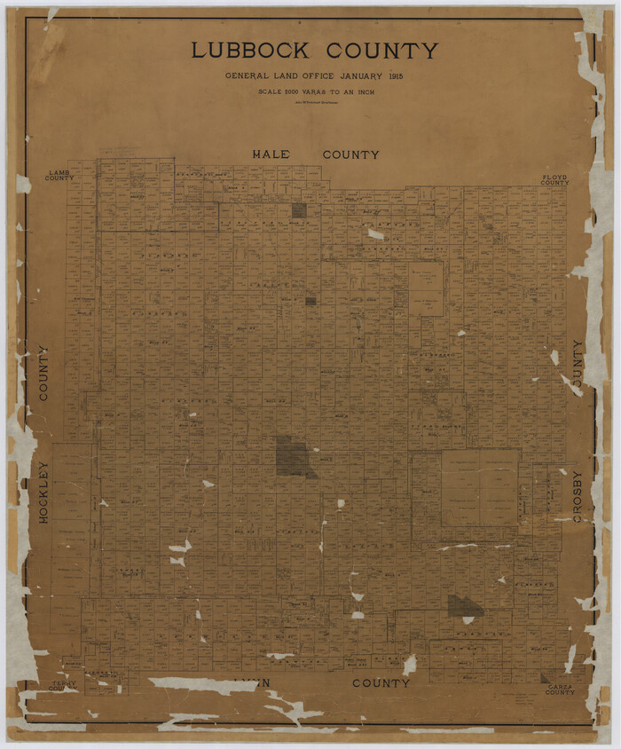
Lubbock County
Print $40.00
- Digital $50.00
Lubbock County
1915
Size 49.0 x 40.6 inches
Map/Doc 895
Flight Mission No. DQO-3K, Frame 87, Galveston County

Print $20.00
- Digital $50.00
Flight Mission No. DQO-3K, Frame 87, Galveston County
1952
Size 18.7 x 22.4 inches
Map/Doc 85092
Zavala County Sketch File 24

Print $12.00
- Digital $50.00
Zavala County Sketch File 24
1885
Size 11.5 x 8.6 inches
Map/Doc 41382
Ward County Rolled Sketch PMY

Print $40.00
- Digital $50.00
Ward County Rolled Sketch PMY
1935
Size 14.4 x 74.5 inches
Map/Doc 10104
Rio Grande, Willamar Sheet

Print $20.00
- Digital $50.00
Rio Grande, Willamar Sheet
1937
Size 36.9 x 37.2 inches
Map/Doc 65111
Flight Mission No. DQN-5K, Frame 37, Calhoun County

Print $20.00
- Digital $50.00
Flight Mission No. DQN-5K, Frame 37, Calhoun County
1953
Size 18.5 x 22.1 inches
Map/Doc 84385
Marion County Working Sketch 27

Print $20.00
- Digital $50.00
Marion County Working Sketch 27
1971
Size 44.8 x 41.0 inches
Map/Doc 70803
Winkler County Working Sketch 3

Print $40.00
- Digital $50.00
Winkler County Working Sketch 3
1944
Size 43.5 x 60.5 inches
Map/Doc 72597
Flight Mission No. DAH-9M, Frame 159, Orange County

Print $20.00
- Digital $50.00
Flight Mission No. DAH-9M, Frame 159, Orange County
1953
Size 18.6 x 22.5 inches
Map/Doc 86858
Galveston County Rolled Sketch 22

Print $20.00
- Digital $50.00
Galveston County Rolled Sketch 22
1953
Size 29.6 x 40.8 inches
Map/Doc 9083
Corpus Christi Bay

Print $20.00
- Digital $50.00
Corpus Christi Bay
1975
Size 36.1 x 47.5 inches
Map/Doc 73475
You may also like
Flight Mission No. CRC-4R, Frame 102, Chambers County

Print $20.00
- Digital $50.00
Flight Mission No. CRC-4R, Frame 102, Chambers County
1956
Size 18.5 x 22.4 inches
Map/Doc 84899
PSL Field Notes for Block CS in Hartley County

PSL Field Notes for Block CS in Hartley County
Map/Doc 81656
West Houston: Hwy. 6 from Spencer Rd. in the North to South of Sugar Land. From Wilcrest Dr. in the East to and including Katy.

West Houston: Hwy. 6 from Spencer Rd. in the North to South of Sugar Land. From Wilcrest Dr. in the East to and including Katy.
Size 35.4 x 22.8 inches
Map/Doc 94335
Map of Colorado County

Print $20.00
- Digital $50.00
Map of Colorado County
1871
Size 18.0 x 18.8 inches
Map/Doc 3425
Right of Way and Track Map Texas & New Orleans R.R. Co. operated by the T. & N. O. R.R. Co. Dallas-Sabine Branch

Print $40.00
- Digital $50.00
Right of Way and Track Map Texas & New Orleans R.R. Co. operated by the T. & N. O. R.R. Co. Dallas-Sabine Branch
1918
Size 26.4 x 56.7 inches
Map/Doc 64154
[Block S, Sections 4 and 11]
![92834, [Block S, Sections 4 and 11], Twichell Survey Records](https://historictexasmaps.com/wmedia_w700/maps/92834-1.tif.jpg)
Print $20.00
- Digital $50.00
[Block S, Sections 4 and 11]
1951
Size 14.8 x 12.2 inches
Map/Doc 92834
Culberson County Sketch File 19

Print $20.00
- Digital $50.00
Culberson County Sketch File 19
1940
Size 11.6 x 20.4 inches
Map/Doc 11269
Knox County Working Sketch 18

Print $20.00
- Digital $50.00
Knox County Working Sketch 18
1988
Size 40.0 x 29.7 inches
Map/Doc 70260
Flight Mission No. BRE-2P, Frame 43, Nueces County

Print $20.00
- Digital $50.00
Flight Mission No. BRE-2P, Frame 43, Nueces County
1956
Size 18.8 x 22.7 inches
Map/Doc 86745
Duval County Sketch File 60

Print $6.00
- Digital $50.00
Duval County Sketch File 60
1940
Size 11.3 x 9.0 inches
Map/Doc 21428
Coast Chart No. 210 Aransas Pass and Corpus Christi Bay with the coast to latitude 27° 12' Texas

Print $20.00
- Digital $50.00
Coast Chart No. 210 Aransas Pass and Corpus Christi Bay with the coast to latitude 27° 12' Texas
1887
Size 27.5 x 18.2 inches
Map/Doc 72802
Morris County Rolled Sketch 2A

Print $20.00
- Digital $50.00
Morris County Rolled Sketch 2A
Size 24.0 x 18.8 inches
Map/Doc 10274