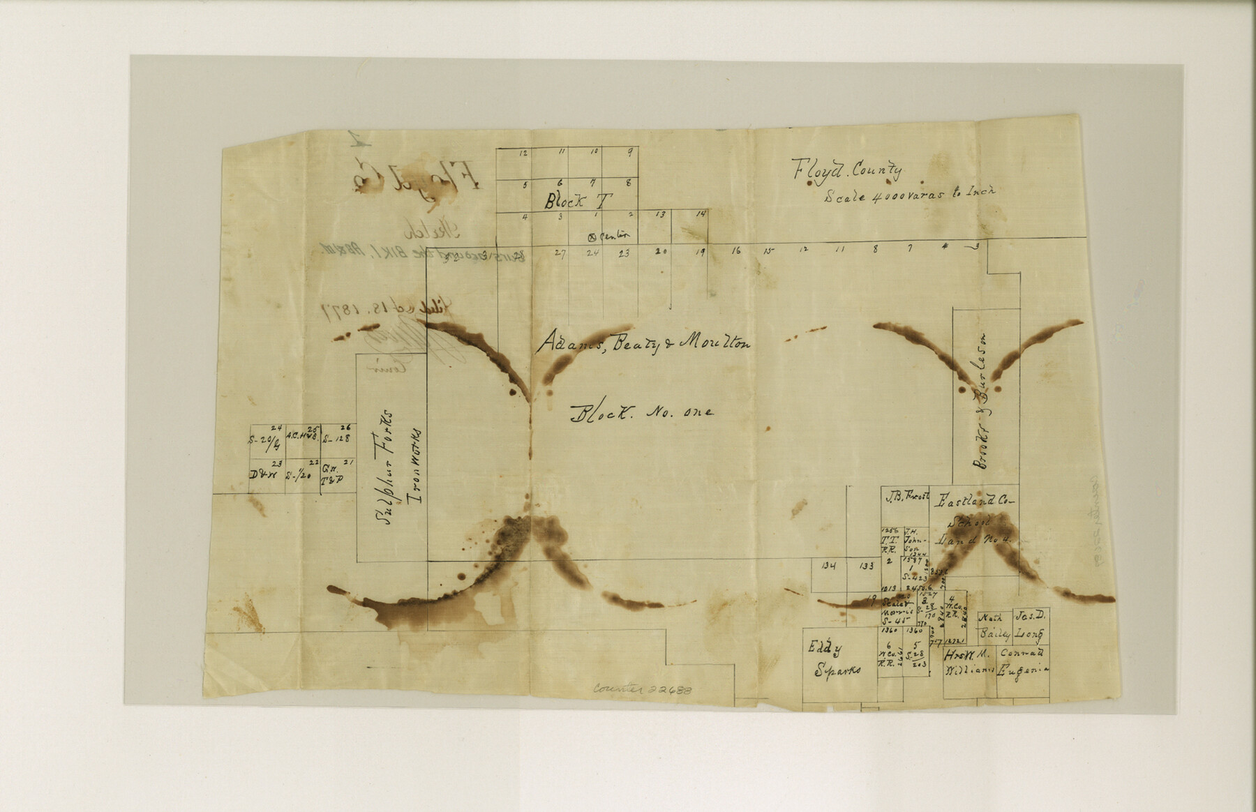
Floyd County Sketch File 1
[Sketch of surveys around Block 1, A. B. & M.]
-
Map/Doc
22688
-
Collection
General Map Collection
-
Object Dates
1877/7/10 (File Date)
1877/10/18 (File Date)
-
Counties
Floyd
-
Subjects
Surveying Sketch File
-
Height x Width
11.0 x 17.0 inches
27.9 x 43.2 cm
-
Medium
paper, manuscript
-
Scale
1:4000
Part of: General Map Collection
Flight Mission No. BRA-8M, Frame 74, Jefferson County

Print $20.00
- Digital $50.00
Flight Mission No. BRA-8M, Frame 74, Jefferson County
1953
Size 18.6 x 22.2 inches
Map/Doc 85594
Brazoria County

Print $20.00
- Digital $50.00
Brazoria County
1879
Size 27.0 x 25.1 inches
Map/Doc 4647
Briscoe County Sketch File 1

Print $5.00
- Digital $50.00
Briscoe County Sketch File 1
1880
Size 9.1 x 14.8 inches
Map/Doc 16413
Wharton County Sketch File A4

Print $11.00
- Digital $50.00
Wharton County Sketch File A4
1904
Size 11.0 x 8.4 inches
Map/Doc 39981
Sam Street's Map of Dallas County, Texas

Sam Street's Map of Dallas County, Texas
1900
Size 32.1 x 28.5 inches
Map/Doc 76173
Dallas County Boundary File 6a

Print $36.00
- Digital $50.00
Dallas County Boundary File 6a
Size 14.0 x 8.6 inches
Map/Doc 52189
McLennan County Sketch File 44

Print $4.00
- Digital $50.00
McLennan County Sketch File 44
1874
Size 12.7 x 7.9 inches
Map/Doc 31335
Reeves County Rolled Sketch 17

Print $20.00
- Digital $50.00
Reeves County Rolled Sketch 17
1963
Size 28.4 x 36.1 inches
Map/Doc 7486
Foard County Aerial Photograph Index Sheet 1

Print $20.00
- Digital $50.00
Foard County Aerial Photograph Index Sheet 1
1950
Size 19.2 x 17.2 inches
Map/Doc 83688
Preliminary Chart of Entrance to Brazos River, Texas

Print $20.00
- Digital $50.00
Preliminary Chart of Entrance to Brazos River, Texas
1858
Size 18.4 x 19.5 inches
Map/Doc 69973
Map of Texas from the most recent authorities

Map of Texas from the most recent authorities
1845
Size 11.2 x 17.2 inches
Map/Doc 4333
McLennan County

Print $20.00
- Digital $50.00
McLennan County
1946
Size 43.8 x 46.9 inches
Map/Doc 95585
You may also like
Dallas County Sketch File 6

Print $20.00
- Digital $50.00
Dallas County Sketch File 6
1850
Size 19.9 x 25.1 inches
Map/Doc 11283
Montgomery County Working Sketch 11

Print $20.00
- Digital $50.00
Montgomery County Working Sketch 11
1933
Size 25.2 x 17.7 inches
Map/Doc 71118
[Blks A, B and C, and Irion, Floyd, Sutton and Lubbock County School Land Leagues]
![90202, [Blks A, B and C, and Irion, Floyd, Sutton and Lubbock County School Land Leagues], Twichell Survey Records](https://historictexasmaps.com/wmedia_w700/maps/90202-1.tif.jpg)
Print $20.00
- Digital $50.00
[Blks A, B and C, and Irion, Floyd, Sutton and Lubbock County School Land Leagues]
Size 15.6 x 19.2 inches
Map/Doc 90202
[Surveys along Richland Creek]
![320, [Surveys along Richland Creek], General Map Collection](https://historictexasmaps.com/wmedia_w700/maps/320.tif.jpg)
Print $2.00
- Digital $50.00
[Surveys along Richland Creek]
Size 7.2 x 6.0 inches
Map/Doc 320
Central Part of Jeff Davis Co.

Print $40.00
- Digital $50.00
Central Part of Jeff Davis Co.
1982
Size 55.4 x 43.9 inches
Map/Doc 73193
Map showing surveys in Blocks 45, 3, R & 5T

Print $20.00
- Digital $50.00
Map showing surveys in Blocks 45, 3, R & 5T
1913
Size 30.2 x 37.5 inches
Map/Doc 496
General Highway Map, Hemphill County, Texas

Print $20.00
General Highway Map, Hemphill County, Texas
1961
Size 18.3 x 24.6 inches
Map/Doc 79515
G. C. & S. F. Ry., San Saba Branch, Right of Way Map, Brady to Melvin

Print $20.00
- Digital $50.00
G. C. & S. F. Ry., San Saba Branch, Right of Way Map, Brady to Melvin
1916
Size 36.9 x 23.0 inches
Map/Doc 61422
Brazoria County Working Sketch 5

Print $20.00
- Digital $50.00
Brazoria County Working Sketch 5
1921
Size 15.1 x 17.1 inches
Map/Doc 67490
Lavaca County Sketch File 5

Print $4.00
- Digital $50.00
Lavaca County Sketch File 5
1858
Size 8.2 x 10.1 inches
Map/Doc 29639
Guadalupe County Working Sketch 8

Print $20.00
- Digital $50.00
Guadalupe County Working Sketch 8
1955
Size 23.6 x 38.6 inches
Map/Doc 63317
Brazos Island Harbor, Texas - Dredging Entrance Channel Plan

Print $20.00
- Digital $50.00
Brazos Island Harbor, Texas - Dredging Entrance Channel Plan
1990
Size 14.5 x 20.1 inches
Map/Doc 83338