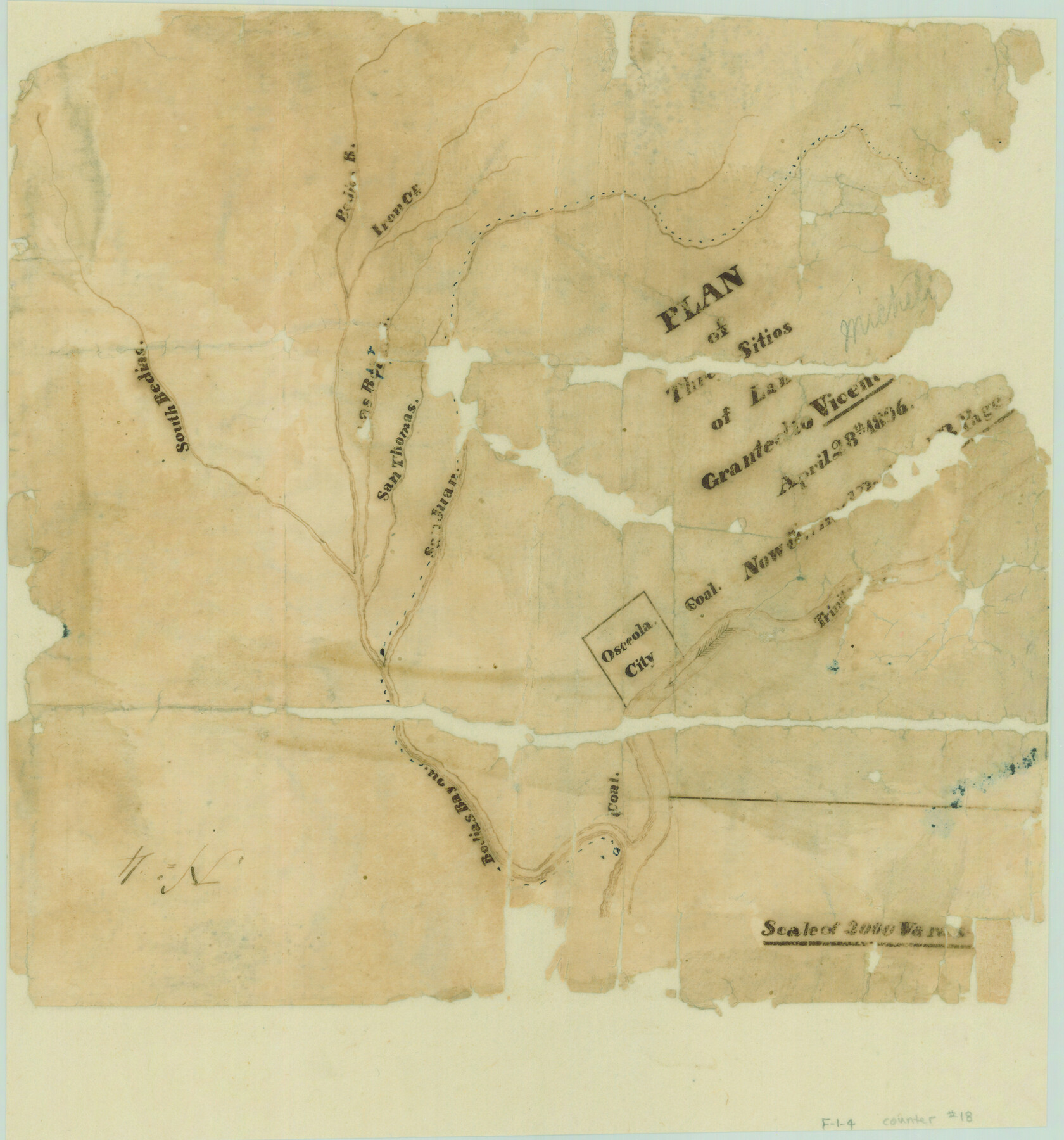
Plan of Three Sitios of Land Granted to Vicente Micheli
Atlas F, Page 1, Sketch 4 (F-1-4)
F-1-4
-
Map/Doc
18
-
Collection
General Map Collection
-
Counties
Madison Walker
-
Subjects
Atlas
-
Height x Width
9.2 x 8.6 inches
23.4 x 21.8 cm
-
Medium
paper, manuscript
-
Scale
1:2000
-
Comments
Conserved in 2004.
-
Features
Bedias Bayou
Iron Creek
South Bedias Bayou
San Thomas Creek
San Juan Creek
Osceola City
Trinity River
Part of: General Map Collection
McMullen County Sketch File 5

Print $4.00
- Digital $50.00
McMullen County Sketch File 5
1854
Size 8.7 x 8.3 inches
Map/Doc 31343
Flight Mission No. CGI-1N, Frame 178, Cameron County

Print $20.00
- Digital $50.00
Flight Mission No. CGI-1N, Frame 178, Cameron County
1955
Size 18.6 x 22.3 inches
Map/Doc 84513
No. 1 - Survey for a road from the Brazo Santiago to the Rio Grande

Print $20.00
- Digital $50.00
No. 1 - Survey for a road from the Brazo Santiago to the Rio Grande
1847
Size 18.3 x 27.2 inches
Map/Doc 72878
Flight Mission No. DIX-10P, Frame 75, Aransas County

Print $20.00
- Digital $50.00
Flight Mission No. DIX-10P, Frame 75, Aransas County
1956
Size 18.6 x 22.3 inches
Map/Doc 83936
Shelby County Working Sketch 15

Print $20.00
- Digital $50.00
Shelby County Working Sketch 15
1952
Size 24.5 x 19.2 inches
Map/Doc 63868
Blanco County Working Sketch 17

Print $20.00
- Digital $50.00
Blanco County Working Sketch 17
1954
Size 31.6 x 30.3 inches
Map/Doc 67377
Marion County Working Sketch 28

Print $20.00
- Digital $50.00
Marion County Working Sketch 28
1975
Size 24.0 x 33.5 inches
Map/Doc 70804
Goliad County Sketch File 22

Print $12.00
- Digital $50.00
Goliad County Sketch File 22
1855
Size 12.8 x 8.1 inches
Map/Doc 24289
Leon County Working Sketch 17

Print $20.00
- Digital $50.00
Leon County Working Sketch 17
1959
Size 30.8 x 30.5 inches
Map/Doc 70416
Donley County Sketch File 6

Print $16.00
- Digital $50.00
Donley County Sketch File 6
1881
Size 12.9 x 8.5 inches
Map/Doc 21230
Carte d'un Nouveau Monde, entre le Nouveau Mexique, et la Mer Glacialle

Print $20.00
- Digital $50.00
Carte d'un Nouveau Monde, entre le Nouveau Mexique, et la Mer Glacialle
Size 11.5 x 18.1 inches
Map/Doc 96555
[Map of Tom Green County]
![4085, [Map of Tom Green County], General Map Collection](https://historictexasmaps.com/wmedia_w700/maps/4085-2.tif.jpg)
Print $20.00
- Digital $50.00
[Map of Tom Green County]
Size 23.9 x 36.5 inches
Map/Doc 4085
You may also like
Presidio County Rolled Sketch 76

Print $20.00
- Digital $50.00
Presidio County Rolled Sketch 76
Size 24.3 x 36.4 inches
Map/Doc 9777
Real County Working Sketch 42

Print $20.00
- Digital $50.00
Real County Working Sketch 42
1953
Size 40.3 x 34.5 inches
Map/Doc 71934
King County Boundary File 4

Print $58.00
- Digital $50.00
King County Boundary File 4
Size 14.1 x 8.7 inches
Map/Doc 64905
Taylor County Rolled Sketch 30

Print $20.00
- Digital $50.00
Taylor County Rolled Sketch 30
1999
Size 29.7 x 29.7 inches
Map/Doc 7923
Brown County Sketch File 13

Print $40.00
- Digital $50.00
Brown County Sketch File 13
Size 17.9 x 33.1 inches
Map/Doc 11020
Wharton County Rolled Sketch 13

Print $20.00
- Digital $50.00
Wharton County Rolled Sketch 13
1990
Size 22.4 x 28.1 inches
Map/Doc 8238
Calhoun County Working Sketch 13

Print $20.00
- Digital $50.00
Calhoun County Working Sketch 13
1962
Size 28.5 x 31.9 inches
Map/Doc 67829
Henderson County Sketch File 23

Print $38.00
- Digital $50.00
Henderson County Sketch File 23
1956
Size 9.1 x 9.1 inches
Map/Doc 26372
Chambers County Sketch File 38

Print $20.00
- Digital $50.00
Chambers County Sketch File 38
Size 25.1 x 35.8 inches
Map/Doc 11068
Sketch Showing Portion of League 4, Wilson County School Land in Lynn County

Print $20.00
- Digital $50.00
Sketch Showing Portion of League 4, Wilson County School Land in Lynn County
Size 20.9 x 22.6 inches
Map/Doc 92941
Dallas County Sketch File 14

Print $22.00
- Digital $50.00
Dallas County Sketch File 14
1859
Size 8.2 x 7.6 inches
Map/Doc 20428
Hartley County Boundary File 5

Print $6.00
- Digital $50.00
Hartley County Boundary File 5
Size 12.7 x 8.2 inches
Map/Doc 54515