[T. & P. Block U and H. & T. C. Block 1]
Print $20.00
- Digital $50.00
[T. & P. Block U and H. & T. C. Block 1]
Size: 20.5 x 16.7 inches
91871
[Surveying sketch of Jones County showing Micaela Fiagoso survey]
Print $20.00
- Digital $50.00
[Surveying sketch of Jones County showing Micaela Fiagoso survey]
Size: 19.5 x 16.8 inches
387
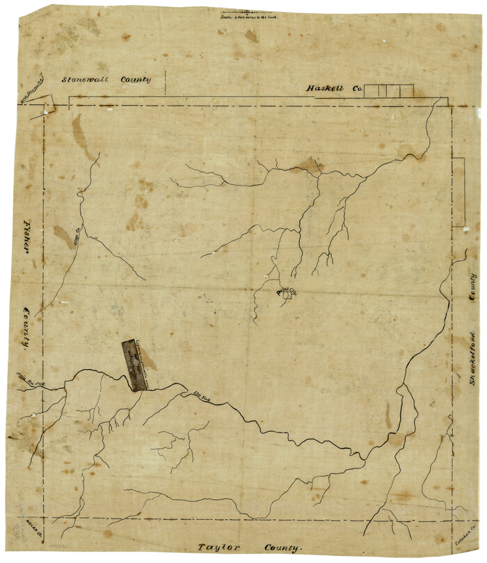
[North 3/4 of County]
Print $20.00
- Digital $50.00
[North 3/4 of County]
1887
Size: 26.0 x 15.4 inches
90840
[Map of Block 97, Borden and Scurry Co (Exhibit A); Map of Southeastern part of Young Territory; Map of part of of Borden, Fisher, Kent, Mitchell, Scurry and Garza Cos. Showing the north boundary line of the T&P 80 mile reservation]
Print $20.00
- Digital $50.00
[Map of Block 97, Borden and Scurry Co (Exhibit A); Map of Southeastern part of Young Territory; Map of part of of Borden, Fisher, Kent, Mitchell, Scurry and Garza Cos. Showing the north boundary line of the T&P 80 mile reservation]
1873
Size: 33.4 x 29.6 inches
65692
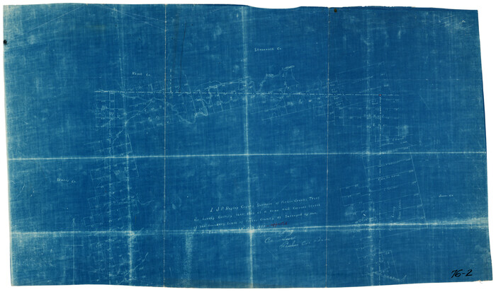
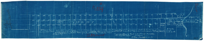
[King/Stonewall County Line]
Print $20.00
- Digital $50.00
[King/Stonewall County Line]
1895
Size: 38.9 x 8.3 inches
90979
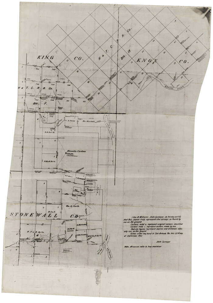
[King, Knox & Stonewall Counties]
Print $20.00
- Digital $50.00
[King, Knox & Stonewall Counties]
1902
Size: 19.6 x 28.1 inches
92916
[King, Knox & Stonewall Counties]
Print $20.00
- Digital $50.00
[King, Knox & Stonewall Counties]
1902
Size: 19.6 x 28.2 inches
92917
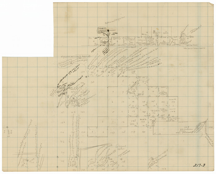
Stonewall County Working Sketch Graphic Index - sheet B

Print $20.00
- Digital $50.00
Stonewall County Working Sketch Graphic Index - sheet B
1933
Size: 43.7 x 36.6 inches
83172
Stonewall County Working Sketch Graphic Index - sheet A

Print $20.00
- Digital $50.00
Stonewall County Working Sketch Graphic Index - sheet A
1933
Size: 43.3 x 36.2 inches
76704
Stonewall County Working Sketch 9

Print $20.00
- Digital $50.00
Stonewall County Working Sketch 9
1950
Size: 27.9 x 34.1 inches
62316
Stonewall County Working Sketch 8

Print $20.00
- Digital $50.00
Stonewall County Working Sketch 8
1950
Size: 23.5 x 23.2 inches
62315
Stonewall County Working Sketch 7

Print $20.00
- Digital $50.00
Stonewall County Working Sketch 7
1949
Size: 30.7 x 24.5 inches
62314
Stonewall County Working Sketch 6

Print $20.00
- Digital $50.00
Stonewall County Working Sketch 6
1949
Size: 16.5 x 30.1 inches
62313
Stonewall County Working Sketch 5

Print $20.00
- Digital $50.00
Stonewall County Working Sketch 5
1927
Size: 17.7 x 24.0 inches
63999
Stonewall County Working Sketch 4

Print $20.00
- Digital $50.00
Stonewall County Working Sketch 4
1919
Size: 28.7 x 23.8 inches
63998
Stonewall County Working Sketch 35

Print $20.00
- Digital $50.00
Stonewall County Working Sketch 35
1991
Size: 41.1 x 33.0 inches
62342
Stonewall County Working Sketch 34

Print $20.00
- Digital $50.00
Stonewall County Working Sketch 34
1985
Size: 34.0 x 33.9 inches
62341
Stonewall County Working Sketch 33

Print $40.00
- Digital $50.00
Stonewall County Working Sketch 33
1984
Size: 70.4 x 42.8 inches
62340
Stonewall County Working Sketch 32

Print $20.00
- Digital $50.00
Stonewall County Working Sketch 32
1983
Size: 27.9 x 36.2 inches
62339
Stonewall County Working Sketch 31

Print $20.00
- Digital $50.00
Stonewall County Working Sketch 31
1983
Size: 42.6 x 42.9 inches
62338
Stonewall County Working Sketch 30

Print $20.00
- Digital $50.00
Stonewall County Working Sketch 30
1982
Size: 28.6 x 29.0 inches
62337
Stonewall County Working Sketch 3

Print $20.00
- Digital $50.00
Stonewall County Working Sketch 3
1916
Size: 22.2 x 17.9 inches
63997
Stonewall County Working Sketch 29

Print $40.00
- Digital $50.00
Stonewall County Working Sketch 29
1979
Size: 48.5 x 43.0 inches
62336
Stonewall County Working Sketch 28

Print $20.00
- Digital $50.00
Stonewall County Working Sketch 28
1976
Size: 34.5 x 39.2 inches
62335
Stonewall County Working Sketch 27

Print $20.00
- Digital $50.00
Stonewall County Working Sketch 27
1976
Size: 20.7 x 29.9 inches
62334
Stonewall County Working Sketch 26

Print $20.00
- Digital $50.00
Stonewall County Working Sketch 26
1973
Size: 27.0 x 17.9 inches
62333
Stonewall County Working Sketch 25

Print $20.00
- Digital $50.00
Stonewall County Working Sketch 25
1973
Size: 29.5 x 23.4 inches
62332
Stonewall County Working Sketch 24

Print $20.00
- Digital $50.00
Stonewall County Working Sketch 24
1973
Size: 27.1 x 30.9 inches
62331
[T. & P. Block U and H. & T. C. Block 1]
Print $20.00
- Digital $50.00
[T. & P. Block U and H. & T. C. Block 1]
-
Size
20.5 x 16.7 inches
-
Map/Doc
91871
[Surveying sketch of Jones County showing Micaela Fiagoso survey]
Print $20.00
- Digital $50.00
[Surveying sketch of Jones County showing Micaela Fiagoso survey]
-
Size
19.5 x 16.8 inches
-
Map/Doc
387
[North 3/4 of County]
Print $20.00
- Digital $50.00
[North 3/4 of County]
1887
-
Size
26.0 x 15.4 inches
-
Map/Doc
90840
-
Creation Date
1887
[Map of Block 97, Borden and Scurry Co (Exhibit A); Map of Southeastern part of Young Territory; Map of part of of Borden, Fisher, Kent, Mitchell, Scurry and Garza Cos. Showing the north boundary line of the T&P 80 mile reservation]
Print $20.00
- Digital $50.00
[Map of Block 97, Borden and Scurry Co (Exhibit A); Map of Southeastern part of Young Territory; Map of part of of Borden, Fisher, Kent, Mitchell, Scurry and Garza Cos. Showing the north boundary line of the T&P 80 mile reservation]
1873
-
Size
33.4 x 29.6 inches
-
Map/Doc
65692
-
Creation Date
1873
[King/Stonewall County Line]
Print $20.00
- Digital $50.00
[King/Stonewall County Line]
1895
-
Size
38.9 x 8.3 inches
-
Map/Doc
90979
-
Creation Date
1895
[King, Knox & Stonewall Counties]
Print $20.00
- Digital $50.00
[King, Knox & Stonewall Counties]
1902
-
Size
19.6 x 28.1 inches
-
Map/Doc
92916
-
Creation Date
1902
[King, Knox & Stonewall Counties]
Print $20.00
- Digital $50.00
[King, Knox & Stonewall Counties]
1902
-
Size
19.6 x 28.2 inches
-
Map/Doc
92917
-
Creation Date
1902
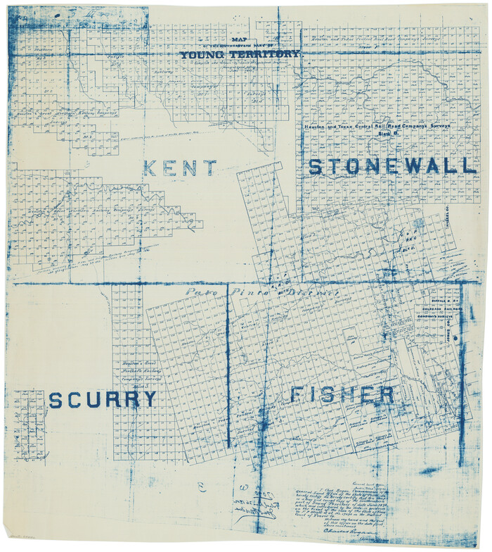
Young Territory

Print $20.00
- Digital $50.00
Young Territory
1873
-
Size
29.2 x 29.9 inches
-
Map/Doc
1976
-
Creation Date
1873
Young Territory

Print $20.00
- Digital $50.00
Young Territory
1873
-
Size
45.3 x 42.8 inches
-
Map/Doc
1988
-
Creation Date
1873
Stonewall County Working Sketch Graphic Index - sheet B
Print $20.00
- Digital $50.00
Stonewall County Working Sketch Graphic Index - sheet B
1933
-
Size
43.7 x 36.6 inches
-
Map/Doc
83172
-
Creation Date
1933
Stonewall County Working Sketch Graphic Index - sheet A
Print $20.00
- Digital $50.00
Stonewall County Working Sketch Graphic Index - sheet A
1933
-
Size
43.3 x 36.2 inches
-
Map/Doc
76704
-
Creation Date
1933
Stonewall County Working Sketch 9
Print $20.00
- Digital $50.00
Stonewall County Working Sketch 9
1950
-
Size
27.9 x 34.1 inches
-
Map/Doc
62316
-
Creation Date
1950
Stonewall County Working Sketch 8
Print $20.00
- Digital $50.00
Stonewall County Working Sketch 8
1950
-
Size
23.5 x 23.2 inches
-
Map/Doc
62315
-
Creation Date
1950
Stonewall County Working Sketch 7
Print $20.00
- Digital $50.00
Stonewall County Working Sketch 7
1949
-
Size
30.7 x 24.5 inches
-
Map/Doc
62314
-
Creation Date
1949
Stonewall County Working Sketch 6
Print $20.00
- Digital $50.00
Stonewall County Working Sketch 6
1949
-
Size
16.5 x 30.1 inches
-
Map/Doc
62313
-
Creation Date
1949
Stonewall County Working Sketch 5
Print $20.00
- Digital $50.00
Stonewall County Working Sketch 5
1927
-
Size
17.7 x 24.0 inches
-
Map/Doc
63999
-
Creation Date
1927
Stonewall County Working Sketch 4
Print $20.00
- Digital $50.00
Stonewall County Working Sketch 4
1919
-
Size
28.7 x 23.8 inches
-
Map/Doc
63998
-
Creation Date
1919
Stonewall County Working Sketch 35
Print $20.00
- Digital $50.00
Stonewall County Working Sketch 35
1991
-
Size
41.1 x 33.0 inches
-
Map/Doc
62342
-
Creation Date
1991
Stonewall County Working Sketch 34
Print $20.00
- Digital $50.00
Stonewall County Working Sketch 34
1985
-
Size
34.0 x 33.9 inches
-
Map/Doc
62341
-
Creation Date
1985
Stonewall County Working Sketch 33
Print $40.00
- Digital $50.00
Stonewall County Working Sketch 33
1984
-
Size
70.4 x 42.8 inches
-
Map/Doc
62340
-
Creation Date
1984
Stonewall County Working Sketch 32
Print $20.00
- Digital $50.00
Stonewall County Working Sketch 32
1983
-
Size
27.9 x 36.2 inches
-
Map/Doc
62339
-
Creation Date
1983
Stonewall County Working Sketch 31
Print $20.00
- Digital $50.00
Stonewall County Working Sketch 31
1983
-
Size
42.6 x 42.9 inches
-
Map/Doc
62338
-
Creation Date
1983
Stonewall County Working Sketch 30
Print $20.00
- Digital $50.00
Stonewall County Working Sketch 30
1982
-
Size
28.6 x 29.0 inches
-
Map/Doc
62337
-
Creation Date
1982
Stonewall County Working Sketch 3
Print $20.00
- Digital $50.00
Stonewall County Working Sketch 3
1916
-
Size
22.2 x 17.9 inches
-
Map/Doc
63997
-
Creation Date
1916
Stonewall County Working Sketch 29
Print $40.00
- Digital $50.00
Stonewall County Working Sketch 29
1979
-
Size
48.5 x 43.0 inches
-
Map/Doc
62336
-
Creation Date
1979
Stonewall County Working Sketch 28
Print $20.00
- Digital $50.00
Stonewall County Working Sketch 28
1976
-
Size
34.5 x 39.2 inches
-
Map/Doc
62335
-
Creation Date
1976
Stonewall County Working Sketch 27
Print $20.00
- Digital $50.00
Stonewall County Working Sketch 27
1976
-
Size
20.7 x 29.9 inches
-
Map/Doc
62334
-
Creation Date
1976
Stonewall County Working Sketch 26
Print $20.00
- Digital $50.00
Stonewall County Working Sketch 26
1973
-
Size
27.0 x 17.9 inches
-
Map/Doc
62333
-
Creation Date
1973
Stonewall County Working Sketch 25
Print $20.00
- Digital $50.00
Stonewall County Working Sketch 25
1973
-
Size
29.5 x 23.4 inches
-
Map/Doc
62332
-
Creation Date
1973
Stonewall County Working Sketch 24
Print $20.00
- Digital $50.00
Stonewall County Working Sketch 24
1973
-
Size
27.1 x 30.9 inches
-
Map/Doc
62331
-
Creation Date
1973