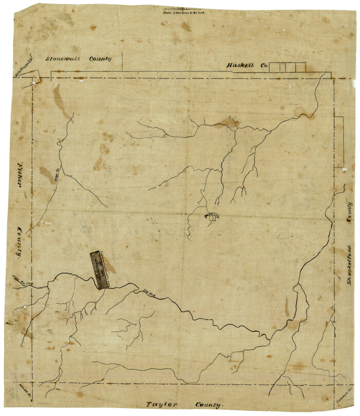
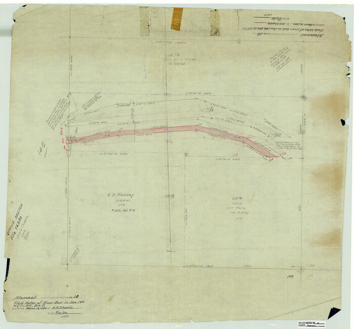
Stonewall County Sketch File 19

Print $20.00
- Digital $50.00
Stonewall County Sketch File 19
Size: 33.2 x 33.6 inches
10392
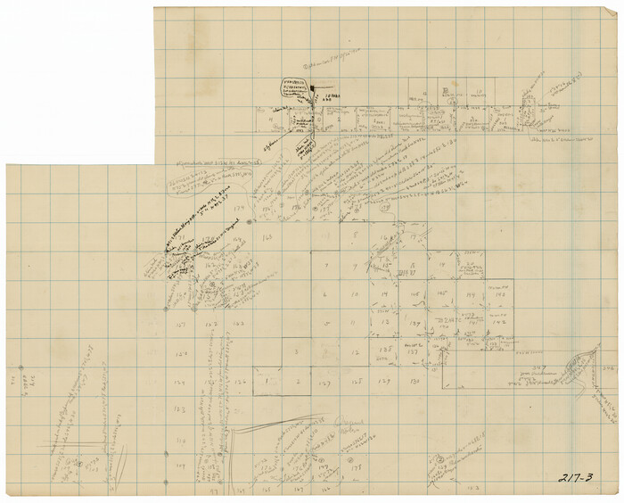
Fisher County Sketch File 11

Print $20.00
- Digital $50.00
Fisher County Sketch File 11
Size: 22.8 x 20.4 inches
11478
Stonewall County Sketch File 4

Print $20.00
- Digital $50.00
Stonewall County Sketch File 4
Size: 18.2 x 25.7 inches
12363
Stonewall County Sketch File 12A

Print $20.00
- Digital $50.00
Stonewall County Sketch File 12A
Size: 25.6 x 17.4 inches
12364
Haskell County Sketch File 15a

Print $4.00
- Digital $50.00
Haskell County Sketch File 15a
Size: 9.8 x 8.6 inches
26161
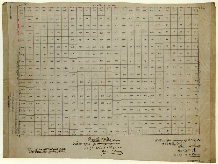
Stonewall County Sketch File 5

Print $40.00
- Digital $50.00
Stonewall County Sketch File 5
Size: 14.9 x 14.4 inches
37206
Stonewall County Sketch File 9

Print $10.00
- Digital $50.00
Stonewall County Sketch File 9
Size: 8.1 x 7.9 inches
37227
Stonewall County Sketch File 15a

Print $2.00
- Digital $50.00
Stonewall County Sketch File 15a
Size: 7.6 x 12.1 inches
37265
[Surveying sketch of Jones County showing Micaela Fiagoso survey]
Print $20.00
- Digital $50.00
[Surveying sketch of Jones County showing Micaela Fiagoso survey]
Size: 19.5 x 16.8 inches
387
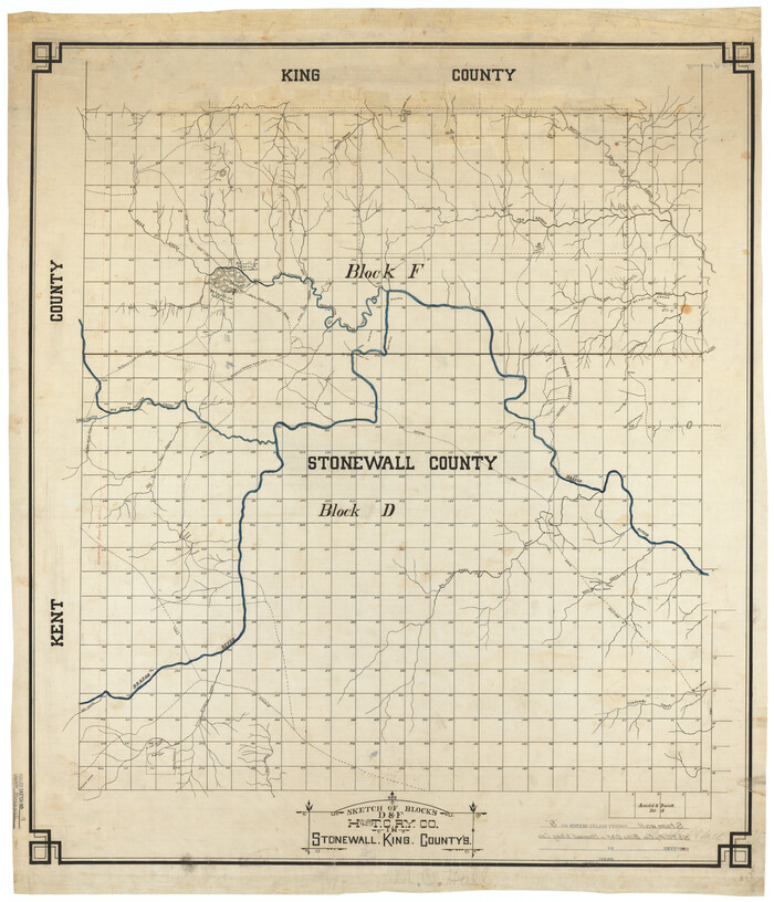
Stonewall County Rolled Sketch 20

Print $40.00
- Digital $50.00
Stonewall County Rolled Sketch 20
Size: 36.7 x 55.7 inches
49129
Stonewall County Boundary File 1

Print $34.00
- Digital $50.00
Stonewall County Boundary File 1
Size: 9.0 x 8.4 inches
58938
Stonewall County Boundary File 2

Print $12.00
- Digital $50.00
Stonewall County Boundary File 2
Size: 14.2 x 8.8 inches
58955
Stonewall County Boundary File 3

Print $54.00
- Digital $50.00
Stonewall County Boundary File 3
Size: 9.2 x 8.0 inches
58961
Stonewall County Boundary File 3a

Print $68.00
- Digital $50.00
Stonewall County Boundary File 3a
Size: 14.4 x 9.0 inches
58970
Stonewall County Boundary File 4

Print $32.00
- Digital $50.00
Stonewall County Boundary File 4
Size: 14.4 x 9.1 inches
58977
Stonewall County Boundary File 4a

Print $18.00
- Digital $50.00
Stonewall County Boundary File 4a
Size: 14.2 x 8.8 inches
58984
Stonewall County Boundary File 4b

Print $18.00
- Digital $50.00
Stonewall County Boundary File 4b
Size: 9.1 x 8.8 inches
58993
Haskell County Rolled Sketch 9

Print $20.00
- Digital $50.00
Haskell County Rolled Sketch 9
Size: 16.4 x 34.3 inches
6168
Stonewall County Rolled Sketch 36A

Print $20.00
- Digital $50.00
Stonewall County Rolled Sketch 36A
Size: 17.6 x 22.4 inches
76403
Stonewall County Rolled Sketch 36B

Print $20.00
- Digital $50.00
Stonewall County Rolled Sketch 36B
Size: 35.2 x 22.8 inches
76404
Stonewall County Rolled Sketch 9
Print $20.00
- Digital $50.00
Stonewall County Rolled Sketch 9
Size: 35.8 x 30.8 inches
7865
Stonewall County Rolled Sketch 10
Print $20.00
- Digital $50.00
Stonewall County Rolled Sketch 10
Size: 22.3 x 29.6 inches
7866
Stonewall County Rolled Sketch 11

Print $20.00
- Digital $50.00
Stonewall County Rolled Sketch 11
Size: 33.2 x 28.1 inches
7867
Stonewall County Rolled Sketch 11A
Print $20.00
- Digital $50.00
Stonewall County Rolled Sketch 11A
Size: 33.4 x 28.2 inches
7868
Stonewall County Rolled Sketch 18
Print $20.00
- Digital $50.00
Stonewall County Rolled Sketch 18
Size: 27.4 x 29.4 inches
7872
Stonewall County Rolled Sketch 30

Print $20.00
- Digital $50.00
Stonewall County Rolled Sketch 30
Size: 25.5 x 37.3 inches
7874
Stonewall County Rolled Sketch 34

Print $20.00
- Digital $50.00
Stonewall County Rolled Sketch 34
Size: 37.5 x 30.2 inches
7878
Fisher County Rolled Sketch 4

Print $20.00
- Digital $50.00
Fisher County Rolled Sketch 4
Size: 32.4 x 37.5 inches
8888
[T. & P. Block U and H. & T. C. Block 1]
Print $20.00
- Digital $50.00
[T. & P. Block U and H. & T. C. Block 1]
Size: 20.5 x 16.7 inches
91871
Scurry County Rolled Sketch 2

Print $20.00
- Digital $50.00
Scurry County Rolled Sketch 2
Size: 44.0 x 44.9 inches
9911
Stonewall County Sketch File 19
Print $20.00
- Digital $50.00
Stonewall County Sketch File 19
-
Size
33.2 x 33.6 inches
-
Map/Doc
10392
Fisher County Sketch File 11
Print $20.00
- Digital $50.00
Fisher County Sketch File 11
-
Size
22.8 x 20.4 inches
-
Map/Doc
11478
Stonewall County Sketch File 4
Print $20.00
- Digital $50.00
Stonewall County Sketch File 4
-
Size
18.2 x 25.7 inches
-
Map/Doc
12363
Stonewall County Sketch File 12A
Print $20.00
- Digital $50.00
Stonewall County Sketch File 12A
-
Size
25.6 x 17.4 inches
-
Map/Doc
12364
Haskell County Sketch File 15a
Print $4.00
- Digital $50.00
Haskell County Sketch File 15a
-
Size
9.8 x 8.6 inches
-
Map/Doc
26161
Stonewall County Sketch File 5
Print $40.00
- Digital $50.00
Stonewall County Sketch File 5
-
Size
14.9 x 14.4 inches
-
Map/Doc
37206
Stonewall County Sketch File 9
Print $10.00
- Digital $50.00
Stonewall County Sketch File 9
-
Size
8.1 x 7.9 inches
-
Map/Doc
37227
Stonewall County Sketch File 15a
Print $2.00
- Digital $50.00
Stonewall County Sketch File 15a
-
Size
7.6 x 12.1 inches
-
Map/Doc
37265
[Surveying sketch of Jones County showing Micaela Fiagoso survey]
Print $20.00
- Digital $50.00
[Surveying sketch of Jones County showing Micaela Fiagoso survey]
-
Size
19.5 x 16.8 inches
-
Map/Doc
387
Stonewall County Rolled Sketch 20
Print $40.00
- Digital $50.00
Stonewall County Rolled Sketch 20
-
Size
36.7 x 55.7 inches
-
Map/Doc
49129
Stonewall County Boundary File 1
Print $34.00
- Digital $50.00
Stonewall County Boundary File 1
-
Size
9.0 x 8.4 inches
-
Map/Doc
58938
Stonewall County Boundary File 2
Print $12.00
- Digital $50.00
Stonewall County Boundary File 2
-
Size
14.2 x 8.8 inches
-
Map/Doc
58955
Stonewall County Boundary File 3
Print $54.00
- Digital $50.00
Stonewall County Boundary File 3
-
Size
9.2 x 8.0 inches
-
Map/Doc
58961
Stonewall County Boundary File 3a
Print $68.00
- Digital $50.00
Stonewall County Boundary File 3a
-
Size
14.4 x 9.0 inches
-
Map/Doc
58970
Stonewall County Boundary File 4
Print $32.00
- Digital $50.00
Stonewall County Boundary File 4
-
Size
14.4 x 9.1 inches
-
Map/Doc
58977
Stonewall County Boundary File 4a
Print $18.00
- Digital $50.00
Stonewall County Boundary File 4a
-
Size
14.2 x 8.8 inches
-
Map/Doc
58984
Stonewall County Boundary File 4b
Print $18.00
- Digital $50.00
Stonewall County Boundary File 4b
-
Size
9.1 x 8.8 inches
-
Map/Doc
58993
Haskell County Rolled Sketch 9
Print $20.00
- Digital $50.00
Haskell County Rolled Sketch 9
-
Size
16.4 x 34.3 inches
-
Map/Doc
6168
Stonewall County Rolled Sketch 36A
Print $20.00
- Digital $50.00
Stonewall County Rolled Sketch 36A
-
Size
17.6 x 22.4 inches
-
Map/Doc
76403
Stonewall County Rolled Sketch 36B
Print $20.00
- Digital $50.00
Stonewall County Rolled Sketch 36B
-
Size
35.2 x 22.8 inches
-
Map/Doc
76404
Stonewall County Rolled Sketch 9
Print $20.00
- Digital $50.00
Stonewall County Rolled Sketch 9
-
Size
35.8 x 30.8 inches
-
Map/Doc
7865
Stonewall County Rolled Sketch 10
Print $20.00
- Digital $50.00
Stonewall County Rolled Sketch 10
-
Size
22.3 x 29.6 inches
-
Map/Doc
7866
Stonewall County Rolled Sketch 11
Print $20.00
- Digital $50.00
Stonewall County Rolled Sketch 11
-
Size
33.2 x 28.1 inches
-
Map/Doc
7867
Stonewall County Rolled Sketch 11A
Print $20.00
- Digital $50.00
Stonewall County Rolled Sketch 11A
-
Size
33.4 x 28.2 inches
-
Map/Doc
7868
Stonewall County Rolled Sketch 18
Print $20.00
- Digital $50.00
Stonewall County Rolled Sketch 18
-
Size
27.4 x 29.4 inches
-
Map/Doc
7872
Stonewall County Rolled Sketch 30
Print $20.00
- Digital $50.00
Stonewall County Rolled Sketch 30
-
Size
25.5 x 37.3 inches
-
Map/Doc
7874
Stonewall County Rolled Sketch 34
Print $20.00
- Digital $50.00
Stonewall County Rolled Sketch 34
-
Size
37.5 x 30.2 inches
-
Map/Doc
7878
Fisher County Rolled Sketch 4
Print $20.00
- Digital $50.00
Fisher County Rolled Sketch 4
-
Size
32.4 x 37.5 inches
-
Map/Doc
8888
[T. & P. Block U and H. & T. C. Block 1]
Print $20.00
- Digital $50.00
[T. & P. Block U and H. & T. C. Block 1]
-
Size
20.5 x 16.7 inches
-
Map/Doc
91871
Scurry County Rolled Sketch 2
Print $20.00
- Digital $50.00
Scurry County Rolled Sketch 2
-
Size
44.0 x 44.9 inches
-
Map/Doc
9911