Armstrong County Working Sketch 11

Print $20.00
- Digital $50.00
Armstrong County Working Sketch 11
2025
97507
Armstrong County Working Sketch 10

Print $20.00
- Digital $50.00
Armstrong County Working Sketch 10
1993
Size: 14.6 x 26.0 inches
87354
Armstrong County Working Sketch 9

Print $20.00
- Digital $50.00
Armstrong County Working Sketch 9
1993
Size: 40.9 x 33.6 inches
67240
General Highway Map, Armstrong County, Texas

Print $20.00
General Highway Map, Armstrong County, Texas
1961
Size: 18.3 x 25.0 inches
79354
Palo Duro Canyon Park

Print $20.00
- Digital $50.00
Palo Duro Canyon Park
1950
Size: 25.2 x 37.9 inches
73567
General Highway Map, Armstrong County, Texas

Print $20.00
General Highway Map, Armstrong County, Texas
1940
Size: 18.1 x 25.0 inches
79006
Armstrong County Working Sketch Graphic Index

Print $20.00
- Digital $50.00
Armstrong County Working Sketch Graphic Index
1933
Size: 40.3 x 40.0 inches
76457
Armstrong County Working Sketch 6

Print $20.00
- Digital $50.00
Armstrong County Working Sketch 6
1929
Size: 24.3 x 19.4 inches
67237
Armstrong County Sketch File A-9

Print $40.00
- Digital $50.00
Armstrong County Sketch File A-9
1920
Size: 13.7 x 35.4 inches
10851
Armstrong County Sketch File A-6

Print $40.00
- Digital $50.00
Armstrong County Sketch File A-6
1919
Size: 18.3 x 15.8 inches
10847
Briscoe County Sketch File J

Print $40.00
- Digital $50.00
Briscoe County Sketch File J
1919
Size: 19.3 x 32.0 inches
11007
Donley County Sketch File B7

Print $20.00
- Digital $50.00
Donley County Sketch File B7
1919
Size: 25.5 x 32.4 inches
11377
Armstrong County Sketch File A-2

Print $40.00
- Digital $50.00
Armstrong County Sketch File A-2
1918
Size: 27.0 x 36.6 inches
10843
Armstrong County Sketch File A-5

Print $40.00
- Digital $50.00
Armstrong County Sketch File A-5
1918
Size: 18.0 x 28.2 inches
10846
Armstrong County Working Sketch 4

Print $20.00
- Digital $50.00
Armstrong County Working Sketch 4
1918
Size: 23.9 x 32.0 inches
67235
Working Sketch in Armstrong County

Print $20.00
- Digital $50.00
Working Sketch in Armstrong County
1918
Size: 31.5 x 24.3 inches
90265
Armstrong County Working Sketch 5

Print $40.00
- Digital $50.00
Armstrong County Working Sketch 5
1918
Size: 48.4 x 41.9 inches
67236
[Mrs. Adair Resurvey]
Print $20.00
- Digital $50.00
[Mrs. Adair Resurvey]
1918
Size: 36.5 x 27.4 inches
89976
Working Sketch Armstrong County

Print $20.00
- Digital $50.00
Working Sketch Armstrong County
1909
Size: 32.0 x 23.8 inches
90264
School District No. 5, Armstrong County, Texas

Print $20.00
- Digital $50.00
School District No. 5, Armstrong County, Texas
1908
Size: 15.5 x 20.2 inches
90271
Donley County Sketch File 30

Print $24.00
- Digital $50.00
Donley County Sketch File 30
1906
Size: 11.3 x 8.7 inches
21270
Armstrong County Sketch File 9

Print $12.00
- Digital $50.00
Armstrong County Sketch File 9
1904
Size: 11.6 x 9.1 inches
41460
Donley County Working Sketch 11

Print $20.00
- Digital $50.00
Donley County Working Sketch 11
1904
Size: 43.7 x 41.1 inches
68744
Armstrong County Sketch File C

Print $46.00
- Digital $50.00
Armstrong County Sketch File C
1904
Size: 16.4 x 15.7 inches
10856
Armstrong County Working Sketch 11
Print $20.00
- Digital $50.00
Armstrong County Working Sketch 11
2025
-
Map/Doc
97507
-
Creation Date
2025
Armstrong County Working Sketch 10
Print $20.00
- Digital $50.00
Armstrong County Working Sketch 10
1993
-
Size
14.6 x 26.0 inches
-
Map/Doc
87354
-
Creation Date
1993
Armstrong County Working Sketch 9
Print $20.00
- Digital $50.00
Armstrong County Working Sketch 9
1993
-
Size
40.9 x 33.6 inches
-
Map/Doc
67240
-
Creation Date
1993
General Highway Map, Armstrong County, Texas
Print $20.00
General Highway Map, Armstrong County, Texas
1961
-
Size
18.3 x 25.0 inches
-
Map/Doc
79354
-
Creation Date
1961
Palo Duro Canyon Park
Print $20.00
- Digital $50.00
Palo Duro Canyon Park
1950
-
Size
25.2 x 37.9 inches
-
Map/Doc
73567
-
Creation Date
1950
General Highway Map, Armstrong County, Texas
Print $20.00
General Highway Map, Armstrong County, Texas
1940
-
Size
18.1 x 25.0 inches
-
Map/Doc
79006
-
Creation Date
1940
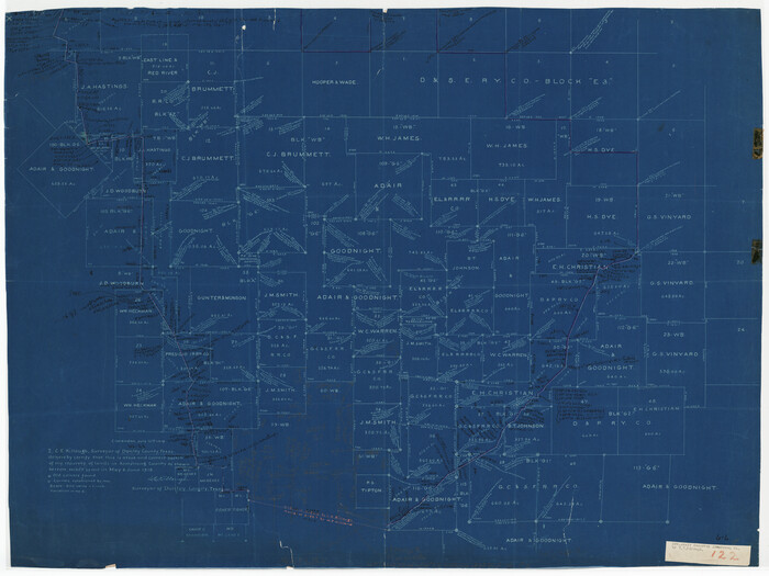
Armstrong County

Print $20.00
- Digital $50.00
Armstrong County
1933
-
Size
44.0 x 41.3 inches
-
Map/Doc
1773
-
Creation Date
1933
Armstrong County

Print $20.00
- Digital $50.00
Armstrong County
1933
-
Size
42.3 x 41.0 inches
-
Map/Doc
73071
-
Creation Date
1933
Armstrong County

Print $20.00
- Digital $50.00
Armstrong County
1933
-
Size
39.3 x 39.4 inches
-
Map/Doc
77203
-
Creation Date
1933
Armstrong County

Print $20.00
- Digital $50.00
Armstrong County
1933
-
Size
43.2 x 41.2 inches
-
Map/Doc
95420
-
Creation Date
1933
Armstrong County Working Sketch Graphic Index
Print $20.00
- Digital $50.00
Armstrong County Working Sketch Graphic Index
1933
-
Size
40.3 x 40.0 inches
-
Map/Doc
76457
-
Creation Date
1933
Armstrong County Working Sketch 6
Print $20.00
- Digital $50.00
Armstrong County Working Sketch 6
1929
-
Size
24.3 x 19.4 inches
-
Map/Doc
67237
-
Creation Date
1929
Armstrong County Sketch File A-9
Print $40.00
- Digital $50.00
Armstrong County Sketch File A-9
1920
-
Size
13.7 x 35.4 inches
-
Map/Doc
10851
-
Creation Date
1920
Armstrong County Sketch File A-6
Print $40.00
- Digital $50.00
Armstrong County Sketch File A-6
1919
-
Size
18.3 x 15.8 inches
-
Map/Doc
10847
-
Creation Date
1919
Briscoe County Sketch File J
Print $40.00
- Digital $50.00
Briscoe County Sketch File J
1919
-
Size
19.3 x 32.0 inches
-
Map/Doc
11007
-
Creation Date
1919
Donley County Sketch File B7
Print $20.00
- Digital $50.00
Donley County Sketch File B7
1919
-
Size
25.5 x 32.4 inches
-
Map/Doc
11377
-
Creation Date
1919
Armstrong County Sketch File A-2
Print $40.00
- Digital $50.00
Armstrong County Sketch File A-2
1918
-
Size
27.0 x 36.6 inches
-
Map/Doc
10843
-
Creation Date
1918
Armstrong County Sketch File A-5
Print $40.00
- Digital $50.00
Armstrong County Sketch File A-5
1918
-
Size
18.0 x 28.2 inches
-
Map/Doc
10846
-
Creation Date
1918
Armstrong County Working Sketch 4
Print $20.00
- Digital $50.00
Armstrong County Working Sketch 4
1918
-
Size
23.9 x 32.0 inches
-
Map/Doc
67235
-
Creation Date
1918
Working Sketch in Armstrong County
Print $20.00
- Digital $50.00
Working Sketch in Armstrong County
1918
-
Size
31.5 x 24.3 inches
-
Map/Doc
90265
-
Creation Date
1918
Armstrong County Working Sketch 5
Print $40.00
- Digital $50.00
Armstrong County Working Sketch 5
1918
-
Size
48.4 x 41.9 inches
-
Map/Doc
67236
-
Creation Date
1918
[Mrs. Adair Resurvey]
Print $20.00
- Digital $50.00
[Mrs. Adair Resurvey]
1918
-
Size
36.5 x 27.4 inches
-
Map/Doc
89976
-
Creation Date
1918
Working Sketch Armstrong County
Print $20.00
- Digital $50.00
Working Sketch Armstrong County
1909
-
Size
32.0 x 23.8 inches
-
Map/Doc
90264
-
Creation Date
1909
School District No. 5, Armstrong County, Texas
Print $20.00
- Digital $50.00
School District No. 5, Armstrong County, Texas
1908
-
Size
15.5 x 20.2 inches
-
Map/Doc
90271
-
Creation Date
1908
Donley County Sketch File 30
Print $24.00
- Digital $50.00
Donley County Sketch File 30
1906
-
Size
11.3 x 8.7 inches
-
Map/Doc
21270
-
Creation Date
1906
Armstrong County Sketch File 9
Print $12.00
- Digital $50.00
Armstrong County Sketch File 9
1904
-
Size
11.6 x 9.1 inches
-
Map/Doc
41460
-
Creation Date
1904
Donley County Working Sketch 11
Print $20.00
- Digital $50.00
Donley County Working Sketch 11
1904
-
Size
43.7 x 41.1 inches
-
Map/Doc
68744
-
Creation Date
1904
Armstrong County Sketch File C
Print $46.00
- Digital $50.00
Armstrong County Sketch File C
1904
-
Size
16.4 x 15.7 inches
-
Map/Doc
10856
-
Creation Date
1904
Armstrong County

Print $20.00
- Digital $50.00
Armstrong County
1904
-
Size
45.7 x 40.6 inches
-
Map/Doc
4876
-
Creation Date
1904
Armstrong County

Print $20.00
- Digital $50.00
Armstrong County
1904
-
Size
40.4 x 33.8 inches
-
Map/Doc
3247
-
Creation Date
1904