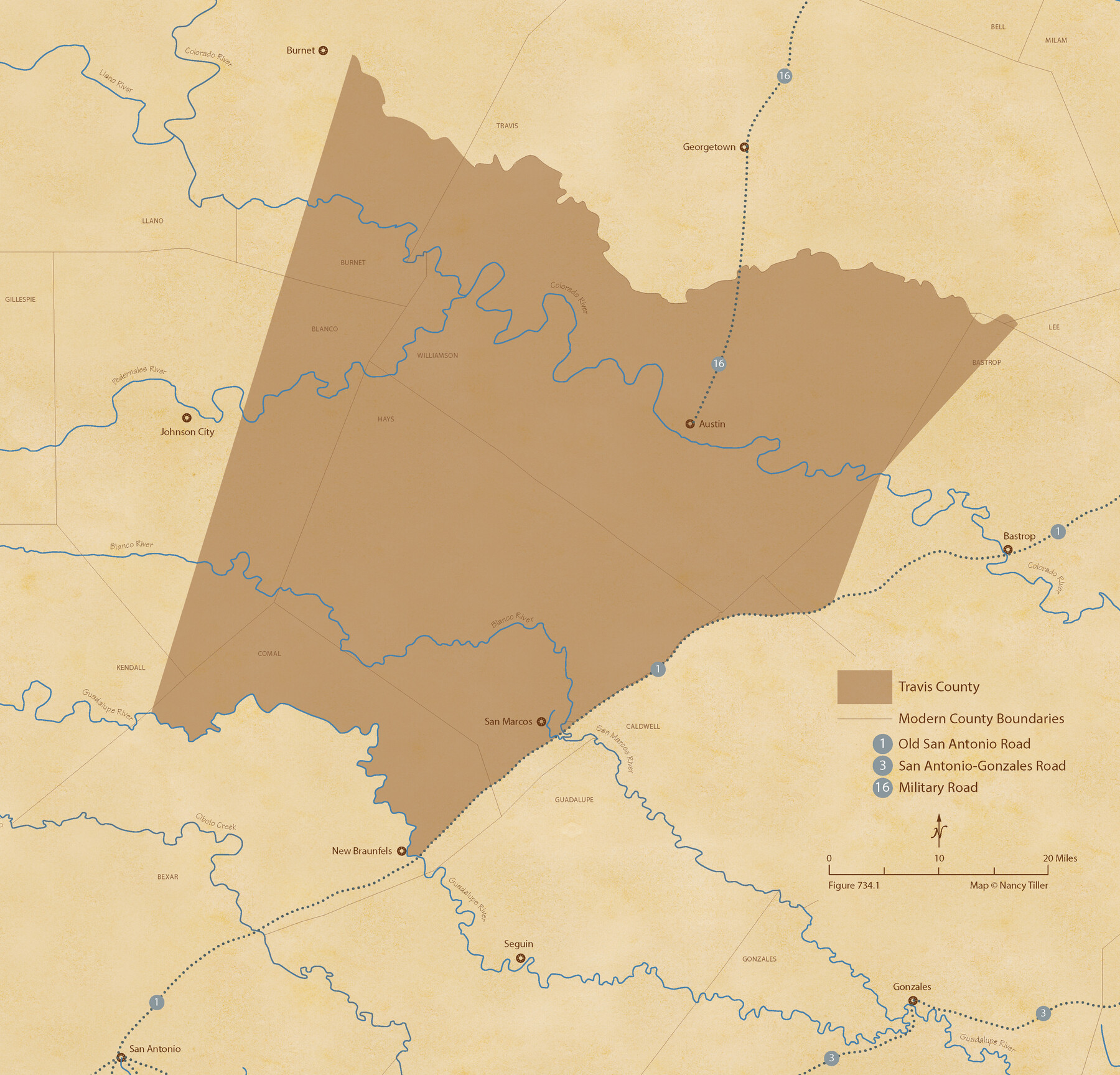
The Republic County of Travis. Created, January 25, 1840
Figure No. 734.1 from 'A Boundary Atlas of Texas, 1821-1845' by Jim Tiller
-
Map/Doc
96289
-
Collection
Nancy and Jim Tiller Digital Collection
-
Object Dates
2020/1/1 (Creation Date)
-
People and Organizations
Jim Tiller (Author)
Nancy Tiller (Cartographer)
Gang Gong (GIS Professional)
-
Counties
Travis
-
Subjects
Atlas County Republic of Texas Texas Boundaries
-
Height x Width
20.8 x 21.6 inches
52.8 x 54.9 cm
-
Medium
digital image
-
Comments
To purchase a digital PDF copy of "A Boundary Atlas of Texas, 1821-1845" see 96437.
Please note that the labels for Williamson and Travis Counties on this map have been transposed in error.
Part of: Nancy and Jim Tiller Digital Collection
The Chief Justice County of Matagorda. March 30, 1837

Print $20.00
The Chief Justice County of Matagorda. March 30, 1837
2020
Size 19.7 x 21.7 inches
Map/Doc 96057
The Republic County of Washington. January 15, 1842

Print $20.00
The Republic County of Washington. January 15, 1842
2020
Size 11.8 x 21.7 inches
Map/Doc 96306
The Republic County of Bowie. January 16, 1843

Print $20.00
The Republic County of Bowie. January 16, 1843
2020
Size 19.5 x 21.7 inches
Map/Doc 96106
The Republic County of Bowie. December 29, 1845

Print $20.00
The Republic County of Bowie. December 29, 1845
2020
Size 19.5 x 21.7 inches
Map/Doc 96108
The Republic County of Victoria. December 29, 1845

Print $20.00
The Republic County of Victoria. December 29, 1845
2020
Size 24.3 x 21.7 inches
Map/Doc 96301
The Republic County of Robertson. November 28, 1839

Print $20.00
The Republic County of Robertson. November 28, 1839
2020
Size 18.9 x 21.6 inches
Map/Doc 96260
The Mexican Company Empresario Colony. May 1, 1832

Print $20.00
The Mexican Company Empresario Colony. May 1, 1832
2020
Size 15.0 x 21.7 inches
Map/Doc 95999
From Citizens of Washington County to Establish a New Eastern Boundary, November 30, 1837

Print $20.00
From Citizens of Washington County to Establish a New Eastern Boundary, November 30, 1837
2020
Size 14.2 x 21.7 inches
Map/Doc 96375
The Pringle and Grieve Colony. November 1, 1843

Print $20.00
The Pringle and Grieve Colony. November 1, 1843
2020
Size 23.0 x 17.7 inches
Map/Doc 96371
de Leon Empresario Colony. Absorbed by DeWitt Colony. April 15, 1825

Print $20.00
de Leon Empresario Colony. Absorbed by DeWitt Colony. April 15, 1825
2020
Size 18.5 x 21.7 inches
Map/Doc 95989
The Republic County of Bowie. Created, December 17, 1840

Print $20.00
The Republic County of Bowie. Created, December 17, 1840
2020
Size 19.5 x 21.7 inches
Map/Doc 96102
The Republic County of Austin. January 10, 1839

Print $20.00
The Republic County of Austin. January 10, 1839
2020
Size 7.0 x 22.0 inches
Map/Doc 96083
You may also like
Kinney County Working Sketch 23

Print $20.00
- Digital $50.00
Kinney County Working Sketch 23
1950
Size 20.8 x 24.3 inches
Map/Doc 70205
Concho County Sketch File 5

Print $2.00
- Digital $50.00
Concho County Sketch File 5
1858
Size 8.1 x 7.4 inches
Map/Doc 82974
Williamson County Sketch File 26

Print $30.00
- Digital $50.00
Williamson County Sketch File 26
1853
Size 14.2 x 8.8 inches
Map/Doc 40367
South Part of Webb County

Print $40.00
- Digital $50.00
South Part of Webb County
1984
Size 41.2 x 61.5 inches
Map/Doc 77453
[Surveys in the Nacogdoches District, from the Sabine River to Cowleach Fork]
![282, [Surveys in the Nacogdoches District, from the Sabine River to Cowleach Fork], General Map Collection](https://historictexasmaps.com/wmedia_w700/maps/282.tif.jpg)
Print $3.00
- Digital $50.00
[Surveys in the Nacogdoches District, from the Sabine River to Cowleach Fork]
Size 15.6 x 11.5 inches
Map/Doc 282
T. & P. R. R. Co. Block 44, Township 1 S

Print $20.00
- Digital $50.00
T. & P. R. R. Co. Block 44, Township 1 S
Size 18.1 x 22.8 inches
Map/Doc 90826
Crosby County Working Sketch 18

Print $20.00
- Digital $50.00
Crosby County Working Sketch 18
1982
Size 22.7 x 31.0 inches
Map/Doc 68452
Sutton County Sketch File 23

Print $30.00
- Digital $50.00
Sutton County Sketch File 23
1918
Size 14.2 x 8.5 inches
Map/Doc 37461
Flight Mission No. DAG-18K, Frame 77, Matagorda County

Print $20.00
- Digital $50.00
Flight Mission No. DAG-18K, Frame 77, Matagorda County
1952
Size 18.5 x 22.3 inches
Map/Doc 86370
Rucker's Work on Upper Red River

Print $20.00
- Digital $50.00
Rucker's Work on Upper Red River
1857
Size 39.3 x 26.2 inches
Map/Doc 3220
Fisher County Sketch File 19

Print $20.00
- Digital $50.00
Fisher County Sketch File 19
Size 18.8 x 15.7 inches
Map/Doc 11481
Dimmit County Working Sketch 26

Print $20.00
- Digital $50.00
Dimmit County Working Sketch 26
1956
Size 19.3 x 15.9 inches
Map/Doc 68687