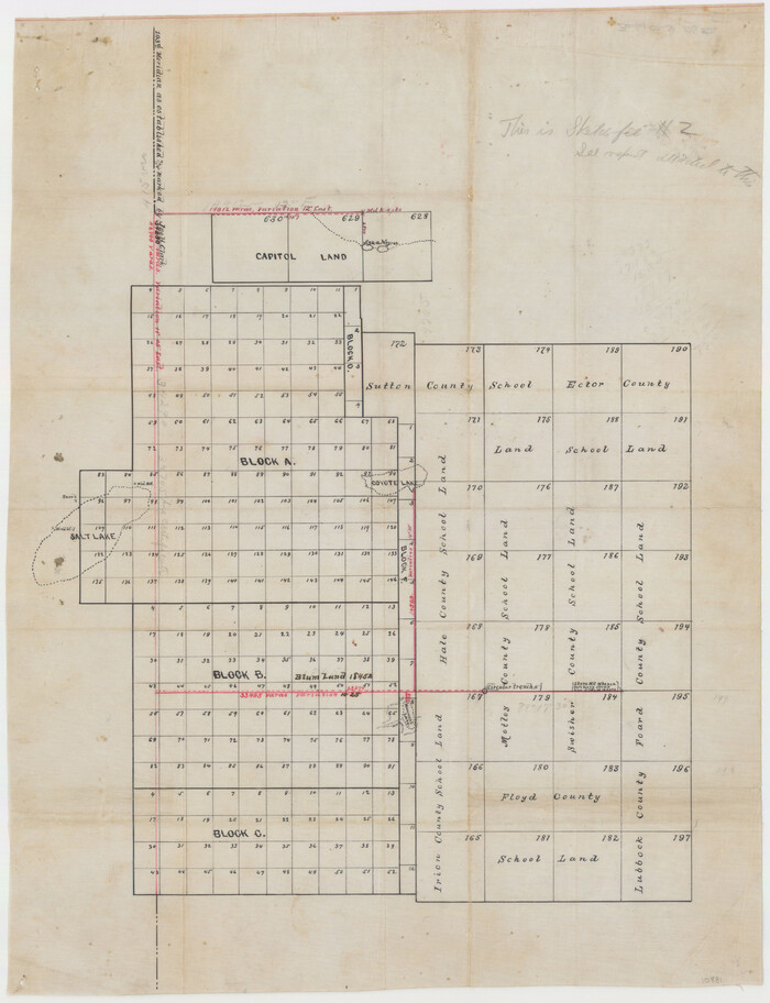
 
                                                                        
                                Bailey County Sketch File 2
1892
 
                                                                        
                                Dallam County Sketch File 2
1886
 
                                                                        
                                Ector County Sketch File 3
1889
 
                                                                        
                                Bailey County Sketch File 2a
1892
 
                                                                        
                                [Plat No. 1, Connecting line from SW corner of Jones Co. to SE corner of Borden Co.]
1908
 
                                                                        
                                Texas Panhandle East Boundary Line
1898
 
                                                                        
                                Texas Panhandle East Boundary Line
1898
 
                                                                        
                                [Texas Panhandle North Boundary Line]
1898
 
                                                                        
                                Texas Panhandle East Boundary Line
1898
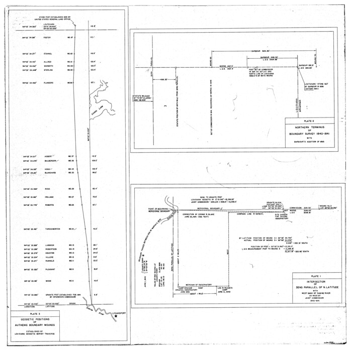
 
                                                                        
                                Geodetic positions of authentic boundary mounds, established by Louisiana Geodetic Survey traverse
 
                                                                        
                                [Texas Panhandle North Boundary Line]
1898
 
                                                                        
                                Texas Panhandle North Boundary Line
1898
 
                                                                        
                                Texas Panhandle East Boundary Line
1898
 
                                                                        
                                Map of the River Sabine from its mouth on the Gulf of Mexico in the Sea to Logan's Ferry in Latitude 31°58'24" North
1842
 
                                                                        
                                International boundary between the United States and Mexico in the Rio Grande and Colorado River delineated in accordance with the Treaty of November 23, 1970 - Volume 1
1972
 
                                                                        
                                International boundary between U.S. & Mexico in Gulf of Mexico from 12 mile point easterly to 200 mile limit
1976
 
                                                                        
                                Rio Grande Rectification Project, El Paso and Juarez Valley
1935
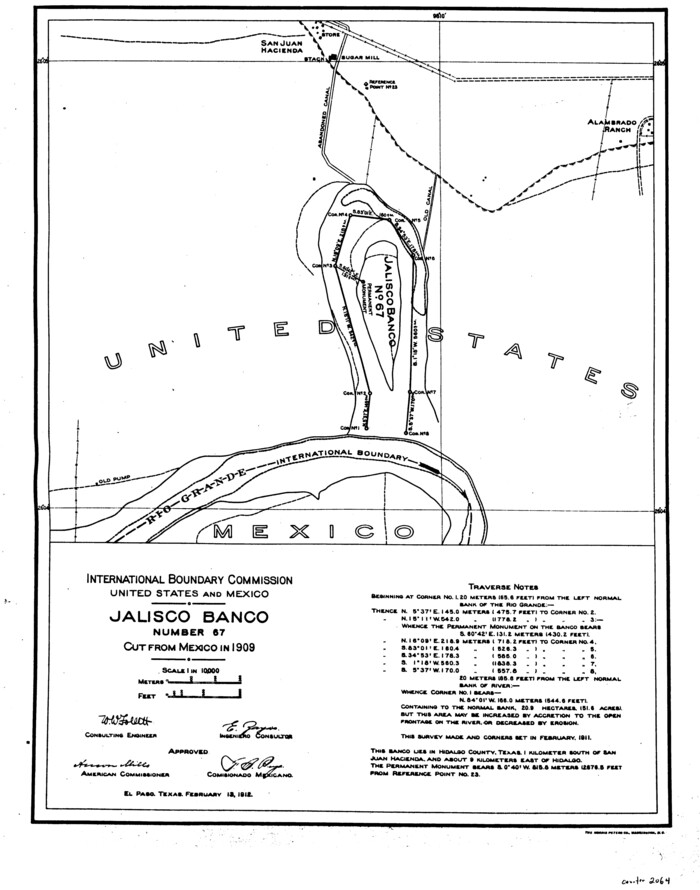
 
                                                                        
                                Jalisco Banco Number 67, cut from Mexico in 1909
1912
 
                                                                        
                                Rio Grande from San Juan River to the Gulf of Mexico showing Boundary between the United States and Mexico
1903
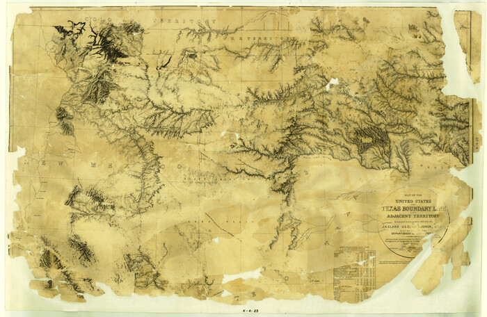
 
                                                                        
                                Map of the United States and Texas Boundary Line and Adjacent Territory
1860
 
                                                                        
                                Lynn County Sketch File 1
1892
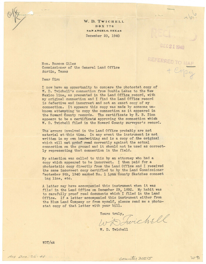
 
                                                                        
                                Lynn County Sketch File 1b
1940
 
                                                                        
                                Supreme Court of the United States, October Term, 1923, No. 15, Original - The State of Oklahoma, Complainant vs. The State of Texas, Defendant, The United States, Intervener; Report of Medial Line Survey
1924
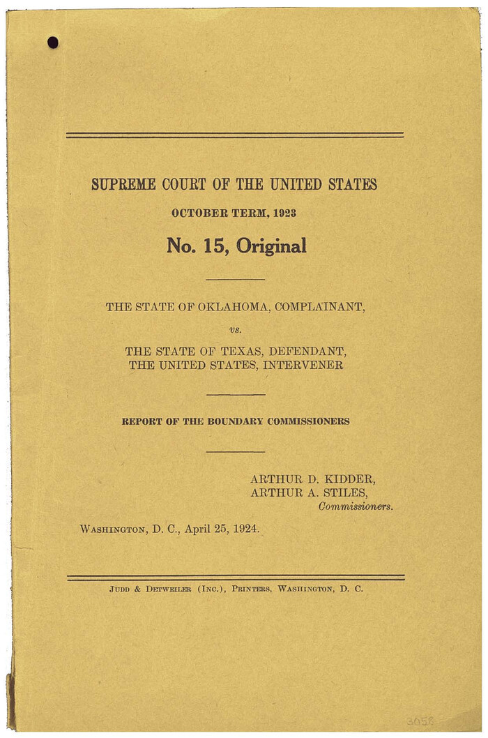
 
                                                                        
                                Supreme Court of the United States, October Term, 1923, No. 15, Original - The State of Oklahoma, Complainant vs. The State of Texas, Defendant, The United States, Intervener; Report of the Boundary Commissioners
1924
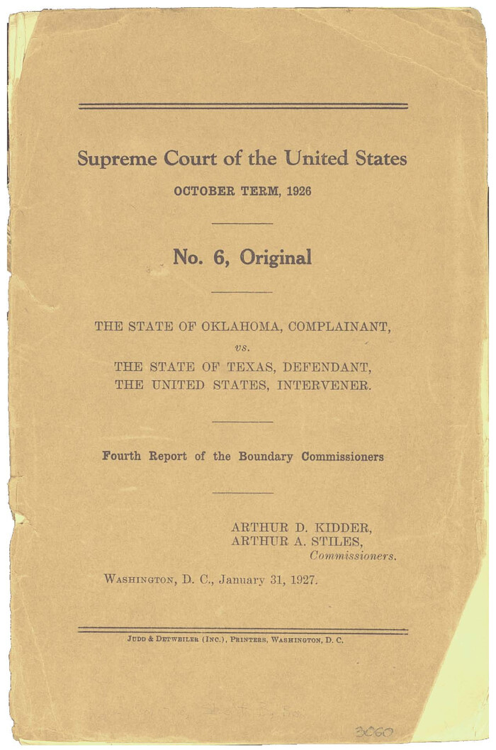
 
                                                                        
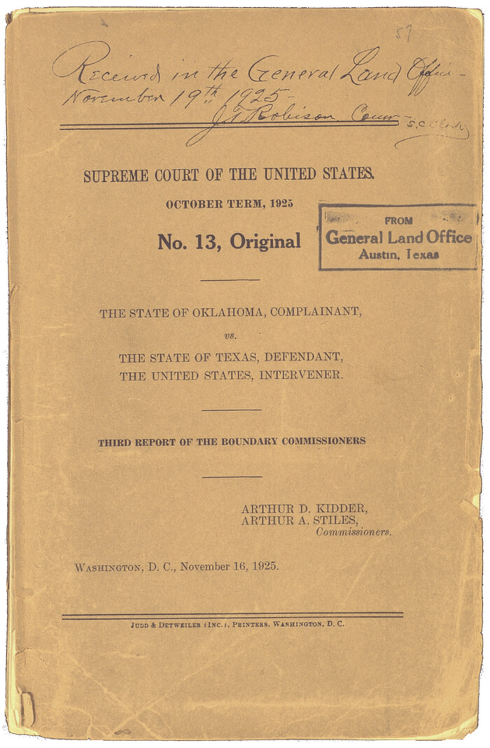
                                Supreme Court of the United States October Term, 1926, No. 6, Original - State of Oklahoma, Complainant vs. The State of Texas, Defendant, the United States, Intervener; Fourth Report of the Boundary Commissioners
1927
 
                                                                        
                                Texas-Oklahoma Boundary Line: brief summary of the lands surveyed and the lands not surveyed in the dispute between Oklahoma vs. Texas
1923
 
                                                                        
                                Map of the Survey of the Parallel 36 1/2 Degrees North Latitude, Commencing at the 100th and Running to the 103rd Degree of Longitude West of Greenwich
1862
 
                                                                        
                                Map of survey of the 100th Meridian west longitude, extending from the north bank of Red River to the intersection of the Northern Boundary of the Creek or Seminole Country
1859
 
                                                                        
                                Map of the survey of the 100th Meridian of longitude west of Greenwich beginning at Red River and extending to the parallel 36 1/2 degrees north latitude
1862
 
                                                                        
                                That part of the boundary between the Republic of Texas and the United States, North of Sabine River from the 36th to the 72nd Mile Mound on the Meridian Line (Sheet No. 2)
1842
 
                                                
                    Bailey County Sketch File 2
1892
- 
                                Size28.0 x 23.6 inches 
- 
                            Map/Doc10881 
- 
                                Creation Date1892 
 
                                                
                    Dallam County Sketch File 2
1886
- 
                                Size29.9 x 17.4 inches 
- 
                            Map/Doc11278 
- 
                                Creation Date1886 
 
                                                
                    Ector County Sketch File 3
1889
- 
                                Size16.2 x 35.5 inches 
- 
                            Map/Doc11417 
- 
                                Creation Date1889 
 
                                                
                    Bailey County Sketch File 2a
1892
- 
                                Size13.0 x 8.3 inches 
- 
                            Map/Doc13935 
- 
                                Creation Date1892 
![1698, [Plat No. 1, Connecting line from SW corner of Jones Co. to SE corner of Borden Co.], General Map Collection](https://historictexasmaps.com/wmedia_w700/maps/1698.tif.jpg) 
                                                
                    [Plat No. 1, Connecting line from SW corner of Jones Co. to SE corner of Borden Co.]
1908
- 
                                Size18.1 x 128.8 inches 
- 
                            Map/Doc1698 
- 
                                Creation Date1908 
 
                                                
                    Texas Panhandle East Boundary Line
1898
- 
                                Size32.1 x 8.8 inches 
- 
                            Map/Doc1700 
- 
                                Creation Date1898 
 
                                                
                    Texas Panhandle East Boundary Line
1898
- 
                                Size65.3 x 10.0 inches 
- 
                            Map/Doc1702 
- 
                                Creation Date1898 
![1714, [Texas Panhandle North Boundary Line], General Map Collection](https://historictexasmaps.com/wmedia_w700/maps/1714.tif.jpg) 
                                                
                    [Texas Panhandle North Boundary Line]
1898
- 
                                Size43.6 x 11.4 inches 
- 
                            Map/Doc1714 
- 
                                Creation Date1898 
 
                                                
                    Texas Panhandle East Boundary Line
1898
- 
                                Size9.2 x 64.9 inches 
- 
                            Map/Doc1716 
- 
                                Creation Date1898 
 
                                                
                    Geodetic positions of authentic boundary mounds, established by Louisiana Geodetic Survey traverse
- 
                                Size28.8 x 28.7 inches 
- 
                            Map/Doc1734 
 
                                                
                    [Texas Panhandle North Boundary Line]
1898
- 
                                Size11.9 x 46.1 inches 
- 
                            Map/Doc1737 
- 
                                Creation Date1898 
 
                                                
                    Texas Panhandle North Boundary Line
1898
- 
                                Size13.4 x 125.2 inches 
- 
                            Map/Doc1738 
- 
                                Creation Date1898 
 
                                                
                    Texas Panhandle East Boundary Line
1898
- 
                                Size11.6 x 35.5 inches 
- 
                            Map/Doc1741 
- 
                                Creation Date1898 
 
                                                
                    Map of the River Sabine from its mouth on the Gulf of Mexico in the Sea to Logan's Ferry in Latitude 31°58'24" North
1842
- 
                                Size173.2 x 31.0 inches 
- 
                            Map/Doc1744 
- 
                                Creation Date1842 
 
                                                
                    International boundary between the United States and Mexico in the Rio Grande and Colorado River delineated in accordance with the Treaty of November 23, 1970 - Volume 1
1972
- 
                            Map/Doc1747 
- 
                                Creation Date1972 
 
                                                
                    International boundary between U.S. & Mexico in Gulf of Mexico from 12 mile point easterly to 200 mile limit
1976
- 
                                Size9.6 x 14.8 inches 
- 
                            Map/Doc1748 
- 
                                Creation Date1976 
 
                                                
                    Rio Grande Rectification Project, El Paso and Juarez Valley
1935
- 
                                Size9.7 x 14.9 inches 
- 
                            Map/Doc1749 
- 
                                Creation Date1935 
 
                                                
                    Jalisco Banco Number 67, cut from Mexico in 1909
1912
- 
                                Size14.2 x 11.2 inches 
- 
                            Map/Doc2064 
- 
                                Creation Date1912 
 
                                                
                    Rio Grande from San Juan River to the Gulf of Mexico showing Boundary between the United States and Mexico
1903
- 
                                Size25.6 x 15.8 inches 
- 
                            Map/Doc2065 
- 
                                Creation Date1903 
 
                                                
                    Map of the United States and Texas Boundary Line and Adjacent Territory
1860
- 
                                Size26.9 x 41.4 inches 
- 
                            Map/Doc2129 
- 
                                Creation Date1860 
 
                                                
                    Lynn County Sketch File 1
1892
- 
                                Size14.0 x 8.8 inches 
- 
                            Map/Doc30443 
- 
                                Creation Date1892 
 
                                                
                    Lynn County Sketch File 1b
1940
- 
                                Size8.7 x 11.3 inches 
- 
                            Map/Doc30515 
- 
                                Creation Date1940 
 
                                                
                    Supreme Court of the United States, October Term, 1923, No. 15, Original - The State of Oklahoma, Complainant vs. The State of Texas, Defendant, The United States, Intervener; Report of Medial Line Survey
1924
- 
                                Size5.9 x 9.1 inches 
- 
                            Map/Doc3055 
- 
                                Creation Date1924 
 
                                                
                    Supreme Court of the United States, October Term, 1923, No. 15, Original - The State of Oklahoma, Complainant vs. The State of Texas, Defendant, The United States, Intervener; Report of the Boundary Commissioners
1924
- 
                                Size6.1 x 9.2 inches 
- 
                            Map/Doc3058 
- 
                                Creation Date1924 
 
                                                
                    Supreme Court of the United States October Term, 1926, No. 6, Original - State of Oklahoma, Complainant vs. The State of Texas, Defendant, the United States, Intervener; Fourth Report of the Boundary Commissioners
1927
- 
                                Size6.0 x 9.2 inches 
- 
                            Map/Doc3060 
- 
                                Creation Date1927 
 
                                                
                    Texas-Oklahoma Boundary Line: brief summary of the lands surveyed and the lands not surveyed in the dispute between Oklahoma vs. Texas
1923
- 
                                Size6.0 x 9.2 inches 
- 
                            Map/Doc3061 
- 
                                Creation Date1923 
 
                                                
                    Map of the Survey of the Parallel 36 1/2 Degrees North Latitude, Commencing at the 100th and Running to the 103rd Degree of Longitude West of Greenwich
1862
- 
                                Size87.1 x 11.1 inches 
- 
                            Map/Doc3084 
- 
                                Creation Date1862 
 
                                                
                    Map of survey of the 100th Meridian west longitude, extending from the north bank of Red River to the intersection of the Northern Boundary of the Creek or Seminole Country
1859
- 
                                Size30.8 x 9.9 inches 
- 
                            Map/Doc3091 
- 
                                Creation Date1859 
 
                                                
                    Map of the survey of the 100th Meridian of longitude west of Greenwich beginning at Red River and extending to the parallel 36 1/2 degrees north latitude
1862
- 
                                Size111.9 x 10.4 inches 
- 
                            Map/Doc3094 
- 
                                Creation Date1862 
 
                                                
                    That part of the boundary between the Republic of Texas and the United States, North of Sabine River from the 36th to the 72nd Mile Mound on the Meridian Line (Sheet No. 2)
1842
- 
                                Size33.7 x 26.0 inches 
- 
                            Map/Doc3132 
- 
                                Creation Date1842