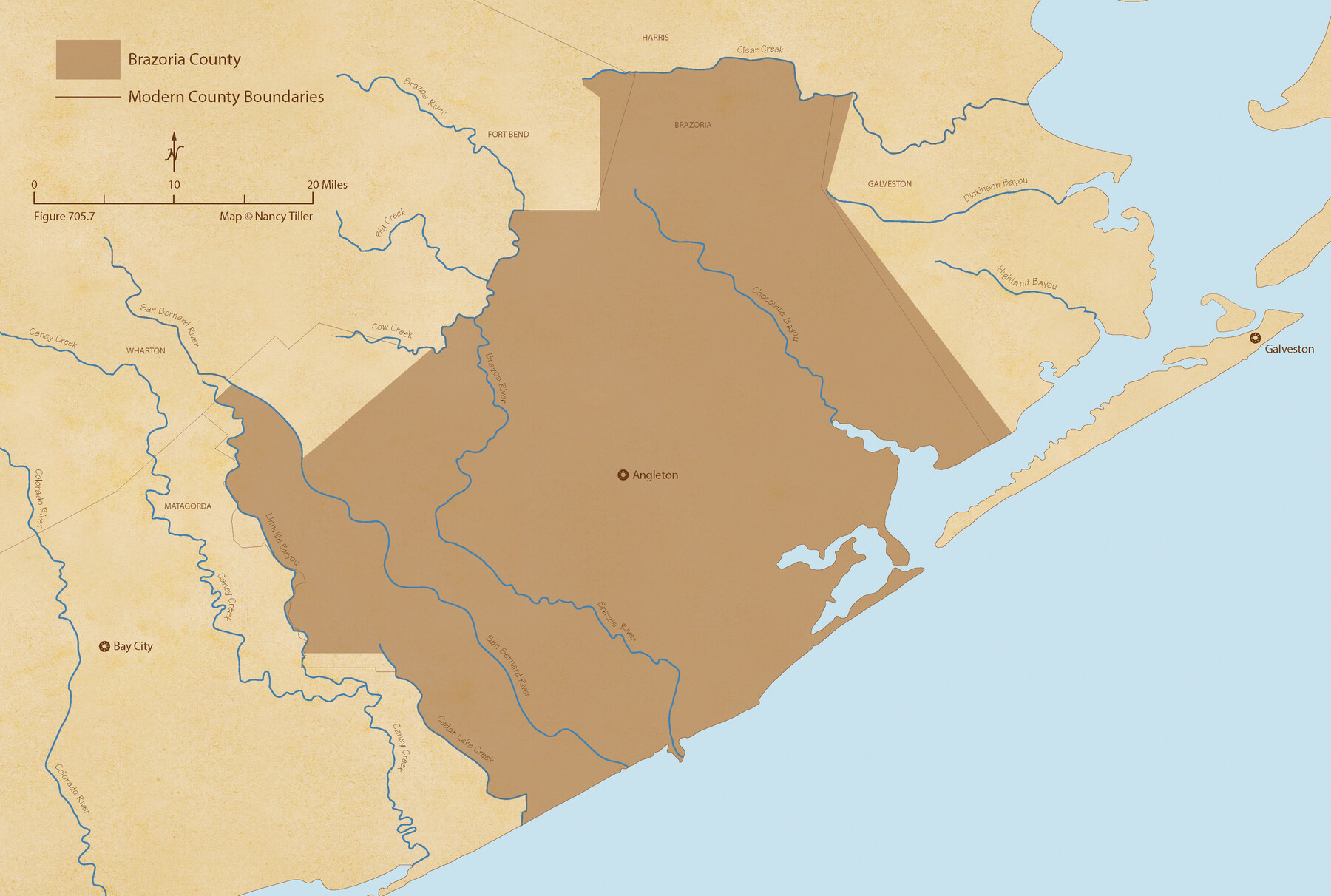
The Republic County of Brazoria. December 29, 1845
Figure No. 705.7 from 'A Boundary Atlas of Texas, 1821-1845' by Jim Tiller
-
Map/Doc
96115
-
Collection
Nancy and Jim Tiller Digital Collection
-
Object Dates
2020/1/1 (Creation Date)
-
People and Organizations
Jim Tiller (Author)
Nancy Tiller (Cartographer)
Gang Gong (GIS Professional)
-
Counties
Brazoria
-
Subjects
Atlas County Republic of Texas Texas Boundaries
-
Height x Width
14.7 x 21.8 inches
37.3 x 55.4 cm
-
Medium
digital image
-
Comments
To purchase a digital PDF copy of "A Boundary Atlas of Texas, 1821-1845" see 96437.
Part of: Nancy and Jim Tiller Digital Collection
The Judicial District/Counties, Late Spring 1842

Print $20.00
The Judicial District/Counties, Late Spring 1842
2020
Size 24.5 x 21.7 inches
Map/Doc 96356
The Republic County of Washington. December 29, 1845

Print $20.00
The Republic County of Washington. December 29, 1845
2020
Size 11.8 x 21.7 inches
Map/Doc 96310
The Mexican Municipality of Matagorda. December 5, 1835

Print $20.00
The Mexican Municipality of Matagorda. December 5, 1835
2020
Size 15.9 x 21.7 inches
Map/Doc 96027
The Republic County of Harris. December 31, 1838

Print $20.00
The Republic County of Harris. December 31, 1838
2020
Size 17.7 x 21.7 inches
Map/Doc 96164
The Mexican Municipality of San Patricio. April 1834

Print $20.00
The Mexican Municipality of San Patricio. April 1834
2020
Size 16.0 x 21.7 inches
Map/Doc 96034
Austin Empresario Colony. March 27, 1827

Print $20.00
Austin Empresario Colony. March 27, 1827
2020
Size 18.0 x 21.6 inches
Map/Doc 95980
The Judicial District/County of Panola. Created, January 30, 1841

Print $20.00
The Judicial District/County of Panola. Created, January 30, 1841
2020
Size 19.3 x 21.6 inches
Map/Doc 96340
The Republic County of Brazos. December 29, 1845

Print $20.00
The Republic County of Brazos. December 29, 1845
2020
Size 20.6 x 21.7 inches
Map/Doc 96117
The Republic County of Bowie. June 24, 1841

Print $20.00
The Republic County of Bowie. June 24, 1841
2020
Size 19.5 x 21.7 inches
Map/Doc 96104
The Republic County of Shelby. January 28, 1839

Print $20.00
The Republic County of Shelby. January 28, 1839
2020
Size 21.1 x 21.7 inches
Map/Doc 96281
The Republic County of Milam. Proposed, Late Fall 1837

Print $20.00
The Republic County of Milam. Proposed, Late Fall 1837
2020
Size 19.9 x 21.7 inches
Map/Doc 96225
The Chief Justice County of San Patricio. Proposed, No Date

Print $20.00
The Chief Justice County of San Patricio. Proposed, No Date
2020
Size 20.0 x 21.7 inches
Map/Doc 96072
You may also like
Dallas County Sketch File 23

Print $6.00
- Digital $50.00
Dallas County Sketch File 23
1860
Size 14.5 x 8.8 inches
Map/Doc 20456
Republic of Texas and State of Louisiana Boundary

Republic of Texas and State of Louisiana Boundary
2022
Size 8.5 x 11.0 inches
Map/Doc 96979
Schleicher County Working Sketch 9

Print $20.00
- Digital $50.00
Schleicher County Working Sketch 9
1923
Size 12.4 x 11.8 inches
Map/Doc 63811
Mapa Geográphico de la Provincia de Tejas

Mapa Geográphico de la Provincia de Tejas
1822
Size 9.8 x 12.7 inches
Map/Doc 94457
[Aaron Cherry and A. M. de Lejarza Surveys on the Trinity River]
![91080, [Aaron Cherry and A. M. de Lejarza Surveys on the Trinity River], Twichell Survey Records](https://historictexasmaps.com/wmedia_w700/maps/91080-1.tif.jpg)
Print $20.00
- Digital $50.00
[Aaron Cherry and A. M. de Lejarza Surveys on the Trinity River]
Size 26.3 x 14.1 inches
Map/Doc 91080
Taylor County Rolled Sketch 30B

Print $20.00
- Digital $50.00
Taylor County Rolled Sketch 30B
Size 17.5 x 11.6 inches
Map/Doc 76411
Williamson County

Print $20.00
- Digital $50.00
Williamson County
1872
Size 18.4 x 28.2 inches
Map/Doc 4151
Subdivision of the East Half of Lot No. 1 in Division "Z" of the Out-Lots adjoining the City of Austin

Print $20.00
- Digital $50.00
Subdivision of the East Half of Lot No. 1 in Division "Z" of the Out-Lots adjoining the City of Austin
Size 32.1 x 42.6 inches
Map/Doc 648
Right of Way & Track Map, St. Louis, Brownsville & Mexico Ry. operated by St. Louis, Brownsville & Mexico Ry. Co.

Print $40.00
- Digital $50.00
Right of Way & Track Map, St. Louis, Brownsville & Mexico Ry. operated by St. Louis, Brownsville & Mexico Ry. Co.
1919
Size 25.7 x 57.6 inches
Map/Doc 64619
Brewster County Rolled Sketch 149

Print $20.00
- Digital $50.00
Brewster County Rolled Sketch 149
1951
Size 23.4 x 20.6 inches
Map/Doc 5316
[Sketch for Mineral Application 16700 - Pecos River Bed]
![2807, [Sketch for Mineral Application 16700 - Pecos River Bed], General Map Collection](https://historictexasmaps.com/wmedia_w700/maps/2807.tif.jpg)
Print $20.00
- Digital $50.00
[Sketch for Mineral Application 16700 - Pecos River Bed]
1927
Size 32.9 x 15.3 inches
Map/Doc 2807
