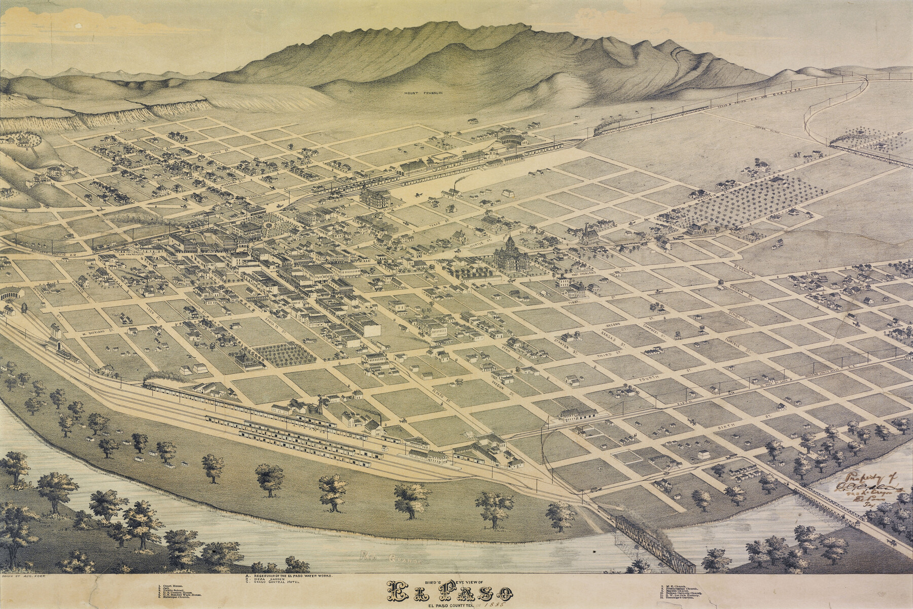
Bird's Eye View of El Paso
-
Map/Doc
93621
-
Collection
Library of Congress
-
Object Dates
1885 (Creation Date)
-
Subjects
Bird's Eye View City
-
Height x Width
20.0 x 30.0 inches
50.8 x 76.2 cm
-
Comments
Prints available from the GLO courtesy of Library of Congress, Geography and Map Division.
Part of: Library of Congress
Map of Taylor County, Texas

Print $20.00
Map of Taylor County, Texas
1890
Size 22.0 x 18.1 inches
Map/Doc 93585
![88957, Hutchinson Co[unty], Library of Congress](https://historictexasmaps.com/wmedia_w700/maps/88957.tif.jpg)
Dallas, Texas. With the Projected River and Navigation Improvements. Viewed from Above the Sister City of Oak Cliff

Print $20.00
Dallas, Texas. With the Projected River and Navigation Improvements. Viewed from Above the Sister City of Oak Cliff
1892
Size 20.9 x 29.7 inches
Map/Doc 93474
Official map of Dallas County, Texas

Print $20.00
Official map of Dallas County, Texas
1886
Size 22.7 x 17.3 inches
Map/Doc 93592
Houston, Texas (Looking South)

Print $20.00
Houston, Texas (Looking South)
1891
Size 41.1 x 25.3 inches
Map/Doc 93465
Colton's new map of the state of Texas, the Indian Territory and adjoining portions of New Mexico, Louisiana, and Arkansas

Print $20.00
Colton's new map of the state of Texas, the Indian Territory and adjoining portions of New Mexico, Louisiana, and Arkansas
1872
Size 31.1 x 36.6 inches
Map/Doc 93579
Red River County, Texas

Print $20.00
Red River County, Texas
1870
Size 22.4 x 17.3 inches
Map/Doc 88989
Map exhibiting the fixed location of the main trunk of the New-Orleans, Opelousas & Great Western Railroad of Louisiana…

Print $20.00
Map exhibiting the fixed location of the main trunk of the New-Orleans, Opelousas & Great Western Railroad of Louisiana…
1859
Size 25.2 x 37.0 inches
Map/Doc 93582
Interpretative map of wind erodibility. Gaines County, Texas

Interpretative map of wind erodibility. Gaines County, Texas
1986
Size 27.6 x 36.2 inches
Map/Doc 93561
Provincias internas del reyno de Nuevo España

Print $20.00
Provincias internas del reyno de Nuevo España
1846
Size 30.7 x 23.6 inches
Map/Doc 93578
Map of the River Sabine from its Mouth on the Gulf of Mexico in the Sea to Logan's Ferry in Latitude 31°58'24" north

Print $40.00
Map of the River Sabine from its Mouth on the Gulf of Mexico in the Sea to Logan's Ferry in Latitude 31°58'24" north
1840
Size 35.0 x 170.0 inches
Map/Doc 88901

You may also like
Loving County Rolled Sketch 13

Print $20.00
- Digital $50.00
Loving County Rolled Sketch 13
2006
Size 43.6 x 45.0 inches
Map/Doc 83650

Bowie County Sketch File 5

Print $4.00
- Digital $50.00
Bowie County Sketch File 5
Size 10.1 x 7.5 inches
Map/Doc 14837
San Patricio County Sketch File 18

Print $4.00
San Patricio County Sketch File 18
Size 6.2 x 8.3 inches
Map/Doc 36066
Map of Hunt County

Print $20.00
- Digital $50.00
Map of Hunt County
1851
Size 25.1 x 18.7 inches
Map/Doc 3690
Tech Town a Subdivision of the Northeast Quarter Section 18, Block B

Print $20.00
- Digital $50.00
Tech Town a Subdivision of the Northeast Quarter Section 18, Block B
Size 17.5 x 21.6 inches
Map/Doc 92792
St. Louis Southwestern Railway of Texas

Print $20.00
- Digital $50.00
St. Louis Southwestern Railway of Texas
1906
Size 22.5 x 30.5 inches
Map/Doc 64449
Howard County Working Sketch 9a

Print $20.00
- Digital $50.00
Howard County Working Sketch 9a
1962
Size 34.8 x 32.8 inches
Map/Doc 66276
Flight Mission No. BRA-7M, Frame 145, Jefferson County

Print $20.00
- Digital $50.00
Flight Mission No. BRA-7M, Frame 145, Jefferson County
1953
Size 16.0 x 16.0 inches
Map/Doc 85539
Cameron County Aerial Photograph Index Sheet 3

Print $20.00
- Digital $50.00
Cameron County Aerial Photograph Index Sheet 3
1955
Size 21.1 x 17.4 inches
Map/Doc 83675
Tom Green County Sketch File 30

Print $12.00
Tom Green County Sketch File 30
1880
Size 11.0 x 8.2 inches
Map/Doc 38182
Johnson County Working Sketch 19

Print $20.00
- Digital $50.00
Johnson County Working Sketch 19
1990
Size 35.2 x 42.5 inches
Map/Doc 66632