Garza County Rolled Sketch R1
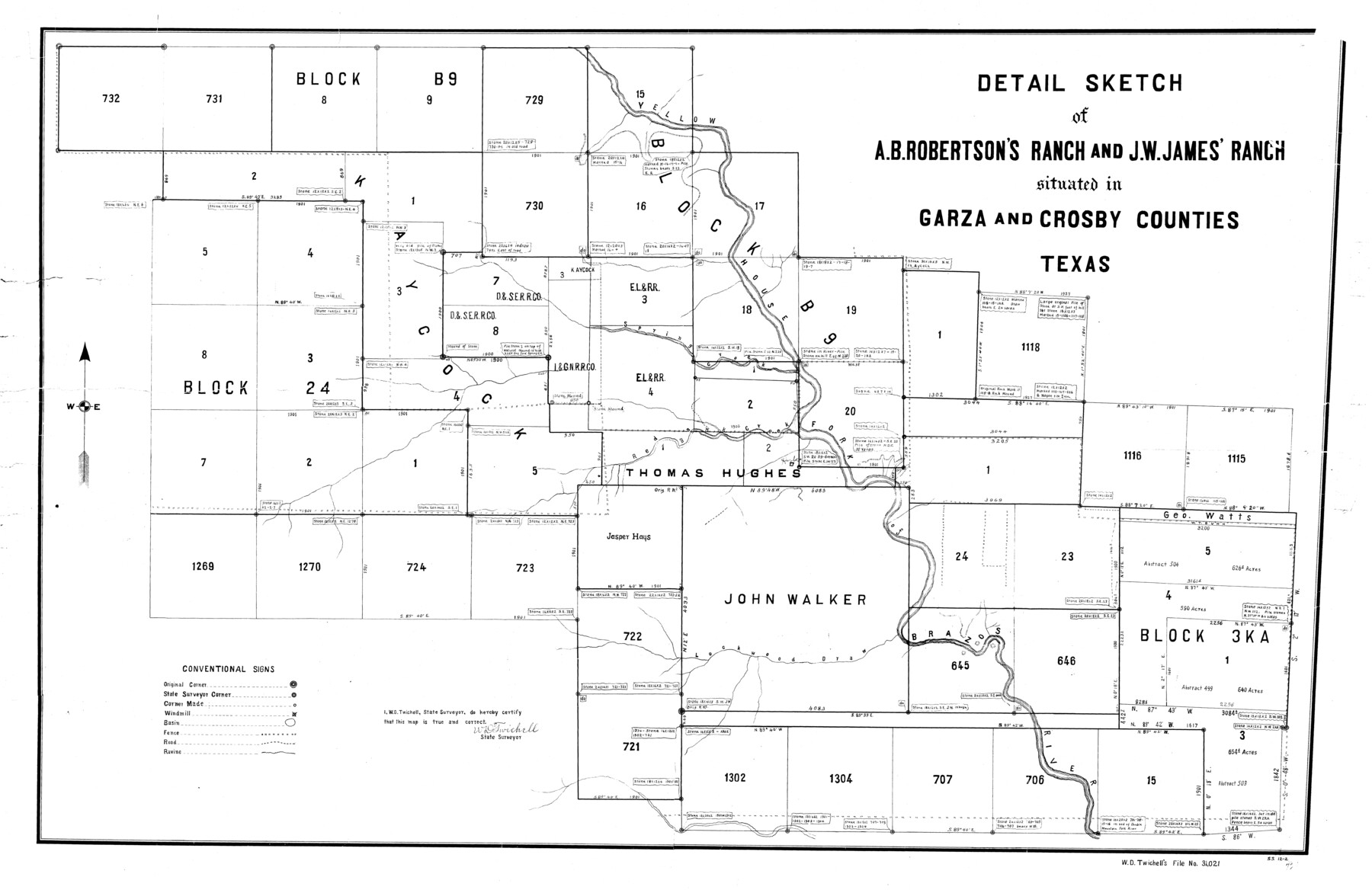
Detail sketch of A.B. Robertson's Ranch and J.W. James' Ranch situated in Garza and Crosby Counties, Texas
-
Map/Doc
9045
-
Collection
General Map Collection
-
People and Organizations
W.D. Twichell (Surveyor/Engineer)
-
Counties
Garza Crosby
-
Subjects
Surveying Rolled Sketch
-
Height x Width
32.1 x 49.3 inches
81.5 x 125.2 cm
Part of: General Map Collection


Liberty County Sketch File 41

Print $2.00
- Digital $50.00
Liberty County Sketch File 41
1872
Size 12.5 x 8.5 inches
Map/Doc 29997
Martin County Rolled Sketch 10A

Print $20.00
- Digital $50.00
Martin County Rolled Sketch 10A
1994
Size 18.3 x 24.5 inches
Map/Doc 6671
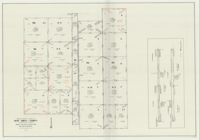
Deaf Smith County Working Sketch 4
Print $40.00
- Digital $50.00
Deaf Smith County Working Sketch 4
1983
Size 37.0 x 52.4 inches
Map/Doc 68644

Roberts County Working Sketch 35

Print $20.00
- Digital $50.00
Roberts County Working Sketch 35
1978
Size 26.7 x 22.5 inches
Map/Doc 63561
Brewster County Rolled Sketch 11A

Print $20.00
- Digital $50.00
Brewster County Rolled Sketch 11A
1881
Size 24.9 x 23.0 inches
Map/Doc 5192
Limestone County Sketch File 14

Print $4.00
- Digital $50.00
Limestone County Sketch File 14
1883
Size 10.7 x 8.2 inches
Map/Doc 30179
Tyler County Rolled Sketch 8

Print $20.00
- Digital $50.00
Tyler County Rolled Sketch 8
1965
Size 18.1 x 25.4 inches
Map/Doc 8058
Navigation Maps of Gulf Intracoastal Waterway, Port Arthur to Brownsville, Texas

Print $4.00
- Digital $50.00
Navigation Maps of Gulf Intracoastal Waterway, Port Arthur to Brownsville, Texas
1951
Size 16.6 x 21.5 inches
Map/Doc 65440
Dallam County Working Sketch 2

Print $20.00
- Digital $50.00
Dallam County Working Sketch 2
1906
Size 38.5 x 24.1 inches
Map/Doc 68587
You may also like
Map of Prison Properties in Vicinity of Huntsville, Walker County, Texas

Print $20.00
- Digital $50.00
Map of Prison Properties in Vicinity of Huntsville, Walker County, Texas
1933
Size 36.6 x 43.0 inches
Map/Doc 62992
Kimble County Working Sketch 64

Print $20.00
- Digital $50.00
Kimble County Working Sketch 64
1964
Size 15.1 x 16.9 inches
Map/Doc 70132
Sketch from old map (authority unknown) showing a portion of the Rio Grande River and harbor of Brazos Santiago, Texas

Print $20.00
- Digital $50.00
Sketch from old map (authority unknown) showing a portion of the Rio Grande River and harbor of Brazos Santiago, Texas
1887
Size 18.4 x 24.1 inches
Map/Doc 73004
Sterling County Sketch File 15

Print $8.00
- Digital $50.00
Sterling County Sketch File 15
1935
Size 11.1 x 8.8 inches
Map/Doc 37150
Hardeman County Sketch File 14a

Print $20.00
- Digital $50.00
Hardeman County Sketch File 14a
Size 24.4 x 29.0 inches
Map/Doc 11626
Nueces County Rolled Sketch 93

Print $161.00
Nueces County Rolled Sketch 93
1983
Size 37.3 x 24.2 inches
Map/Doc 7029
San Luis Pass to East Matagorda Bay

Print $40.00
- Digital $50.00
San Luis Pass to East Matagorda Bay
1982
Size 35.6 x 49.3 inches
Map/Doc 69970
Flight Mission No. DIX-8P, Frame 88, Aransas County

Print $20.00
- Digital $50.00
Flight Mission No. DIX-8P, Frame 88, Aransas County
1956
Size 18.6 x 22.3 inches
Map/Doc 83913
Flight Mission No. CRC-3R, Frame 10, Chambers County

Print $20.00
- Digital $50.00
Flight Mission No. CRC-3R, Frame 10, Chambers County
1956
Size 18.5 x 22.2 inches
Map/Doc 84784
Dallas County Sketch File 18

Print $6.00
- Digital $50.00
Dallas County Sketch File 18
1871
Size 15.8 x 11.0 inches
Map/Doc 20437

Mason County Boundary File 2

Print $16.00
- Digital $50.00
Mason County Boundary File 2
Size 9.1 x 8.3 inches
Map/Doc 56830