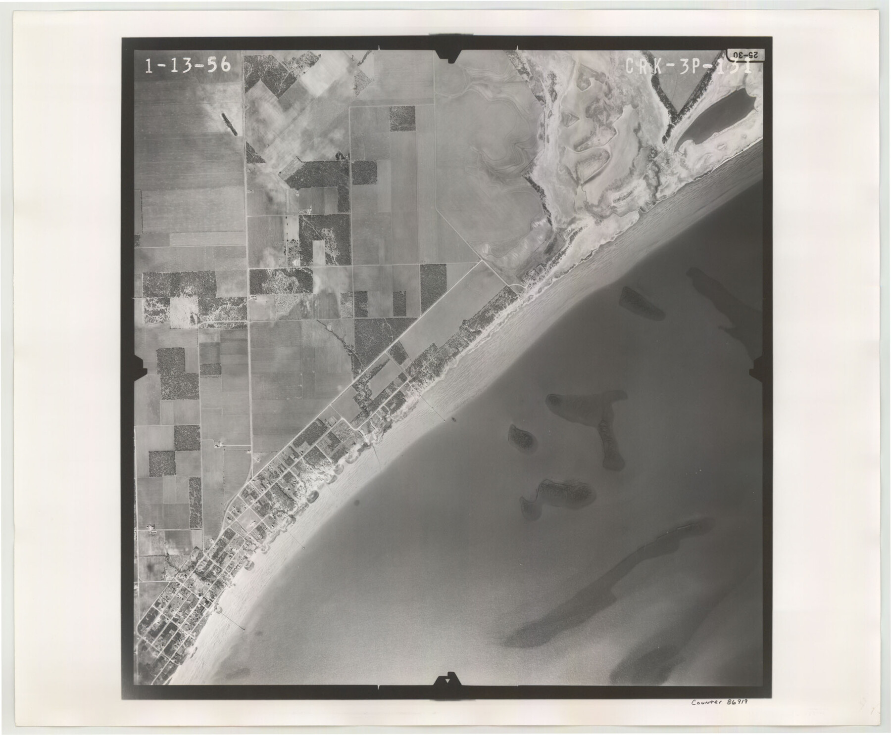
Flight Mission No. CRK-3P, Frame 131, Refugio County
CRK-3P-131
-
Map/Doc
86919
-
Collection
General Map Collection
-
Object Dates
1956/1/13 (Creation Date)
-
People and Organizations
U. S. Department of Agriculture (Publisher)
-
Counties
Refugio
-
Subjects
Aerial Photograph
-
Height x Width
18.5 x 22.4 inches
47.0 x 56.9 cm
-
Comments
Flown by V. L. Beavers and Associates of San Antonio, Texas.
Part of: General Map Collection
Knox County Sketch File 28

Print $20.00
- Digital $50.00
Knox County Sketch File 28
Size 43.4 x 38.3 inches
Map/Doc 10516
Denton County Working Sketch 32

Print $20.00
- Digital $50.00
Denton County Working Sketch 32
Size 35.1 x 32.0 inches
Map/Doc 68637
Concho County Working Sketch 6
Print $20.00
- Digital $50.00
Concho County Working Sketch 6
1948
Size 47.3 x 43.2 inches
Map/Doc 68188

Trinity County Sketch File 36

Print $20.00
- Digital $50.00
Trinity County Sketch File 36
Size 43.4 x 18.1 inches
Map/Doc 10408
Flight Mission No. BQY-4M, Frame 126, Harris County

Print $20.00
- Digital $50.00
Flight Mission No. BQY-4M, Frame 126, Harris County
1953
Size 18.5 x 22.2 inches
Map/Doc 85295
Map of Gonzales County

Print $40.00
- Digital $50.00
Map of Gonzales County
1842
Size 59.5 x 50.0 inches
Map/Doc 16839
Real County Working Sketch 5

Print $20.00
- Digital $50.00
Real County Working Sketch 5
1924
Size 17.9 x 29.1 inches
Map/Doc 71897
Kimble County Working Sketch 26

Print $20.00
- Digital $50.00
Kimble County Working Sketch 26
1934
Size 24.3 x 18.4 inches
Map/Doc 70094
McCulloch County Boundary File 64

Print $36.00
- Digital $50.00
McCulloch County Boundary File 64
Size 9.2 x 8.9 inches
Map/Doc 56919
Jack County Sketch File 11

Print $4.00
- Digital $50.00
Jack County Sketch File 11
1858
Size 10.2 x 8.1 inches
Map/Doc 27531
The Coast of New Spain from Neuva Vera Cruz to Triste Island

Print $20.00
- Digital $50.00
The Coast of New Spain from Neuva Vera Cruz to Triste Island
1775
Size 21.0 x 28.9 inches
Map/Doc 95919
You may also like
Hansford County Sketch File 12

Print $6.00
- Digital $50.00
Hansford County Sketch File 12
1934
Size 11.2 x 8.9 inches
Map/Doc 24975
Flight Mission No. BRA-8M, Frame 68, Jefferson County

Print $20.00
- Digital $50.00
Flight Mission No. BRA-8M, Frame 68, Jefferson County
1953
Size 18.6 x 22.4 inches
Map/Doc 85588
Val Verde County Rolled Sketch 27

Print $20.00
- Digital $50.00
Val Verde County Rolled Sketch 27
Size 26.0 x 37.9 inches
Map/Doc 8109
[I. & G. N. Block 1]
![91592, [I. & G. N. Block 1], Twichell Survey Records](https://historictexasmaps.com/wmedia_w700/maps/91592-1.tif.jpg)
Print $20.00
- Digital $50.00
[I. & G. N. Block 1]
Size 17.2 x 18.1 inches
Map/Doc 91592
Map of Panola County

Print $20.00
- Digital $50.00
Map of Panola County
1882
Size 20.9 x 22.0 inches
Map/Doc 4504
General Highway Map, Val Verde County, Texas

Print $20.00
General Highway Map, Val Verde County, Texas
1940
Size 25.0 x 18.4 inches
Map/Doc 79266
Kent County Rolled Sketch A

Print $20.00
- Digital $50.00
Kent County Rolled Sketch A
1902
Size 23.9 x 36.8 inches
Map/Doc 6477
Clay County Working Sketch 10

Print $20.00
- Digital $50.00
Clay County Working Sketch 10
1941
Size 35.5 x 26.5 inches
Map/Doc 68033
Tyler County Working Sketch 19

Print $20.00
- Digital $50.00
Tyler County Working Sketch 19
1967
Size 47.8 x 42.9 inches
Map/Doc 69489
Medina County Sketch File 19

Print $20.00
- Digital $50.00
Medina County Sketch File 19
1989
Size 32.5 x 21.0 inches
Map/Doc 12071
Dickens County Sketch File 16

Print $4.00
- Digital $50.00
Dickens County Sketch File 16
Size 7.4 x 11.1 inches
Map/Doc 20975
Trinity River, Daugherty Lake Sheet/East Fork of Trinity River

Print $20.00
- Digital $50.00
Trinity River, Daugherty Lake Sheet/East Fork of Trinity River
1920
Size 41.9 x 30.1 inches
Map/Doc 65191