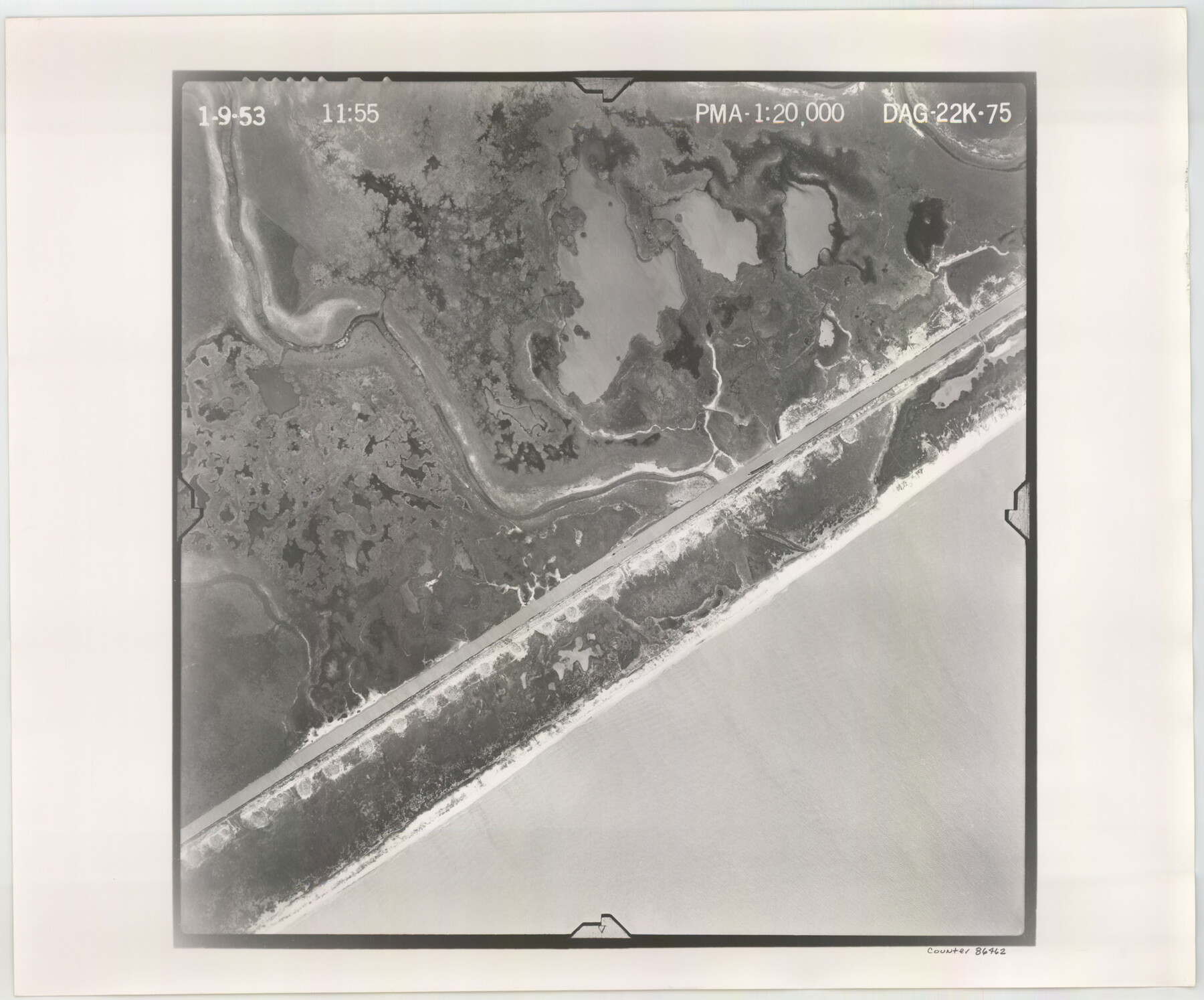
Flight Mission No. DAG-22K, Frame 75, Matagorda County
DAG-22K-75
-
Map/Doc
86462
-
Collection
General Map Collection
-
Object Dates
1953/1/9 (Creation Date)
-
People and Organizations
U. S. Department of Agriculture (Publisher)
-
Counties
Matagorda
-
Subjects
Aerial Photograph
-
Height x Width
18.5 x 22.3 inches
47.0 x 56.6 cm
-
Comments
Flown by Aero Exploration Company of Tulsa, Oklahoma.
Part of: General Map Collection
Rockwall County Boundary File 4a

Print $10.00
- Digital $50.00
Rockwall County Boundary File 4a
Size 11.2 x 8.8 inches
Map/Doc 58399
Crockett County Rolled Sketch 63

Print $20.00
- Digital $50.00
Crockett County Rolled Sketch 63
1947
Size 18.9 x 30.8 inches
Map/Doc 5606
Map of Grimes County

Print $20.00
- Digital $50.00
Map of Grimes County
1881
Size 29.9 x 16.3 inches
Map/Doc 3606
Bastrop County

Print $20.00
- Digital $50.00
Bastrop County
1917
Size 45.5 x 40.8 inches
Map/Doc 66711
Travis County State Real Property Sketch 17

Print $20.00
- Digital $50.00
Travis County State Real Property Sketch 17
2012
Size 36.0 x 24.5 inches
Map/Doc 93354
Cameron County Rolled Sketch 31

Print $20.00
- Digital $50.00
Cameron County Rolled Sketch 31
1993
Size 18.4 x 24.3 inches
Map/Doc 5395
Goliad County Sketch File 13

Print $8.00
- Digital $50.00
Goliad County Sketch File 13
1856
Size 12.4 x 8.0 inches
Map/Doc 24239
Val Verde County Sketch File 35

Print $23.00
- Digital $50.00
Val Verde County Sketch File 35
1937
Size 15.3 x 9.4 inches
Map/Doc 12574
Pecos County Working Sketch 45

Print $20.00
- Digital $50.00
Pecos County Working Sketch 45
1946
Size 20.8 x 26.7 inches
Map/Doc 71517
Hardin County

Print $20.00
- Digital $50.00
Hardin County
1940
Size 47.4 x 42.4 inches
Map/Doc 73171
Hemphill County Working Sketch 19

Print $20.00
- Digital $50.00
Hemphill County Working Sketch 19
1972
Size 35.8 x 42.6 inches
Map/Doc 66114
St. L. S.-W. Ry. of Texas, Map of Lufkin Branch in Smith County, Texas

Print $20.00
- Digital $50.00
St. L. S.-W. Ry. of Texas, Map of Lufkin Branch in Smith County, Texas
1912
Size 23.1 x 37.2 inches
Map/Doc 64694
You may also like
Map of Hill County

Print $40.00
- Digital $50.00
Map of Hill County
1884
Size 80.1 x 68.0 inches
Map/Doc 82049
Swisher County

Print $20.00
- Digital $50.00
Swisher County
1910
Size 47.5 x 39.8 inches
Map/Doc 16888
[Scripture Addition to the City of Denton]
![90587, [Scripture Addition to the City of Denton], Twichell Survey Records](https://historictexasmaps.com/wmedia_w700/maps/90587-1.tif.jpg)
Print $20.00
- Digital $50.00
[Scripture Addition to the City of Denton]
Size 27.3 x 22.0 inches
Map/Doc 90587
[I. & G. N. Sections 11, 12, and 13]
![91039, [I. & G. N. Sections 11, 12, and 13], Twichell Survey Records](https://historictexasmaps.com/wmedia_w700/maps/91039-1.tif.jpg)
Print $20.00
- Digital $50.00
[I. & G. N. Sections 11, 12, and 13]
Size 24.7 x 15.6 inches
Map/Doc 91039
[Blk. O1, W. H. Godair]
![90632, [Blk. O1, W. H. Godair], Twichell Survey Records](https://historictexasmaps.com/wmedia_w700/maps/90632-1.tif.jpg)
Print $20.00
- Digital $50.00
[Blk. O1, W. H. Godair]
1913
Size 30.1 x 10.3 inches
Map/Doc 90632
[South part Block AX and A21 and part of Block C44 and League 305]
![90798, [South part Block AX and A21 and part of Block C44 and League 305], Twichell Survey Records](https://historictexasmaps.com/wmedia_w700/maps/90798-1.tif.jpg)
Print $40.00
- Digital $50.00
[South part Block AX and A21 and part of Block C44 and League 305]
Size 49.3 x 23.5 inches
Map/Doc 90798
Fisher County Working Sketch 12

Print $20.00
- Digital $50.00
Fisher County Working Sketch 12
1956
Size 25.2 x 23.2 inches
Map/Doc 69146
Dimmit County Sketch File 29

Print $40.00
- Digital $50.00
Dimmit County Sketch File 29
1877
Size 26.5 x 22.1 inches
Map/Doc 11351
Red River County Working Sketch 61

Print $20.00
- Digital $50.00
Red River County Working Sketch 61
1973
Size 37.8 x 38.5 inches
Map/Doc 72044
Freestone County Sketch File 27

Print $2.00
- Digital $50.00
Freestone County Sketch File 27
1934
Size 11.3 x 8.6 inches
Map/Doc 23098
[Surveys along the San Gabriel River]
![78375, [Surveys along the San Gabriel River], General Map Collection](https://historictexasmaps.com/wmedia_w700/maps/78375.tif.jpg)
Print $2.00
- Digital $50.00
[Surveys along the San Gabriel River]
Size 9.0 x 6.3 inches
Map/Doc 78375
Webb County Sketch File 12-2

Print $20.00
- Digital $50.00
Webb County Sketch File 12-2
1936
Size 24.5 x 20.1 inches
Map/Doc 12630