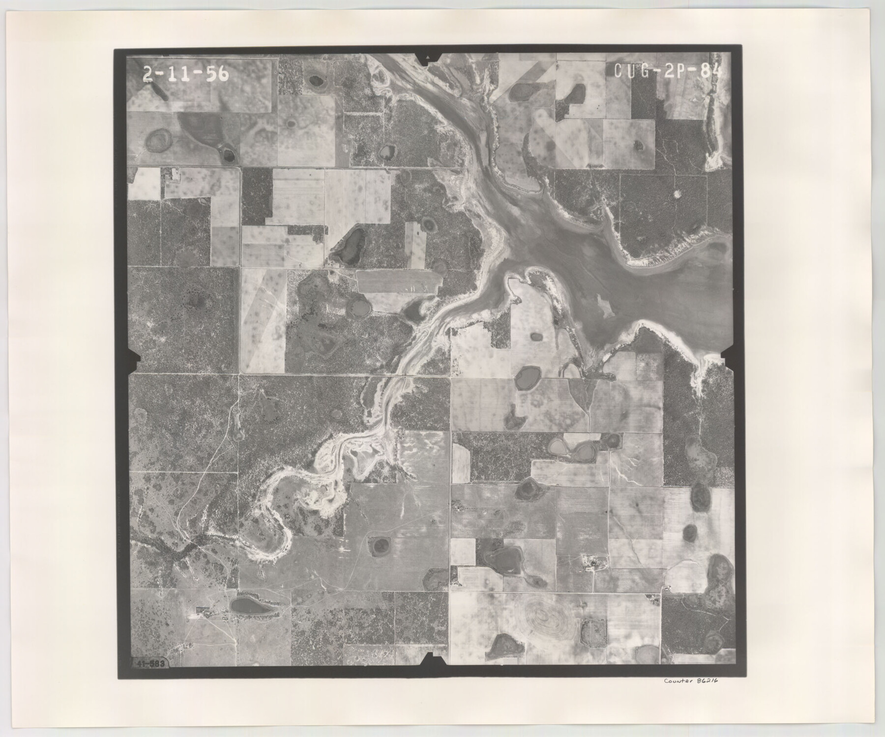
Flight Mission No. CUG-2P, Frame 84, Kleberg County
CUG-2P-84
-
Map/Doc
86216
-
Collection
General Map Collection
-
Object Dates
1956/2/11 (Creation Date)
-
People and Organizations
U. S. Department of Agriculture (Publisher)
-
Counties
Kleberg
-
Subjects
Aerial Photograph
-
Height x Width
18.6 x 22.3 inches
47.2 x 56.6 cm
-
Comments
Flown by V. L. Beavers and Associates of San Antonio, Texas.
Part of: General Map Collection
Starr County Rolled Sketch 15

Print $20.00
- Digital $50.00
Starr County Rolled Sketch 15
1913
Size 22.7 x 23.6 inches
Map/Doc 7800
Nautical Chart 885-SC Intracoastal Waterway - Ellender to Galveston Bay, Louisiana-Texas

Print $40.00
- Digital $50.00
Nautical Chart 885-SC Intracoastal Waterway - Ellender to Galveston Bay, Louisiana-Texas
1972
Size 16.4 x 60.1 inches
Map/Doc 69835
Kendall County Boundary File 2

Print $4.00
- Digital $50.00
Kendall County Boundary File 2
Size 10.2 x 8.2 inches
Map/Doc 55746
Flight Mission No. DQN-2K, Frame 80, Calhoun County

Print $20.00
- Digital $50.00
Flight Mission No. DQN-2K, Frame 80, Calhoun County
1953
Size 18.4 x 22.2 inches
Map/Doc 84272
Presidio County Boundary File 2

Print $8.00
- Digital $50.00
Presidio County Boundary File 2
Size 14.0 x 8.6 inches
Map/Doc 58054
Brazoria County NRC Article 33.136 Sketch 3

Print $20.00
- Digital $50.00
Brazoria County NRC Article 33.136 Sketch 3
2002
Size 40.6 x 29.6 inches
Map/Doc 77039
Webb County Sketch File 51

Print $4.00
- Digital $50.00
Webb County Sketch File 51
1938
Size 11.3 x 8.8 inches
Map/Doc 39837
Parker County Sketch File 24

Print $4.00
- Digital $50.00
Parker County Sketch File 24
Size 8.6 x 13.0 inches
Map/Doc 33564
Crosby County Sketch File 12a

Print $20.00
- Digital $50.00
Crosby County Sketch File 12a
1901
Size 21.5 x 30.9 inches
Map/Doc 11248

Dickens County Sketch File 21

Print $20.00
- Digital $50.00
Dickens County Sketch File 21
1911
Size 16.0 x 12.8 inches
Map/Doc 11324
Bexar County Sketch File 50

Print $40.00
- Digital $50.00
Bexar County Sketch File 50
1874
Size 22.5 x 18.2 inches
Map/Doc 10926
You may also like
[Sketch for Mineral Application 35981 - Liberty County, John Mecom]
![65618, [Sketch for Mineral Application 35981 - Liberty County, John Mecom], General Map Collection](https://historictexasmaps.com/wmedia_w700/maps/65618.tif.jpg)
Print $20.00
- Digital $50.00
[Sketch for Mineral Application 35981 - Liberty County, John Mecom]
1941
Size 30.1 x 26.4 inches
Map/Doc 65618
Nolan County Rolled Sketch 1

Print $20.00
- Digital $50.00
Nolan County Rolled Sketch 1
Size 27.8 x 21.5 inches
Map/Doc 6859
Surveys in Reeves and Culberson Counties, Texas and Pacific Railroad Company, Blocks 58, 59, 60, and 61

Print $20.00
- Digital $50.00
Surveys in Reeves and Culberson Counties, Texas and Pacific Railroad Company, Blocks 58, 59, 60, and 61
1937
Size 30.7 x 25.3 inches
Map/Doc 2250
Brazoria County Sketch File 14

Print $8.00
- Digital $50.00
Brazoria County Sketch File 14
1892
Size 13.9 x 8.7 inches
Map/Doc 14973
Plat showing survey of tracts in the C. A. West survey A-337 and the Wm. Standiferd survey A-301 in Bastrop County as surveyed for the Veteran's Land Board

Print $20.00
- Digital $50.00
Plat showing survey of tracts in the C. A. West survey A-337 and the Wm. Standiferd survey A-301 in Bastrop County as surveyed for the Veteran's Land Board
1992
Size 34.9 x 46.8 inches
Map/Doc 61151
Hutchinson County Rolled Sketch 37

Print $20.00
- Digital $50.00
Hutchinson County Rolled Sketch 37
1950
Size 24.4 x 44.4 inches
Map/Doc 6296
Presidio County Working Sketch 25

Print $20.00
- Digital $50.00
Presidio County Working Sketch 25
1945
Size 22.8 x 18.9 inches
Map/Doc 71701
Grimes County Working Sketch 6

Print $20.00
- Digital $50.00
Grimes County Working Sketch 6
1951
Size 33.2 x 33.4 inches
Map/Doc 63297
Kaufman County Boundary File 5

Print $37.00
- Digital $50.00
Kaufman County Boundary File 5
Size 13.4 x 8.7 inches
Map/Doc 55942
Texas Panhandle North Boundary Line

Print $40.00
- Digital $50.00
Texas Panhandle North Boundary Line
1898
Size 13.4 x 125.2 inches
Map/Doc 1738
Travis County State Real Property Sketch 6

Print $40.00
- Digital $50.00
Travis County State Real Property Sketch 6
1987
Size 30.2 x 41.4 inches
Map/Doc 61697
Baylor County Working Sketch 8

Print $20.00
- Digital $50.00
Baylor County Working Sketch 8
1955
Size 44.1 x 20.7 inches
Map/Doc 67293