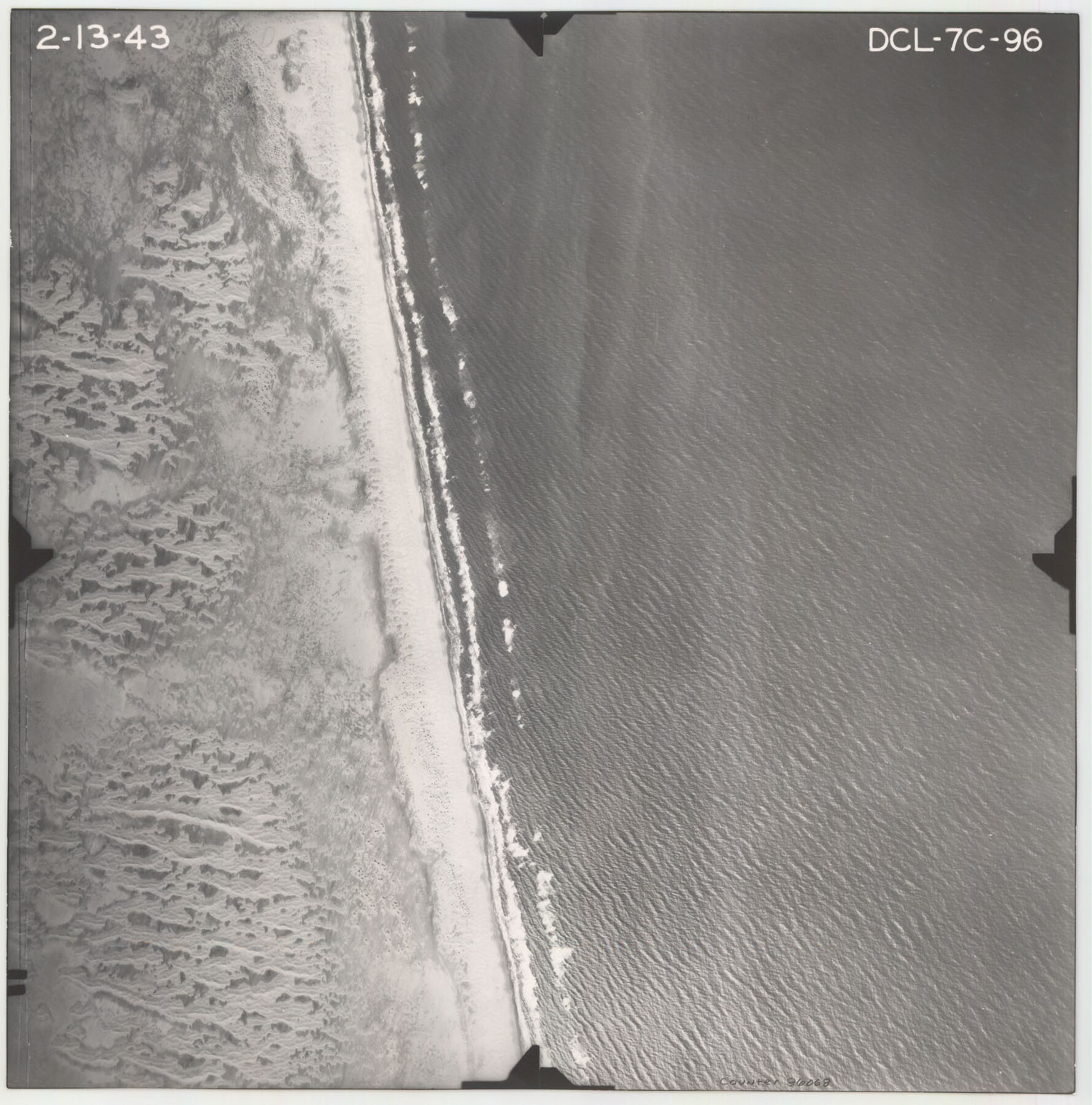
Flight Mission No. DCL-7C, Frame 96, Kenedy County
DCL-7C-96
-
Map/Doc
86068
-
Collection
General Map Collection
-
Object Dates
1943/2/13 (Creation Date)
-
People and Organizations
U. S. Department of Agriculture (Publisher)
-
Counties
Kenedy
-
Subjects
Aerial Photograph
-
Height x Width
15.4 x 15.2 inches
39.1 x 38.6 cm
-
Comments
Flown by Aerial Surveys of Pittsburgh, Inc. of Pittsburgh, Pennsylvania.
Part of: General Map Collection
Pecos County Rolled Sketch 90A

Print $20.00
- Digital $50.00
Pecos County Rolled Sketch 90A
1934
Size 27.0 x 31.1 inches
Map/Doc 7246
Llano County Boundary File 3

Print $42.00
- Digital $50.00
Llano County Boundary File 3
Size 14.1 x 8.7 inches
Map/Doc 56449
Galveston Bay Texas Lower Part Encluding [sic] Bar and Entrance
![69869, Galveston Bay Texas Lower Part Encluding [sic] Bar and Entrance, General Map Collection](https://historictexasmaps.com/wmedia_w700/maps/69869-1.tif.jpg)
Print $40.00
- Digital $50.00
Galveston Bay Texas Lower Part Encluding [sic] Bar and Entrance
1867
Size 52.6 x 39.1 inches
Map/Doc 69869
Flight Mission No. BRE-1P, Frame 146, Nueces County

Print $20.00
- Digital $50.00
Flight Mission No. BRE-1P, Frame 146, Nueces County
1956
Size 18.5 x 22.6 inches
Map/Doc 86706
Flight Mission No. CUG-3P, Frame 31, Kleberg County

Print $20.00
- Digital $50.00
Flight Mission No. CUG-3P, Frame 31, Kleberg County
1956
Size 18.5 x 22.4 inches
Map/Doc 86236
Edwards County Working Sketch 54

Print $20.00
- Digital $50.00
Edwards County Working Sketch 54
1951
Size 19.2 x 28.5 inches
Map/Doc 68930
Hockley County Rolled Sketch 7

Print $40.00
- Digital $50.00
Hockley County Rolled Sketch 7
Size 41.4 x 56.6 inches
Map/Doc 9176
Atascosa County Boundary File 6

Print $34.00
- Digital $50.00
Atascosa County Boundary File 6
Size 9.1 x 23.0 inches
Map/Doc 50205
Flight Mission No. DCL-7C, Frame 44, Kenedy County

Print $20.00
- Digital $50.00
Flight Mission No. DCL-7C, Frame 44, Kenedy County
1943
Size 15.4 x 15.2 inches
Map/Doc 86032
Zavala County Rolled Sketch 26

Print $20.00
- Digital $50.00
Zavala County Rolled Sketch 26
1952
Size 25.3 x 41.8 inches
Map/Doc 8328
Runnels County

Print $40.00
- Digital $50.00
Runnels County
1948
Size 48.8 x 38.8 inches
Map/Doc 73278
Pecos County Rolled Sketch 160

Print $20.00
- Digital $50.00
Pecos County Rolled Sketch 160
Size 43.0 x 36.9 inches
Map/Doc 9739
You may also like

Flight Mission No. CUG-2P, Frame 11, Kleberg County

Print $20.00
- Digital $50.00
Flight Mission No. CUG-2P, Frame 11, Kleberg County
1956
Size 18.5 x 22.2 inches
Map/Doc 86183
Harris County Working Sketch 24

Print $20.00
- Digital $50.00
Harris County Working Sketch 24
1928
Size 29.3 x 15.9 inches
Map/Doc 65916
The Republic County of Shelby. January 16, 1843

Print $20.00
The Republic County of Shelby. January 16, 1843
2020
Size 20.0 x 21.7 inches
Map/Doc 96285
Collingsworth County

Print $20.00
- Digital $50.00
Collingsworth County
Size 42.4 x 40.6 inches
Map/Doc 66778
Roswell District, New Mexico

Print $40.00
- Digital $50.00
Roswell District, New Mexico
Size 40.7 x 57.6 inches
Map/Doc 89817
San Saba County Working Sketch 4

Print $20.00
- Digital $50.00
San Saba County Working Sketch 4
1941
Size 43.4 x 31.8 inches
Map/Doc 63792
Hudspeth County Sketch File 4b

Print $20.00
- Digital $50.00
Hudspeth County Sketch File 4b
1860
Size 13.0 x 39.2 inches
Map/Doc 10492
Polk County Working Sketch Graphic Index

Print $20.00
- Digital $50.00
Polk County Working Sketch Graphic Index
1943
Size 46.9 x 41.5 inches
Map/Doc 76668
Oldham County Working Sketch 6

Print $40.00
- Digital $50.00
Oldham County Working Sketch 6
1981
Size 32.4 x 50.4 inches
Map/Doc 71328
Hardin County Working Sketch 15

Print $20.00
- Digital $50.00
Hardin County Working Sketch 15
1939
Size 21.1 x 34.6 inches
Map/Doc 63413
Harris County Working Sketch 57

Print $20.00
- Digital $50.00
Harris County Working Sketch 57
1951
Size 21.7 x 20.0 inches
Map/Doc 65949