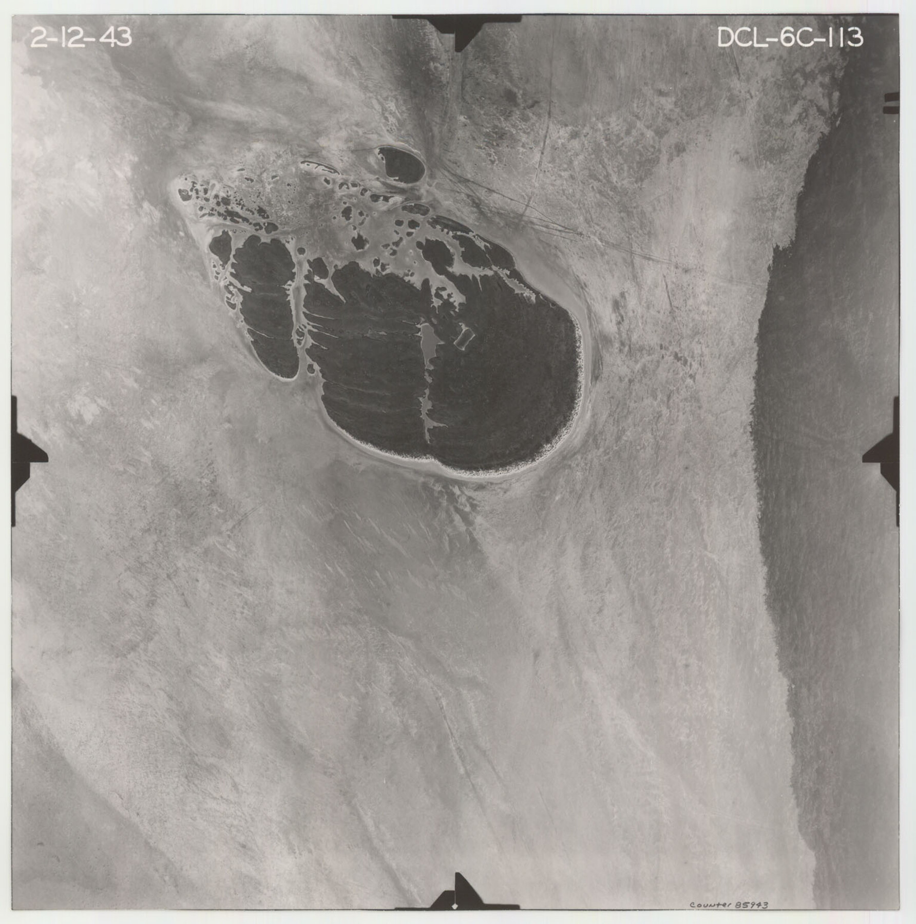
Flight Mission No. DCL-6C, Frame 113, Kenedy County
DCL-6C-113
-
Map/Doc
85943
-
Collection
General Map Collection
-
Object Dates
1943/2/12 (Creation Date)
-
People and Organizations
U. S. Department of Agriculture (Publisher)
-
Counties
Kenedy
-
Subjects
Aerial Photograph
-
Height x Width
15.5 x 15.3 inches
39.4 x 38.9 cm
-
Comments
Flown by Aerial Surveys of Pittsburgh, Inc. of Pittsburgh, Pennsylvania.
Part of: General Map Collection
Potter County Working Sketch 6

Print $20.00
- Digital $50.00
Potter County Working Sketch 6
1959
Size 23.3 x 27.0 inches
Map/Doc 71666
1988 Land Use - El Paso, Ciudad Juarez and Vicinity

Print $20.00
- Digital $50.00
1988 Land Use - El Paso, Ciudad Juarez and Vicinity
1988
Size 34.2 x 25.1 inches
Map/Doc 87369
Refugio County Working Sketch 9

Print $20.00
- Digital $50.00
Refugio County Working Sketch 9
1941
Size 38.6 x 28.3 inches
Map/Doc 63518
Maps of Gulf Intracoastal Waterway, Texas - Sabine River to the Rio Grande and connecting waterways including ship channels

Print $20.00
- Digital $50.00
Maps of Gulf Intracoastal Waterway, Texas - Sabine River to the Rio Grande and connecting waterways including ship channels
1966
Size 14.6 x 22.2 inches
Map/Doc 61971

Flight Mission No. DQN-5K, Frame 79, Calhoun County

Print $20.00
- Digital $50.00
Flight Mission No. DQN-5K, Frame 79, Calhoun County
1953
Size 18.5 x 22.2 inches
Map/Doc 84412
Wharton County Rolled Sketch 14

Print $20.00
- Digital $50.00
Wharton County Rolled Sketch 14
2020
Size 36.1 x 24.3 inches
Map/Doc 95915
Ochiltree County

Print $20.00
- Digital $50.00
Ochiltree County
1958
Size 41.0 x 33.1 inches
Map/Doc 77386
Intrenched depot of the army of occupation at Point Isabel, Texas

Print $20.00
- Digital $50.00
Intrenched depot of the army of occupation at Point Isabel, Texas
1846
Size 17.0 x 25.2 inches
Map/Doc 72922
Liberty County Working Sketch Graphic Index - west part

Print $20.00
- Digital $50.00
Liberty County Working Sketch Graphic Index - west part
1977
Size 45.7 x 34.5 inches
Map/Doc 76619
Flight Mission No. DAG-18K, Frame 180, Matagorda County

Print $20.00
- Digital $50.00
Flight Mission No. DAG-18K, Frame 180, Matagorda County
1952
Size 18.6 x 22.3 inches
Map/Doc 86372
Map Showing Part of the Blue Ridge Farm of the Texas Prison System, Fort Bend County, Texas

Print $20.00
- Digital $50.00
Map Showing Part of the Blue Ridge Farm of the Texas Prison System, Fort Bend County, Texas
Size 22.2 x 36.2 inches
Map/Doc 62979
You may also like
Hudspeth County Rolled Sketch 39

Print $40.00
- Digital $50.00
Hudspeth County Rolled Sketch 39
1935
Size 21.7 x 88.2 inches
Map/Doc 9212
Pecos County Rolled Sketch 18

Print $20.00
- Digital $50.00
Pecos County Rolled Sketch 18
1882
Size 34.4 x 44.1 inches
Map/Doc 9683
Crockett County Working Sketch 2

Print $20.00
- Digital $50.00
Crockett County Working Sketch 2
Size 18.4 x 14.9 inches
Map/Doc 68335
Flight Mission No. CRC-4R, Frame 153, Chambers County

Print $20.00
- Digital $50.00
Flight Mission No. CRC-4R, Frame 153, Chambers County
1956
Size 18.7 x 22.4 inches
Map/Doc 84916
Galveston County Working Sketch 19

Print $20.00
- Digital $50.00
Galveston County Working Sketch 19
1983
Size 28.7 x 38.6 inches
Map/Doc 69356
Victoria County Working Sketch 4

Print $20.00
- Digital $50.00
Victoria County Working Sketch 4
1944
Size 37.0 x 47.6 inches
Map/Doc 72274
Brazos Santiago, Texas

Print $20.00
- Digital $50.00
Brazos Santiago, Texas
1900
Size 18.3 x 26.9 inches
Map/Doc 73031
Cameron County Sketch File 2

Print $98.00
- Digital $50.00
Cameron County Sketch File 2
1904
Size 14.3 x 8.7 inches
Map/Doc 16975
Culberson County Working Sketch 70

Print $40.00
- Digital $50.00
Culberson County Working Sketch 70
1975
Size 50.3 x 32.2 inches
Map/Doc 68524
[H. & T. C. RR. Company, Block 47 and vicinity]
![91158, [H. & T. C. RR. Company, Block 47 and vicinity], Twichell Survey Records](https://historictexasmaps.com/wmedia_w700/maps/91158-1.tif.jpg)
Print $20.00
- Digital $50.00
[H. & T. C. RR. Company, Block 47 and vicinity]
Size 18.5 x 19.2 inches
Map/Doc 91158
Comal County Boundary File 1

Print $5.00
- Digital $50.00
Comal County Boundary File 1
Size 12.9 x 11.0 inches
Map/Doc 51776
Parker County Sketch File 2

Print $4.00
- Digital $50.00
Parker County Sketch File 2
1856
Size 12.7 x 8.2 inches
Map/Doc 33519