Hudspeth County Rolled Sketch 39
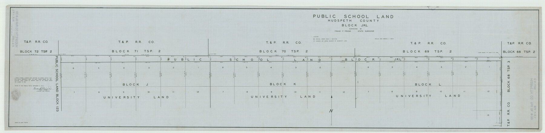
Public School Land, Hudspeth County, Block JKL
-
Map/Doc
9212
-
Collection
General Map Collection
-
Object Dates
1935/9/5 (Creation Date)
-
People and Organizations
Frank F. Friend (Surveyor/Engineer)
Eleta Foster (Draftsman)
-
Counties
Hudspeth
-
Subjects
Surveying Rolled Sketch
-
Height x Width
21.7 x 88.2 inches
55.1 x 224.0 cm
-
Medium
linen, manuscript
-
Scale
1" = 500 varas
Related maps
PSL Field Notes for Block JKL in Hudspeth County

PSL Field Notes for Block JKL in Hudspeth County
Map/Doc 81658
Part of: General Map Collection
Menard County Working Sketch 10

Print $20.00
- Digital $50.00
Menard County Working Sketch 10
1938
Size 21.8 x 18.5 inches
Map/Doc 70957
Marion County Working Sketch 42

Print $20.00
- Digital $50.00
Marion County Working Sketch 42
2000
Size 29.6 x 41.4 inches
Map/Doc 70818
Crockett County Working Sketch 21

Print $20.00
- Digital $50.00
Crockett County Working Sketch 21
1920
Size 18.5 x 24.8 inches
Map/Doc 68354
Jefferson Co.

Print $20.00
- Digital $50.00
Jefferson Co.
1978
Size 47.0 x 41.1 inches
Map/Doc 77329
Rockwall County Sketch File 6

Print $4.00
- Digital $50.00
Rockwall County Sketch File 6
1862
Size 8.5 x 9.4 inches
Map/Doc 35425
Coke County Boundary File 4

Print $44.00
- Digital $50.00
Coke County Boundary File 4
Size 14.3 x 8.7 inches
Map/Doc 51593
Harris County Working Sketch 15

Print $20.00
- Digital $50.00
Harris County Working Sketch 15
1916
Size 29.3 x 41.2 inches
Map/Doc 65907
Val Verde County Working Sketch 52

Print $20.00
- Digital $50.00
Val Verde County Working Sketch 52
1956
Size 20.6 x 14.9 inches
Map/Doc 72187
Flight Mission No. BQY-15M, Frame 14, Harris County

Print $20.00
- Digital $50.00
Flight Mission No. BQY-15M, Frame 14, Harris County
1953
Size 18.6 x 22.4 inches
Map/Doc 85312
Outer Continental Shelf Leasing Maps (Louisiana Offshore Operations)

Print $20.00
- Digital $50.00
Outer Continental Shelf Leasing Maps (Louisiana Offshore Operations)
1955
Size 9.7 x 11.3 inches
Map/Doc 76089
Terrell County Working Sketch 53

Print $40.00
- Digital $50.00
Terrell County Working Sketch 53
1958
Size 61.9 x 39.7 inches
Map/Doc 62146

You may also like
Gaines County Rolled Sketch 23

Print $20.00
- Digital $50.00
Gaines County Rolled Sketch 23
1963
Size 24.6 x 37.1 inches
Map/Doc 5938
Morris County Sketch File 5

Print $20.00
- Digital $50.00
Morris County Sketch File 5
Size 21.4 x 11.6 inches
Map/Doc 42132
Ward County Sketch File 13

Print $14.00
- Digital $50.00
Ward County Sketch File 13
1951
Size 14.5 x 8.8 inches
Map/Doc 39640
Edwards County Sketch File 55

Print $4.00
- Digital $50.00
Edwards County Sketch File 55
1982
Size 9.1 x 14.5 inches
Map/Doc 21806
Bastrop County Sketch File 7

Print $40.00
- Digital $50.00
Bastrop County Sketch File 7
Size 13.2 x 12.4 inches
Map/Doc 14052
Submerged Lands of Texas, Brownsville-Harlingen Sheet

Print $20.00
- Digital $50.00
Submerged Lands of Texas, Brownsville-Harlingen Sheet
1978
Size 23.9 x 32.2 inches
Map/Doc 76129
Childress County Sketch File 15a

Print $4.00
- Digital $50.00
Childress County Sketch File 15a
Size 8.6 x 11.7 inches
Map/Doc 18303

Williamson County Working Sketch 16

Print $20.00
- Digital $50.00
Williamson County Working Sketch 16
1984
Size 31.9 x 23.7 inches
Map/Doc 72576

Harris County Rolled Sketch P3

Print $20.00
- Digital $50.00
Harris County Rolled Sketch P3
1933
Size 13.9 x 20.0 inches
Map/Doc 6142
Uvalde County Sketch File 25

Print $8.00
- Digital $50.00
Uvalde County Sketch File 25
1928
Size 14.5 x 8.8 inches
Map/Doc 39016