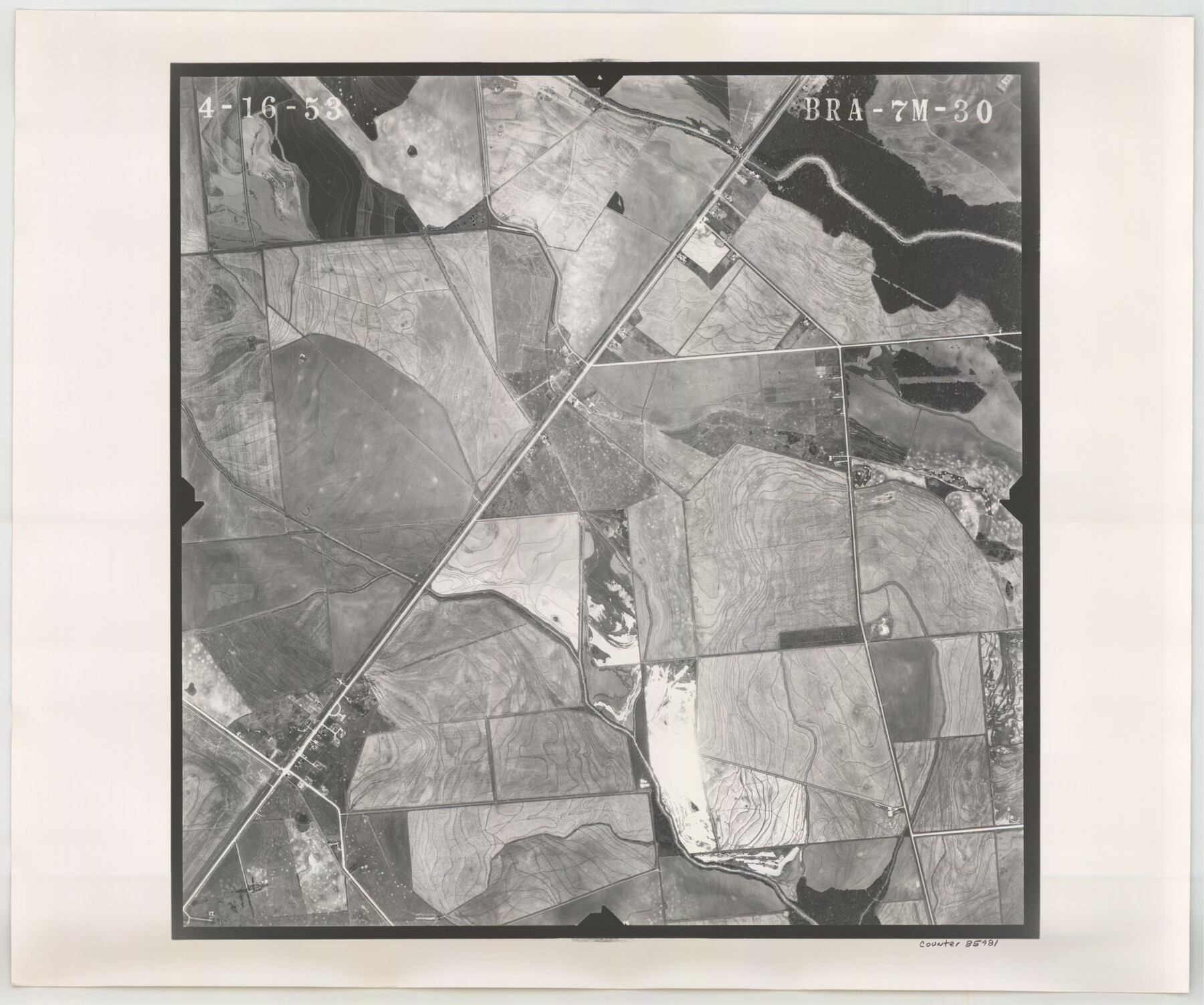
Flight Mission No. BRA-7M, Frame 30, Jefferson County
BRA-7M-30
-
Map/Doc
85481
-
Collection
General Map Collection
-
Object Dates
1953/4/16 (Creation Date)
-
People and Organizations
U. S. Department of Agriculture (Publisher)
-
Counties
Jefferson
-
Subjects
Aerial Photograph
-
Height x Width
18.6 x 22.3 inches
47.2 x 56.6 cm
-
Comments
Flown by Jack Ammann Photogrammetric Engineers of San Antonio, Texas.
Part of: General Map Collection
Lamb County Sketch File C

Print $18.00
- Digital $50.00
Lamb County Sketch File C
1904
Size 10.2 x 8.4 inches
Map/Doc 29347
Young County Working Sketch 16

Print $20.00
- Digital $50.00
Young County Working Sketch 16
1955
Size 23.8 x 21.7 inches
Map/Doc 62039
Roberts County Sketch File 7

Print $16.00
- Digital $50.00
Roberts County Sketch File 7
1992
Size 14.3 x 8.8 inches
Map/Doc 35316
Harris County Rolled Sketch 61

Print $20.00
- Digital $50.00
Harris County Rolled Sketch 61
1928
Size 25.7 x 26.8 inches
Map/Doc 6107
Bandera County Sketch File 32

Print $52.00
- Digital $50.00
Bandera County Sketch File 32
1966
Size 23.6 x 20.0 inches
Map/Doc 10901

Tarrant County Sketch File 33

Print $48.00
- Digital $50.00
Tarrant County Sketch File 33
1954
Size 11.6 x 8.8 inches
Map/Doc 37759
[Surveys in Austin's Colony on the east side of the Colorado River]
![167, [Surveys in Austin's Colony on the east side of the Colorado River], General Map Collection](https://historictexasmaps.com/wmedia_w700/maps/167.tif.jpg)
Print $20.00
- Digital $50.00
[Surveys in Austin's Colony on the east side of the Colorado River]
1830
Size 30.9 x 25.1 inches
Map/Doc 167
Cochran County Boundary File 6

Print $10.00
- Digital $50.00
Cochran County Boundary File 6
Size 10.4 x 4.3 inches
Map/Doc 51562
[Note to Thos. W. Ward to make corrections for J. D. Wheeler, Survey 147 in San Patricio County, San Patricio District]
![69748, [Note to Thos. W. Ward to make corrections for J. D. Wheeler, Survey 147 in San Patricio County, San Patricio District], General Map Collection](https://historictexasmaps.com/wmedia_w700/maps/69748.tif.jpg)
Print $2.00
- Digital $50.00
[Note to Thos. W. Ward to make corrections for J. D. Wheeler, Survey 147 in San Patricio County, San Patricio District]
1842
Size 4.5 x 6.8 inches
Map/Doc 69748
Edwards County Working Sketch 73

Print $20.00
- Digital $50.00
Edwards County Working Sketch 73
1958
Size 30.4 x 27.0 inches
Map/Doc 68949

You may also like
Gulf Intracoastal Waterway - Aransas Bay to Corpus Christi Bay - Modified Route Main Channel

Print $20.00
- Digital $50.00
Gulf Intracoastal Waterway - Aransas Bay to Corpus Christi Bay - Modified Route Main Channel
1960
Size 31.3 x 42.7 inches
Map/Doc 61902
Victoria County Sketch File 11

Print $8.00
- Digital $50.00
Victoria County Sketch File 11
1985
Size 11.3 x 9.0 inches
Map/Doc 39536
Kenedy County Rolled Sketch 18

Print $20.00
- Digital $50.00
Kenedy County Rolled Sketch 18
1995
Size 29.5 x 39.2 inches
Map/Doc 6472
Lavaca County Rolled Sketch 5

Print $40.00
- Digital $50.00
Lavaca County Rolled Sketch 5
Size 37.0 x 49.1 inches
Map/Doc 10288
Hemphill County Working Sketch 3

Print $40.00
- Digital $50.00
Hemphill County Working Sketch 3
1940
Size 51.8 x 27.4 inches
Map/Doc 66098
Flight Mission No. BRE-1P, Frame 80, Nueces County

Print $20.00
- Digital $50.00
Flight Mission No. BRE-1P, Frame 80, Nueces County
1956
Size 18.4 x 22.3 inches
Map/Doc 86662
Haskell County Working Sketch Graphic Index

Print $20.00
- Digital $50.00
Haskell County Working Sketch Graphic Index
1933
Size 43.3 x 37.7 inches
Map/Doc 76572
Map showing lands of D. Sullivan situated in Starr County, Texas

Print $20.00
- Digital $50.00
Map showing lands of D. Sullivan situated in Starr County, Texas
Size 15.5 x 18.6 inches
Map/Doc 755
General Highway Map, Lipscomb County, Texas

Print $20.00
General Highway Map, Lipscomb County, Texas
1940
Size 18.2 x 24.7 inches
Map/Doc 79175
Sterling County Rolled Sketch 15

Print $20.00
- Digital $50.00
Sterling County Rolled Sketch 15
Size 30.0 x 31.2 inches
Map/Doc 9947
Fisher County Rolled Sketch 7

Print $20.00
- Digital $50.00
Fisher County Rolled Sketch 7
1873
Size 47.1 x 43.5 inches
Map/Doc 8891
Revised Map of MacDade, Bastrop County, Texas

Print $20.00
- Digital $50.00
Revised Map of MacDade, Bastrop County, Texas
Size 26.6 x 18.4 inches
Map/Doc 78478