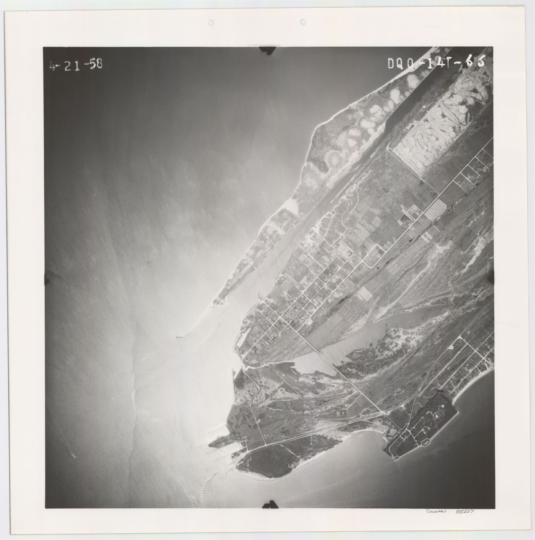
Flight Mission No. DQO-14T, Frame 66, Galveston County
DQO-14T-66
-
Map/Doc
85217
-
Collection
General Map Collection
-
Object Dates
1958/4/21 (Creation Date)
-
People and Organizations
U. S. Department of Agriculture (Publisher)
-
Counties
Galveston
-
Subjects
Aerial Photograph
-
Height x Width
17.6 x 17.4 inches
44.7 x 44.2 cm
Part of: General Map Collection
Right of Way and Track Map International & Gt. Northern Ry. operated by the International & Gt. Northern Ry. Co., Columbia Branch, Gulf Division

Print $40.00
- Digital $50.00
Right of Way and Track Map International & Gt. Northern Ry. operated by the International & Gt. Northern Ry. Co., Columbia Branch, Gulf Division
1917
Size 25.1 x 56.5 inches
Map/Doc 64598
Jones County Working Sketch 5

Print $20.00
- Digital $50.00
Jones County Working Sketch 5
1950
Size 35.5 x 29.3 inches
Map/Doc 66643
Harris County Working Sketch 24

Print $20.00
- Digital $50.00
Harris County Working Sketch 24
1928
Size 29.3 x 15.9 inches
Map/Doc 65916
Fort Bend County Sketch File 36

Print $6.00
- Digital $50.00
Fort Bend County Sketch File 36
1997
Size 11.4 x 8.9 inches
Map/Doc 23007
Jeff Davis County Working Sketch 43

Print $20.00
- Digital $50.00
Jeff Davis County Working Sketch 43
1983
Size 37.2 x 47.0 inches
Map/Doc 66538
Winkler County Rolled Sketch 13

Print $40.00
- Digital $50.00
Winkler County Rolled Sketch 13
1902
Size 39.5 x 48.7 inches
Map/Doc 10153
Coryell County

Print $20.00
- Digital $50.00
Coryell County
1936
Size 45.4 x 41.4 inches
Map/Doc 95466
Terrell County Working Sketch 64

Print $20.00
- Digital $50.00
Terrell County Working Sketch 64
1971
Size 29.3 x 27.7 inches
Map/Doc 69585
Flight Mission No. CLL-3N, Frame 15, Willacy County

Print $20.00
- Digital $50.00
Flight Mission No. CLL-3N, Frame 15, Willacy County
1950
Size 18.4 x 22.0 inches
Map/Doc 87081
Borden County Working Sketch 7

Print $20.00
- Digital $50.00
Borden County Working Sketch 7
1947
Size 21.0 x 22.5 inches
Map/Doc 67467
Flight Mission No. DQN-1K, Frame 134, Calhoun County

Print $20.00
- Digital $50.00
Flight Mission No. DQN-1K, Frame 134, Calhoun County
1953
Size 18.5 x 22.2 inches
Map/Doc 84197
Webb County Sketch File 1a

Print $20.00
- Digital $50.00
Webb County Sketch File 1a
1871
Size 23.3 x 18.0 inches
Map/Doc 12623
You may also like
Cooke County Working Sketch 35

Print $20.00
- Digital $50.00
Cooke County Working Sketch 35
1974
Size 30.7 x 32.6 inches
Map/Doc 68272
Haskell County Rolled Sketch 13

Print $3.00
- Digital $50.00
Haskell County Rolled Sketch 13
1991
Size 11.0 x 17.1 inches
Map/Doc 6171
Louisiana and Texas Intracoastal Waterway - Dredging Tributary Channel, Port Aransas to Aransas Pass, Texas

Print $20.00
- Digital $50.00
Louisiana and Texas Intracoastal Waterway - Dredging Tributary Channel, Port Aransas to Aransas Pass, Texas
1940
Size 31.1 x 42.3 inches
Map/Doc 61820
Menard County Sketch File 8

Print $20.00
- Digital $50.00
Menard County Sketch File 8
Size 19.7 x 28.5 inches
Map/Doc 12073
Angelina County Sketch File 15f

Print $4.00
- Digital $50.00
Angelina County Sketch File 15f
Size 10.4 x 7.6 inches
Map/Doc 12994
A. R. Roessler's Latest Map of the State of Texas Exhibiting Mineral and Agricultural Districts, Post Offices and Mailroutes, Railroads projected and finished, Timber, Prairie, Swamp Lands, etc. etc. etc.

Print $20.00
- Digital $50.00
A. R. Roessler's Latest Map of the State of Texas Exhibiting Mineral and Agricultural Districts, Post Offices and Mailroutes, Railroads projected and finished, Timber, Prairie, Swamp Lands, etc. etc. etc.
1874
Size 40.8 x 47.4 inches
Map/Doc 93934
[Block O1, Godair]
![90565, [Block O1, Godair], Twichell Survey Records](https://historictexasmaps.com/wmedia_w700/maps/90565-1.tif.jpg)
Print $20.00
- Digital $50.00
[Block O1, Godair]
Size 22.6 x 17.7 inches
Map/Doc 90565
Kimble County Working Sketch 35

Print $20.00
- Digital $50.00
Kimble County Working Sketch 35
1946
Size 24.7 x 32.0 inches
Map/Doc 70103
Henderson County Boundary File 2a

Print $12.00
- Digital $50.00
Henderson County Boundary File 2a
Size 14.2 x 8.8 inches
Map/Doc 54656
Maverick County Working Sketch 12

Print $20.00
- Digital $50.00
Maverick County Working Sketch 12
1965
Size 23.6 x 22.4 inches
Map/Doc 70904
Flight Mission No. CRK-8P, Frame 107, Refugio County

Print $20.00
- Digital $50.00
Flight Mission No. CRK-8P, Frame 107, Refugio County
1956
Size 18.4 x 22.0 inches
Map/Doc 86968
Coke County Sketch File 28

Print $20.00
- Digital $50.00
Coke County Sketch File 28
1886
Size 36.4 x 26.5 inches
Map/Doc 11113