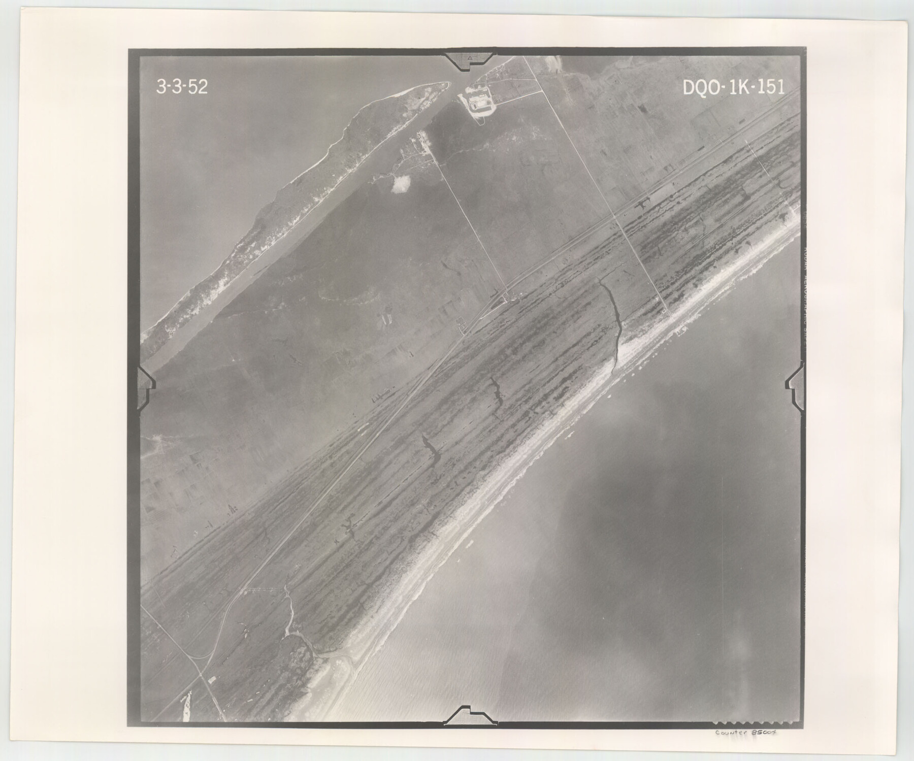
Flight Mission No. DQO-1K, Frame 151, Galveston County
DQO-1K-151
-
Map/Doc
85004
-
Collection
General Map Collection
-
Object Dates
1952/3/3 (Creation Date)
-
People and Organizations
U. S. Department of Agriculture (Publisher)
-
Counties
Galveston
-
Subjects
Aerial Photograph
-
Height x Width
18.8 x 22.5 inches
47.8 x 57.2 cm
-
Comments
Flown by Aero Exploration Company of Tulsa, Oklahoma.
Part of: General Map Collection
Upton County Working Sketch 40

Print $40.00
- Digital $50.00
Upton County Working Sketch 40
1959
Size 37.5 x 63.7 inches
Map/Doc 69536
Gregg County Sketch File 8

Print $28.00
- Digital $50.00
Gregg County Sketch File 8
1931
Size 12.9 x 8.3 inches
Map/Doc 24582
America's Fun-Tier: Texas 1967 Official State Highway Map

Digital $50.00
America's Fun-Tier: Texas 1967 Official State Highway Map
Size 28.2 x 36.4 inches
Map/Doc 94321
Sherman County Rolled Sketch 5

Print $20.00
- Digital $50.00
Sherman County Rolled Sketch 5
1919
Size 36.9 x 41.4 inches
Map/Doc 9928
Real County Working Sketch 45

Print $20.00
- Digital $50.00
Real County Working Sketch 45
1955
Size 23.1 x 18.5 inches
Map/Doc 71937
Morris County Rolled Sketch 2A

Print $20.00
- Digital $50.00
Morris County Rolled Sketch 2A
Size 24.2 x 19.1 inches
Map/Doc 10249
Jackson County

Print $20.00
- Digital $50.00
Jackson County
1920
Size 46.9 x 40.8 inches
Map/Doc 77324
Concho County Working Sketch 21

Print $20.00
- Digital $50.00
Concho County Working Sketch 21
1957
Size 36.4 x 36.0 inches
Map/Doc 68203
Coast Chart No. 210 Aransas Pass and Corpus Christi Bay with the coast to latitude 27° 12' Texas

Print $20.00
- Digital $50.00
Coast Chart No. 210 Aransas Pass and Corpus Christi Bay with the coast to latitude 27° 12' Texas
1887
Size 27.5 x 18.4 inches
Map/Doc 72786
Ellis County Working Sketch 1

Print $20.00
- Digital $50.00
Ellis County Working Sketch 1
1939
Size 19.1 x 19.3 inches
Map/Doc 69017
Zavala County Sketch File 18

Print $16.00
- Digital $50.00
Zavala County Sketch File 18
1897
Size 14.0 x 9.1 inches
Map/Doc 41356
Val Verde County Rolled Sketch 66

Print $40.00
- Digital $50.00
Val Verde County Rolled Sketch 66
1957
Size 30.7 x 55.0 inches
Map/Doc 10084
You may also like
[Anderson County]
![5051, [Anderson County], General Map Collection](https://historictexasmaps.com/wmedia_w700/maps/5051-GC.tif.jpg)
Print $20.00
- Digital $50.00
[Anderson County]
1848
Size 26.0 x 19.9 inches
Map/Doc 5051
Eastland County Working Sketch 51

Print $20.00
- Digital $50.00
Eastland County Working Sketch 51
1982
Size 37.7 x 39.6 inches
Map/Doc 68832
Coke County Sketch File 16

Print $20.00
- Digital $50.00
Coke County Sketch File 16
1902
Size 18.7 x 16.2 inches
Map/Doc 11108
Lamar County Sketch File 15

Print $134.00
- Digital $50.00
Lamar County Sketch File 15
1989
Size 14.5 x 9.1 inches
Map/Doc 29310
Stonewall County Sketch File 8

Print $14.00
- Digital $50.00
Stonewall County Sketch File 8
1896
Size 8.7 x 7.7 inches
Map/Doc 37222
Smith County Rolled Sketch 6A1

Print $40.00
- Digital $50.00
Smith County Rolled Sketch 6A1
Size 49.2 x 38.6 inches
Map/Doc 10704
Atascosa County

Print $20.00
- Digital $50.00
Atascosa County
1873
Size 22.2 x 23.1 inches
Map/Doc 3249
J. De Cordova's Map of the State of Texas Compiled from the records of the General Land Office of the State

Print $20.00
- Digital $50.00
J. De Cordova's Map of the State of Texas Compiled from the records of the General Land Office of the State
1849
Size 33.9 x 32.1 inches
Map/Doc 7826
A Compleat Map of the West Indies, containing the Coasts of Florida, Louisiana, New Spain, and Terra Firma: with all the Islands

Print $20.00
- Digital $50.00
A Compleat Map of the West Indies, containing the Coasts of Florida, Louisiana, New Spain, and Terra Firma: with all the Islands
1774
Size 13.9 x 19.0 inches
Map/Doc 97400
[Leagues 486-494, 503-539]
![93099, [Leagues 486-494, 503-539], Twichell Survey Records](https://historictexasmaps.com/wmedia_w700/maps/93099-1.tif.jpg)
Print $20.00
- Digital $50.00
[Leagues 486-494, 503-539]
Size 31.8 x 19.9 inches
Map/Doc 93099
Map of the United States and Canada designed to accompany Smith's Geography for Schools

Print $20.00
- Digital $50.00
Map of the United States and Canada designed to accompany Smith's Geography for Schools
1850
Size 12.1 x 19.2 inches
Map/Doc 93884
[Capitol Lands, Block B6]
![91402, [Capitol Lands, Block B6], Twichell Survey Records](https://historictexasmaps.com/wmedia_w700/maps/91402-1.tif.jpg)
Print $20.00
- Digital $50.00
[Capitol Lands, Block B6]
Size 22.7 x 27.4 inches
Map/Doc 91402