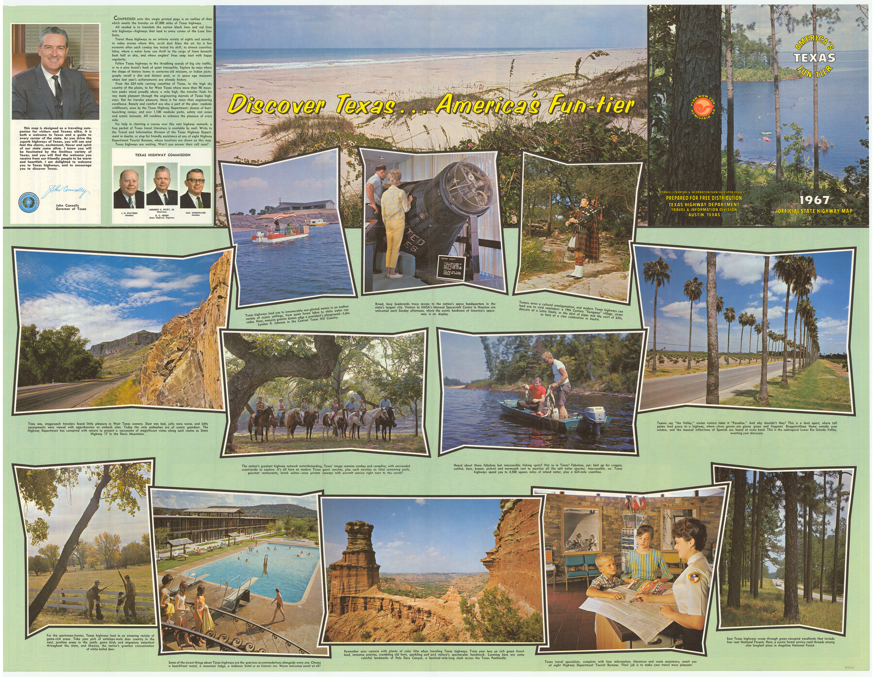
America's Fun-Tier: Texas 1967 Official State Highway Map
[Recto - Pictures of Texas attractions]
-
Map/Doc
94321
-
Collection
General Map Collection
-
Object Dates
1967 (Edition Date)
-
People and Organizations
Texas Highway Department (Publisher)
-
Subjects
State of Texas
-
Height x Width
28.2 x 36.4 inches
71.6 x 92.5 cm
-
Medium
paper, etching/engraving/lithograph
-
Comments
For map of Texas on verso see 94322. For reseach purposes only.
Related maps
America's Fun-Tier: Texas 1967 Official State Highway Map

Digital $50.00
America's Fun-Tier: Texas 1967 Official State Highway Map
Size 28.3 x 36.6 inches
Map/Doc 94322
Part of: General Map Collection
Medina County Rolled Sketch 23

Print $20.00
- Digital $50.00
Medina County Rolled Sketch 23
Size 30.4 x 42.6 inches
Map/Doc 89063
Presidio County Working Sketch 59

Print $20.00
- Digital $50.00
Presidio County Working Sketch 59
1956
Size 20.6 x 22.6 inches
Map/Doc 71736
Matagorda County Working Sketch 1

Print $20.00
- Digital $50.00
Matagorda County Working Sketch 1
Size 24.1 x 17.1 inches
Map/Doc 70859
Crockett County Rolled Sketch 66

Print $20.00
- Digital $50.00
Crockett County Rolled Sketch 66
1947
Size 22.4 x 23.3 inches
Map/Doc 5609
Medina County Rolled Sketch 6

Print $40.00
- Digital $50.00
Medina County Rolled Sketch 6
1930
Size 51.1 x 45.2 inches
Map/Doc 9506
Jasper County Boundary File 2

Print $58.00
- Digital $50.00
Jasper County Boundary File 2
Size 9.0 x 8.0 inches
Map/Doc 55469
Oldham County Rolled Sketch 10

Print $20.00
- Digital $50.00
Oldham County Rolled Sketch 10
Size 22.0 x 13.3 inches
Map/Doc 7176

Throckmorton County Rolled Sketch 3B

Print $20.00
- Digital $50.00
Throckmorton County Rolled Sketch 3B
Size 31.3 x 37.9 inches
Map/Doc 7988
Pecos County Rolled Sketch CM-2

Print $20.00
- Digital $50.00
Pecos County Rolled Sketch CM-2
1938
Size 33.6 x 41.3 inches
Map/Doc 9716
Edwards County Working Sketch 3

Print $20.00
- Digital $50.00
Edwards County Working Sketch 3
Size 22.6 x 18.3 inches
Map/Doc 68879
Right of Way and Track Map, International & Gt. Northern Ry. Operated by the International & Gt. Northern Ry. Co., Gulf Division

Print $40.00
- Digital $50.00
Right of Way and Track Map, International & Gt. Northern Ry. Operated by the International & Gt. Northern Ry. Co., Gulf Division
1917
Size 25.0 x 56.5 inches
Map/Doc 64248
You may also like
University Lands Blocks 29-33, Crockett County, Texas

Print $20.00
- Digital $50.00
University Lands Blocks 29-33, Crockett County, Texas
1936
Size 29.8 x 42.7 inches
Map/Doc 2443
Waller County Sketch File 2

Print $52.00
- Digital $50.00
Waller County Sketch File 2
Size 13.3 x 9.0 inches
Map/Doc 39570
Flight Mission No. CRK-5P, Frame 154, Refugio County

Print $20.00
- Digital $50.00
Flight Mission No. CRK-5P, Frame 154, Refugio County
1956
Size 18.6 x 22.5 inches
Map/Doc 86935
Palo Pinto County Working Sketch 2

Print $20.00
- Digital $50.00
Palo Pinto County Working Sketch 2
1906
Size 15.2 x 46.2 inches
Map/Doc 71385
Coke County Sketch File 19

Print $20.00
- Digital $50.00
Coke County Sketch File 19
Size 18.5 x 25.0 inches
Map/Doc 11110
Kimble County Working Sketch 79

Print $20.00
- Digital $50.00
Kimble County Working Sketch 79
1971
Size 34.7 x 31.9 inches
Map/Doc 70147
Val Verde County Sketch File 54

Print $6.00
- Digital $50.00
Val Verde County Sketch File 54
1940
Size 11.3 x 8.9 inches
Map/Doc 39334
Kent County Boundary File 4b

Print $36.00
- Digital $50.00
Kent County Boundary File 4b
Size 14.2 x 8.7 inches
Map/Doc 55847
[Sketch showing Leagues 464, 467-472, 483-489, 495, 510, 517, 532, 541, 556-570]
![89802, [Sketch showing Leagues 464, 467-472, 483-489, 495, 510, 517, 532, 541, 556-570], Twichell Survey Records](https://historictexasmaps.com/wmedia_w700/maps/89802-1.tif.jpg)
Print $20.00
- Digital $50.00
[Sketch showing Leagues 464, 467-472, 483-489, 495, 510, 517, 532, 541, 556-570]
Size 44.8 x 42.7 inches
Map/Doc 89802
Flight Mission No. CLL-3N, Frame 43, Willacy County

Print $20.00
- Digital $50.00
Flight Mission No. CLL-3N, Frame 43, Willacy County
1954
Size 18.3 x 22.0 inches
Map/Doc 87101
[W. T. Brewer: M. McDonald, Ralph Gilpin, A. Vanhooser, John Baker, John R. Taylor Surveys]
![90958, [W. T. Brewer: M. McDonald, Ralph Gilpin, A. Vanhooser, John Baker, John R. Taylor Surveys], Twichell Survey Records](https://historictexasmaps.com/wmedia_w700/maps/90958-1.tif.jpg)
Print $2.00
- Digital $50.00
[W. T. Brewer: M. McDonald, Ralph Gilpin, A. Vanhooser, John Baker, John R. Taylor Surveys]
Size 8.9 x 11.2 inches
Map/Doc 90958
Roberts County Boundary File 2c

Print $28.00
- Digital $50.00
Roberts County Boundary File 2c
Size 9.5 x 28.3 inches
Map/Doc 58363