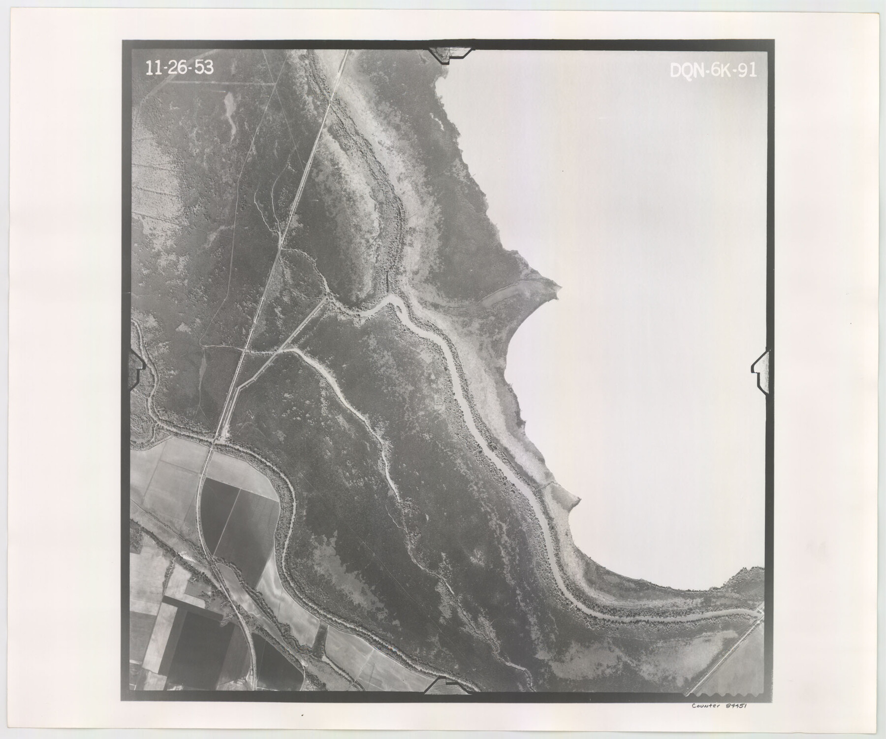
Flight Mission No. DQN-6K, Frame 91, Calhoun County
DQN-6K-91
-
Map/Doc
84451
-
Collection
General Map Collection
-
Object Dates
1953/11/26 (Creation Date)
-
People and Organizations
U. S. Department of Agriculture (Publisher)
-
Counties
Calhoun
-
Subjects
Aerial Photograph
-
Height x Width
18.5 x 22.2 inches
47.0 x 56.4 cm
-
Comments
Flown by Aero Exploration Company of Tulsa, Oklahoma.
Part of: General Map Collection
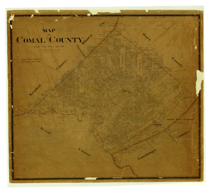
Map of Comal County
Print $40.00
- Digital $50.00
Map of Comal County
1897
Size 44.3 x 48.5 inches
Map/Doc 4681
Real County Rolled Sketch 18

Print $20.00
- Digital $50.00
Real County Rolled Sketch 18
Size 22.0 x 28.0 inches
Map/Doc 7464
Presidio County Boundary File 5

Print $8.00
- Digital $50.00
Presidio County Boundary File 5
Size 10.3 x 8.2 inches
Map/Doc 58087
Coke County Sketch File 31

Print $4.00
- Digital $50.00
Coke County Sketch File 31
Size 14.1 x 8.8 inches
Map/Doc 18643
Jasper County Texas

Print $20.00
- Digital $50.00
Jasper County Texas
1879
Size 31.5 x 18.2 inches
Map/Doc 3716
Orange County Sketch File 26

Print $20.00
- Digital $50.00
Orange County Sketch File 26
Size 38.5 x 29.3 inches
Map/Doc 10564
Lynn County Sketch File 1

Print $8.00
- Digital $50.00
Lynn County Sketch File 1
1892
Size 14.0 x 8.8 inches
Map/Doc 30443
Dickens County Sketch File 25

Print $20.00
- Digital $50.00
Dickens County Sketch File 25
1914
Size 19.2 x 14.4 inches
Map/Doc 11326
Edwards County Sketch File A1

Print $6.00
- Digital $50.00
Edwards County Sketch File A1
Size 8.5 x 8.8 inches
Map/Doc 21659
Kinney County Sketch File 26

Print $20.00
- Digital $50.00
Kinney County Sketch File 26
1928
Size 20.4 x 18.8 inches
Map/Doc 11945
Rockwall County Sketch File 7

Print $4.00
Rockwall County Sketch File 7
1873
Size 12.6 x 8.3 inches
Map/Doc 35427
Brewster County Sketch File 41

Print $12.00
- Digital $50.00
Brewster County Sketch File 41
Size 6.9 x 14.5 inches
Map/Doc 16304
You may also like
D. B. Gardner vs. Mrs. Clara C. Starr, Details 1, 2, 3, and 4

Print $20.00
- Digital $50.00
D. B. Gardner vs. Mrs. Clara C. Starr, Details 1, 2, 3, and 4
Size 25.1 x 30.0 inches
Map/Doc 91045
Knox County Rolled Sketch 18

Print $20.00
- Digital $50.00
Knox County Rolled Sketch 18
1945
Size 23.1 x 29.5 inches
Map/Doc 6558
Tom Green County Sketch File 62

Print $20.00
- Digital $50.00
Tom Green County Sketch File 62
1890
Size 27.7 x 43.9 inches
Map/Doc 10405
Robertson County Sketch File 5

Print $6.00
Robertson County Sketch File 5
1863
Size 12.0 x 9.0 inches
Map/Doc 35358
Subdivision for R.N. Graham

Print $3.00
- Digital $50.00
Subdivision for R.N. Graham
1913
Size 10.4 x 15.2 inches
Map/Doc 473
Bee County Working Sketch 34

Print $20.00
- Digital $50.00
Bee County Working Sketch 34
1988
Size 46.3 x 43.6 inches
Map/Doc 67285
Young County Sketch File 12

Print $4.00
- Digital $50.00
Young County Sketch File 12
1889
Size 8.5 x 13.6 inches
Map/Doc 40876
Montgomery County Rolled Sketch 28

Print $20.00
- Digital $50.00
Montgomery County Rolled Sketch 28
1942
Size 35.1 x 22.6 inches
Map/Doc 6810
Bahia de S. Bernardo

Print $20.00
- Digital $50.00
Bahia de S. Bernardo
1809
Size 17.0 x 25.2 inches
Map/Doc 95142
Midland County Rolled Sketch 4A

Print $40.00
- Digital $50.00
Midland County Rolled Sketch 4A
1951
Size 43.0 x 85.3 inches
Map/Doc 61735
Hopkins County Working Sketch 3

Print $20.00
- Digital $50.00
Hopkins County Working Sketch 3
1955
Size 24.2 x 20.0 inches
Map/Doc 66228
Flight Mission No. DQO-8K, Frame 71, Galveston County

Print $20.00
- Digital $50.00
Flight Mission No. DQO-8K, Frame 71, Galveston County
1952
Size 18.6 x 22.4 inches
Map/Doc 85175