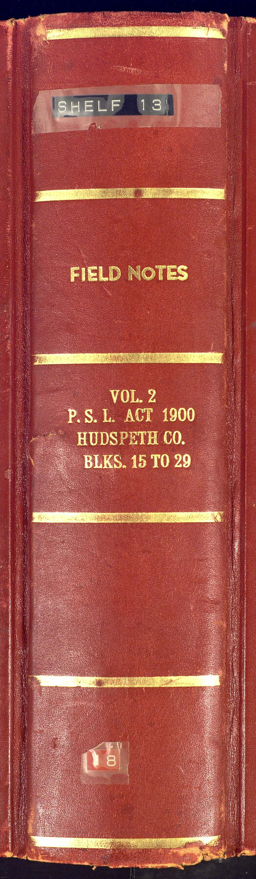
PSL Field Notes for Blocks 15 through 29 in Hudspeth County
-
Map/Doc
81659
-
Collection
General Map Collection
-
People and Organizations
Charles Rogan (GLO Commissioner)
A.H. Parker (Surveyor/Engineer)
-
Counties
Hudspeth
-
Subjects
Bound Volume Public School Land
-
Medium
paper, bound volume
-
Comments
See the following surveying items related to this PSL field note volume: Hudspeth County Rolled Sketch 23; Hudspeth County Sketch Files 1, 2, 7, 9, 10, 12, and 36.
See 97176 for an index to the Public School Land field note volumes.
Related maps
Hudspeth County Sketch File 1

Print $8.00
- Digital $50.00
Hudspeth County Sketch File 1
1900
Size 11.3 x 8.8 inches
Map/Doc 26880
Hudspeth County Sketch File 2

Print $10.00
- Digital $50.00
Hudspeth County Sketch File 2
1900
Size 13.4 x 8.6 inches
Map/Doc 26884
Hudspeth County Sketch File 7

Print $6.00
- Digital $50.00
Hudspeth County Sketch File 7
1900
Size 14.2 x 8.7 inches
Map/Doc 26892
Hudspeth County Sketch File 9

Print $8.00
- Digital $50.00
Hudspeth County Sketch File 9
1900
Size 11.3 x 8.8 inches
Map/Doc 26895
Hudspeth County Sketch File 10

Print $4.00
- Digital $50.00
Hudspeth County Sketch File 10
1900
Size 11.2 x 8.8 inches
Map/Doc 26899
Hudspeth County Sketch File 12

Print $10.00
- Digital $50.00
Hudspeth County Sketch File 12
1901
Size 14.2 x 8.7 inches
Map/Doc 26924
Hudspeth County Sketch File 36

Print $12.00
- Digital $50.00
Hudspeth County Sketch File 36
1901
Size 10.5 x 8.2 inches
Map/Doc 27003
Hudspeth County Rolled Sketch 23

Print $40.00
- Digital $50.00
Hudspeth County Rolled Sketch 23
Size 43.7 x 70.3 inches
Map/Doc 9207
Public School Land Field Note Volume Index

Public School Land Field Note Volume Index
2023
Size 8.5 x 11.0 inches
Map/Doc 97176
Part of: General Map Collection
Rusk County Working Sketch 2

Print $40.00
- Digital $50.00
Rusk County Working Sketch 2
Size 36.4 x 58.2 inches
Map/Doc 63637
Houston County Working Sketch 16

Print $20.00
- Digital $50.00
Houston County Working Sketch 16
1962
Size 13.4 x 15.6 inches
Map/Doc 66246
Map of Erath County

Print $40.00
- Digital $50.00
Map of Erath County
1896
Size 50.4 x 45.1 inches
Map/Doc 7820
Colorado County Working Sketch Graphic Index

Print $40.00
- Digital $50.00
Colorado County Working Sketch Graphic Index
1946
Size 52.7 x 42.4 inches
Map/Doc 76500
Brazoria County NRC Article 33.136 Sketch 24

Print $24.00
Brazoria County NRC Article 33.136 Sketch 24
2025
Map/Doc 97504
Flight Mission No. DCL-7C, Frame 26, Kenedy County

Print $20.00
- Digital $50.00
Flight Mission No. DCL-7C, Frame 26, Kenedy County
1943
Size 15.3 x 15.5 inches
Map/Doc 86018
Crane County Rolled Sketch 29

Print $20.00
- Digital $50.00
Crane County Rolled Sketch 29
2024
Size 24.6 x 35.5 inches
Map/Doc 97338
Loving County Working Sketch 4

Print $20.00
- Digital $50.00
Loving County Working Sketch 4
1941
Size 20.1 x 40.2 inches
Map/Doc 70636
Crockett County Working Sketch 58

Print $40.00
- Digital $50.00
Crockett County Working Sketch 58
1954
Size 24.3 x 54.4 inches
Map/Doc 68391
DeWitt County Rolled Sketch 2

Print $20.00
- Digital $50.00
DeWitt County Rolled Sketch 2
1943
Size 32.0 x 42.7 inches
Map/Doc 8778
Map of Atascosa Co.

Print $40.00
- Digital $50.00
Map of Atascosa Co.
1894
Size 48.3 x 46.6 inches
Map/Doc 4877
McMullen County Sketch File 12

Print $4.00
- Digital $50.00
McMullen County Sketch File 12
1876
Size 10.9 x 8.3 inches
Map/Doc 31357
You may also like
Sabine County, Texas

Print $20.00
- Digital $50.00
Sabine County, Texas
1879
Size 22.1 x 18.6 inches
Map/Doc 751
Jeff Davis County Sketch File 21

Print $4.00
- Digital $50.00
Jeff Davis County Sketch File 21
1927
Size 14.1 x 8.8 inches
Map/Doc 27988
Cochran County Working Sketch 5

Print $20.00
- Digital $50.00
Cochran County Working Sketch 5
Size 23.8 x 24.9 inches
Map/Doc 68016
Old Miscellaneous File 37

Print $4.00
- Digital $50.00
Old Miscellaneous File 37
1912
Size 11.2 x 8.8 inches
Map/Doc 75280
General Highway Map, Lamar County, Texas

Print $20.00
General Highway Map, Lamar County, Texas
1961
Size 24.6 x 18.2 inches
Map/Doc 79561
Presidio County Sketch File 29

Print $20.00
- Digital $50.00
Presidio County Sketch File 29
1890
Size 29.7 x 20.1 inches
Map/Doc 11711
Dimmit County Sketch File 60

Print $4.00
- Digital $50.00
Dimmit County Sketch File 60
1991
Size 14.2 x 8.8 inches
Map/Doc 21206
Sabine Bank to East Bay including Heald Bank

Print $20.00
- Digital $50.00
Sabine Bank to East Bay including Heald Bank
1971
Size 45.0 x 34.4 inches
Map/Doc 69849
Edwards County Working Sketch 35

Print $20.00
- Digital $50.00
Edwards County Working Sketch 35
1948
Size 20.9 x 31.1 inches
Map/Doc 68911
Tom Green County Sketch File 30

Print $12.00
Tom Green County Sketch File 30
1880
Size 11.0 x 8.2 inches
Map/Doc 38182
Dimmit County Boundary File 10a

Print $4.00
- Digital $50.00
Dimmit County Boundary File 10a
Size 14.0 x 8.5 inches
Map/Doc 52611
Clemens Farm, State Prison System, Brazoria County

Print $4.00
- Digital $50.00
Clemens Farm, State Prison System, Brazoria County
1932
Size 14.2 x 18.7 inches
Map/Doc 65274