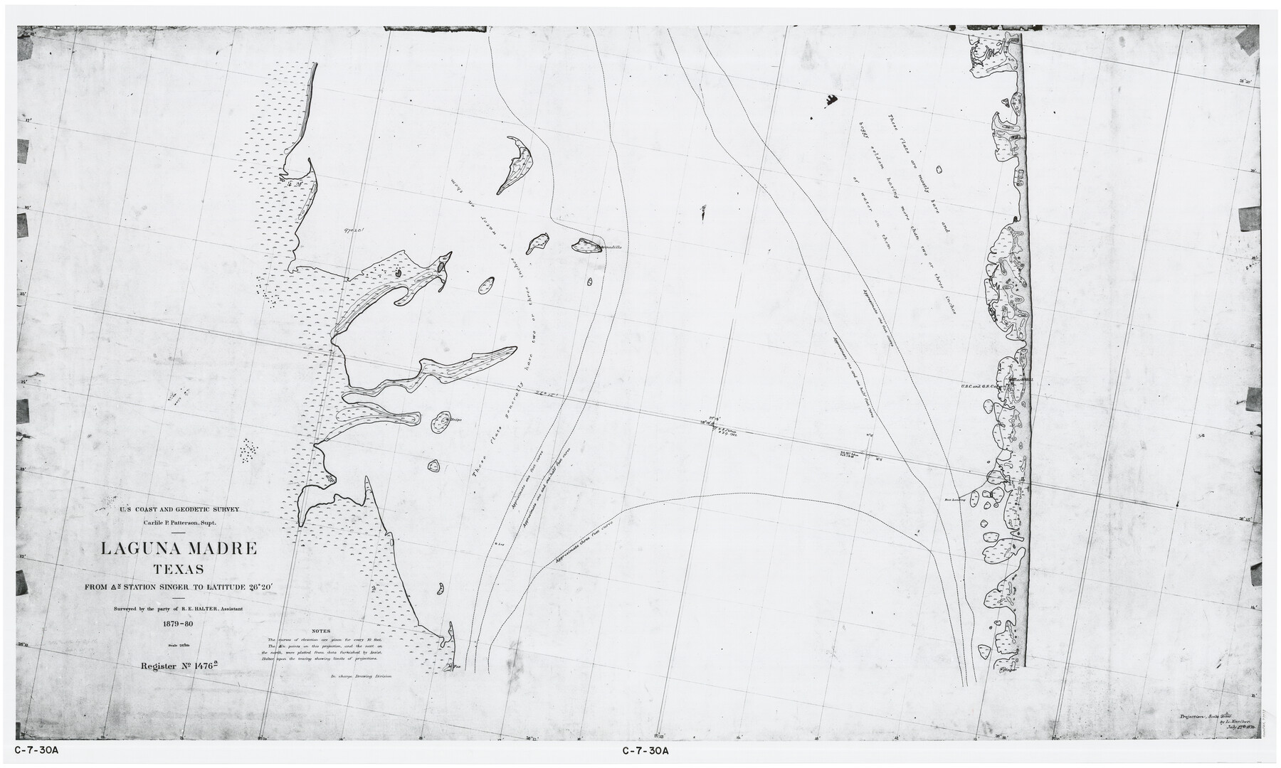
Laguna Madre, Texas from Triangulation Station Singer to Latitude 26° 20'
C-7-30a
-
Map/Doc
73493
-
Collection
General Map Collection
-
Object Dates
1880 (Creation Date)
-
Counties
Cameron
-
Subjects
Nautical Charts
-
Height x Width
31.9 x 53.4 inches
81.0 x 135.6 cm
-
Comments
Register No. 1476a
Part of: General Map Collection
Young County Working Sketch 12

Print $20.00
- Digital $50.00
Young County Working Sketch 12
1921
Size 17.6 x 19.0 inches
Map/Doc 62035
[Surveys in the Travis District along the Colorado River]
![120, [Surveys in the Travis District along the Colorado River], General Map Collection](https://historictexasmaps.com/wmedia_w700/maps/120-2.tif.jpg)
Print $3.00
- Digital $50.00
[Surveys in the Travis District along the Colorado River]
1841
Size 7.0 x 16.5 inches
Map/Doc 120
Tarrant County Boundary File 1

Print $20.00
- Digital $50.00
Tarrant County Boundary File 1
Size 9.2 x 34.6 inches
Map/Doc 59110
Zavala County Working Sketch 8

Print $20.00
- Digital $50.00
Zavala County Working Sketch 8
1949
Size 24.2 x 17.6 inches
Map/Doc 62083
Brazos County Rolled Sketch 6

Print $20.00
- Digital $50.00
Brazos County Rolled Sketch 6
1979
Size 24.3 x 36.4 inches
Map/Doc 5190
Presidio County Rolled Sketch 71

Print $20.00
- Digital $50.00
Presidio County Rolled Sketch 71
1941
Size 31.7 x 42.9 inches
Map/Doc 7361

Hardin County Sketch File 24b

Print $4.00
- Digital $50.00
Hardin County Sketch File 24b
Size 6.4 x 8.0 inches
Map/Doc 25146
Reconnaissance of Aransas Pass, Texas

Print $20.00
- Digital $50.00
Reconnaissance of Aransas Pass, Texas
1852
Size 14.4 x 13.6 inches
Map/Doc 76171
Crosby County Sketch File 15a

Print $20.00
- Digital $50.00
Crosby County Sketch File 15a
1907
Size 37.6 x 41.1 inches
Map/Doc 10352
Map of Wise County

Print $20.00
- Digital $50.00
Map of Wise County
1862
Size 23.5 x 19.0 inches
Map/Doc 4162
Map of Fayette County Texas

Print $20.00
- Digital $50.00
Map of Fayette County Texas
1840
Size 26.4 x 22.6 inches
Map/Doc 3539
You may also like
Dawson County

Print $20.00
- Digital $50.00
Dawson County
1892
Size 27.1 x 23.3 inches
Map/Doc 66797
Welch, Dawson County, Texas

Print $20.00
- Digital $50.00
Welch, Dawson County, Texas
Size 19.4 x 16.6 inches
Map/Doc 92592
Current Miscellaneous File 16

Print $20.00
- Digital $50.00
Current Miscellaneous File 16
1951
Size 10.7 x 8.2 inches
Map/Doc 73830
General Highway Map, Matagorda County, Texas

Print $20.00
General Highway Map, Matagorda County, Texas
1961
Size 24.8 x 18.2 inches
Map/Doc 79585
[Coleman County Sections 359, 360, and 361]
![92552, [Coleman County Sections 359, 360, and 361], Twichell Survey Records](https://historictexasmaps.com/wmedia_w700/maps/92552-1.tif.jpg)
Print $20.00
- Digital $50.00
[Coleman County Sections 359, 360, and 361]
1946
Size 17.6 x 22.6 inches
Map/Doc 92552
[Section 1, Block 12, H. & G. N. RR. Co.]
![91651, [Section 1, Block 12, H. & G. N. RR. Co.], Twichell Survey Records](https://historictexasmaps.com/wmedia_w700/maps/91651-1.tif.jpg)
Print $3.00
- Digital $50.00
[Section 1, Block 12, H. & G. N. RR. Co.]
Size 12.9 x 9.6 inches
Map/Doc 91651
Brewster County Rolled Sketch K1

Print $20.00
- Digital $50.00
Brewster County Rolled Sketch K1
Size 22.9 x 15.4 inches
Map/Doc 5322
Flight Mission No. CUG-1P, Frame 25, Kleberg County

Print $20.00
- Digital $50.00
Flight Mission No. CUG-1P, Frame 25, Kleberg County
1956
Size 18.6 x 22.3 inches
Map/Doc 86115
Kent County Working Sketch 20

Print $40.00
- Digital $50.00
Kent County Working Sketch 20
1980
Size 50.7 x 44.1 inches
Map/Doc 70027

Jefferson County NRC Article 33.136 Sketch 8

Print $20.00
- Digital $50.00
Jefferson County NRC Article 33.136 Sketch 8
2007
Size 20.1 x 18.7 inches
Map/Doc 87503
Map of lands owned by R.E. Montgomery in Martin and Andrews County, Texas

Print $20.00
- Digital $50.00
Map of lands owned by R.E. Montgomery in Martin and Andrews County, Texas
Size 20.0 x 24.5 inches
Map/Doc 75764