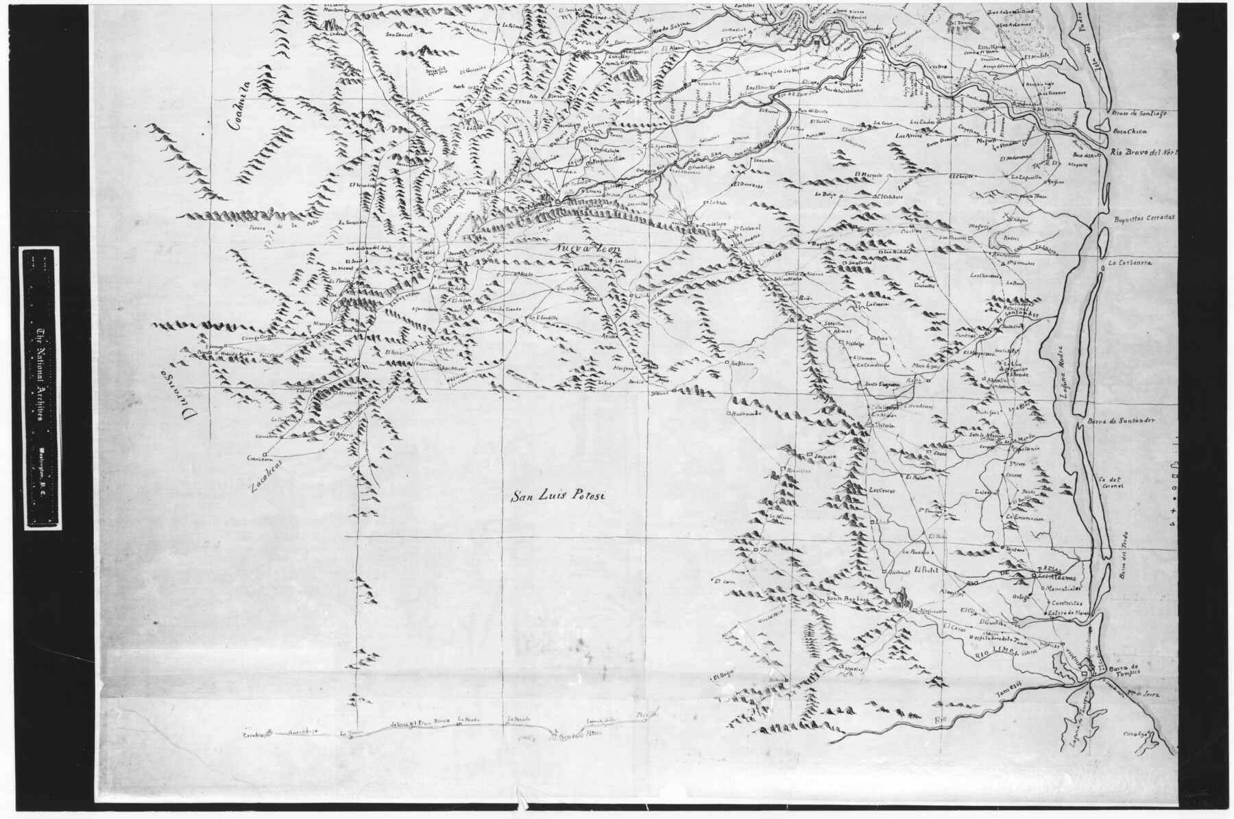
Traced from Genl. Arista's map captured by the American Army under Genl. Taylor at Resaca de la Palma 9th May '46 and presented to James K. Polk, President U. States
RL-5-1f
-
Map/Doc
73061
-
Collection
General Map Collection
-
Object Dates
1846/12/14 (Creation Date)
-
People and Organizations
U. S. Corps of Engineers (Publisher)
J.M. Scarritt (Draftsman)
-
Subjects
Military
-
Height x Width
18.2 x 27.4 inches
46.2 x 69.6 cm
-
Comments
B/W photostat copy from National Archives in multiple pieces.
Part of: General Map Collection
Fannin County Boundary File 8

Print $8.00
- Digital $50.00
Fannin County Boundary File 8
Size 12.8 x 8.1 inches
Map/Doc 53316
Controlled Mosaic by Jack Amman Photogrammetric Engineers, Inc - Sheet 37

Print $20.00
- Digital $50.00
Controlled Mosaic by Jack Amman Photogrammetric Engineers, Inc - Sheet 37
1954
Size 20.0 x 24.0 inches
Map/Doc 83491
Presidio County Working Sketch 75

Print $20.00
- Digital $50.00
Presidio County Working Sketch 75
1962
Size 36.3 x 32.4 inches
Map/Doc 71752
Kent County Working Sketch 8

Print $20.00
- Digital $50.00
Kent County Working Sketch 8
1952
Size 27.2 x 37.1 inches
Map/Doc 70015
Fannin County Sketch File 12

Print $4.00
- Digital $50.00
Fannin County Sketch File 12
Size 8.4 x 6.5 inches
Map/Doc 22460
Erath County Working Sketch 31

Print $20.00
- Digital $50.00
Erath County Working Sketch 31
1970
Size 23.2 x 26.2 inches
Map/Doc 69112
Upton County Working Sketch 28

Print $40.00
- Digital $50.00
Upton County Working Sketch 28
1956
Size 52.5 x 35.9 inches
Map/Doc 69524
[Surveys in the Bexar District along the Nueces River]
![84, [Surveys in the Bexar District along the Nueces River], General Map Collection](https://historictexasmaps.com/wmedia_w700/maps/84.tif.jpg)
Print $3.00
- Digital $50.00
[Surveys in the Bexar District along the Nueces River]
1847
Size 17.1 x 8.1 inches
Map/Doc 84
Plan of the town of Austin

Print $20.00
- Digital $50.00
Plan of the town of Austin
Size 18.4 x 13.0 inches
Map/Doc 94117
Johnson County Sketch File 10

Print $4.00
- Digital $50.00
Johnson County Sketch File 10
1859
Size 10.1 x 8.0 inches
Map/Doc 28443
Limestone County Sketch File 22

Print $4.00
- Digital $50.00
Limestone County Sketch File 22
Size 11.4 x 7.3 inches
Map/Doc 30201
Martin County Rolled Sketch 10

Print $20.00
- Digital $50.00
Martin County Rolled Sketch 10
1994
Size 18.4 x 24.2 inches
Map/Doc 6670
You may also like
Bell County Working Sketch 13

Print $20.00
- Digital $50.00
Bell County Working Sketch 13
1964
Size 19.6 x 18.5 inches
Map/Doc 67353
North America corrected from the observations communicated to the Royal Society at London and the Royal Academy at Paris

Print $20.00
- Digital $50.00
North America corrected from the observations communicated to the Royal Society at London and the Royal Academy at Paris
1710
Size 38.9 x 26.9 inches
Map/Doc 93820
[Jas. T. Williams Survey and vicinity]
![91263, [Jas. T. Williams Survey and vicinity], Twichell Survey Records](https://historictexasmaps.com/wmedia_w700/maps/91263-1.tif.jpg)
Print $20.00
- Digital $50.00
[Jas. T. Williams Survey and vicinity]
Size 27.0 x 22.1 inches
Map/Doc 91263
Reconnoissance of Sabine River and Valley

Print $20.00
Reconnoissance of Sabine River and Valley
1863
Size 30.4 x 42.5 inches
Map/Doc 97498
Swisher County Rolled Sketch 3

Print $20.00
- Digital $50.00
Swisher County Rolled Sketch 3
Size 21.3 x 19.4 inches
Map/Doc 7904
Flight Mission No. DQN-6K, Frame 4, Calhoun County

Print $20.00
- Digital $50.00
Flight Mission No. DQN-6K, Frame 4, Calhoun County
1953
Size 18.4 x 22.1 inches
Map/Doc 84426
Winkler County, Texas

Print $20.00
- Digital $50.00
Winkler County, Texas
1889
Size 24.6 x 19.0 inches
Map/Doc 658
Fort Bend County Rolled Sketch B

Print $20.00
- Digital $50.00
Fort Bend County Rolled Sketch B
Size 20.4 x 28.9 inches
Map/Doc 5904
Military Reconstruction Districts

Military Reconstruction Districts
2024
Size 8.5 x 11.0 inches
Map/Doc 97345
Victoria County, Texas

Print $20.00
- Digital $50.00
Victoria County, Texas
1879
Size 26.5 x 22.8 inches
Map/Doc 511
Reagan County Sketch File 32

Print $6.00
- Digital $50.00
Reagan County Sketch File 32
1954
Size 11.5 x 9.0 inches
Map/Doc 35025
Upshur County Working Sketch 12

Print $20.00
- Digital $50.00
Upshur County Working Sketch 12
1984
Size 31.9 x 29.6 inches
Map/Doc 69569