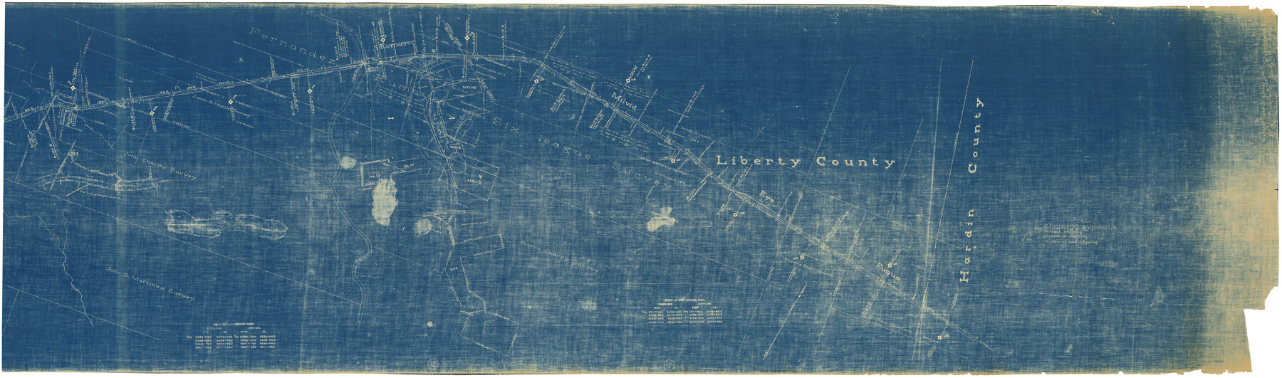
Sketch of 103rd Meridian, W. L. Showing Conflict of Capitol Leagues
Z-2-95
-
Map/Doc
65505
-
Collection
General Map Collection
-
Counties
Montgomery Liberty
-
Subjects
Railroads Texas Boundaries
-
Height x Width
26.9 x 85.1 inches
68.3 x 216.2 cm
-
Comments
Segment 1; see counter no. 65505 for segment 2.
Part of: General Map Collection
Hutchinson County Rolled Sketch 12

Print $20.00
- Digital $50.00
Hutchinson County Rolled Sketch 12
Size 26.1 x 41.4 inches
Map/Doc 6282
Val Verde County Rolled Sketch 62

Print $40.00
- Digital $50.00
Val Verde County Rolled Sketch 62
1956
Size 34.6 x 52.1 inches
Map/Doc 10081
Flight Mission No. DCL-6C, Frame 15, Kenedy County

Print $20.00
- Digital $50.00
Flight Mission No. DCL-6C, Frame 15, Kenedy County
1943
Size 18.7 x 22.4 inches
Map/Doc 85872
Tarrant County Sketch File 32

Print $16.00
- Digital $50.00
Tarrant County Sketch File 32
1946
Size 11.3 x 8.8 inches
Map/Doc 37751
Harris County Working Sketch 104

Print $20.00
- Digital $50.00
Harris County Working Sketch 104
1980
Size 17.2 x 10.3 inches
Map/Doc 65996
Trinity River, East Fork of Trinity River Levee Improvement Districts/Widths of Floodways as Established by Approved Plans

Print $4.00
- Digital $50.00
Trinity River, East Fork of Trinity River Levee Improvement Districts/Widths of Floodways as Established by Approved Plans
1919
Size 28.4 x 18.5 inches
Map/Doc 65248
Leon County Sketch File 5a

Print $4.00
- Digital $50.00
Leon County Sketch File 5a
1861
Size 13.1 x 8.5 inches
Map/Doc 29717
Denton County Working Sketch 33

Print $20.00
- Digital $50.00
Denton County Working Sketch 33
2002
Size 35.3 x 46.1 inches
Map/Doc 78203
Aransas County NRC Article 33.136 Sketch 2

Print $26.00
- Digital $50.00
Aransas County NRC Article 33.136 Sketch 2
2001
Size 18.6 x 24.2 inches
Map/Doc 61643
Glasscock County Working Sketch 3

Print $20.00
- Digital $50.00
Glasscock County Working Sketch 3
Size 16.8 x 28.0 inches
Map/Doc 63176
Caldwell County Sketch File 3a

Print $4.00
- Digital $50.00
Caldwell County Sketch File 3a
1870
Size 10.1 x 8.1 inches
Map/Doc 35829
Real County Working Sketch 74

Print $20.00
- Digital $50.00
Real County Working Sketch 74
1979
Size 17.1 x 23.5 inches
Map/Doc 71966
You may also like
Flight Mission No. DQO-7K, Frame 108, Galveston County

Print $20.00
- Digital $50.00
Flight Mission No. DQO-7K, Frame 108, Galveston County
1952
Size 18.7 x 22.5 inches
Map/Doc 85123
Map Showing Resurvey of Capitol Leagues, Lamb, Cochran & Hockley Co's.

Print $20.00
- Digital $50.00
Map Showing Resurvey of Capitol Leagues, Lamb, Cochran & Hockley Co's.
1918
Size 37.0 x 29.3 inches
Map/Doc 1759
Laguna Madre, Register No. 1477A

Print $40.00
- Digital $50.00
Laguna Madre, Register No. 1477A
1880
Size 34.3 x 56.0 inches
Map/Doc 73606
Upton County Rolled Sketch 42

Print $40.00
- Digital $50.00
Upton County Rolled Sketch 42
Size 26.5 x 55.9 inches
Map/Doc 10056
Description of Best Route from San Antonio to Laredo, Texas

Print $20.00
Description of Best Route from San Antonio to Laredo, Texas
1865
Size 28.6 x 13.7 inches
Map/Doc 79302
Wood County Working Sketch 19

Print $20.00
- Digital $50.00
Wood County Working Sketch 19
1982
Size 25.8 x 24.8 inches
Map/Doc 62019
Flight Mission No. DQN-6K, Frame 71, Calhoun County

Print $20.00
- Digital $50.00
Flight Mission No. DQN-6K, Frame 71, Calhoun County
1953
Size 18.5 x 22.2 inches
Map/Doc 84443
Controlled Mosaic by Jack Amman Photogrammetric Engineers, Inc - Sheet 50

Print $20.00
- Digital $50.00
Controlled Mosaic by Jack Amman Photogrammetric Engineers, Inc - Sheet 50
1954
Size 20.0 x 24.0 inches
Map/Doc 83509
Angelina County Working Sketch 54

Print $20.00
- Digital $50.00
Angelina County Working Sketch 54
1989
Size 31.6 x 26.9 inches
Map/Doc 67138
Young County Working Sketch 20

Print $20.00
- Digital $50.00
Young County Working Sketch 20
1961
Size 25.5 x 23.2 inches
Map/Doc 62043
Map of Perico, Dallam County, Texas

Print $20.00
- Digital $50.00
Map of Perico, Dallam County, Texas
Size 20.1 x 16.7 inches
Map/Doc 92128
Kenedy County Sketch File 1

Print $68.00
- Digital $50.00
Kenedy County Sketch File 1
1950
Size 14.2 x 8.8 inches
Map/Doc 28739