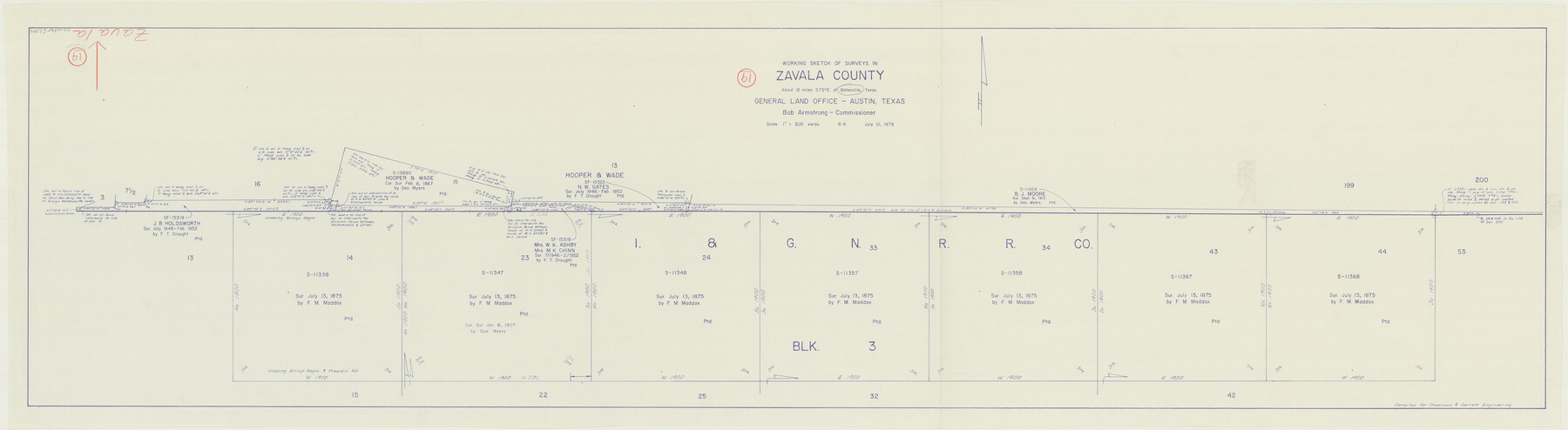
Zavala County Working Sketch 19
-
Map/Doc
62094
-
Collection
General Map Collection
-
Object Dates
7/10/1978 (Creation Date)
-
People and Organizations
Beverly Robison (Draftsman)
-
Counties
Zavala
-
Subjects
Surveying Working Sketch
-
Height x Width
16.2 x 59.1 inches
41.2 x 150.1 cm
-
Scale
1" = 300 varas
Part of: General Map Collection
Cochran County Boundary File 3a

Print $34.00
- Digital $50.00
Cochran County Boundary File 3a
Size 11.2 x 8.8 inches
Map/Doc 51538
Panola County Working Sketch 6

Print $20.00
- Digital $50.00
Panola County Working Sketch 6
1941
Map/Doc 71415
Right of Way & Track Map, St. Louis, Brownsville & Mexico Ry. operated by St. Louis, Brownsville & Mexico Ry. Co.

Print $40.00
- Digital $50.00
Right of Way & Track Map, St. Louis, Brownsville & Mexico Ry. operated by St. Louis, Brownsville & Mexico Ry. Co.
1919
Size 25.7 x 57.1 inches
Map/Doc 64625
Presidio County Rolled Sketch 102

Print $20.00
- Digital $50.00
Presidio County Rolled Sketch 102
1957
Size 22.8 x 17.4 inches
Map/Doc 7384
Texas, Aransas Bay, Aransas Pass to Nine Mile Point

Print $40.00
- Digital $50.00
Texas, Aransas Bay, Aransas Pass to Nine Mile Point
1934
Size 35.2 x 48.4 inches
Map/Doc 73431
Rebel Defenses of Galveston and Vicinity

Print $20.00
- Digital $50.00
Rebel Defenses of Galveston and Vicinity
1865
Size 17.0 x 23.7 inches
Map/Doc 61802
Texas 1971 Official State Highway Map

Digital $50.00
Texas 1971 Official State Highway Map
Size 28.3 x 36.5 inches
Map/Doc 94316
Brewster County Rolled Sketch 67

Print $20.00
- Digital $50.00
Brewster County Rolled Sketch 67
1940
Size 32.0 x 23.5 inches
Map/Doc 5233
Dimmit County Boundary File 7

Print $14.00
- Digital $50.00
Dimmit County Boundary File 7
Size 12.8 x 8.4 inches
Map/Doc 52590
Flight Mission No. BRA-8M, Frame 117, Jefferson County

Print $20.00
- Digital $50.00
Flight Mission No. BRA-8M, Frame 117, Jefferson County
1953
Size 18.5 x 22.3 inches
Map/Doc 85613
Orange County Working Sketch 26

Print $20.00
- Digital $50.00
Orange County Working Sketch 26
1953
Size 13.4 x 22.0 inches
Map/Doc 71358
Bee County Sketch File 33

Print $56.00
- Digital $50.00
Bee County Sketch File 33
Size 11.3 x 8.9 inches
Map/Doc 14349
You may also like
Ward County Rolled Sketch 28

Print $20.00
- Digital $50.00
Ward County Rolled Sketch 28
Size 22.3 x 27.5 inches
Map/Doc 8167
Gray's New Map of Texas and the Indian Territory

Print $20.00
- Digital $50.00
Gray's New Map of Texas and the Indian Territory
1876
Size 17.6 x 28.6 inches
Map/Doc 97282
Runnels County Working Sketch 19

Print $20.00
- Digital $50.00
Runnels County Working Sketch 19
1950
Size 24.9 x 30.8 inches
Map/Doc 63615
[Surveys along the Liberty and Hardin County line]
![295, [Surveys along the Liberty and Hardin County line], General Map Collection](https://historictexasmaps.com/wmedia_w700/maps/295.tif.jpg)
Print $2.00
- Digital $50.00
[Surveys along the Liberty and Hardin County line]
1847
Size 13.5 x 7.7 inches
Map/Doc 295
Nueces County Rolled Sketch 83

Print $40.00
- Digital $50.00
Nueces County Rolled Sketch 83
1973
Size 20.1 x 48.7 inches
Map/Doc 9629
Rusk County Rolled Sketch 9A

Print $20.00
- Digital $50.00
Rusk County Rolled Sketch 9A
1971
Size 30.4 x 19.1 inches
Map/Doc 7547
Atascosa County Sketch File 15a

Print $5.00
- Digital $50.00
Atascosa County Sketch File 15a
1879
Size 17.4 x 8.2 inches
Map/Doc 13777
Roberts County Working Sketch 6

Print $20.00
- Digital $50.00
Roberts County Working Sketch 6
1952
Size 29.3 x 21.9 inches
Map/Doc 63532
Williamson County Working Sketch 7

Print $20.00
- Digital $50.00
Williamson County Working Sketch 7
1949
Size 30.2 x 37.3 inches
Map/Doc 72567
Map of Terry County

Print $2.00
- Digital $50.00
Map of Terry County
Size 7.7 x 8.4 inches
Map/Doc 92887
Duval County Sketch File 4a

Print $6.00
- Digital $50.00
Duval County Sketch File 4a
1875
Size 13.3 x 10.8 inches
Map/Doc 21280
Reagan County Rolled Sketch 19

Print $20.00
- Digital $50.00
Reagan County Rolled Sketch 19
1939
Size 24.0 x 20.5 inches
Map/Doc 7445