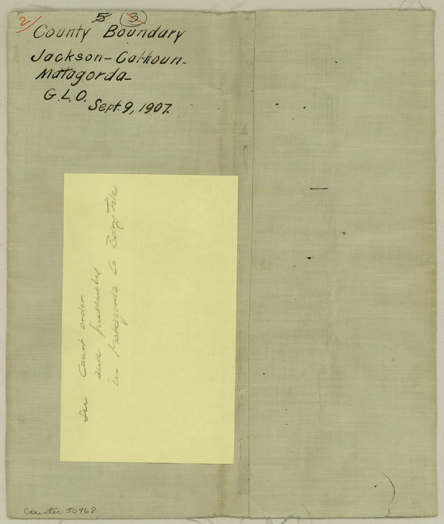
Calhoun County Boundary File 2
[Calhoun-Jackson-Matagorda]
-
Map/Doc
50968
-
Collection
General Map Collection
-
Counties
Calhoun
-
Subjects
County Boundaries
-
Height x Width
9.1 x 7.7 inches
23.1 x 19.6 cm
Part of: General Map Collection
Flight Mission No. DIX-10P, Frame 166, Aransas County

Print $20.00
- Digital $50.00
Flight Mission No. DIX-10P, Frame 166, Aransas County
1956
Size 18.5 x 22.2 inches
Map/Doc 83956
Terrell County Working Sketch 18a

Print $40.00
- Digital $50.00
Terrell County Working Sketch 18a
1931
Size 48.9 x 34.6 inches
Map/Doc 62168

Rusk County Working Sketch 24

Print $20.00
- Digital $50.00
Rusk County Working Sketch 24
1949
Size 20.2 x 24.7 inches
Map/Doc 63660
Hudspeth County Working Sketch 28

Print $20.00
- Digital $50.00
Hudspeth County Working Sketch 28
1972
Size 29.2 x 31.3 inches
Map/Doc 66310
Dickens County Sketch File 20

Print $2.00
- Digital $50.00
Dickens County Sketch File 20
1911
Size 11.5 x 8.9 inches
Map/Doc 20984
Live Oak County

Print $40.00
- Digital $50.00
Live Oak County
1899
Size 51.8 x 37.2 inches
Map/Doc 78404
Nueces County Rolled Sketch 25

Print $40.00
- Digital $50.00
Nueces County Rolled Sketch 25
1940
Size 32.2 x 48.4 inches
Map/Doc 9594
Van Zandt County Sketch File 33

Print $8.00
- Digital $50.00
Van Zandt County Sketch File 33
1860
Size 12.4 x 7.8 inches
Map/Doc 39469
Yoakum County

Print $20.00
- Digital $50.00
Yoakum County
1902
Size 46.1 x 36.6 inches
Map/Doc 63138
Ward County Rolled Sketch 3

Print $40.00
- Digital $50.00
Ward County Rolled Sketch 3
Size 65.3 x 25.7 inches
Map/Doc 10101
Flight Mission No. DCL-6C, Frame 29, Kenedy County

Print $20.00
- Digital $50.00
Flight Mission No. DCL-6C, Frame 29, Kenedy County
1943
Size 18.6 x 22.4 inches
Map/Doc 85886
You may also like
San Jacinto County Working Sketch 11

Print $20.00
- Digital $50.00
San Jacinto County Working Sketch 11
1935
Size 40.1 x 40.0 inches
Map/Doc 63724
Presidio County Sketch File 49

Print $6.00
- Digital $50.00
Presidio County Sketch File 49
1919
Size 14.6 x 11.9 inches
Map/Doc 34584
Brewster County Sketch File S-1

Print $10.00
- Digital $50.00
Brewster County Sketch File S-1
1921
Size 13.3 x 8.8 inches
Map/Doc 15726
Foard County Working Sketch 5a

Print $20.00
- Digital $50.00
Foard County Working Sketch 5a
1942
Size 18.4 x 24.2 inches
Map/Doc 69195
The Newest Land Of Promise - The Pecos Valley in Texas

Print $20.00
- Digital $50.00
The Newest Land Of Promise - The Pecos Valley in Texas
1900
Size 17.8 x 22.8 inches
Map/Doc 97037
Brewster County Sketch File 57

Print $6.00
- Digital $50.00
Brewster County Sketch File 57
2008
Size 11.0 x 8.5 inches
Map/Doc 88871
Bell County Working Sketch 8

Print $20.00
- Digital $50.00
Bell County Working Sketch 8
1954
Size 44.2 x 37.3 inches
Map/Doc 67348
Map of Fort Bend Co.

Print $20.00
- Digital $50.00
Map of Fort Bend Co.
1898
Size 45.1 x 41.1 inches
Map/Doc 75965
Van Zandt County Sketch File 9

Print $18.00
- Digital $50.00
Van Zandt County Sketch File 9
1859
Size 12.9 x 8.4 inches
Map/Doc 39384
Trinity River, Waxahachie Sheet/Waxahachie Creek

Print $6.00
- Digital $50.00
Trinity River, Waxahachie Sheet/Waxahachie Creek
1931
Size 30.1 x 32.8 inches
Map/Doc 65237
Potter County Sketch File 2

Print $20.00
- Digital $50.00
Potter County Sketch File 2
1887
Size 29.3 x 39.4 inches
Map/Doc 10573
[Wilson Strickland Survey]
![91378, [Wilson Strickland Survey], Twichell Survey Records](https://historictexasmaps.com/wmedia_w700/maps/91378-1.tif.jpg)
Print $20.00
- Digital $50.00
[Wilson Strickland Survey]
Size 39.7 x 29.2 inches
Map/Doc 91378